Acarsaid a' Ghiubhais

Sea, Estuary, Creek in Ross-shire

Scotland

Acarsaid a' Ghiubhais

Trigpoint, Meall na h-Airde Looking north-east towards Gairloch
Trigpoint, Meall na h-Airde Credit: Becky Williamson

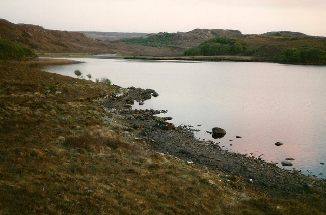
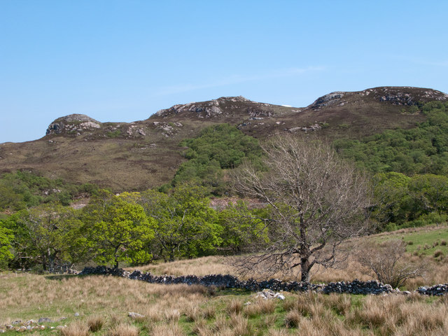
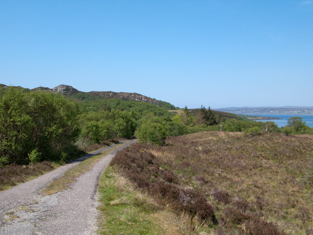
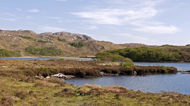
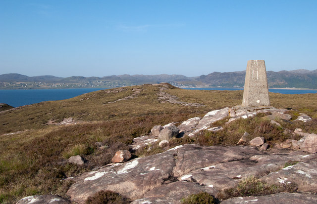
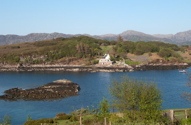
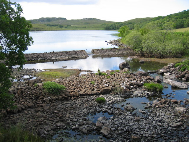
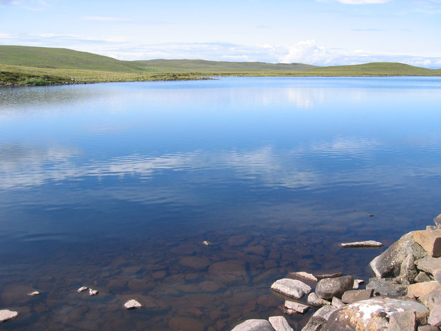
Acarsaid a' Ghiubhais, located in Ross-shire, Scotland, is a picturesque coastal area that encompasses a sea, estuary, and a creek. The name "Acarsaid a' Ghiubhais" translates to "Bay of the Fir Trees" in English, and it perfectly captures the natural beauty that surrounds this stunning location.

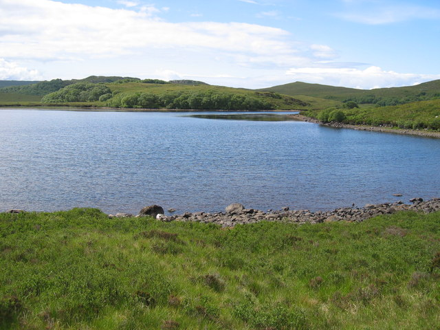
Situated along the coast, Acarsaid a' Ghiubhais offers breathtaking views of the sea. The pristine waters of the bay are often calm and inviting, making it a popular spot for recreational activities such as swimming, sailing, and fishing. The sandy beaches that line the bay are perfect for sunbathing and picnicking, attracting locals and tourists alike.

The estuary of Acarsaid a' Ghiubhais is a haven for wildlife enthusiasts. The area is home to a diverse range of bird species, making it an ideal spot for birdwatching. Visitors can witness the graceful flight of seabirds, including gulls, terns, and cormorants, as they swoop and dive over the estuary.

The creek that meanders through Acarsaid a' Ghiubhais adds an element of tranquility to the area. Surrounded by lush greenery and tall fir trees, the creek provides a peaceful retreat for those seeking solace amidst nature. The gentle sound of flowing water complements the serene atmosphere, making it a perfect place for a leisurely stroll or a quiet moment of reflection.

Overall, Acarsaid a' Ghiubhais offers a unique blend of coastal beauty, diverse wildlife, and tranquil surroundings. Whether one wishes to explore the sea, observe the estuary's birdlife, or simply relax by the creek, this picturesque location is a must-visit destination for nature enthusiasts and those seeking a peaceful escape.

If you have any feedback on the listing, please let us know in the comments section below.

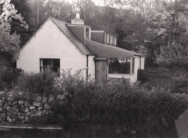
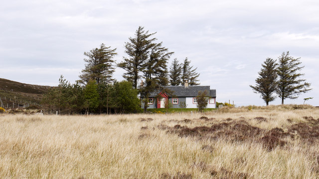
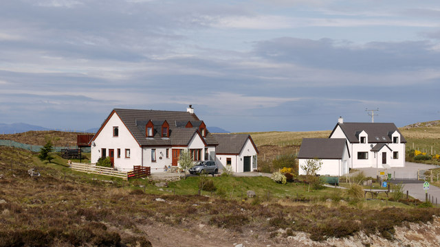
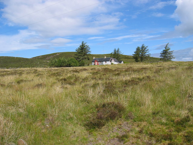
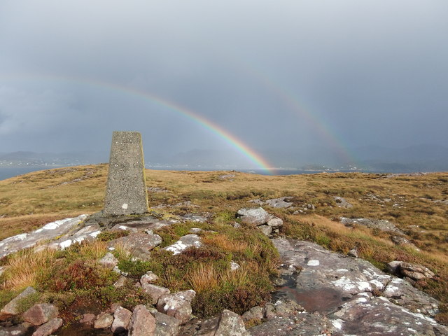
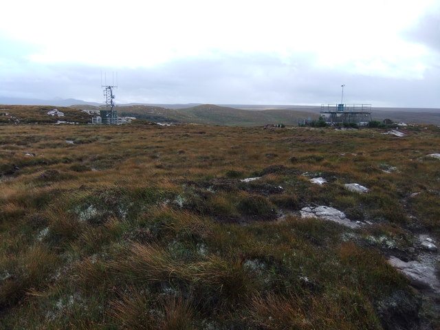
Acarsaid a' Ghiubhais Images

Images are sourced within 2km of 57.70589/-5.7218684 or Grid Reference NG7874. Thanks to Geograph Open Source API. All images are credited.

Trigpoint, Meall na h-Airde Looking north-east towards Gairloch
Trigpoint, Meall na h-Airde
Looking north-east towards Gairloch
Aird Cottage
Aird Cottage
Loch Bad a' Chrotha
Loch Bad a' Chrotha
Park Cottage Park Cottage is part of the crofting community of Port Henderson, near to Gairloch.
Park Cottage
Park Cottage is part of the crofting community of Port Henderson, near to Gairloch.
New housing at Badachro Badachro is a small village on the south side of Loch Gairloch. The detached houses seen in this image are part of the Coille Dhorch development on what was until recently, moorland.
New housing at Badachro
Badachro is a small village on the south side of Loch Gairloch. The detached houses seen in this image are part of the Coille Dhorch development on what was until recently, moorland.
An Torr An Torr is a minor hill rising to just 96m, lying east of the village of Badachro.
An Torr
An Torr is a minor hill rising to just 96m, lying east of the village of Badachro.
Road descending to Camas na h-Airigh The road leaves the B8056 near to Badachro giving access to the few homes above the bay. Loch Gairloch lies in the distance.
Road descending to Camas na h-Airigh
The road leaves the B8056 near to Badachro giving access to the few homes above the bay. Loch Gairloch lies in the distance.
Loch Bad a' Chròtha Loch Bad a' Chròtha as seen from close to the B8032. A promontory bearing a few trees juts into the water; seen at its base are the remains of ancient trees preserved in peat bog and now exposed again.
Loch Bad a' Chròtha
Loch Bad a' Chròtha as seen from close to the B8032. A promontory bearing a few trees juts into the water; seen at its base are the remains of ancient trees preserved in peat bog and now exposed again.
Sandstone slab with cairn on Meall na h-Airde Meall na h-Airde is a low hill on the south side of Loch Gairloch. Baosbheinn is the distant, prominent mountain at the left side of the image; the Torridon mountains lie to the right of it.
Sandstone slab with cairn on Meall na h-Airde
Meall na h-Airde is a low hill on the south side of Loch Gairloch. Baosbheinn is the distant, prominent mountain at the left side of the image; the Torridon mountains lie to the right of it.
Trig point of Meall na h-Airde Meall na h-Airde is a low hill on the south side of Loch Gairloch. Sandstone ribs run away from the pillar towards the loch.
Trig point of Meall na h-Airde
Meall na h-Airde is a low hill on the south side of Loch Gairloch. Sandstone ribs run away from the pillar towards the loch.
Eilean Horrisdale Eilean Horrisdale as seen from Aird, to the west.
Eilean Horrisdale
Eilean Horrisdale as seen from Aird, to the west.
Scrubland near Leacnasaide
Weir at Loch Bad a' Chrotha
Loch Bad na h-Achlaise
Park Cottage near Port Henderson
Loch Bad a' Chrotha
Loch Bad a' Chrotha
Double rainbow , Meall na h-Airde
Mast and reservoir on Meall na h-Airde
Show me another place!

Acarsaid a' Ghiubhais is located at Grid Ref: NG7874 (Lat: 57.70589, Lng: -5.7218684)

Unitary Authority: Highland

Police Authority: Highlands and Islands

What 3 Words

///novelist.stadium.harnessed. Near Gairloch, Highland

Related Wikis

Eilean Horrisdale

Eilean Horrisdale is an uninhabited island in Loch Gairloch in Wester Ross, Scotland. == Geography == Eilean Horrisdale is the largest island in Loch Gairloch...

Badachro

Badachro (Scottish Gaelic: Bad a' Chrò) is a former fishing village, in the northwest Highlands of Scotland. == Geography == Badachro sits about 3 km south...

Broadford Beds Formation

The Broadford Beds Formation is a Sinemurian geologic formation in western Scotland. An indeterminate partial tibia of a theropod dinosaur are among the...

Gair Loch

The Gair Loch is a sea loch on the North West coast of Highland, Scotland. In Scottish Gaelic it is an Geàrr Loch meaning 'the short loch'. Around 6 miles...

An Ard

An Ard (Scottish Gaelic: ) is a collection of small settlements on the A832 road, close to Charlestown, in Gairloch, Ross-shire, on the east shore of Gair...

Port Henderson

Port Henderson (Scottish Gaelic: Portaigil) is a fishing village on the south west shore of the Gair Loch near the village of Gairloch, Ross-shire, Scottish...

Lonemore, Wester Ross

Lonemore (Scottish Gaelic: An Lòn Mòr) is a crofting village on the north shore of Gair Loch near the village of Gairloch, Ross-shire, Scottish Highlands...

Charlestown, Wester Ross

Charlestown is a small hamlet, making up one of the settlements which are collectively called Gairloch, and located directly south of the main village...

Nearby Amenities

Located within 500m of 57.70589,-5.7218684
Created By: almien_coastlines
Source: PGS
Lat/Long: 57.702093/-5.717703
Source: PGS
Lat/Long: 57.7023077/-5.7190398
Created By: almien_coastlines
Source: PGS
Lat/Long: 57.702435/-5.719643
Source: PGS
Lat/Long: 57.7026875/-5.7197477
Source: PGS
Lat/Long: 57.7036067/-5.7190084
Source: PGS
Lat/Long: 57.7036423/-5.720159
Created By: almien_coastlines
Source: PGS
Lat/Long: 57.703939/-5.721191
Source: PGS
Lat/Long: 57.7044755/-5.7212976
Created By: almien_coastlines
Source: PGS
Lat/Long: 57.704701/-5.721488
Source: PGS
Lat/Long: 57.7048603/-5.7219535
Source: PGS
Lat/Long: 57.7051953/-5.7221659
Source: PGS
Lat/Long: 57.7056666/-5.7216327
Source: PGS
Lat/Long: 57.7060935/-5.7212298
Created By: almien_coastlines
Source: PGS
Lat/Long: 57.70624/-5.721364
Created By: almien_coastlines
Source: PGS
Lat/Long: 57.70623/-5.721841
Source: PGS
Lat/Long: 57.7074564/-5.7211945
Source: PGS
Lat/Long: 57.7076044/-5.7207245
Created By: almien_coastlines
Source: PGS
Lat/Long: 57.707667/-5.720514
Source: PGS
Lat/Long: 57.7076889/-5.7201883
Source: PGS
Lat/Long: 57.7079837/-5.7196912
Source: PGS
Lat/Long: 57.7079733/-5.7192523
Created By: almien_coastlines
Source: PGS
Lat/Long: 57.70823/-5.718163
Source: PGS
Lat/Long: 57.7081849/-5.7178854
Created By: almien_coastlines
Source: PGS
Lat/Long: 57.707857/-5.717657
Source: PGS
Lat/Long: 57.7079635/-5.7168272
Source: PGS
Lat/Long: 57.7078989/-5.7163001
Source: PGS
Lat/Long: 57.7076082/-5.7159479
Source: PGS
Lat/Long: 57.7074165/-5.7154795
Source: PGS
Lat/Long: 57.7072883/-5.7151819
Source: PGS
Lat/Long: 57.7016336/-5.7236745
Created By: almien_coastlines
Source: PGS
Lat/Long: 57.701581/-5.723646
Source: PGS
Lat/Long: 57.7016867/-5.7223149
Source: PGS
Lat/Long: 57.7018094/-5.7220421
Source: PGS
Lat/Long: 57.7019016/-5.721793
Source: PGS
Lat/Long: 57.7016042/-5.7217122
Source: PGS
Lat/Long: 57.7024383/-5.7250063
Source: PGS
Lat/Long: 57.7030215/-5.7246482
Source: PGS
Lat/Long: 57.7032079/-5.7246956
Created By: almien_coastlines
Source: PGS
Lat/Long: 57.703852/-5.725252
Created By: almien_coastlines
Source: PGS
Lat/Long: 57.704107/-5.725271
Source: PGS
Lat/Long: 57.7044788/-5.7256717
Created By: almien_coastlines
Source: PGS
Lat/Long: 57.704608/-5.725787
Source: PGS
Lat/Long: 57.7048485/-5.7263459
Created By: almien_coastlines
Source: PGS
Lat/Long: 57.705877/-5.726361
Source: PGS
Lat/Long: 57.7061926/-5.7266861
Source: PGS
Lat/Long: 57.7063573/-5.7269819
Source: PGS
Lat/Long: 57.7063483/-5.7302035
Leisure: slipway
Lat/Long: 57.7056125/-5.7263137
Power: pole
Lat/Long: 57.7030081/-5.7274475
Power: pole
Lat/Long: 57.7035751/-5.7269149
Power: pole
Lat/Long: 57.7049482/-5.7280807
Power: pole
Lat/Long: 57.7045784/-5.7275755
Power: pole
Lat/Long: 57.7042134/-5.7270835
Power: pole
Lat/Long: 57.7038631/-5.7266097
Power: pole
Lat/Long: 57.7053265/-5.7286002
Noexit: yes
Lat/Long: 57.7038297/-5.7190702
The data included in this document is from www.openstreetmap.org. The data is made available under ODbL.

Have you been to Acarsaid a' Ghiubhais?

Leave your review of Acarsaid a' Ghiubhais below (or comments, questions and feedback).