Port an Eilein

Sea, Estuary, Creek in Ross-shire

Scotland

Port an Eilein

Trigpoint, Meall na h-Airde Looking north-east towards Gairloch
Trigpoint, Meall na h-Airde Credit: Becky Williamson

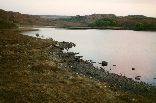
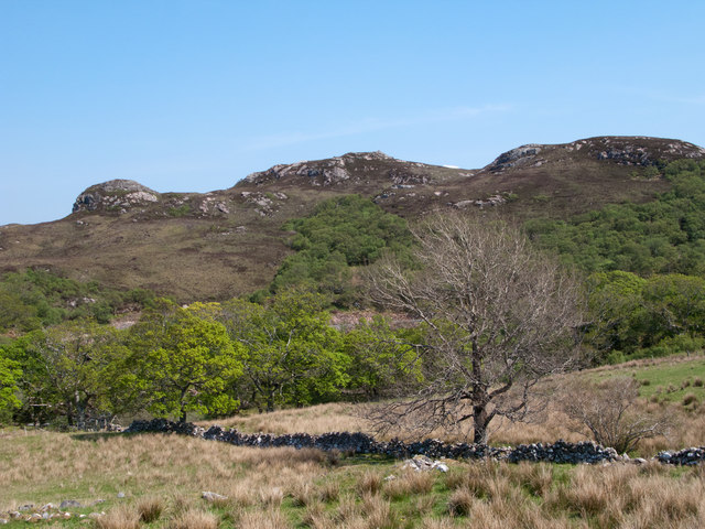
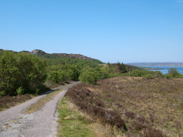
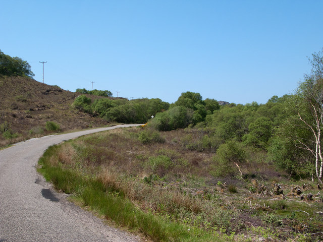
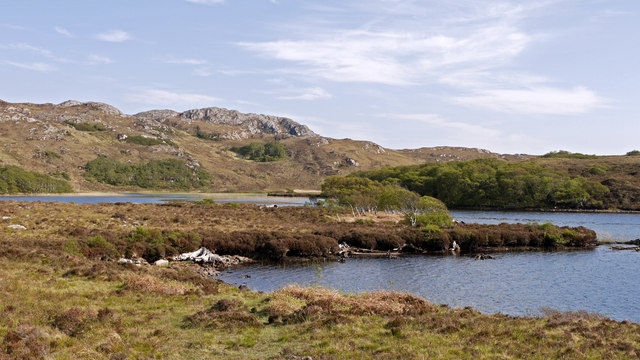
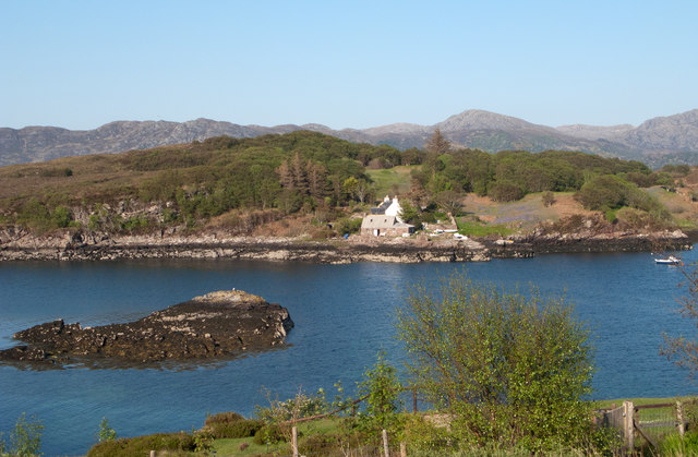
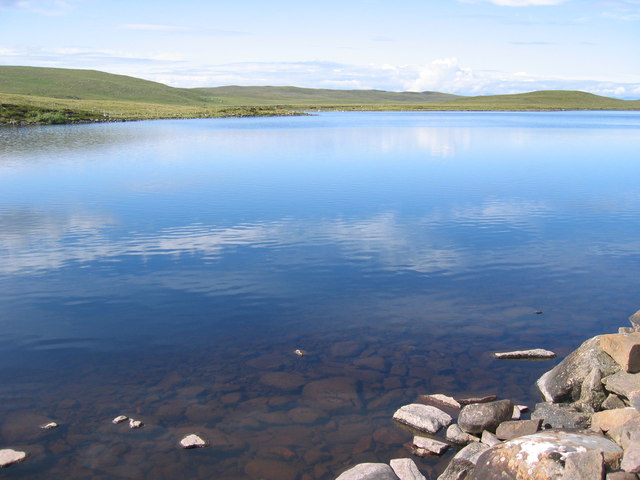
Port an Eilein is a picturesque coastal village located in Ross-shire, Scotland. Situated on the eastern shore of the Cromarty Firth, it offers stunning views of the sea, estuary, and creek. The name "Port an Eilein" translates to "Port of the Island," referring to a small island that lies just off the coast.

The village is known for its natural beauty and tranquility, attracting visitors who seek a peaceful retreat by the water. The sea surrounding Port an Eilein is a vibrant blue, reflecting the clear skies above. It is a popular spot for boating and sailing enthusiasts, who can often be seen gliding across the waves.

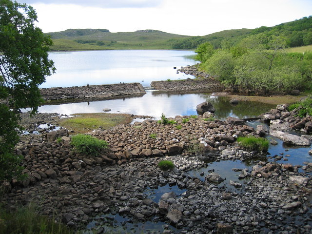
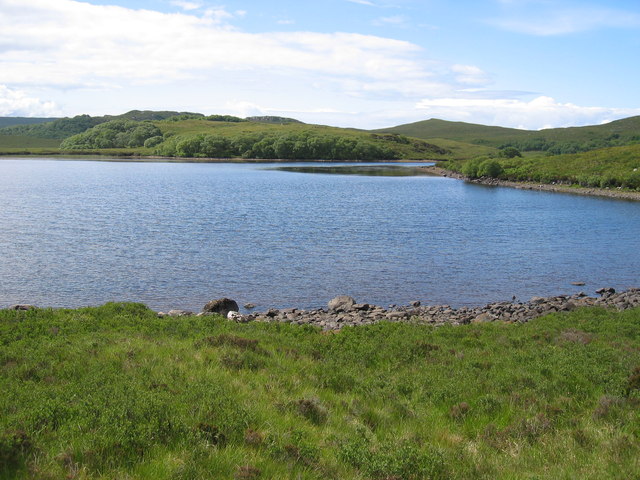
The estuary is a haven for wildlife, with a diverse range of bird species, including gulls, herons, and ducks, frequently spotted along its shores. The calm waters of the estuary provide an ideal habitat for various fish species, making it a favored spot for anglers.

A small creek winds its way through the village, adding to its charm. The creek is flanked by lush greenery, creating a picturesque setting for leisurely walks or picnics along its banks. The gentle sound of water flowing and the occasional sighting of otters or other wildlife make it a peaceful escape from the hustle and bustle of everyday life.

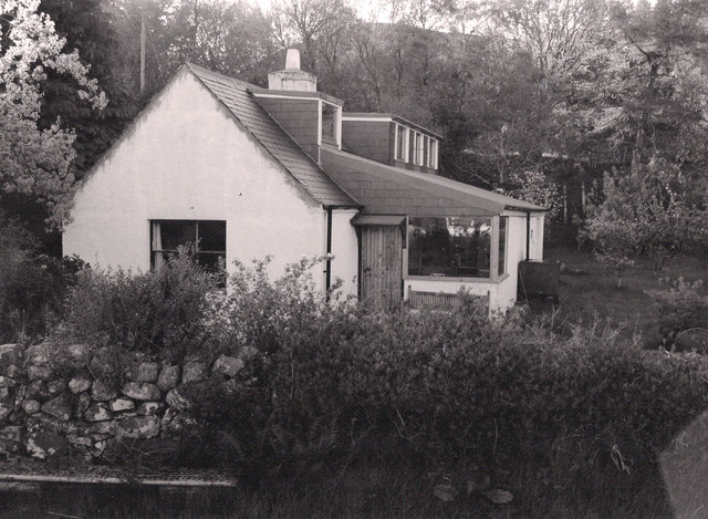
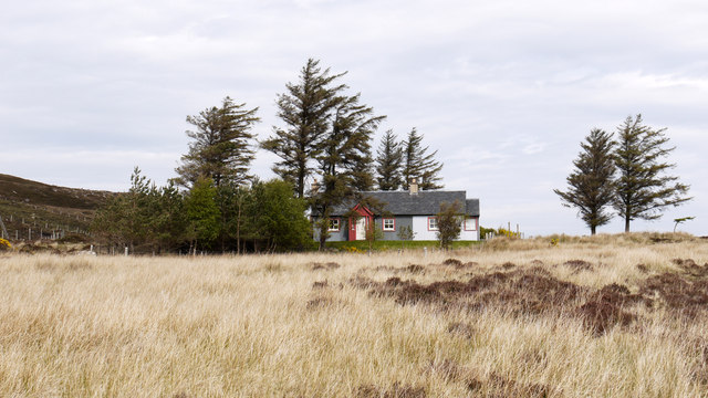
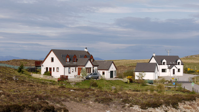
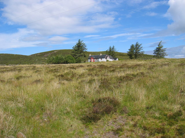
Port an Eilein is also home to a few quaint cottages and a local inn, offering visitors the opportunity to stay and immerse themselves in the tranquil surroundings. Whether exploring the coast, observing wildlife, or simply enjoying the serenity of the water, Port an Eilein is a destination that captures the essence of Scotland's natural beauty.

If you have any feedback on the listing, please let us know in the comments section below.

Port an Eilein Images

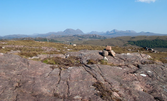
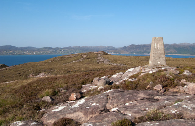
Images are sourced within 2km of 57.70322/-5.7197467 or Grid Reference NG7874. Thanks to Geograph Open Source API. All images are credited.

Trigpoint, Meall na h-Airde Looking north-east towards Gairloch
Trigpoint, Meall na h-Airde
Looking north-east towards Gairloch
Aird Cottage
Aird Cottage
Loch Bad a' Chrotha
Loch Bad a' Chrotha
Park Cottage Park Cottage is part of the crofting community of Port Henderson, near to Gairloch.
Park Cottage
Park Cottage is part of the crofting community of Port Henderson, near to Gairloch.
New housing at Badachro Badachro is a small village on the south side of Loch Gairloch. The detached houses seen in this image are part of the Coille Dhorch development on what was until recently, moorland.
New housing at Badachro
Badachro is a small village on the south side of Loch Gairloch. The detached houses seen in this image are part of the Coille Dhorch development on what was until recently, moorland.
An Torr An Torr is a minor hill rising to just 96m, lying east of the village of Badachro.
An Torr
An Torr is a minor hill rising to just 96m, lying east of the village of Badachro.
Road descending to Camas na h-Airigh The road leaves the B8056 near to Badachro giving access to the few homes above the bay. Loch Gairloch lies in the distance.
Road descending to Camas na h-Airigh
The road leaves the B8056 near to Badachro giving access to the few homes above the bay. Loch Gairloch lies in the distance.
B8056 above Leacnasaide Leacnasaide is a small community above Loch Shieldaig; the B8056 is seen here passing above it on its way to Red Point.
B8056 above Leacnasaide
Leacnasaide is a small community above Loch Shieldaig; the B8056 is seen here passing above it on its way to Red Point.
Loch Bad a' Chròtha Loch Bad a' Chròtha as seen from close to the B8032. A promontory bearing a few trees juts into the water; seen at its base are the remains of ancient trees preserved in peat bog and now exposed again.
Loch Bad a' Chròtha
Loch Bad a' Chròtha as seen from close to the B8032. A promontory bearing a few trees juts into the water; seen at its base are the remains of ancient trees preserved in peat bog and now exposed again.
Sandstone slab with cairn on Meall na h-Airde Meall na h-Airde is a low hill on the south side of Loch Gairloch. Baosbheinn is the distant, prominent mountain at the left side of the image; the Torridon mountains lie to the right of it.
Sandstone slab with cairn on Meall na h-Airde
Meall na h-Airde is a low hill on the south side of Loch Gairloch. Baosbheinn is the distant, prominent mountain at the left side of the image; the Torridon mountains lie to the right of it.
Trig point of Meall na h-Airde Meall na h-Airde is a low hill on the south side of Loch Gairloch. Sandstone ribs run away from the pillar towards the loch.
Trig point of Meall na h-Airde
Meall na h-Airde is a low hill on the south side of Loch Gairloch. Sandstone ribs run away from the pillar towards the loch.
Eilean Horrisdale Eilean Horrisdale as seen from Aird, to the west.
Eilean Horrisdale
Eilean Horrisdale as seen from Aird, to the west.
Scrubland near Leacnasaide
Weir at Loch Bad a' Chrotha
Loch Bad na h-Achlaise
Park Cottage near Port Henderson
Loch Bad a' Chrotha
Loch Bad a' Chrotha
Double rainbow , Meall na h-Airde
Show me another place!

Port an Eilein is located at Grid Ref: NG7874 (Lat: 57.70322, Lng: -5.7197467)

Unitary Authority: Highland

Police Authority: Highlands and Islands

What 3 Words

///swear.isolating.hooks. Near Gairloch, Highland

Related Wikis

Eilean Horrisdale

Eilean Horrisdale is an uninhabited island in Loch Gairloch in Wester Ross, Scotland. == Geography == Eilean Horrisdale is the largest island in Loch Gairloch...

Badachro

Badachro (Scottish Gaelic: Bad a' Chrò) is a former fishing village, in the northwest Highlands of Scotland. == Geography == Badachro sits about 3 km south...

Broadford Beds Formation

The Broadford Beds Formation is a Sinemurian geologic formation in western Scotland. An indeterminate partial tibia of a theropod dinosaur are among the...

Gair Loch

The Gair Loch is a sea loch on the North West coast of Highland, Scotland. In Scottish Gaelic it is an Geàrr Loch meaning 'the short loch'. Around 6 miles...

Nearby Amenities

Located within 500m of 57.70322,-5.7197467
Created By: almien_coastlines
Source: PGS
Lat/Long: 57.70197/-5.717456
Created By: almien_coastlines
Source: PGS
Lat/Long: 57.702093/-5.717703
Source: PGS
Lat/Long: 57.7023077/-5.7190398
Created By: almien_coastlines
Source: PGS
Lat/Long: 57.702435/-5.719643
Source: PGS
Lat/Long: 57.7026875/-5.7197477
Source: PGS
Lat/Long: 57.7036067/-5.7190084
Source: PGS
Lat/Long: 57.7036423/-5.720159
Created By: almien_coastlines
Source: PGS
Lat/Long: 57.703939/-5.721191
Source: PGS
Lat/Long: 57.7044755/-5.7212976
Created By: almien_coastlines
Source: PGS
Lat/Long: 57.704701/-5.721488
Source: PGS
Lat/Long: 57.7048603/-5.7219535
Source: PGS
Lat/Long: 57.7051953/-5.7221659
Source: PGS
Lat/Long: 57.7056666/-5.7216327
Source: PGS
Lat/Long: 57.7060935/-5.7212298
Created By: almien_coastlines
Source: PGS
Lat/Long: 57.70624/-5.721364
Created By: almien_coastlines
Source: PGS
Lat/Long: 57.70623/-5.721841
Source: PGS
Lat/Long: 57.7074564/-5.7211945
Source: PGS
Lat/Long: 57.7076044/-5.7207245
Created By: almien_coastlines
Source: PGS
Lat/Long: 57.707667/-5.720514
Source: PGS
Lat/Long: 57.7076889/-5.7201883
Created By: almien_coastlines
Source: PGS
Lat/Long: 57.704129/-5.712355
Source: PGS
Lat/Long: 57.703412/-5.7131749
Source: PGS
Lat/Long: 57.7032282/-5.7132124
Created By: almien_coastlines
Source: PGS
Lat/Long: 57.703085/-5.713233
Source: PGS
Lat/Long: 57.7024317/-5.7134826
Source: PGS
Lat/Long: 57.7020944/-5.7135588
Created By: almien_coastlines
Source: PGS
Lat/Long: 57.701797/-5.713615
Created By: almien_coastlines
Source: PGS
Lat/Long: 57.701663/-5.713844
Source: PGS
Lat/Long: 57.7015201/-5.7151437
Source: PGS
Lat/Long: 57.701342/-5.7159114
Source: PGS
Lat/Long: 57.7014879/-5.7167146
Source: PGS
Lat/Long: 57.7005884/-5.7259856
Source: PGS
Lat/Long: 57.7007875/-5.7258389
Source: PGS
Lat/Long: 57.7008568/-5.7258269
Source: PGS
Lat/Long: 57.7011941/-5.7251262
Source: PGS
Lat/Long: 57.7013431/-5.7246015
Source: PGS
Lat/Long: 57.7015302/-5.7240378
Source: PGS
Lat/Long: 57.7016336/-5.7236745
Created By: almien_coastlines
Source: PGS
Lat/Long: 57.701581/-5.723646
Source: PGS
Lat/Long: 57.7013854/-5.7232643
Source: PGS
Lat/Long: 57.7013563/-5.7229386
Source: PGS
Lat/Long: 57.7016867/-5.7223149
Source: PGS
Lat/Long: 57.7018094/-5.7220421
Source: PGS
Lat/Long: 57.7019016/-5.721793
Source: PGS
Lat/Long: 57.7016042/-5.7217122
Source: PGS
Lat/Long: 57.701338/-5.7219921
Source: PGS
Lat/Long: 57.7011618/-5.7220878
Source: PGS
Lat/Long: 57.7012378/-5.7232347
Source: PGS
Lat/Long: 57.7011958/-5.7236402
Source: PGS
Lat/Long: 57.7008776/-5.7242182
Source: PGS
Lat/Long: 57.7006804/-5.7244849
Created By: almien_coastlines
Source: PGS
Lat/Long: 57.700404/-5.724753
Source: PGS
Lat/Long: 57.7002211/-5.7248878
Source: PGS
Lat/Long: 57.7000998/-5.7251253
Source: PGS
Lat/Long: 57.699921/-5.7149378
Source: PGS
Lat/Long: 57.7005031/-5.7167951
Source: PGS
Lat/Long: 57.7005143/-5.7171318
Source: PGS
Lat/Long: 57.7004817/-5.7174833
Created By: almien_coastlines
Source: PGS
Lat/Long: 57.700538/-5.718544
Source: PGS
Lat/Long: 57.7007857/-5.7189834
Source: PGS
Lat/Long: 57.6997441/-5.7197366
Source: PGS
Lat/Long: 57.6995229/-5.7203565
Source: PGS
Lat/Long: 57.6993926/-5.7204993
Source: PGS
Lat/Long: 57.6990649/-5.7217291
Source: PGS
Lat/Long: 57.7012198/-5.7266192
Source: PGS
Lat/Long: 57.7015471/-5.7262135
Source: PGS
Lat/Long: 57.701741/-5.7257868
Source: PGS
Lat/Long: 57.7018446/-5.7256104
Source: PGS
Lat/Long: 57.7024383/-5.7250063
Source: PGS
Lat/Long: 57.7030215/-5.7246482
Source: PGS
Lat/Long: 57.7032079/-5.7246956
Created By: almien_coastlines
Source: PGS
Lat/Long: 57.703852/-5.725252
Created By: almien_coastlines
Source: PGS
Lat/Long: 57.704107/-5.725271
Source: PGS
Lat/Long: 57.7044788/-5.7256717
Created By: almien_coastlines
Source: PGS
Lat/Long: 57.704608/-5.725787
Source: PGS
Lat/Long: 57.7048485/-5.7263459
Created By: almien_coastlines
Source: PGS
Lat/Long: 57.705877/-5.726361
Leisure: slipway
Lat/Long: 57.7056125/-5.7263137
Power: pole
Lat/Long: 57.7030081/-5.7274475
Power: pole
Lat/Long: 57.7035751/-5.7269149
Power: pole
Lat/Long: 57.7045784/-5.7275755
Power: pole
Lat/Long: 57.7042134/-5.7270835
Power: pole
Lat/Long: 57.7038631/-5.7266097
Noexit: yes
Lat/Long: 57.7038297/-5.7190702
The data included in this document is from www.openstreetmap.org. The data is made available under ODbL.

Have you been to Port an Eilein?

Leave your review of Port an Eilein below (or comments, questions and feedback).