An Cannunn

Island in Ross-shire

Scotland

An Cannunn

Trigpoint, Meall na h-Airde Looking north-east towards Gairloch
Trigpoint, Meall na h-Airde Credit: Becky Williamson

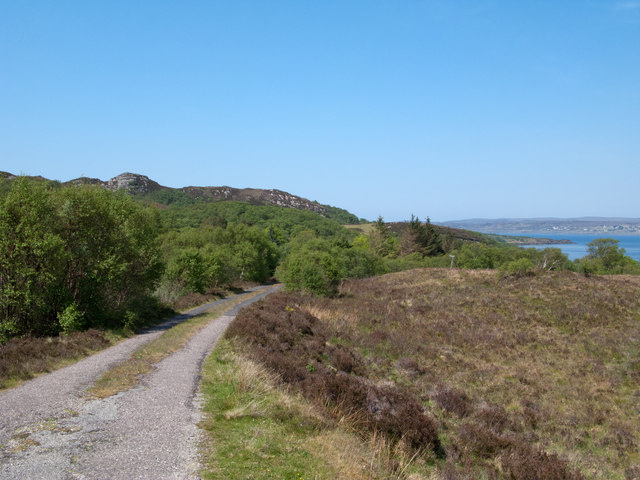
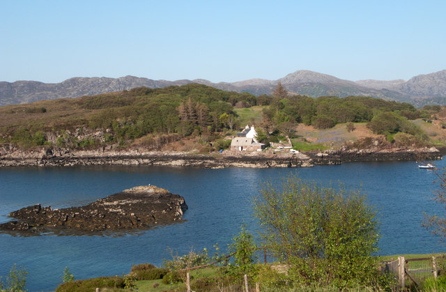
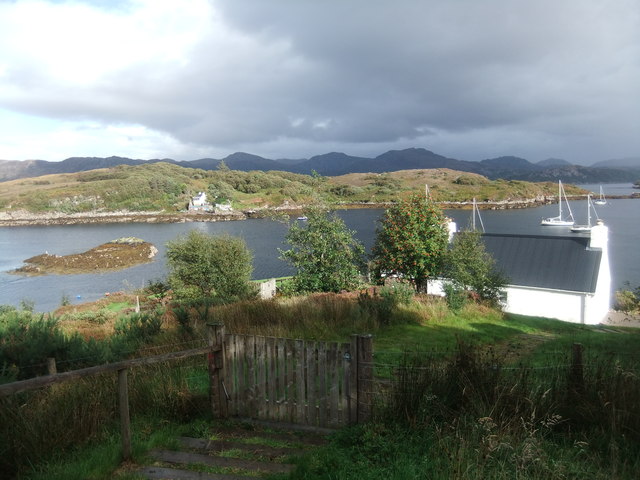
An Cannunn is a small island located off the coast of Ross-shire in Scotland. The island is situated in the Inner Hebrides, specifically in the Sound of Raasay. It is part of the Highland Council area and is known for its stunning natural beauty and rich history.

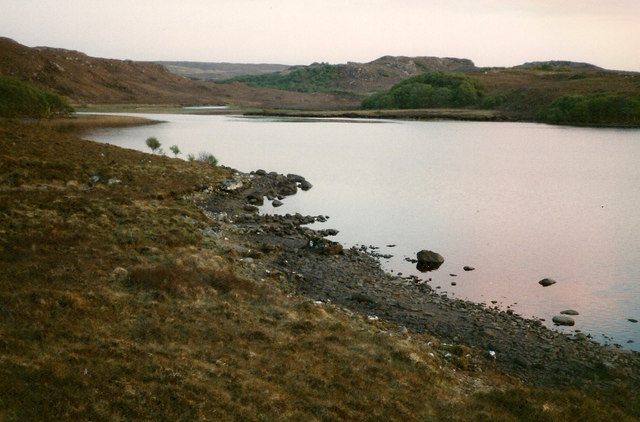
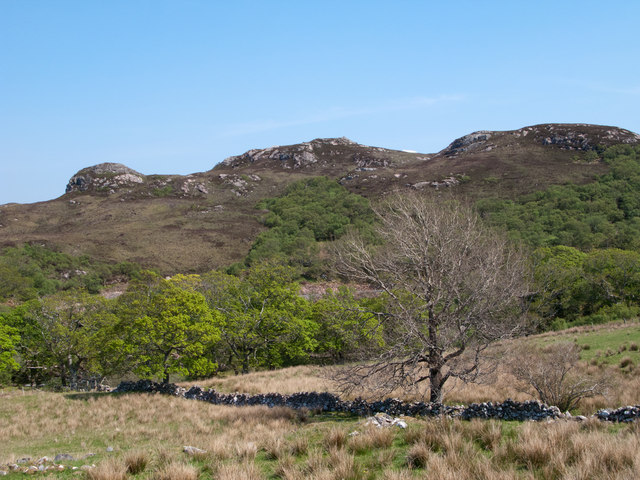
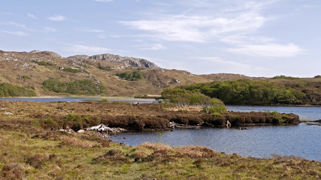
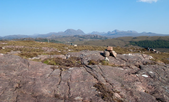
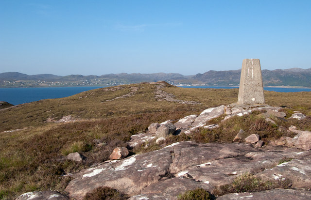
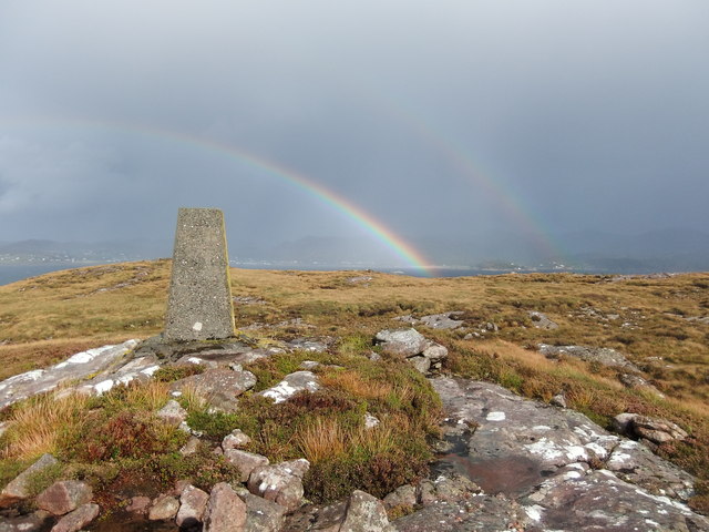
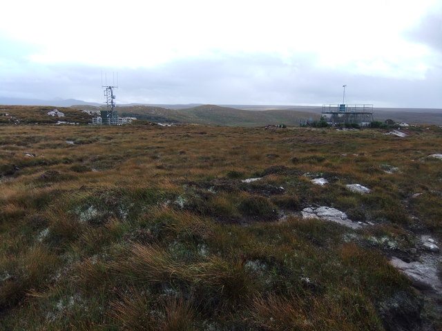
Measuring approximately 0.5 square kilometers, An Cannunn is characterized by rugged coastline, with cliffs and rocky formations. The island is predominantly covered in grass and heather, providing a habitat for various species of birds and wildlife.

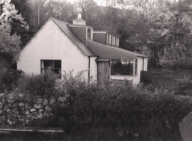
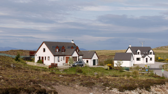
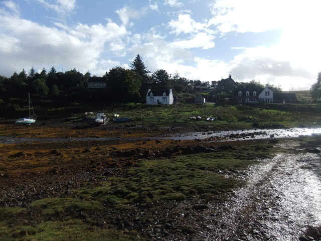
Historically, An Cannunn was inhabited by a small population engaged in fishing and agriculture. However, over the years, the island's population has dwindled, and it is now primarily used for tourism and recreational activities. Visitors can explore the island's picturesque landscapes, go hiking along its trails, and enjoy birdwatching opportunities.

Access to An Cannunn is primarily via boat or ferry, with regular services available from nearby towns such as Portree and Kyle of Lochalsh. The island does not have any permanent facilities or accommodations, making it a true escape from the hustle and bustle of modern life.

An Cannunn offers a serene and secluded getaway for nature enthusiasts and those seeking tranquility amidst breathtaking scenery. With its unspoiled landscapes and historical remnants, the island provides a glimpse into the traditional way of life in the Scottish Highlands.

If you have any feedback on the listing, please let us know in the comments section below.

An Cannunn Images

Images are sourced within 2km of 57.708121/-5.7193766 or Grid Reference NG7874. Thanks to Geograph Open Source API. All images are credited.

Trigpoint, Meall na h-Airde Looking north-east towards Gairloch
Trigpoint, Meall na h-Airde
Looking north-east towards Gairloch
Aird Cottage
Aird Cottage
Loch Bad a' Chrotha
Loch Bad a' Chrotha
New housing at Badachro Badachro is a small village on the south side of Loch Gairloch. The detached houses seen in this image are part of the Coille Dhorch development on what was until recently, moorland.
New housing at Badachro
Badachro is a small village on the south side of Loch Gairloch. The detached houses seen in this image are part of the Coille Dhorch development on what was until recently, moorland.
An Torr An Torr is a minor hill rising to just 96m, lying east of the village of Badachro.
An Torr
An Torr is a minor hill rising to just 96m, lying east of the village of Badachro.
Road descending to Camas na h-Airigh The road leaves the B8056 near to Badachro giving access to the few homes above the bay. Loch Gairloch lies in the distance.
Road descending to Camas na h-Airigh
The road leaves the B8056 near to Badachro giving access to the few homes above the bay. Loch Gairloch lies in the distance.
Loch Bad a' Chròtha Loch Bad a' Chròtha as seen from close to the B8032. A promontory bearing a few trees juts into the water; seen at its base are the remains of ancient trees preserved in peat bog and now exposed again.
Loch Bad a' Chròtha
Loch Bad a' Chròtha as seen from close to the B8032. A promontory bearing a few trees juts into the water; seen at its base are the remains of ancient trees preserved in peat bog and now exposed again.
Sandstone slab with cairn on Meall na h-Airde Meall na h-Airde is a low hill on the south side of Loch Gairloch. Baosbheinn is the distant, prominent mountain at the left side of the image; the Torridon mountains lie to the right of it.
Sandstone slab with cairn on Meall na h-Airde
Meall na h-Airde is a low hill on the south side of Loch Gairloch. Baosbheinn is the distant, prominent mountain at the left side of the image; the Torridon mountains lie to the right of it.
Trig point of Meall na h-Airde Meall na h-Airde is a low hill on the south side of Loch Gairloch. Sandstone ribs run away from the pillar towards the loch.
Trig point of Meall na h-Airde
Meall na h-Airde is a low hill on the south side of Loch Gairloch. Sandstone ribs run away from the pillar towards the loch.
Eilean Horrisdale Eilean Horrisdale as seen from Aird, to the west.
Eilean Horrisdale
Eilean Horrisdale as seen from Aird, to the west.
Scrubland near Leacnasaide
Weir at Loch Bad a' Chrotha
Loch Bad na h-Achlaise
Loch Bad a' Chrotha
Loch Bad a' Chrotha
Double rainbow , Meall na h-Airde
Mast and reservoir on Meall na h-Airde
Eilean Horrisdale
Eilean Horrisdale
Badachro
Badachro
Show me another place!

An Cannunn is located at Grid Ref: NG7874 (Lat: 57.708121, Lng: -5.7193766)

Unitary Authority: Highland

Police Authority: Highlands and Islands

What 3 Words

///hazelnuts.quiz.tram. Near Gairloch, Highland

Related Wikis

Eilean Horrisdale

Eilean Horrisdale is an uninhabited island in Loch Gairloch in Wester Ross, Scotland. == Geography == Eilean Horrisdale is the largest island in Loch Gairloch...

Badachro

Badachro (Scottish Gaelic: Bad a' Chrò) is a former fishing village, in the northwest Highlands of Scotland. == Geography == Badachro sits about 3 km south...

Gair Loch

The Gair Loch is a sea loch on the North West coast of Highland, Scotland. In Scottish Gaelic it is an Geàrr Loch meaning 'the short loch'. Around 6 miles...

Broadford Beds Formation

The Broadford Beds Formation is a Sinemurian geologic formation in western Scotland. An indeterminate partial tibia of a theropod dinosaur are among the...

Nearby Amenities

Located within 500m of 57.708121,-5.7193766
Source: PGS
Lat/Long: 57.7036423/-5.720159
Created By: almien_coastlines
Source: PGS
Lat/Long: 57.703939/-5.721191
Source: PGS
Lat/Long: 57.7044755/-5.7212976
Created By: almien_coastlines
Source: PGS
Lat/Long: 57.704701/-5.721488
Source: PGS
Lat/Long: 57.7048603/-5.7219535
Source: PGS
Lat/Long: 57.7051953/-5.7221659
Source: PGS
Lat/Long: 57.7056666/-5.7216327
Source: PGS
Lat/Long: 57.7060935/-5.7212298
Created By: almien_coastlines
Source: PGS
Lat/Long: 57.70624/-5.721364
Created By: almien_coastlines
Source: PGS
Lat/Long: 57.70623/-5.721841
Source: PGS
Lat/Long: 57.7074564/-5.7211945
Source: PGS
Lat/Long: 57.7076044/-5.7207245
Created By: almien_coastlines
Source: PGS
Lat/Long: 57.707667/-5.720514
Source: PGS
Lat/Long: 57.7076889/-5.7201883
Source: PGS
Lat/Long: 57.7079837/-5.7196912
Source: PGS
Lat/Long: 57.7079733/-5.7192523
Created By: almien_coastlines
Source: PGS
Lat/Long: 57.70823/-5.718163
Source: PGS
Lat/Long: 57.7081849/-5.7178854
Created By: almien_coastlines
Source: PGS
Lat/Long: 57.707857/-5.717657
Source: PGS
Lat/Long: 57.7079635/-5.7168272
Source: PGS
Lat/Long: 57.7078989/-5.7163001
Source: PGS
Lat/Long: 57.7076082/-5.7159479
Source: PGS
Lat/Long: 57.7074165/-5.7154795
Source: PGS
Lat/Long: 57.7072883/-5.7151819
Source: PGS
Lat/Long: 57.707238/-5.713806
Source: PGS
Lat/Long: 57.707565/-5.712872
Source: PGS
Lat/Long: 57.7076367/-5.7117617
Source: PGS
Lat/Long: 57.7072449/-5.7113679
Created By: almien_coastlines
Source: PGS
Lat/Long: 57.705877/-5.726361
Source: PGS
Lat/Long: 57.7061926/-5.7266861
Source: PGS
Lat/Long: 57.7063573/-5.7269819
Leisure: slipway
Lat/Long: 57.7056125/-5.7263137
Noexit: yes
Lat/Long: 57.7038297/-5.7190702
The data included in this document is from www.openstreetmap.org. The data is made available under ODbL.

Have you been to An Cannunn?

Leave your review of An Cannunn below (or comments, questions and feedback).