Caol Cumhang

Sea, Estuary, Creek in Ross-shire

Scotland

Caol Cumhang

A pig pen on the track to Bruinagil
A pig pen on the track to Bruinagil Credit: Mike Dunn

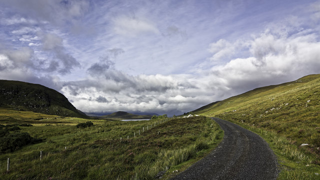
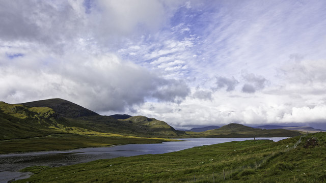
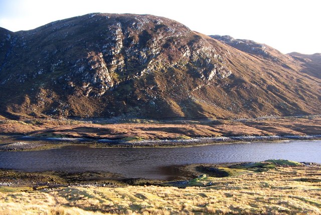
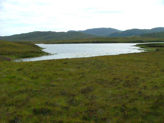
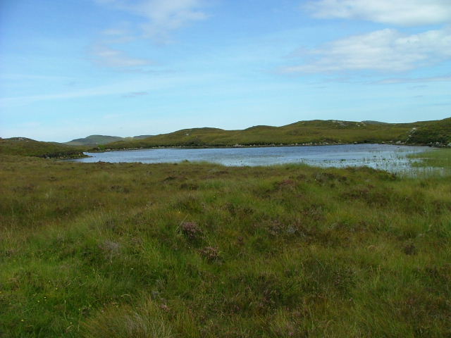
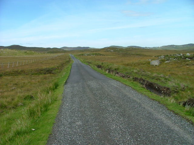
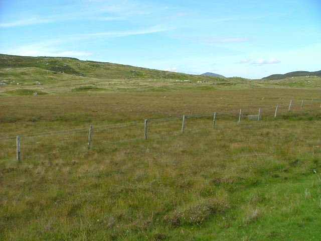
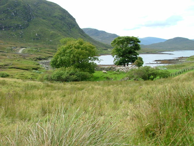
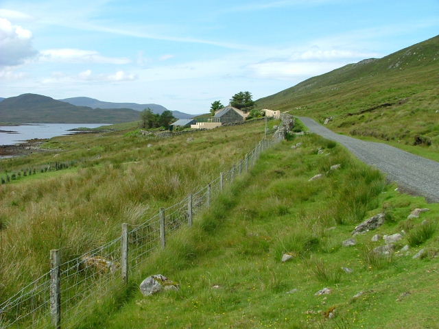
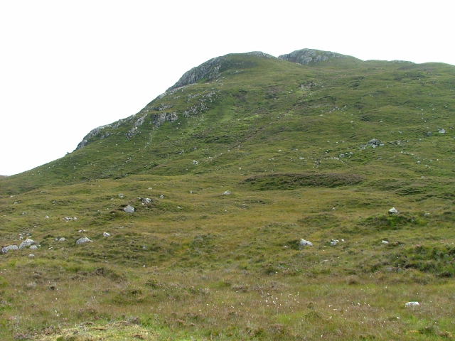
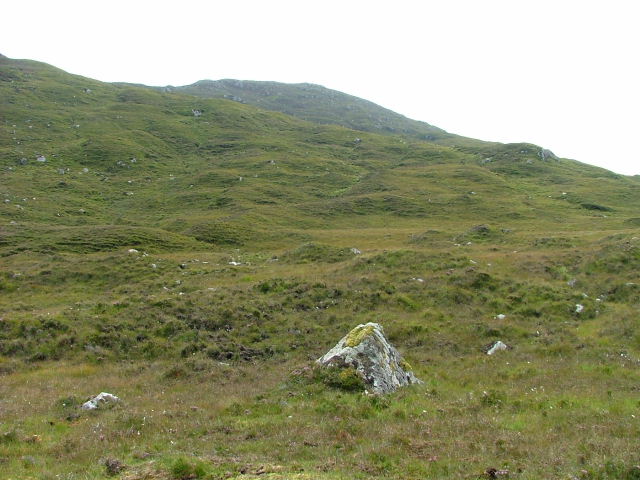
Caol Cumhang is a small coastal village located in Ross-shire, Scotland. Situated on the shores of the sea, it is nestled between picturesque hills and offers stunning views of the surrounding landscape. The village is primarily known for its sea, estuary, and creek, which are all natural features that greatly contribute to the charm of the area.

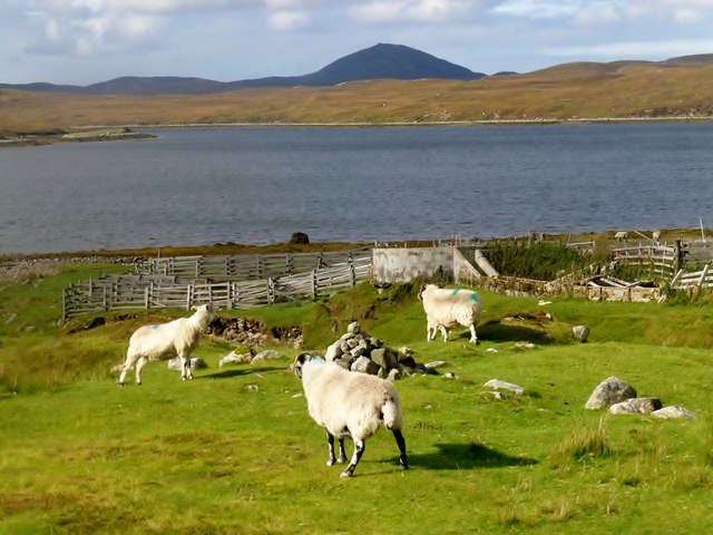
The sea in Caol Cumhang is part of the Moray Firth, a large inlet of the North Sea. It provides residents and visitors with opportunities for fishing, boating, and other water activities. The sea is also home to a diverse range of marine life, including seals, dolphins, and various species of fish.

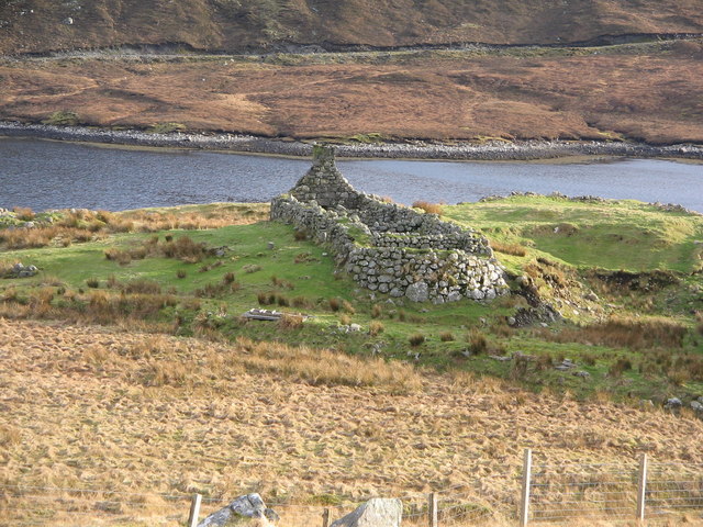
Adjacent to the sea is an estuary, where a river meets the sea. The estuary in Caol Cumhang is formed by the convergence of the River Cumhang and the sea. This creates a unique ecosystem that supports a variety of bird species, such as herons and oystercatchers, making it a popular spot for birdwatching enthusiasts.

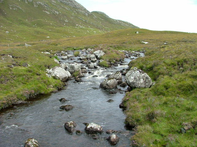
A creek runs through the village, adding to its natural beauty. The creek provides a peaceful and tranquil setting for residents and visitors to enjoy. It is often frequented by locals who appreciate its calming presence and use it as a place for relaxation and reflection.

Overall, Caol Cumhang is a charming coastal village with a rich natural environment. Its sea, estuary, and creek offer a range of recreational opportunities and contribute to the area's scenic beauty. Whether one seeks outdoor activities or simply desires a peaceful retreat, Caol Cumhang is a destination that can cater to those needs.

If you have any feedback on the listing, please let us know in the comments section below.

Caol Cumhang Images

Images are sourced within 2km of 58.052795/-6.5975348 or Grid Reference NB2816. Thanks to Geograph Open Source API. All images are credited.

A pig pen on the track to Bruinagil
Sheep Folds At Bruinagil Just about to reach the track on the southern edge of the eastern arm of Loch Seaforth after collecting my last 3 Marilyns on the Isle of Lewis.
Parked at the bridge before using the track to the south of the loch to the sheep folds. Then up SSW to the first cairn then onto Mor Mhonadh then Guineamol before the second Marilyn Muitheabhal and then the third Marilyn Beinn Mhor before returning on a low route to the start.
Sheep Folds At Bruinagil
Just about to reach the track on the southern edge of the eastern arm of Loch Seaforth after collecting my last 3 Marilyns on the Isle of Lewis. Parked at the bridge before using the track to the south of the loch to the sheep folds. Then up SSW to the first cairn then onto Mor Mhonadh then Guineamol before the second Marilyn Muitheabhal and then the third Marilyn Beinn Mhor before returning on a low route to the start.
Road beyond Ceann Shiphoirt
Upper Loch Shiphoirt
Ruin on shore of Loch Seaforth, Isle of Lewis The photo is taken looking south with the upper end of Loch Seaforth in the background.
Ruin on shore of Loch Seaforth, Isle of Lewis
The photo is taken looking south with the upper end of Loch Seaforth in the background.
Lochan and bog, Isle of Lewis Unnamed lochan perched on a broad ledge on the western flank of Feiriosbhal.  Photo taken looking north in bright-light after rain.
Lochan and bog, Isle of Lewis
Unnamed lochan perched on a broad ledge on the western flank of Feiriosbhal. Photo taken looking north in bright-light after rain.
Cul Chreag, Isle of Lewis Photo of Cul Chreag (229mAOD) taken looking south across the narrow upper reaches of Loch Seaforth.
Cul Chreag, Isle of Lewis
Photo of Cul Chreag (229mAOD) taken looking south across the narrow upper reaches of Loch Seaforth.
Loch na Muilne
Loch na Muilne
Unnamed Lochan By the Eisgein road.
Unnamed Lochan
By the Eisgein road.
The Eisgein road Looking south.
The Eisgein road
Looking south.
Moorland east of the Eisgein road.
Trees and ruins At the eastern head of Loch Shiphoirt.
Trees and ruins
At the eastern head of Loch Shiphoirt.
Lodge at Ceann Shiphoirt On the Shiphoirt Estate.
Lodge at Ceann Shiphoirt
On the Shiphoirt Estate.
Bridge at Ceann Shiphoirt The bridge spans the short stretch of water between Loch Shiphoirt and Loch Sgiobacleit.
Bridge at Ceann Shiphoirt
The bridge spans the short stretch of water between Loch Shiphoirt and Loch Sgiobacleit.
Outflow from Loch Sgiobacleit
Northwestern slopes of Feiriosbhal
Moorland below Cúl Chreag
Commemorative stone at Ceann Shìpoirt The stone reads..........
                           Seaforth Castle
In 1620, Kenneth, chief of the Clan Mackenzie and owner of Lewis, built his first residence here at Seaforth Head.
His successors, the Earls of Seaforth took their title from the nearby loch and raised the Seaforth Highlanders Regiment, taking their name all over the world.
They were amongst the most decorated and successful fighting units in the British army until the name was lost in the reforms of the late 20th century.
The Mackenzies brought peace to the island and ruleed for over 200 years.
Commemorative stone at Ceann Shìpoirt
The stone reads.......... Seaforth Castle In 1620, Kenneth, chief of the Clan Mackenzie and owner of Lewis, built his first residence here at Seaforth Head. His successors, the Earls of Seaforth took their title from the nearby loch and raised the Seaforth Highlanders Regiment, taking their name all over the world. They were amongst the most decorated and successful fighting units in the British army until the name was lost in the reforms of the late 20th century. The Mackenzies brought peace to the island and ruleed for over 200 years.
Show me another place!

Caol Cumhang is located at Grid Ref: NB2816 (Lat: 58.052795, Lng: -6.5975348)

Unitary Authority: Na h-Eileanan an Iar

Police Authority: Highlands and Islands

What 3 Words

///justifies.ducks.hoaxes. Near Leurbost, Na h-Eileanan Siar

Related Wikis

Balallan

Balallan (Scottish Gaelic: Baile Ailein, Bail' Ailein), meaning "Allan's Town", is a crofting township on the Isle of Lewis, in the Outer Hebrides, Scotland...

Airidh a' Bhruaich

Airidh a' Bhruaich (Arivruaich - anglicised) is a scattered crofting township in the South Lochs district of the Isle of Lewis in the Outer Hebrides of...

Park, Lewis

Park (Scottish Gaelic: A' Phàirc), also known as South Lochs, is a huge area of land connected to the rest of Lewis only by a narrow neck between Loch...

Loch Erisort

Loch Erisort (Scottish Gaelic: Èireasort) is an 8-mile-long narrow sea inlet on the east coast of the Isle of Lewis in the Outer Hebrides off the west...

Nearby Amenities

Located within 500m of 58.052795,-6.5975348
Mackenzies of Seaforth
Historic: monument
Lat/Long: 58.054613/-6.6048468
Passing Place
Lat/Long: 58.05453/-6.6018993
Passing Place
Lat/Long: 58.054285/-6.5910025
Caol Cumhang
Natural: strait
Lat/Long: 58.0528607/-6.5972793
The data included in this document is from www.openstreetmap.org. The data is made available under ODbL.

Have you been to Caol Cumhang?

Leave your review of Caol Cumhang below (or comments, questions and feedback).