Pwell Edyn

Sea, Estuary, Creek in Pembrokeshire

Wales

Pwell Edyn

Fishguard Codd bottle (1) This broken bottle, found here, once contained ginger beer or a similar fizzy drink, using a method invented by Hiram Codd, a British engineer (1838-1887). His idea, which involved using the pressure of the carbonated water to push a glass ball against a rubber ring so creating a perfect seal, revolutionized the drinks trade world-wide. The invention was patented but bottle manufacturers could replicate it if they purchased the balls, the sealing rings and requisite tool. Mineral water firms had bottles made to their own specifications, with their names and trademarks. 
This example was no doubt broken years ago when children used routinely to smash the bottles to extract the marbles. It came from the local bottling factory of T. Lewis, Fishguard, which is still known as the Popworks and has recently been converted into a youth centre, see <a title="https://www.geograph.org.uk/photo/496156" href="https://www.geograph.org.uk/photo/496156">Link</a>
The trademark  which I have seen described as an iceberg, represents in fact, the rocky pinnacle known as Needle Rock which stands off the coast east of Fishguard. See <a title="https://www.geograph.org.uk/photo/758403" href="https://www.geograph.org.uk/photo/758403">Link</a>
(My thanks to Roy Lewis for this revelation!)
Fishguard Codd bottle (1) Credit: Natasha Ceridwen de Chroustchoff

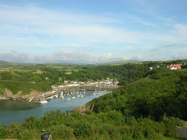
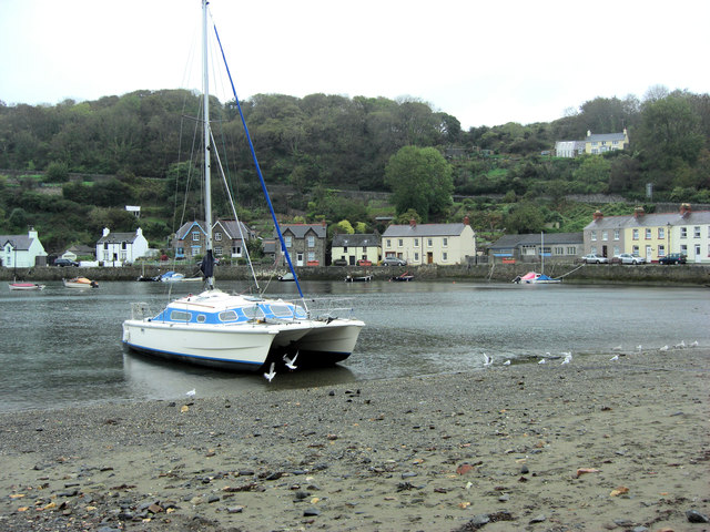
Pwell Edyn is a picturesque coastal village located in Pembrokeshire, Wales. Situated along the stunning Welsh coastline, it is renowned for its beautiful sea, estuary, and creek, making it a popular destination for nature lovers and outdoor enthusiasts.

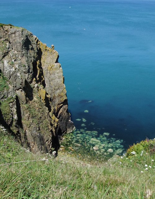
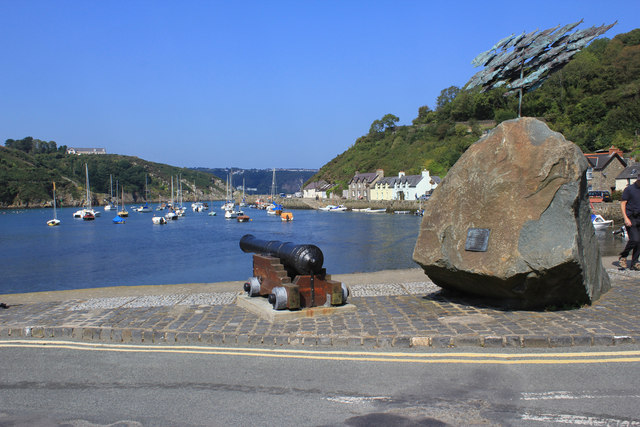
The village is nestled between rolling hills and offers breathtaking views of the sea, with its crystal-clear waters and golden sandy beaches. The coastline boasts rugged cliffs and hidden coves, providing a tranquil and idyllic setting for visitors to explore and enjoy.

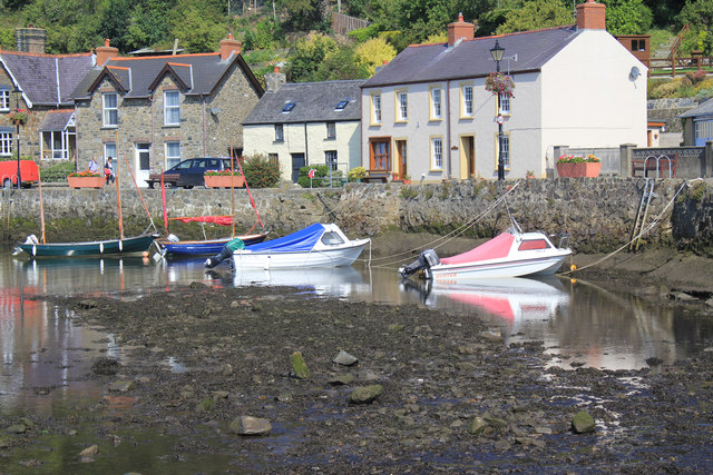
Pwell Edyn is also known for its estuary and creek, which add to the village's natural beauty. The estuary is formed where a river meets the sea, creating a unique habitat for various species of birds, fish, and other marine life. Visitors can witness the tides ebb and flow, unveiling a mesmerizing landscape that changes with the seasons.

For those seeking outdoor activities, Pwell Edyn offers a wealth of options. The sea and estuary are perfect for swimming, kayaking, and paddleboarding, while the creek provides opportunities for fishing and boating. The village is also surrounded by scenic walking trails, allowing visitors to immerse themselves in the stunning coastal scenery.

In addition to its natural wonders, Pwell Edyn offers a range of amenities for visitors. There are charming cafes, restaurants, and pubs where visitors can indulge in delicious local cuisine and relax after a day of exploring. The village also has a vibrant arts and crafts scene, with galleries and workshops showcasing the work of local artists.

Overall, Pwell Edyn is a captivating destination that offers a blend of natural beauty, outdoor activities, and cultural experiences, making it a must-visit location for those seeking a peaceful and picturesque coastal getaway.

If you have any feedback on the listing, please let us know in the comments section below.
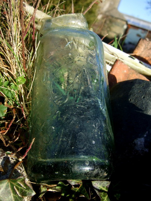
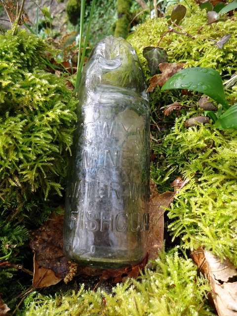
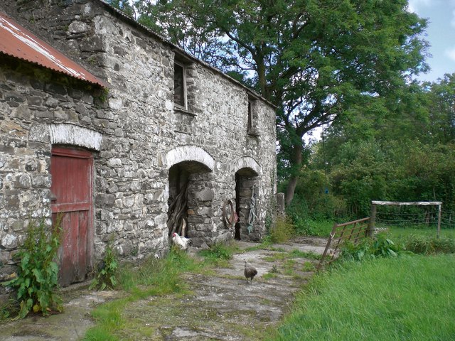
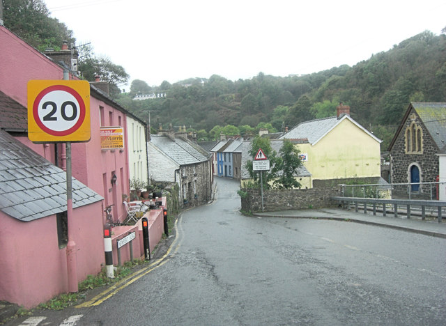
Pwell Edyn Images

Images are sourced within 2km of 52.000393/-4.9616442 or Grid Reference SM9637. Thanks to Geograph Open Source API. All images are credited.

Fishguard Codd bottle (1) This broken bottle, found here, once contained ginger beer or a similar fizzy drink, using a method invented by Hiram Codd, a British engineer (1838-1887). His idea, which involved using the pressure of the carbonated water to push a glass ball against a rubber ring so creating a perfect seal, revolutionized the drinks trade world-wide. The invention was patented but bottle manufacturers could replicate it if they purchased the balls, the sealing rings and requisite tool. Mineral water firms had bottles made to their own specifications, with their names and trademarks. 
This example was no doubt broken years ago when children used routinely to smash the bottles to extract the marbles. It came from the local bottling factory of T. Lewis, Fishguard, which is still known as the Popworks and has recently been converted into a youth centre, see <a title="https://www.geograph.org.uk/photo/496156" href="https://www.geograph.org.uk/photo/496156">Link</a>
The trademark  which I have seen described as an iceberg, represents in fact, the rocky pinnacle known as Needle Rock which stands off the coast east of Fishguard. See <a title="https://www.geograph.org.uk/photo/758403" href="https://www.geograph.org.uk/photo/758403">Link</a>
(My thanks to Roy Lewis for this revelation!)
Fishguard Codd bottle (1)
This broken bottle, found here, once contained ginger beer or a similar fizzy drink, using a method invented by Hiram Codd, a British engineer (1838-1887). His idea, which involved using the pressure of the carbonated water to push a glass ball against a rubber ring so creating a perfect seal, revolutionized the drinks trade world-wide. The invention was patented but bottle manufacturers could replicate it if they purchased the balls, the sealing rings and requisite tool. Mineral water firms had bottles made to their own specifications, with their names and trademarks. This example was no doubt broken years ago when children used routinely to smash the bottles to extract the marbles. It came from the local bottling factory of T. Lewis, Fishguard, which is still known as the Popworks and has recently been converted into a youth centre, see Link The trademark which I have seen described as an iceberg, represents in fact, the rocky pinnacle known as Needle Rock which stands off the coast east of Fishguard. See Link (My thanks to Roy Lewis for this revelation!)
Fishguard Codd bottle (2) This is the second Codd bottle I have found, within a few weeks of the first, for which see here <a title="https://www.geograph.org.uk/photo/2332162" href="https://www.geograph.org.uk/photo/2332162">Link</a> for details. Like the first the bottle had its top broken to retrieve the desirable marble closure device from the neck.
Here, it has been washed and returned to its original finding place for the photograph, on a tumbledown wall in the woods close to the Afon Gwaun. 
It is bears the legend GWYNFA MINERAL WATER WORKS FISHGUARD. This was a small factory run by the Bateman family and located only a short distance away, as the crow flies, across the valley at Plas-y-fron on the edge of the town. The place has been closed for some time but is still standing, see <a title="https://www.geograph.org.uk/photo/2326322" href="https://www.geograph.org.uk/photo/2326322">Link</a> and <a title="https://www.geograph.org.uk/photo/2326331" href="https://www.geograph.org.uk/photo/2326331">Link</a>

(Thanks again to Roy Lewis for info.)
Fishguard Codd bottle (2)
This is the second Codd bottle I have found, within a few weeks of the first, for which see here Link for details. Like the first the bottle had its top broken to retrieve the desirable marble closure device from the neck. Here, it has been washed and returned to its original finding place for the photograph, on a tumbledown wall in the woods close to the Afon Gwaun. It is bears the legend GWYNFA MINERAL WATER WORKS FISHGUARD. This was a small factory run by the Bateman family and located only a short distance away, as the crow flies, across the valley at Plas-y-fron on the edge of the town. The place has been closed for some time but is still standing, see Link and Link (Thanks again to Roy Lewis for info.)
The Old harbour at Fishguard, Pembrokeshire Looking down on Old Harbour at Fishguard from the coastal path near Heol Emrys
The Old harbour at Fishguard, Pembrokeshire
Looking down on Old Harbour at Fishguard from the coastal path near Heol Emrys
Coast rider on the road again Bob Jones the coastriding Geographer sets off on the next stage of his marathon after spending the night just outside Fishguard. Nice to meet you Bob!
See <span class="nowrap"><a title="http://www.coastrider.org.uk/" rel="nofollow ugc noopener" href="http://www.coastrider.org.uk/">Link</a><img style="margin-left:2px;" alt="External link" title="External link - shift click to open in new window" src="https://s1.geograph.org.uk/img/external.png" width="10" height="10"/></span>
Coast rider on the road again
Bob Jones the coastriding Geographer sets off on the next stage of his marathon after spending the night just outside Fishguard. Nice to meet you Bob! See LinkExternal link
Bennetts Navy Tavern, Fishguard/ Abergwaun In the High Street/ Heol Fawr, uphill from the Square.  Nobody could say that towns in this part of Wales are drab - around here this pink and navy blue colour scheme  would pass as quite subdued.
Bennetts Navy Tavern, Fishguard/ Abergwaun
In the High Street/ Heol Fawr, uphill from the Square. Nobody could say that towns in this part of Wales are drab - around here this pink and navy blue colour scheme would pass as quite subdued.
Ty Tollau - the old custom house, Fishguard/Abergwaun This house stands at a sharp bend, part way down the steep hill which links 'uphill' Fishguard with the Lower Town (Cwm) and old harbour.  Given its commanding position overlooking the harbour, it comes as no surprise to learn that it was once the customs house - see ceridwen's image of the same building:<a href="https://www.geograph.org.uk/photo/2320103">SM9537 : Old custom house, Hill Terrace</a>.
Ty Tollau - the old custom house, Fishguard/Abergwaun
This house stands at a sharp bend, part way down the steep hill which links 'uphill' Fishguard with the Lower Town (Cwm) and old harbour. Given its commanding position overlooking the harbour, it comes as no surprise to learn that it was once the customs house - see ceridwen's image of the same building:SM9537 : Old custom house, Hill Terrace.
View from the cliff top, near Needle Rock The name 'Needle Rock' appears on the map in two quite distinct places along this stretch of coastline, the other being in SN0140.  No Welsh name appears on the map, in either case.   Both localities are significant nesting sites for sea birds.
View from the cliff top, near Needle Rock
The name 'Needle Rock' appears on the map in two quite distinct places along this stretch of coastline, the other being in SN0140. No Welsh name appears on the map, in either case. Both localities are significant nesting sites for sea birds.
Buildings in the old farmyard at Cilshafe Fawr After dipping into RW Brunskill's 'Illustrated Handbook of Vernacular Architecture' I think I can identify this building (at the NW corner of the yard) as a cart-shed.  Round the corner at the far end of the building is an outside staircase giving access to the first floor, which - again according to Brunskill - would by tradition have been used as a granary.

This and other buildings around the farmyard - all of similar rugged build - are said to date back to the 18th century.
Buildings in the old farmyard at Cilshafe Fawr
After dipping into RW Brunskill's 'Illustrated Handbook of Vernacular Architecture' I think I can identify this building (at the NW corner of the yard) as a cart-shed. Round the corner at the far end of the building is an outside staircase giving access to the first floor, which - again according to Brunskill - would by tradition have been used as a granary. This and other buildings around the farmyard - all of similar rugged build - are said to date back to the 18th century.
Dapper cottages in Hamilton Street, Fishguard/ Abergwaun A fellow Geographer, ceridwen has suggested a mid-19th century date for these buildings.  She knows the history of the locality far better than I do, and may have her reasons -  but I'd guess they were earlier.  The classical detailing is quite refined - Georgian in flavour rather than Victorian - so that if these were in, say, Stamford (Lincolnshire) or Blandford (Dorset) I'd guess at a date nearer 1800.

The cottages (with their railings) are Grade II listed, but the Listing Text is very brief and gives no guidance as to date <span class="nowrap"><a title="http://www.britishlistedbuildings.co.uk/wa-12262-nos-11-13-hamilton-street-fishguard-and-g" rel="nofollow ugc noopener" href="http://www.britishlistedbuildings.co.uk/wa-12262-nos-11-13-hamilton-street-fishguard-and-g">Link</a><img style="margin-left:2px;" alt="External link" title="External link - shift click to open in new window" src="https://s1.geograph.org.uk/img/external.png" width="10" height="10"/></span>.
Dapper cottages in Hamilton Street, Fishguard/ Abergwaun
A fellow Geographer, ceridwen has suggested a mid-19th century date for these buildings. She knows the history of the locality far better than I do, and may have her reasons - but I'd guess they were earlier. The classical detailing is quite refined - Georgian in flavour rather than Victorian - so that if these were in, say, Stamford (Lincolnshire) or Blandford (Dorset) I'd guess at a date nearer 1800. The cottages (with their railings) are Grade II listed, but the Listing Text is very brief and gives no guidance as to date LinkExternal link.
View from Fishguard Quay View of boats and houses from Fishguard Quay
View from Fishguard Quay
View of boats and houses from Fishguard Quay
View from the quay at Fishguard View from the quay at Fishguard with large cannon and rock in the foreground.
View from the quay at Fishguard
View from the quay at Fishguard with large cannon and rock in the foreground.
Modern Sculpture at Fishguard View of modern sculpture at end of quay at Fishguard.
Modern Sculpture at Fishguard
View of modern sculpture at end of quay at Fishguard.
Farmland near Fishguard A view across the farmland from the cemetery located by the B4313 road near Fishguard.
Farmland near Fishguard
A view across the farmland from the cemetery located by the B4313 road near Fishguard.
A487 descends towards Fishguard Lower Town
Fishguard Harbour
Fishguard Harbour
Abergwaun Hotel A coaching inn from the late 19th C.
Abergwaun Hotel
A coaching inn from the late 19th C.
Penyraber looking towards Saddle Point The older settlement of Abergwaun nestles below this headland, which in turn is covered with modern housing. The latter dwellings have a fine view of Goodwick and the modern ferry port.
Penyraber looking towards Saddle Point
The older settlement of Abergwaun nestles below this headland, which in turn is covered with modern housing. The latter dwellings have a fine view of Goodwick and the modern ferry port.
Goodwick Harbour and East Breakwater
Show me another place!

Pwell Edyn is located at Grid Ref: SM9637 (Lat: 52.000393, Lng: -4.9616442)

Unitary Authority: Pembrokeshire

Police Authority: Dyfed Powys

Also known as: Pwll Beti

What 3 Words

///steady.typically.cornering. Near Fishguard, Pembrokeshire

Related Wikis

River Gwaun

The River Gwaun (Welsh: Afon Gwaun, "Gwaun" meaning 'marsh, moor') is a river in Pembrokeshire, West Wales, which flows west to the sea at Fishguard (Welsh...
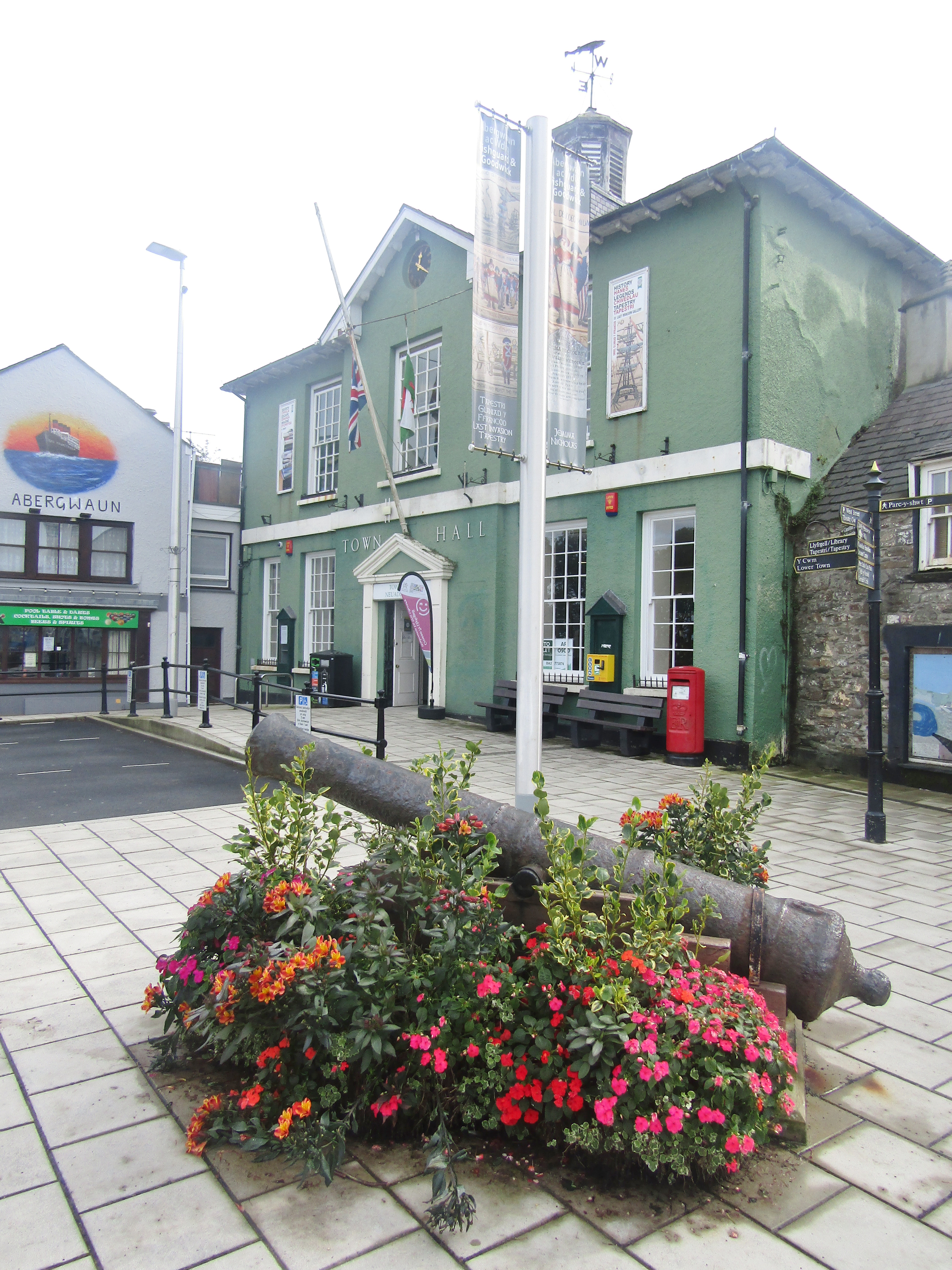
Fishguard Town Hall

Fishguard Town Hall (Welsh: Neuadd y Dref Abergwaun) is a municipal building in the Market Square, Fishguard, Pembrokeshire, Wales. The structure, which...
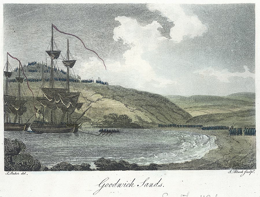
Battle of Fishguard

The Battle of Fishguard was a military invasion of Great Britain by Revolutionary France during the War of the First Coalition. The brief campaign, on...

Fishguard

Fishguard (Welsh: Abergwaun, meaning "Mouth of the River Gwaun") is a coastal town in Pembrokeshire, Wales, with a population of 3,400 (rounded to the...

Nearby Amenities

Located within 500m of 52.000393,-4.9616442
Power: pole
Lat/Long: 51.9961003/-4.9632301
Power: pole
Lat/Long: 51.9959533/-4.9611167
Power: pole
Lat/Long: 51.9960349/-4.9623063
Barrier: kissing_gate
Lat/Long: 52.0010048/-4.9565785
The data included in this document is from www.openstreetmap.org. The data is made available under ODbL.

Have you been to Pwell Edyn?

Leave your review of Pwell Edyn below (or comments, questions and feedback).