Carreg Coffin

Island in Pembrokeshire

Wales

Carreg Coffin

Baptism stand by Afon Gwaun A close-up of the concrete platform used for river baptisms, see <a href="https://www.geograph.org.uk/photo/2176311">SM9636 : Former baptism pool, Mwsland</a> for further information about it.
The word BEBYDD (baptism) and the date 1905 are impressed upon it.

Note: the correct spelling of baptism in Welsh is BEDYDD. The error is likely to be the maker's.
Baptism stand by Afon Gwaun Credit: Natasha Ceridwen de Chroustchoff

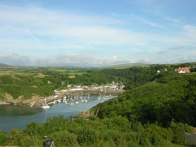
Carreg Coffin is a small island located off the coast of Pembrokeshire, Wales. Also known as Coffin Rock, it is situated in the Celtic Sea, approximately 1.5 kilometers from the mainland. The island gets its name from its unique shape, resembling an upturned coffin when viewed from a distance.

Covering an area of just under half a hectare, Carreg Coffin is a rocky outcrop with steep cliffs on all sides. The island is uninhabited and lacks any significant vegetation, making it a stark and desolate landscape. It is primarily composed of volcanic rock, which adds to its rugged and dramatic appearance.

Although Carreg Coffin is small in size, it has attracted attention due to its historical significance and geological features. It is believed to have been a place of burial during the Bronze Age, with evidence of ancient cairns and burial mounds found on the island. These archaeological remains provide insights into the prehistoric communities that once inhabited the area.

The island also serves as a nesting site for various seabirds, including guillemots, razorbills, and kittiwakes. It is an important breeding ground for these species, and birdwatchers often visit to observe and study their behavior.

Access to Carreg Coffin is limited and can be challenging, as there are no regular ferries or boats that operate to the island. However, it is possible to view the island from the mainland, particularly from viewpoints along the Pembrokeshire Coast National Park.

If you have any feedback on the listing, please let us know in the comments section below.

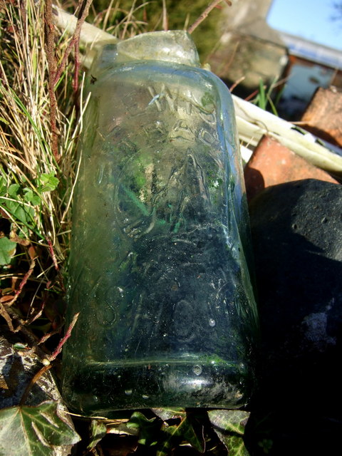
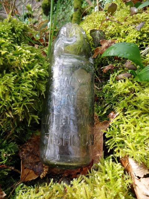
Carreg Coffin Images

Images are sourced within 2km of 52.001515/-4.9677945 or Grid Reference SM9637. Thanks to Geograph Open Source API. All images are credited.

Baptism stand by Afon Gwaun A close-up of the concrete platform used for river baptisms, see <a href="https://www.geograph.org.uk/photo/2176311">SM9636 : Former baptism pool, Mwsland</a> for further information about it.
The word BEBYDD (baptism) and the date 1905 are impressed upon it.

Note: the correct spelling of baptism in Welsh is BEDYDD. The error is likely to be the maker's.
Baptism stand by Afon Gwaun
A close-up of the concrete platform used for river baptisms, see SM9636 : Former baptism pool, Mwsland for further information about it. The word BEBYDD (baptism) and the date 1905 are impressed upon it. Note: the correct spelling of baptism in Welsh is BEDYDD. The error is likely to be the maker's.
Pwll Landdu and coast to northwest The small bay below Parcymorfa, with protruding parts of coastline and Pen Dinas further in the distance, on a bright afternoon in early March. The sea level is fairly low as can be seen from the pale line above the water along the foot of the cliffs.
Pwll Landdu and coast to northwest
The small bay below Parcymorfa, with protruding parts of coastline and Pen Dinas further in the distance, on a bright afternoon in early March. The sea level is fairly low as can be seen from the pale line above the water along the foot of the cliffs.
Former pub in Hamilton Street The little house tucked into a corner behind a premises on Main Street was formerly The Three Crowns, from 1805 until 1924 when it closed under pressure from temperance campaigners. Apparently it is constructed partly from old ships' timbers.
(Information from The Pubs of St David's, Fishguard & North Pembrokeshire, by Keith Johnson, 2010)
Former pub in Hamilton Street
The little house tucked into a corner behind a premises on Main Street was formerly The Three Crowns, from 1805 until 1924 when it closed under pressure from temperance campaigners. Apparently it is constructed partly from old ships' timbers. (Information from The Pubs of St David's, Fishguard & North Pembrokeshire, by Keith Johnson, 2010)
Old custom house, Hill Terrace The house at the end of the terrace, standing on the corner of the steep hill leading down to Lower Fishguard is called Ty Tollau. It was not however one of the toll houses associated with the social and political unrest in the mid C19 (the Rebecca Riots) but it was the custom house in charge of levying taxes on imports into the harbour below.
The Stena line ferry can be seen beyond, leaving Goodwick bound for Rosslare.
Old custom house, Hill Terrace
The house at the end of the terrace, standing on the corner of the steep hill leading down to Lower Fishguard is called Ty Tollau. It was not however one of the toll houses associated with the social and political unrest in the mid C19 (the Rebecca Riots) but it was the custom house in charge of levying taxes on imports into the harbour below. The Stena line ferry can be seen beyond, leaving Goodwick bound for Rosslare.
Tabernacle cemetery The graveyard behind the chapel in Park Street.
Tabernacle cemetery
The graveyard behind the chapel in Park Street.
View from Tabernacle cemetery Looking west towards the backs of houses in Wallis Street, from the graveyard behind Tabernacle.
View from Tabernacle cemetery
Looking west towards the backs of houses in Wallis Street, from the graveyard behind Tabernacle.
The toll taken by the sea Three members of the same family are commemorated on this gravestone in the Tabernacle cemetery. Henry Lewis of the brigantine Gwladys who was drowned in the Bristol Channel in December 1891  (while en route from Cardiff to Messina with a cargo of coal the ship was rammed by a steamer off Hartland Point and went down, 3 of the 7 men were lost); brothers David and Arthur were lost in the South Atlantic in 1907 when en route from Bahia Blanca to Antwerp with a cargo of wheat. Their ship S.S. Dulverton was posted missing, last seen hove to with engine trouble. They were both in their 20s, sons of John and Tamar Lewis of Fishguard.
The toll taken by the sea
Three members of the same family are commemorated on this gravestone in the Tabernacle cemetery. Henry Lewis of the brigantine Gwladys who was drowned in the Bristol Channel in December 1891 (while en route from Cardiff to Messina with a cargo of coal the ship was rammed by a steamer off Hartland Point and went down, 3 of the 7 men were lost); brothers David and Arthur were lost in the South Atlantic in 1907 when en route from Bahia Blanca to Antwerp with a cargo of wheat. Their ship S.S. Dulverton was posted missing, last seen hove to with engine trouble. They were both in their 20s, sons of John and Tamar Lewis of Fishguard.
Old bottling plant/laundry, Plas-y-fron The site of Gwynfa mineral water works which produced bottled water obtained from a spring in the field. Subsequently there was a laundry here. 
It's the last building when leaving Fishguard on the Llanychaer road.
Update (2012): building now destroyed prior to redevelopment of the site for housing.
Old bottling plant/laundry, Plas-y-fron
The site of Gwynfa mineral water works which produced bottled water obtained from a spring in the field. Subsequently there was a laundry here. It's the last building when leaving Fishguard on the Llanychaer road. Update (2012): building now destroyed prior to redevelopment of the site for housing.
Gwynfa bottling plant The derelict remains of a laundry, on the site of Bateman's mineral water bottling plant, in Plas-y-fron on the eastern edge of Fishguard. The spring from which the water was obtained is across this field but appears to be overgrown and fenced off.
Gwynfa bottling plant
The derelict remains of a laundry, on the site of Bateman's mineral water bottling plant, in Plas-y-fron on the eastern edge of Fishguard. The spring from which the water was obtained is across this field but appears to be overgrown and fenced off.
View from above Plas-y-fron The houses up above Plas-y-fron enjoy a fine view north over the Fishguard bay and the harbour at Goodwick.
View from above Plas-y-fron
The houses up above Plas-y-fron enjoy a fine view north over the Fishguard bay and the harbour at Goodwick.
Fishguard Codd bottle (1) This broken bottle, found here, once contained ginger beer or a similar fizzy drink, using a method invented by Hiram Codd, a British engineer (1838-1887). His idea, which involved using the pressure of the carbonated water to push a glass ball against a rubber ring so creating a perfect seal, revolutionized the drinks trade world-wide. The invention was patented but bottle manufacturers could replicate it if they purchased the balls, the sealing rings and requisite tool. Mineral water firms had bottles made to their own specifications, with their names and trademarks. 
This example was no doubt broken years ago when children used routinely to smash the bottles to extract the marbles. It came from the local bottling factory of T. Lewis, Fishguard, which is still known as the Popworks and has recently been converted into a youth centre, see <a title="https://www.geograph.org.uk/photo/496156" href="https://www.geograph.org.uk/photo/496156">Link</a>
The trademark  which I have seen described as an iceberg, represents in fact, the rocky pinnacle known as Needle Rock which stands off the coast east of Fishguard. See <a title="https://www.geograph.org.uk/photo/758403" href="https://www.geograph.org.uk/photo/758403">Link</a>
(My thanks to Roy Lewis for this revelation!)
Fishguard Codd bottle (1)
This broken bottle, found here, once contained ginger beer or a similar fizzy drink, using a method invented by Hiram Codd, a British engineer (1838-1887). His idea, which involved using the pressure of the carbonated water to push a glass ball against a rubber ring so creating a perfect seal, revolutionized the drinks trade world-wide. The invention was patented but bottle manufacturers could replicate it if they purchased the balls, the sealing rings and requisite tool. Mineral water firms had bottles made to their own specifications, with their names and trademarks. This example was no doubt broken years ago when children used routinely to smash the bottles to extract the marbles. It came from the local bottling factory of T. Lewis, Fishguard, which is still known as the Popworks and has recently been converted into a youth centre, see Link The trademark which I have seen described as an iceberg, represents in fact, the rocky pinnacle known as Needle Rock which stands off the coast east of Fishguard. See Link (My thanks to Roy Lewis for this revelation!)
Fishguard Codd bottle (2) This is the second Codd bottle I have found, within a few weeks of the first, for which see here <a title="https://www.geograph.org.uk/photo/2332162" href="https://www.geograph.org.uk/photo/2332162">Link</a> for details. Like the first the bottle had its top broken to retrieve the desirable marble closure device from the neck.
Here, it has been washed and returned to its original finding place for the photograph, on a tumbledown wall in the woods close to the Afon Gwaun. 
It is bears the legend GWYNFA MINERAL WATER WORKS FISHGUARD. This was a small factory run by the Bateman family and located only a short distance away, as the crow flies, across the valley at Plas-y-fron on the edge of the town. The place has been closed for some time but is still standing, see <a title="https://www.geograph.org.uk/photo/2326322" href="https://www.geograph.org.uk/photo/2326322">Link</a> and <a title="https://www.geograph.org.uk/photo/2326331" href="https://www.geograph.org.uk/photo/2326331">Link</a>

(Thanks again to Roy Lewis for info.)
Fishguard Codd bottle (2)
This is the second Codd bottle I have found, within a few weeks of the first, for which see here Link for details. Like the first the bottle had its top broken to retrieve the desirable marble closure device from the neck. Here, it has been washed and returned to its original finding place for the photograph, on a tumbledown wall in the woods close to the Afon Gwaun. It is bears the legend GWYNFA MINERAL WATER WORKS FISHGUARD. This was a small factory run by the Bateman family and located only a short distance away, as the crow flies, across the valley at Plas-y-fron on the edge of the town. The place has been closed for some time but is still standing, see Link and Link (Thanks again to Roy Lewis for info.)
The Old harbour at Fishguard, Pembrokeshire Looking down on Old Harbour at Fishguard from the coastal path near Heol Emrys
The Old harbour at Fishguard, Pembrokeshire
Looking down on Old Harbour at Fishguard from the coastal path near Heol Emrys
Part of Harbour Village above Goodwick The name seems to derive from the 'Garden City' type model village developments of the 1930's and the property types seem to comply with that, being varied in style and size. Some modern developments fail to be as attractive and varied and maybe will fail to stand the test of time too, unlike this street where houses are well maintained on the whole.
Part of Harbour Village above Goodwick
The name seems to derive from the 'Garden City' type model village developments of the 1930's and the property types seem to comply with that, being varied in style and size. Some modern developments fail to be as attractive and varied and maybe will fail to stand the test of time too, unlike this street where houses are well maintained on the whole.
Near the viewpoint overlooking Fishguard Harbour From the end of Harbour Village in Goodwick you can admire the coastline to the north-east.
Near the viewpoint overlooking Fishguard Harbour
From the end of Harbour Village in Goodwick you can admire the coastline to the north-east.
The Goodwick 'Banksy' strikes again! Some eyecatching graffiti has been painstakingly added to this old reservoir wall overlooking Dinas Island and Goodwick and Fishguard Harbours. Some may say it's a bit sixth-form-y in style and content but I prefer it to the usual mindless, skill-less obscenities, tagging and drivel that is all too commonplace.
The Goodwick 'Banksy' strikes again!
Some eyecatching graffiti has been painstakingly added to this old reservoir wall overlooking Dinas Island and Goodwick and Fishguard Harbours. Some may say it's a bit sixth-form-y in style and content but I prefer it to the usual mindless, skill-less obscenities, tagging and drivel that is all too commonplace.
Old reservoir above Goodwick Harbour The coast path passes above an old reservoir near the Northern Breakwater or mole and from here you get excellent views out across Goodwick and Fishguard Harbours towards Dinas Island.
Old reservoir above Goodwick Harbour
The coast path passes above an old reservoir near the Northern Breakwater or mole and from here you get excellent views out across Goodwick and Fishguard Harbours towards Dinas Island.
Coast rider on the road again Bob Jones the coastriding Geographer sets off on the next stage of his marathon after spending the night just outside Fishguard. Nice to meet you Bob!
See <span class="nowrap"><a title="http://www.coastrider.org.uk/" rel="nofollow ugc noopener" href="http://www.coastrider.org.uk/">Link</a><img style="margin-left:2px;" alt="External link" title="External link - shift click to open in new window" src="https://s1.geograph.org.uk/img/external.png" width="10" height="10"/></span>
Coast rider on the road again
Bob Jones the coastriding Geographer sets off on the next stage of his marathon after spending the night just outside Fishguard. Nice to meet you Bob! See LinkExternal link
Show me another place!

Carreg Coffin is located at Grid Ref: SM9637 (Lat: 52.001515, Lng: -4.9677945)

Unitary Authority: Pembrokeshire

Police Authority: Dyfed Powys

What 3 Words

///extend.rails.novelists. Near Fishguard, Pembrokeshire

Related Wikis

River Gwaun

The River Gwaun (Welsh: Afon Gwaun, "Gwaun" meaning 'marsh, moor') is a river in Pembrokeshire, West Wales, which flows west to the sea at Fishguard (Welsh...
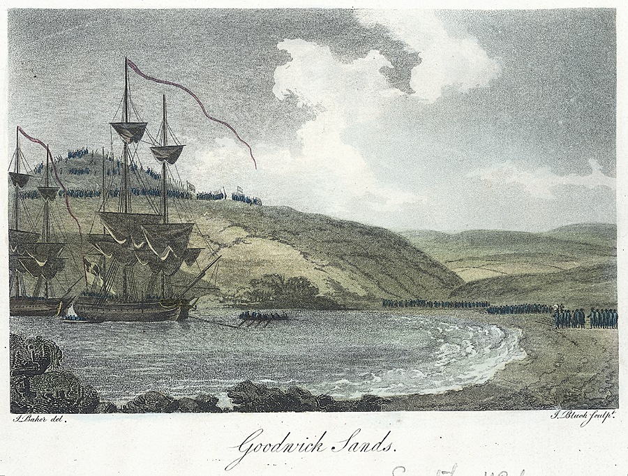
Battle of Fishguard

The Battle of Fishguard was a military invasion of Great Britain by Revolutionary France during the War of the First Coalition. The brief campaign, on...

Fishguard

Fishguard (Welsh: Abergwaun, meaning "Mouth of the River Gwaun") is a coastal town in Pembrokeshire, Wales, with a population of 3,419 in 2011; the community...
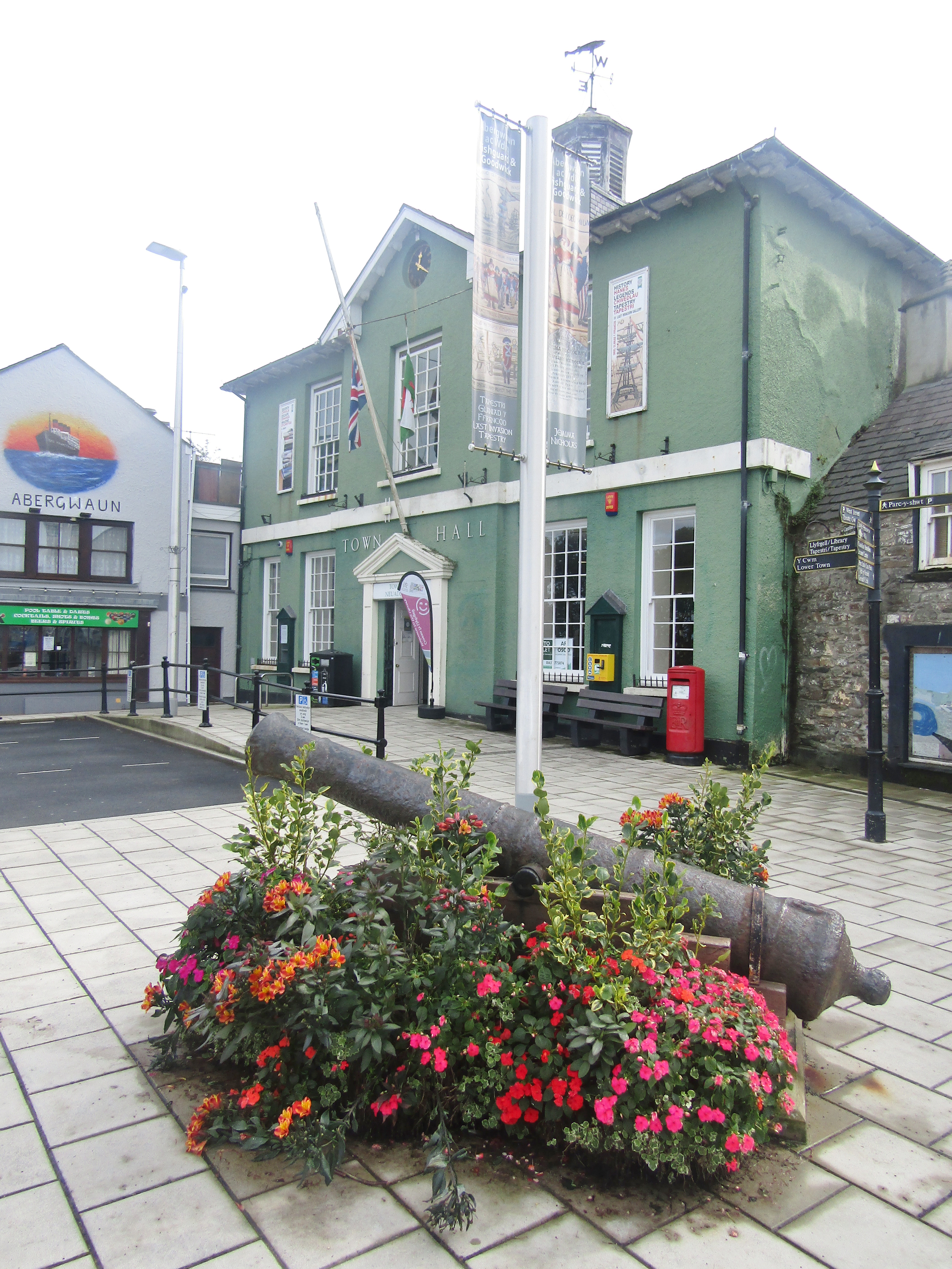
Fishguard Town Hall

Fishguard Town Hall (Welsh: Neuadd y Dref Abergwaun) is a municipal building in the Market Square, Fishguard, Pembrokeshire, Wales. The structure, which...
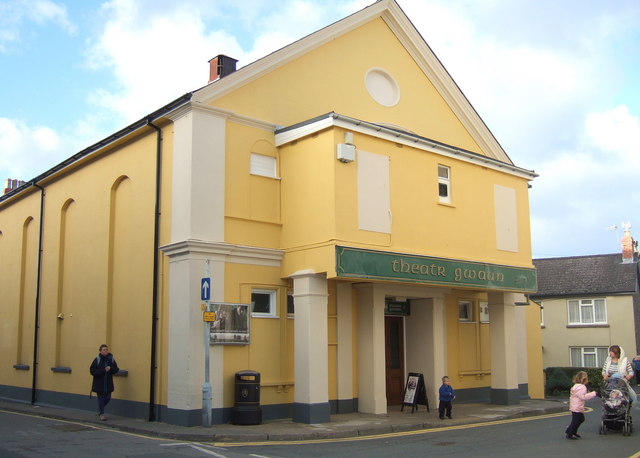
Theatr Gwaun

Theatr Gwaun is a cinema/theatre in Fishguard, Pembrokeshire. Built in 1885 as a Temperance hall, it was briefly converted for use as a school in January...

Fishguard and Goodwick

Fishguard and Goodwick is the name of a community that wraps around Fishguard Bay, on the northern coast of Pembrokeshire, Wales. It comprises the two...

Ysgol Bro Gwaun

Ysgol Bro Gwaun (formerly Fishguard County Secondary School) is a secondary comprehensive school in the town of Fishguard in north Pembrokeshire. It is...

Goodwick

Goodwick (; Welsh: Wdig) is a coastal town in Pembrokeshire, Wales, immediately west of its twin town of Fishguard. Fishguard and Goodwick form a community...

Nearby Amenities

Located within 500m of 52.001515,-4.9677945
Toilets
Lat/Long: 51.9971612/-4.9696042
Historic: cannon
Lat/Long: 52.0012239/-4.9703397
Historic: cannon
Lat/Long: 52.0012333/-4.9702622
Historic: cannon
Lat/Long: 52.0012433/-4.9701843
Historic: cannon
Lat/Long: 52.0012485/-4.970105
The data included in this document is from www.openstreetmap.org. The data is made available under ODbL.

Have you been to Carreg Coffin?

Leave your review of Carreg Coffin below (or comments, questions and feedback).