Càrn Deas

Island in Cromartyshire

Scotland

Càrn Deas

Eilean Dubh from the Lewis Ferry
Eilean Dubh from the Lewis Ferry Credit: Jo and Steve Turner

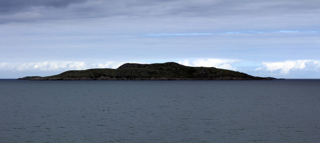
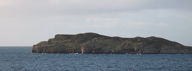
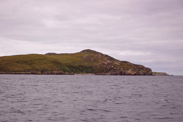
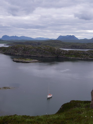
Càrn Deas is a small island located off the coast of Cromartyshire, in the Highland region of Scotland. The island measures approximately 0.5 square kilometers and is situated in the Cromarty Firth, about 2 kilometers northeast of the town of Cromarty.

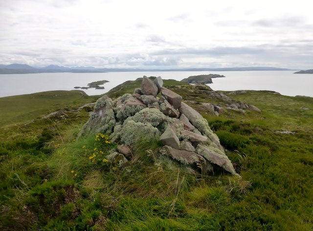
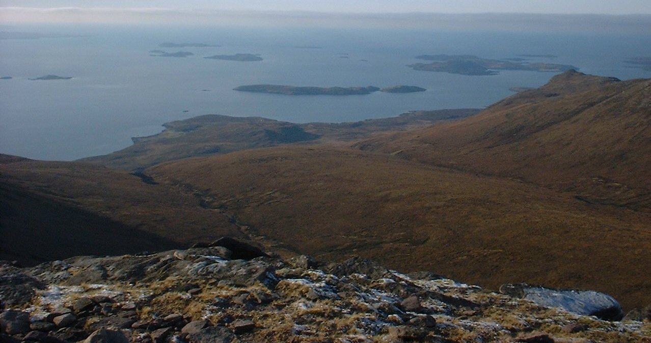
The island is known for its rugged beauty and natural landscapes. It features a mix of rocky cliffs, grassy slopes, and some pockets of woodland. The highest point on Càrn Deas reaches about 40 meters above sea level, offering panoramic views of the surrounding area.

Despite its small size, the island is home to a variety of wildlife. Seabirds such as guillemots and razorbills can be spotted nesting on the cliffs, while seals are often seen basking on the rocky shores. The surrounding waters are also rich in marine life, making it a popular spot for fishing and birdwatching.

Càrn Deas has a rich history, with evidence of human habitation dating back thousands of years. Archaeological excavations have uncovered ancient artifacts, including pottery and stone tools. The island also played a role in the defense of the Cromarty Firth during World War II, with remnants of military structures still visible today.

Access to Càrn Deas is limited, as there are no regular ferry services to the island. However, it can be reached by private boat or during low tide by walking across a causeway from the mainland. Visitors to the island can enjoy its natural beauty, go hiking along its trails, or simply relax and take in the peaceful surroundings.

If you have any feedback on the listing, please let us know in the comments section below.

Càrn Deas Images

Images are sourced within 2km of 57.964602/-5.4430521 or Grid Reference NB9602. Thanks to Geograph Open Source API. All images are credited.

Eilean Dubh from the Lewis Ferry
Sgeir nam Mult and Eilean Dubh from the Lewis Ferry
Bottle Island With the mountains of Coigach and Assynt in the background.
Bottle Island
With the mountains of Coigach and Assynt in the background.
Bottle Island One of the Summer Isles, all of 0.5km long.
Bottle Island
One of the Summer Isles, all of 0.5km long.
Summer Isles from the ferry On a grey moist day. From left to right Bottle Island, Carn Iar,  Carn Deas and 
Sgeirean Glasa.
Summer Isles from the ferry
On a grey moist day. From left to right Bottle Island, Carn Iar, Carn Deas and Sgeirean Glasa.
One of the Summer Isles, Eilean Dubh Looking north though the rain from the Ullapool-Stornoway ferry.
One of the Summer Isles, Eilean Dubh
Looking north though the rain from the Ullapool-Stornoway ferry.
East coast of Eilean Dubh Typical Summer Isles rough, rocky coastline.
East coast of Eilean Dubh
Typical Summer Isles rough, rocky coastline.
Eilean Dubh Tricky rock landing at NE side of island, with private pier in sight. Then found a good path not present 5 years ago, leading to new hut then onto NE ridge, whence easy ground to summit.
Name: Eilean Dubh
Hill number: 10004
Height: 87m / 285ft
Parent (Ma/M): none
Section: 16F: Lochinver to Ullapool
County/UA: Highland (UA)
Island: Mono Tump island
Maritime Area: Gruinard & The Summer Isles
Class: Tump (0-99m), SIB
Grid ref: NB972038 (est)
Drop: 87m
Col: Sea
Eilean Dubh
Tricky rock landing at NE side of island, with private pier in sight. Then found a good path not present 5 years ago, leading to new hut then onto NE ridge, whence easy ground to summit. Name: Eilean Dubh Hill number: 10004 Height: 87m / 285ft Parent (Ma/M): none Section: 16F: Lochinver to Ullapool County/UA: Highland (UA) Island: Mono Tump island Maritime Area: Gruinard & The Summer Isles Class: Tump (0-99m), SIB Grid ref: NB972038 (est) Drop: 87m Col: Sea
Carn Iar Landed on small islet between the 2 main islands. Carn Iar first, then crossed to Carn Deas. The two islands are probably only separate at higher tidal states with a lower shingle bar acting as a col around 1 metre above sea level. Steep short scramble or long way round then heathery ascent.
Name: Carn Iar
Hill number: 10084
Height: 50m / 164ft
Parent (Ma/M): none
Section: 16F: Lochinver to Ullapool
County/UA: Highland (UA)
Maritime Area: Gruinard & The Summer Isles
Island: Mono Tump island
Class: Tump (0-99m), SIB
Grid ref: NB961026 (est)
Drop: 50m
Col: Sea
Carn Iar
Landed on small islet between the 2 main islands. Carn Iar first, then crossed to Carn Deas. The two islands are probably only separate at higher tidal states with a lower shingle bar acting as a col around 1 metre above sea level. Steep short scramble or long way round then heathery ascent. Name: Carn Iar Hill number: 10084 Height: 50m / 164ft Parent (Ma/M): none Section: 16F: Lochinver to Ullapool County/UA: Highland (UA) Maritime Area: Gruinard & The Summer Isles Island: Mono Tump island Class: Tump (0-99m), SIB Grid ref: NB961026 (est) Drop: 50m Col: Sea
Bottle Island Landed SE shore near the east corner and then an easy slabby scramble to gain the summit which has beautiful views.
Name: Bottle Island
Hill number: 10117
Height: 36m / 118ft
Parent (Ma/M): none
Section: 16F: Lochinver to Ullapool
County/UA: Highland (UA)
Island: Mono Tump island
Maritime Area: Gruinard & The Summer Isles
Class: Tump (0-99m), SIB
Grid ref: NB953019 (est)
Drop: 36m
Col: Sea
Bottle Island
Landed SE shore near the east corner and then an easy slabby scramble to gain the summit which has beautiful views. Name: Bottle Island Hill number: 10117 Height: 36m / 118ft Parent (Ma/M): none Section: 16F: Lochinver to Ullapool County/UA: Highland (UA) Island: Mono Tump island Maritime Area: Gruinard & The Summer Isles Class: Tump (0-99m), SIB Grid ref: NB953019 (est) Drop: 36m Col: Sea
View Towards The NE Of Bottle Island
Eilean Dubh Taken from MV Summer Queen
Eilean Dubh
Taken from MV Summer Queen
Bottle Island Southern shore, seen from the ferry to Lewis.
Bottle Island
Southern shore, seen from the ferry to Lewis.
Sgeir nam Mult For the "skerry of wethers", I find it hard to imagine grazing any stock here!
Sgeir nam Mult
For the "skerry of wethers", I find it hard to imagine grazing any stock here!
Waves break on Sgeir nam Mult In the background can be seen Glas-leac Beag.
Waves break on Sgeir nam Mult
In the background can be seen Glas-leac Beag.
A gap between skerries The waves break much higher on the gently-angled right-hand side than the steep left hand side.
A gap between skerries
The waves break much higher on the gently-angled right-hand side than the steep left hand side.
Northern cliffs of Eilean Dubh
Seals bask in the sun These seals were all crammed on top of this little rock.  In the background are the mountains of the Fisherfield Forest on the mainland.
Seals bask in the sun
These seals were all crammed on top of this little rock. In the background are the mountains of the Fisherfield Forest on the mainland.
Show me another place!

Càrn Deas is located at Grid Ref: NB9602 (Lat: 57.964602, Lng: -5.4430521)

Unitary Authority: Highland

Police Authority: Highlands and Islands

What 3 Words

///intruded.throw.brush. Near Ullapool, Highland

Related Wikis

Bottle Island

Bottle Island (Scottish Gaelic: Eilean a' Bhotail) is one of the Summer Isles in Loch Broom, Scotland. So called because of its shape, an alternative name...

Eilean Dubh, Summer Isles

Eilean Dubh is an uninhabited island in Loch Broom, one of the smaller Summer Isles. It lies about two miles south of Tanera Beag and has probably not...

Priest Island

Priest Island (Scottish Gaelic: Eilean a' Chlèirich) is a small, uninhabited island in the Summer Isles off the west coast of Scotland. == History == According...

Tanera Beag

Tanera Beag or Tanera Beg is an uninhabited island in the Summer Isles off north west Scotland. It is called "Tanera Beag" ("Little Tanera") to distinguish...

Tanera Mòr

Tanera Mòr (Scottish Gaelic: Tannara Mòr) is a sporadically inhabited island in Loch Broom in the Inner Hebrides of Scotland, the largest of the Summer...

Horse Island, Summer Isles

Horse Island (Scottish Gaelic: Eilean nan Each) is an uninhabited island in the Summer Isles, in the north west of Scotland. Once inhabited, the island...

Scoraig

Scoraig (Scottish Gaelic: Sgoraig) is a settlement located on a remote peninsula between Little Loch Broom and Loch Broom, north-west of Ullapool in Ross...

Summer Isles

The Summer Isles (Scottish Gaelic: Na h-Eileanan Samhraidh, pronounced [nə ˈhelanən ˈs̪ãũɾɪ] ) are an archipelago lying in the mouth of Loch Broom, in...

Have you been to Càrn Deas?

Leave your review of Càrn Deas below (or comments, questions and feedback).