Carreg Tomas

Island in Pembrokeshire

Wales

Carreg Tomas

Smyth Street Fishguard Residential street with 18thC terraced housing along the east side, as drawn in the 1839 tithe map. The street may have originally been called Barham Street, named after a local landowner, but  changed to Smyth Street after the occupier of the land, John Smyth a maltster from Cornwall.
In the 1901 census  occupations of residents were recorded as ostler, charwoman, laundress, mason, carpenter, farm labourer, grocer, tinplate worker and retired slate quarry worker, among others.
Smyth Street Fishguard Credit: Natasha Ceridwen de Chroustchoff

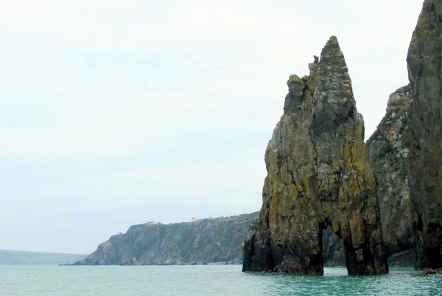
Carreg Tomas is a small island located off the coast of Pembrokeshire, Wales. It is situated in the Irish Sea and is part of the Milford Haven Waterway. The island is known for its rugged beauty and is a popular destination for nature enthusiasts and hikers.

Carreg Tomas measures approximately 1.7 hectares in size and is predominantly composed of rocky terrain and sparse vegetation. It is uninhabited by humans and is primarily used as a nesting site for various seabird species, including puffins, razorbills, and guillemots. These birds can be observed during their breeding season, which typically lasts from spring to summer.

Access to Carreg Tomas is limited, as there are no regular boat services or public transportation available to the island. However, it can be reached by private boat or kayak from the nearby coastal town of Milford Haven. Visitors are advised to take caution when venturing onto the island, as the terrain can be treacherous and slippery.

The island offers stunning views of the surrounding coastline and is a haven for wildlife. Seals and dolphins can often be spotted in the waters surrounding Carreg Tomas, adding to its natural charm. It is a tranquil and secluded spot, providing a peaceful escape from the bustling mainland.

Due to its ecological significance and delicate ecosystem, Carreg Tomas has been designated as a Site of Special Scientific Interest (SSSI), ensuring its protection and preservation for future generations to enjoy.

If you have any feedback on the listing, please let us know in the comments section below.

Carreg Tomas Images

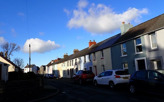
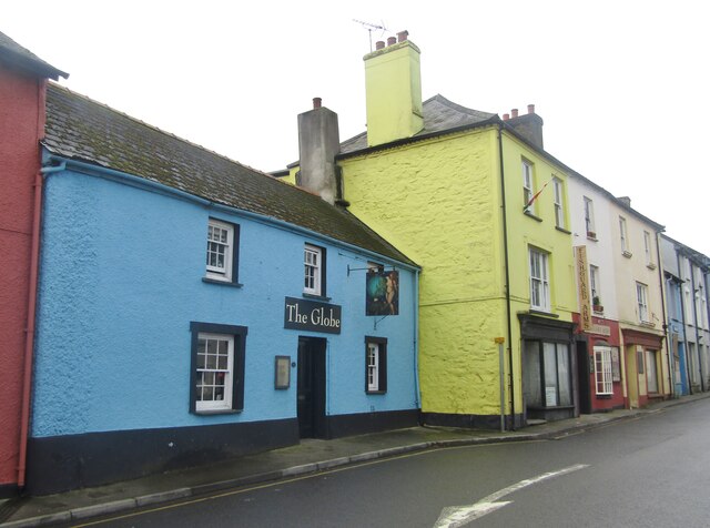
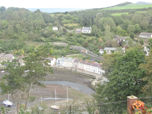
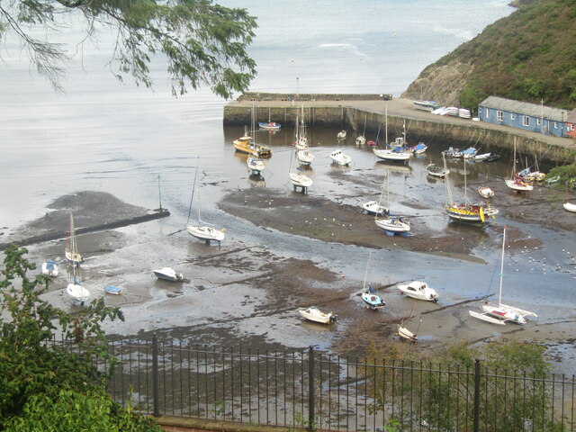
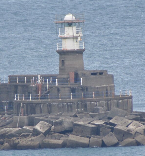
Images are sourced within 2km of 52.00225/-4.9657449 or Grid Reference SM9637. Thanks to Geograph Open Source API. All images are credited.

Smyth Street Fishguard Residential street with 18thC terraced housing along the east side, as drawn in the 1839 tithe map. The street may have originally been called Barham Street, named after a local landowner, but  changed to Smyth Street after the occupier of the land, John Smyth a maltster from Cornwall.
In the 1901 census  occupations of residents were recorded as ostler, charwoman, laundress, mason, carpenter, farm labourer, grocer, tinplate worker and retired slate quarry worker, among others.
Smyth Street Fishguard
Residential street with 18thC terraced housing along the east side, as drawn in the 1839 tithe map. The street may have originally been called Barham Street, named after a local landowner, but changed to Smyth Street after the occupier of the land, John Smyth a maltster from Cornwall. In the 1901 census occupations of residents were recorded as ostler, charwoman, laundress, mason, carpenter, farm labourer, grocer, tinplate worker and retired slate quarry worker, among others.
Needle Rock from the sea Unusual view of the sea stack from the water, thanks to a boat trip. The aperture through it is known as the Eye of the Needle.
Fragments from the wrecked Hermina (1921) are said to be visible here at low water.
Needle Rock from the sea
Unusual view of the sea stack from the water, thanks to a boat trip. The aperture through it is known as the Eye of the Needle. Fragments from the wrecked Hermina (1921) are said to be visible here at low water.
Guillemot breeding ledge Guillemots 'nest' each year on this narrow ledge and paint the cliff face with their excreta. Seen from below, by boat.
Guillemot breeding ledge
Guillemots 'nest' each year on this narrow ledge and paint the cliff face with their excreta. Seen from below, by boat.
Pirate cannonball in Glynymel Road This cannonball was unearthed in the garden above. Its size and shape suggest that it was fired from a pirate or privateer ship in the harbour since it resembles the description of the cannonball that injured a local resident, Miss Mary Fenton, sister of the merchant Samuel Fenton who built the harbour walls and main warehouse during the latter part of the 18thC. It is recorded that a privateer, probably Stephen Manhant, entered the harbour in 1779 and fired cannon shot into the village.
Pirate cannonball in Glynymel Road
This cannonball was unearthed in the garden above. Its size and shape suggest that it was fired from a pirate or privateer ship in the harbour since it resembles the description of the cannonball that injured a local resident, Miss Mary Fenton, sister of the merchant Samuel Fenton who built the harbour walls and main warehouse during the latter part of the 18thC. It is recorded that a privateer, probably Stephen Manhant, entered the harbour in 1779 and fired cannon shot into the village.
Fishguard - Tenby House Old building on West Street, now housing a newsagent.
Fishguard - Tenby House
Old building on West Street, now housing a newsagent.
Fishguard - West Street Painted gables dominate this scene in central Fishguard.
Fishguard - West Street
Painted gables dominate this scene in central Fishguard.
Fishguard - Royal Oak "The pub is famous for its place in history as in 1797, the French unsuccessfully attempted an invasion on the west coast of Wales only to be thwarted by the locals. This was the last invasion attempt on Britain. A peace treaty was signed between the British and French in the bar area".
<span class="nowrap"><a title="www.royaloakfishguard.co.uk" rel="nofollow ugc noopener" href="http://www.royaloakfishguard.co.uk">Link</a><img style="margin-left:2px;" alt="External link" title="External link - shift click to open in new window" src="https://s1.geograph.org.uk/img/external.png" width="10" height="10"/></span>
Fishguard - Royal Oak
"The pub is famous for its place in history as in 1797, the French unsuccessfully attempted an invasion on the west coast of Wales only to be thwarted by the locals. This was the last invasion attempt on Britain. A peace treaty was signed between the British and French in the bar area". LinkExternal link
Fishguard - High Street Town centre shopping street leading away from Fishguard Square.
<span class="nowrap"><a title="www.gofishguard.co.uk" rel="nofollow ugc noopener" href="http://www.gofishguard.co.uk">Link</a><img style="margin-left:2px;" alt="External link" title="External link - shift click to open in new window" src="https://s1.geograph.org.uk/img/external.png" width="10" height="10"/></span>
Fishguard - High Street
Town centre shopping street leading away from Fishguard Square. LinkExternal link
Fishguard - The Abergwaun Hotel Gallery and hotel on a prime position overlooking Fishguard Square.
<span class="nowrap"><a title="www.gofishguard.co.uk" rel="nofollow ugc noopener" href="http://www.gofishguard.co.uk">Link</a><img style="margin-left:2px;" alt="External link" title="External link - shift click to open in new window" src="https://s1.geograph.org.uk/img/external.png" width="10" height="10"/></span>
Fishguard - The Abergwaun Hotel
Gallery and hotel on a prime position overlooking Fishguard Square. LinkExternal link
Fishguard - Town Hall Historic administrative building on Fishguard Square, containing the local tourist office. Note the old cannon in the foreground.
<span class="nowrap"><a title="www.gofishguard.co.uk" rel="nofollow ugc noopener" href="http://www.gofishguard.co.uk">Link</a><img style="margin-left:2px;" alt="External link" title="External link - shift click to open in new window" src="https://s1.geograph.org.uk/img/external.png" width="10" height="10"/></span>
Fishguard - Town Hall
Historic administrative building on Fishguard Square, containing the local tourist office. Note the old cannon in the foreground. LinkExternal link
Fishguard - The Farmer's Arms An old pub sign on Fishguard Square. James Williams operated the Pembroke Steam Brewery.
Fishguard - The Farmer's Arms
An old pub sign on Fishguard Square. James Williams operated the Pembroke Steam Brewery.
Fishguard Arms Town centre bar on Main Street, Fishguard.
Fishguard Arms
Town centre bar on Main Street, Fishguard.
Fishguard - Main Street Town centre street with colourfully painted old buildings and pubs e.g. The Globe.
<span class="nowrap"><a title="www.gofishguard.co.uk" rel="nofollow ugc noopener" href="http://www.gofishguard.co.uk">Link</a><img style="margin-left:2px;" alt="External link" title="External link - shift click to open in new window" src="https://s1.geograph.org.uk/img/external.png" width="10" height="10"/></span>
Fishguard - Main Street
Town centre street with colourfully painted old buildings and pubs e.g. The Globe. LinkExternal link
Fishguard - The Globe Pub sign on Fishguard's Main Street.
<span class="nowrap"><a title="www.gofishguard.co.uk" rel="nofollow ugc noopener" href="http://www.gofishguard.co.uk">Link</a><img style="margin-left:2px;" alt="External link" title="External link - shift click to open in new window" src="https://s1.geograph.org.uk/img/external.png" width="10" height="10"/></span>
Fishguard - The Globe
Pub sign on Fishguard's Main Street. LinkExternal link
Fishguard - Lower Town Quay Street and the tidal harbour seen from Tower Hill viewpoint.
<span class="nowrap"><a title="www.gofishguard.co.uk" rel="nofollow ugc noopener" href="http://www.gofishguard.co.uk">Link</a><img style="margin-left:2px;" alt="External link" title="External link - shift click to open in new window" src="https://s1.geograph.org.uk/img/external.png" width="10" height="10"/></span>
Fishguard - Lower Town
Quay Street and the tidal harbour seen from Tower Hill viewpoint. LinkExternal link
Fishguard - Harbour Mouth Yachts and small boats sit high and dry at low tide where the River Gwaun flows into the sea.
<span class="nowrap"><a title="www.gofishguard.co.uk" rel="nofollow ugc noopener" href="http://www.gofishguard.co.uk">Link</a><img style="margin-left:2px;" alt="External link" title="External link - shift click to open in new window" src="https://s1.geograph.org.uk/img/external.png" width="10" height="10"/></span>
Fishguard - Harbour Mouth
Yachts and small boats sit high and dry at low tide where the River Gwaun flows into the sea. LinkExternal link
Fishguard - North Breakwater Light Built 1906 when Transatlantic shipping traffic used the harbour. Note that the breakwater has been shored up with sea defence blocks.
<span class="nowrap"><a title="www.gofishguard.co.uk" rel="nofollow ugc noopener" href="http://www.gofishguard.co.uk">Link</a><img style="margin-left:2px;" alt="External link" title="External link - shift click to open in new window" src="https://s1.geograph.org.uk/img/external.png" width="10" height="10"/></span>
Fishguard - North Breakwater Light
Built 1906 when Transatlantic shipping traffic used the harbour. Note that the breakwater has been shored up with sea defence blocks. LinkExternal link
Show me another place!

Carreg Tomas is located at Grid Ref: SM9637 (Lat: 52.00225, Lng: -4.9657449)

Unitary Authority: Pembrokeshire

Police Authority: Dyfed Powys

What 3 Words

///situated.drooling.sliding. Near Fishguard, Pembrokeshire

Related Wikis

River Gwaun

The River Gwaun (Welsh: Afon Gwaun, "Gwaun" meaning 'marsh, moor') is a river in Pembrokeshire, West Wales, which flows west to the sea at Fishguard (Welsh...
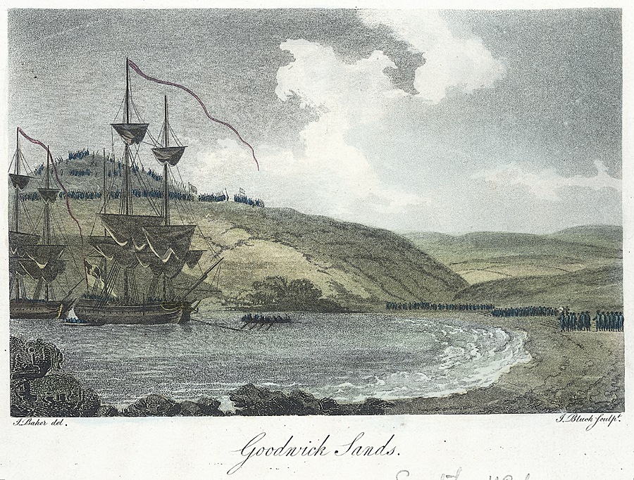
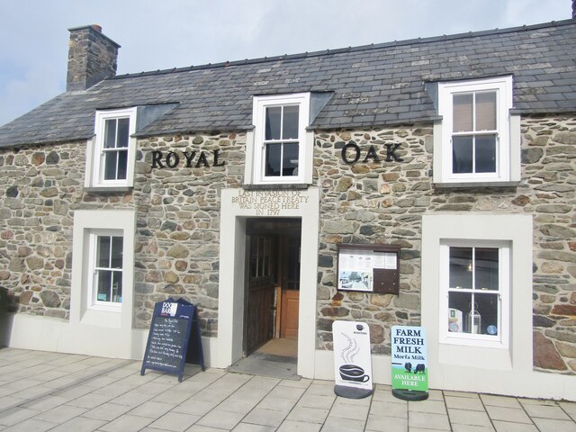
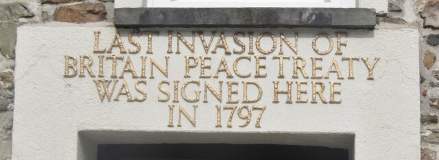
Battle of Fishguard

The Battle of Fishguard was a military invasion of Great Britain by Revolutionary France during the War of the First Coalition. The brief campaign, on...
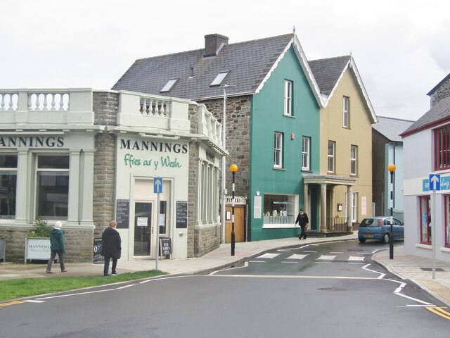
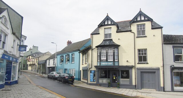
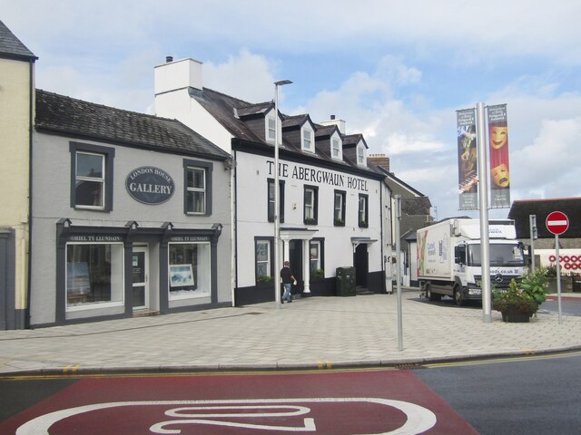
Fishguard

Fishguard (Welsh: Abergwaun, meaning "Mouth of the River Gwaun") is a coastal town in Pembrokeshire, Wales, with a population of 3,419 in 2011; the community...
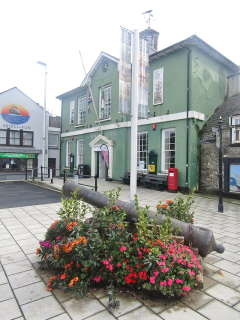
Fishguard Town Hall

Fishguard Town Hall (Welsh: Neuadd y Dref Abergwaun) is a municipal building in the Market Square, Fishguard, Pembrokeshire, Wales. The structure, which...

Nearby Amenities

Located within 500m of 52.00225,-4.9657449
Historic: cannon
Lat/Long: 52.0012239/-4.9703397
Historic: cannon
Lat/Long: 52.0012333/-4.9702622
Historic: cannon
Lat/Long: 52.0012433/-4.9701843
Historic: cannon
Lat/Long: 52.0012485/-4.970105
The data included in this document is from www.openstreetmap.org. The data is made available under ODbL.

Have you been to Carreg Tomas?

Leave your review of Carreg Tomas below (or comments, questions and feedback).