Carreg yr Eos

Coastal Feature, Headland, Point in Pembrokeshire

Wales

Carreg yr Eos

Former pub in Hamilton Street The little house tucked into a corner behind a premises on Main Street was formerly The Three Crowns, from 1805 until 1924 when it closed under pressure from temperance campaigners. Apparently it is constructed partly from old ships' timbers.
(Information from The Pubs of St David's, Fishguard & North Pembrokeshire, by Keith Johnson, 2010)
Former pub in Hamilton Street Credit: Natasha Ceridwen de Chroustchoff

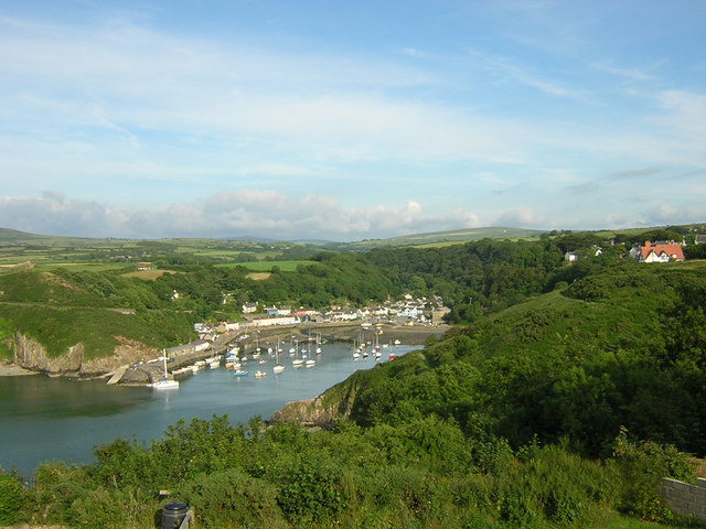
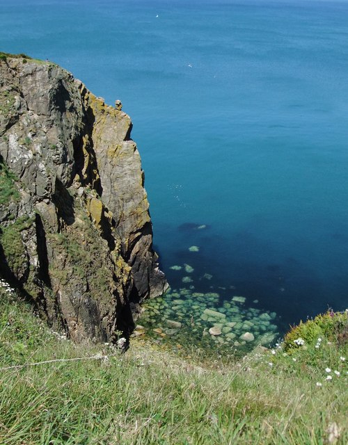
Carreg yr Eos, located in Pembrokeshire, Wales, is a prominent headland and coastal feature that offers stunning views and natural beauty. Sitting on the west coast of Wales, it is a popular destination for nature enthusiasts, hikers, and photographers alike.

Carreg yr Eos is characterized by its rugged cliffs, which rise dramatically from the sea, creating a picturesque backdrop. The headland is made up of layers of sedimentary rock, including sandstone and shale, which have been shaped by the relentless force of the ocean over thousands of years. These geological formations make it a fascinating site for geologists and rock enthusiasts.

The headland provides a habitat for various coastal flora and fauna, including seabirds such as gulls, cormorants, and puffins. The surrounding waters are also home to a diverse range of marine life, including seals and dolphins, making it a great spot for wildlife enthusiasts.

For those seeking outdoor activities, Carreg yr Eos offers several walking trails that allow visitors to explore the area's natural beauty. The headland is also a popular spot for rock climbing, with its vertical cliffs providing a thrilling challenge for climbers of all levels.

In addition to its natural beauty, Carreg yr Eos has historical significance. It is said to have been a lookout point during ancient times, offering strategic vantage points for observing approaching ships. Today, remnants of this history can still be seen in the form of ancient ruins and fortifications.

Overall, Carreg yr Eos is a captivating coastal feature and headland that offers a unique blend of natural beauty, wildlife, and historical significance. Its stunning cliffs, wildlife, and recreational opportunities make it a must-visit destination for anyone exploring the Pembrokeshire coastline.

If you have any feedback on the listing, please let us know in the comments section below.

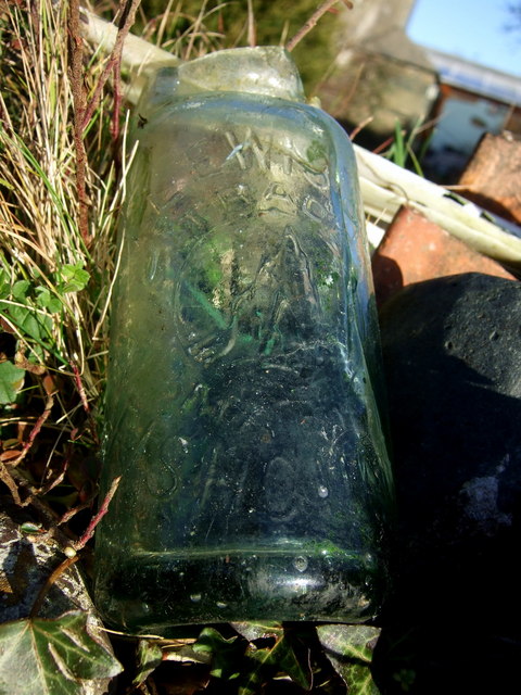
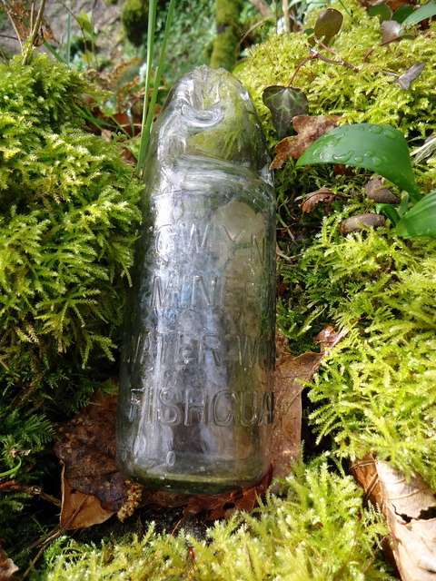
Carreg yr Eos Images

Images are sourced within 2km of 51.996235/-4.9727922 or Grid Reference SM9637. Thanks to Geograph Open Source API. All images are credited.

Former pub in Hamilton Street The little house tucked into a corner behind a premises on Main Street was formerly The Three Crowns, from 1805 until 1924 when it closed under pressure from temperance campaigners. Apparently it is constructed partly from old ships' timbers.
(Information from The Pubs of St David's, Fishguard & North Pembrokeshire, by Keith Johnson, 2010)
Former pub in Hamilton Street
The little house tucked into a corner behind a premises on Main Street was formerly The Three Crowns, from 1805 until 1924 when it closed under pressure from temperance campaigners. Apparently it is constructed partly from old ships' timbers. (Information from The Pubs of St David's, Fishguard & North Pembrokeshire, by Keith Johnson, 2010)
Old custom house, Hill Terrace The house at the end of the terrace, standing on the corner of the steep hill leading down to Lower Fishguard is called Ty Tollau. It was not however one of the toll houses associated with the social and political unrest in the mid C19 (the Rebecca Riots) but it was the custom house in charge of levying taxes on imports into the harbour below.
The Stena line ferry can be seen beyond, leaving Goodwick bound for Rosslare.
Old custom house, Hill Terrace
The house at the end of the terrace, standing on the corner of the steep hill leading down to Lower Fishguard is called Ty Tollau. It was not however one of the toll houses associated with the social and political unrest in the mid C19 (the Rebecca Riots) but it was the custom house in charge of levying taxes on imports into the harbour below. The Stena line ferry can be seen beyond, leaving Goodwick bound for Rosslare.
Tabernacle cemetery The graveyard behind the chapel in Park Street.
Tabernacle cemetery
The graveyard behind the chapel in Park Street.
View from Tabernacle cemetery Looking west towards the backs of houses in Wallis Street, from the graveyard behind Tabernacle.
View from Tabernacle cemetery
Looking west towards the backs of houses in Wallis Street, from the graveyard behind Tabernacle.
The toll taken by the sea Three members of the same family are commemorated on this gravestone in the Tabernacle cemetery. Henry Lewis of the brigantine Gwladys who was drowned in the Bristol Channel in December 1891  (while en route from Cardiff to Messina with a cargo of coal the ship was rammed by a steamer off Hartland Point and went down, 3 of the 7 men were lost); brothers David and Arthur were lost in the South Atlantic in 1907 when en route from Bahia Blanca to Antwerp with a cargo of wheat. Their ship S.S. Dulverton was posted missing, last seen hove to with engine trouble. They were both in their 20s, sons of John and Tamar Lewis of Fishguard.
The toll taken by the sea
Three members of the same family are commemorated on this gravestone in the Tabernacle cemetery. Henry Lewis of the brigantine Gwladys who was drowned in the Bristol Channel in December 1891 (while en route from Cardiff to Messina with a cargo of coal the ship was rammed by a steamer off Hartland Point and went down, 3 of the 7 men were lost); brothers David and Arthur were lost in the South Atlantic in 1907 when en route from Bahia Blanca to Antwerp with a cargo of wheat. Their ship S.S. Dulverton was posted missing, last seen hove to with engine trouble. They were both in their 20s, sons of John and Tamar Lewis of Fishguard.
Old bottling plant/laundry, Plas-y-fron The site of Gwynfa mineral water works which produced bottled water obtained from a spring in the field. Subsequently there was a laundry here. 
It's the last building when leaving Fishguard on the Llanychaer road.
Update (2012): building now destroyed prior to redevelopment of the site for housing.
Old bottling plant/laundry, Plas-y-fron
The site of Gwynfa mineral water works which produced bottled water obtained from a spring in the field. Subsequently there was a laundry here. It's the last building when leaving Fishguard on the Llanychaer road. Update (2012): building now destroyed prior to redevelopment of the site for housing.
Gwynfa bottling plant The derelict remains of a laundry, on the site of Bateman's mineral water bottling plant, in Plas-y-fron on the eastern edge of Fishguard. The spring from which the water was obtained is across this field but appears to be overgrown and fenced off.
Gwynfa bottling plant
The derelict remains of a laundry, on the site of Bateman's mineral water bottling plant, in Plas-y-fron on the eastern edge of Fishguard. The spring from which the water was obtained is across this field but appears to be overgrown and fenced off.
View from above Plas-y-fron The houses up above Plas-y-fron enjoy a fine view north over the Fishguard bay and the harbour at Goodwick.
View from above Plas-y-fron
The houses up above Plas-y-fron enjoy a fine view north over the Fishguard bay and the harbour at Goodwick.
Fishguard Codd bottle (1) This broken bottle, found here, once contained ginger beer or a similar fizzy drink, using a method invented by Hiram Codd, a British engineer (1838-1887). His idea, which involved using the pressure of the carbonated water to push a glass ball against a rubber ring so creating a perfect seal, revolutionized the drinks trade world-wide. The invention was patented but bottle manufacturers could replicate it if they purchased the balls, the sealing rings and requisite tool. Mineral water firms had bottles made to their own specifications, with their names and trademarks. 
This example was no doubt broken years ago when children used routinely to smash the bottles to extract the marbles. It came from the local bottling factory of T. Lewis, Fishguard, which is still known as the Popworks and has recently been converted into a youth centre, see <a title="https://www.geograph.org.uk/photo/496156" href="https://www.geograph.org.uk/photo/496156">Link</a>
The trademark  which I have seen described as an iceberg, represents in fact, the rocky pinnacle known as Needle Rock which stands off the coast east of Fishguard. See <a title="https://www.geograph.org.uk/photo/758403" href="https://www.geograph.org.uk/photo/758403">Link</a>
(My thanks to Roy Lewis for this revelation!)
Fishguard Codd bottle (1)
This broken bottle, found here, once contained ginger beer or a similar fizzy drink, using a method invented by Hiram Codd, a British engineer (1838-1887). His idea, which involved using the pressure of the carbonated water to push a glass ball against a rubber ring so creating a perfect seal, revolutionized the drinks trade world-wide. The invention was patented but bottle manufacturers could replicate it if they purchased the balls, the sealing rings and requisite tool. Mineral water firms had bottles made to their own specifications, with their names and trademarks. This example was no doubt broken years ago when children used routinely to smash the bottles to extract the marbles. It came from the local bottling factory of T. Lewis, Fishguard, which is still known as the Popworks and has recently been converted into a youth centre, see Link The trademark which I have seen described as an iceberg, represents in fact, the rocky pinnacle known as Needle Rock which stands off the coast east of Fishguard. See Link (My thanks to Roy Lewis for this revelation!)
Fishguard Codd bottle (2) This is the second Codd bottle I have found, within a few weeks of the first, for which see here <a title="https://www.geograph.org.uk/photo/2332162" href="https://www.geograph.org.uk/photo/2332162">Link</a> for details. Like the first the bottle had its top broken to retrieve the desirable marble closure device from the neck.
Here, it has been washed and returned to its original finding place for the photograph, on a tumbledown wall in the woods close to the Afon Gwaun. 
It is bears the legend GWYNFA MINERAL WATER WORKS FISHGUARD. This was a small factory run by the Bateman family and located only a short distance away, as the crow flies, across the valley at Plas-y-fron on the edge of the town. The place has been closed for some time but is still standing, see <a title="https://www.geograph.org.uk/photo/2326322" href="https://www.geograph.org.uk/photo/2326322">Link</a> and <a title="https://www.geograph.org.uk/photo/2326331" href="https://www.geograph.org.uk/photo/2326331">Link</a>

(Thanks again to Roy Lewis for info.)
Fishguard Codd bottle (2)
This is the second Codd bottle I have found, within a few weeks of the first, for which see here Link for details. Like the first the bottle had its top broken to retrieve the desirable marble closure device from the neck. Here, it has been washed and returned to its original finding place for the photograph, on a tumbledown wall in the woods close to the Afon Gwaun. It is bears the legend GWYNFA MINERAL WATER WORKS FISHGUARD. This was a small factory run by the Bateman family and located only a short distance away, as the crow flies, across the valley at Plas-y-fron on the edge of the town. The place has been closed for some time but is still standing, see Link and Link (Thanks again to Roy Lewis for info.)
The Old harbour at Fishguard, Pembrokeshire Looking down on Old Harbour at Fishguard from the coastal path near Heol Emrys
The Old harbour at Fishguard, Pembrokeshire
Looking down on Old Harbour at Fishguard from the coastal path near Heol Emrys
Coast rider on the road again Bob Jones the coastriding Geographer sets off on the next stage of his marathon after spending the night just outside Fishguard. Nice to meet you Bob!
See <span class="nowrap"><a title="http://www.coastrider.org.uk/" rel="nofollow ugc noopener" href="http://www.coastrider.org.uk/">Link</a><img style="margin-left:2px;" alt="External link" title="External link - shift click to open in new window" src="https://s1.geograph.org.uk/img/external.png" width="10" height="10"/></span>
Coast rider on the road again
Bob Jones the coastriding Geographer sets off on the next stage of his marathon after spending the night just outside Fishguard. Nice to meet you Bob! See LinkExternal link
Bennetts Navy Tavern, Fishguard/ Abergwaun In the High Street/ Heol Fawr, uphill from the Square.  Nobody could say that towns in this part of Wales are drab - around here this pink and navy blue colour scheme  would pass as quite subdued.
Bennetts Navy Tavern, Fishguard/ Abergwaun
In the High Street/ Heol Fawr, uphill from the Square. Nobody could say that towns in this part of Wales are drab - around here this pink and navy blue colour scheme would pass as quite subdued.
Ty Tollau - the old custom house, Fishguard/Abergwaun This house stands at a sharp bend, part way down the steep hill which links 'uphill' Fishguard with the Lower Town (Cwm) and old harbour.  Given its commanding position overlooking the harbour, it comes as no surprise to learn that it was once the customs house - see ceridwen's image of the same building:<a href="https://www.geograph.org.uk/photo/2320103">SM9537 : Old custom house, Hill Terrace</a>.
Ty Tollau - the old custom house, Fishguard/Abergwaun
This house stands at a sharp bend, part way down the steep hill which links 'uphill' Fishguard with the Lower Town (Cwm) and old harbour. Given its commanding position overlooking the harbour, it comes as no surprise to learn that it was once the customs house - see ceridwen's image of the same building:SM9537 : Old custom house, Hill Terrace.
Abandoned railway station at Goodwick/ Wdig This was once the Fishguard & Goodwick station of the Great Western Railway.  British Railways closed it in 1961. The building is timber framed, with weatherboard cladding - very typical of 19th- and early 20th century railway structures.

If a railway line is well used, the contact surface of the rails looks bright and shiny.  Here the track is dull and rusty.  At present just two trains run to Fishguard Harbour each day, to connect with ferry sailings, and that means that one of them is in the middle of the night - of little use to local residents.  However, things could be about to change: <span class="nowrap"><a title="http://www.blipfoto.com/view.php?id=1069609" rel="nofollow ugc noopener" href="http://www.blipfoto.com/view.php?id=1069609">Link</a><img style="margin-left:2px;" alt="External link" title="External link - shift click to open in new window" src="https://s1.geograph.org.uk/img/external.png" width="10" height="10"/></span>

Belated UPDATE, September 2016:   Things did indeed change, and quite dramatically.  Not long after I took this photograph the station was completely rebuilt, and regular services were re-instated in May 2012.  In John Lucas's contribution the scene seems completely transformed: <a href="https://www.geograph.org.uk/photo/4866402">SM9438 : A train departing from Fishguard and Goodwick Station</a>
Abandoned railway station at Goodwick/ Wdig
This was once the Fishguard & Goodwick station of the Great Western Railway. British Railways closed it in 1961. The building is timber framed, with weatherboard cladding - very typical of 19th- and early 20th century railway structures. If a railway line is well used, the contact surface of the rails looks bright and shiny. Here the track is dull and rusty. At present just two trains run to Fishguard Harbour each day, to connect with ferry sailings, and that means that one of them is in the middle of the night - of little use to local residents. However, things could be about to change: LinkExternal link Belated UPDATE, September 2016: Things did indeed change, and quite dramatically. Not long after I took this photograph the station was completely rebuilt, and regular services were re-instated in May 2012. In John Lucas's contribution the scene seems completely transformed: SM9438 : A train departing from Fishguard and Goodwick Station
Abandoned railway station at Goodwick/ Wdig: looking along the line This was once the Great Western Railway's Fishguard & Goodwick station, serving the towns rather than the ferry harbour.  It was closed by British Railways in 1961.  The track to Fishguard Harbour, the end of the line, is now single rather than double, and the rusty state of the track tells its own story - just two trains a day pass through.  However, things could be about to change: <span class="nowrap"><a title="http://www.blipfoto.com/view.php?id=1069609" rel="nofollow ugc noopener" href="http://www.blipfoto.com/view.php?id=1069609">Link</a><img style="margin-left:2px;" alt="External link" title="External link - shift click to open in new window" src="https://s1.geograph.org.uk/img/external.png" width="10" height="10"/></span>

UPDATE: Things have indeed changed, and quite dramatically. Not long after I took this photograph the station was completely rebuilt, and regular services were re-instated in May 2012. In John Lucas's contribution the scene seems completely transformed: <a href="https://www.geograph.org.uk/photo/4866402">SM9438 : A train departing from Fishguard and Goodwick Station</a>
Abandoned railway station at Goodwick/ Wdig: looking along the line
This was once the Great Western Railway's Fishguard & Goodwick station, serving the towns rather than the ferry harbour. It was closed by British Railways in 1961. The track to Fishguard Harbour, the end of the line, is now single rather than double, and the rusty state of the track tells its own story - just two trains a day pass through. However, things could be about to change: LinkExternal link UPDATE: Things have indeed changed, and quite dramatically. Not long after I took this photograph the station was completely rebuilt, and regular services were re-instated in May 2012. In John Lucas's contribution the scene seems completely transformed: SM9438 : A train departing from Fishguard and Goodwick Station
The depth of dereliction: detail of the abandoned station at Goodwick A collapsed window-frame, seen from inside this derelict timber-framed building.  For a more general view of the building see <a title="https://www.geograph.org.uk/photo/2503353" href="https://www.geograph.org.uk/photo/2503353">Link</a>.
The depth of dereliction: detail of the abandoned station at Goodwick
A collapsed window-frame, seen from inside this derelict timber-framed building. For a more general view of the building see Link.
View from the cliff top, near Needle Rock The name 'Needle Rock' appears on the map in two quite distinct places along this stretch of coastline, the other being in SN0140.  No Welsh name appears on the map, in either case.   Both localities are significant nesting sites for sea birds.
View from the cliff top, near Needle Rock
The name 'Needle Rock' appears on the map in two quite distinct places along this stretch of coastline, the other being in SN0140. No Welsh name appears on the map, in either case. Both localities are significant nesting sites for sea birds.
Show me another place!

Carreg yr Eos is located at Grid Ref: SM9637 (Lat: 51.996235, Lng: -4.9727922)

Unitary Authority: Pembrokeshire

Police Authority: Dyfed Powys

What 3 Words

///loaded.tidying.masks. Near Fishguard, Pembrokeshire

Related Wikis

River Gwaun

The River Gwaun (Welsh: Afon Gwaun, "Gwaun" meaning 'marsh, moor') is a river in Pembrokeshire, West Wales, which flows west to the sea at Fishguard (Welsh...
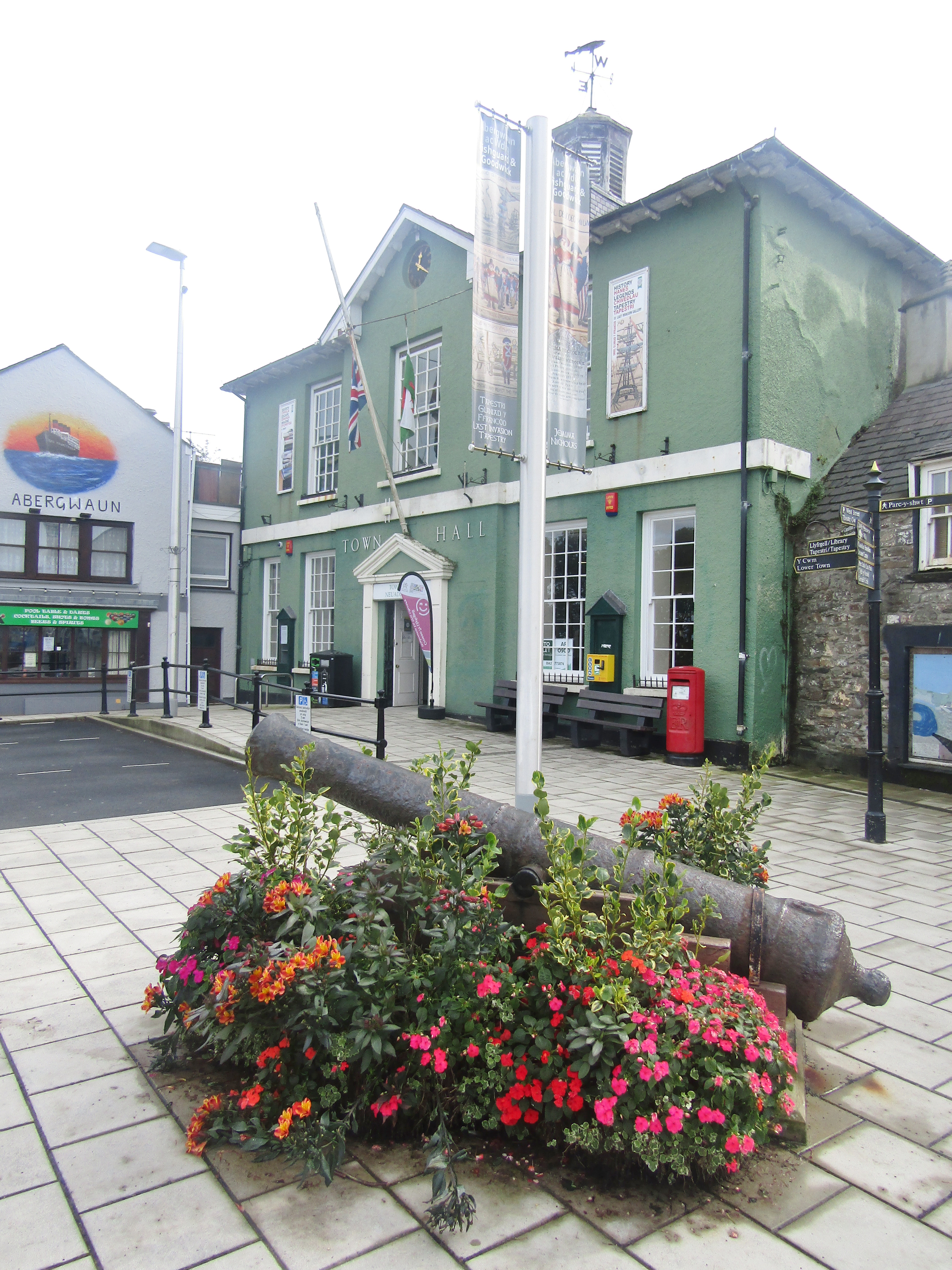
Fishguard Town Hall

Fishguard Town Hall (Welsh: Neuadd y Dref Abergwaun) is a municipal building in the Market Square, Fishguard, Pembrokeshire, Wales. The structure, which...
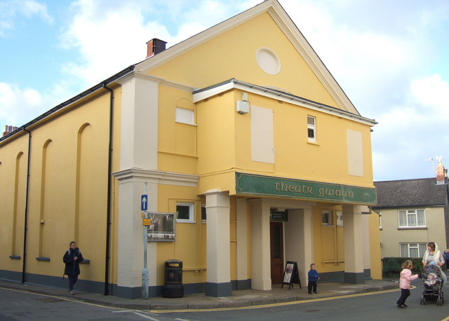
Theatr Gwaun

Theatr Gwaun is a cinema/theatre in Fishguard, Pembrokeshire. Built in 1885 as a Temperance hall, it was briefly converted for use as a school in January...
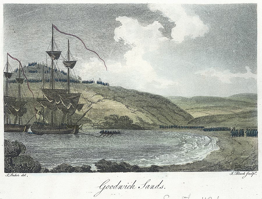
Battle of Fishguard

The Battle of Fishguard was a military invasion of Great Britain by Revolutionary France during the War of the First Coalition. The brief campaign, on...

Fishguard

Fishguard (Welsh: Abergwaun, meaning "Mouth of the River Gwaun") is a coastal town in Pembrokeshire, Wales, with a population of 3,419 in 2011; the community...

Ysgol Bro Gwaun

Ysgol Bro Gwaun (formerly Fishguard County Secondary School) is a secondary comprehensive school in the town of Fishguard in north Pembrokeshire. It is...

Fishguard and Goodwick

Fishguard and Goodwick is the name of a community that wraps around Fishguard Bay, on the northern coast of Pembrokeshire, Wales. It comprises the two...

Goodwick

Goodwick (; Welsh: Wdig) is a coastal town in Pembrokeshire, Wales, immediately west of its twin town of Fishguard. Fishguard and Goodwick form a community...

Nearby Amenities

Located within 500m of 51.996235,-4.9727922
Lower Town
Alt Name: Lower Fishguard
Alt Name En: Lower Fishguard
Name Cy: Cwm Abergwaun
Name En: Lower Town
Place: suburb
Source: npe
Lat/Long: 51.995195/-4.9688981
Fishguard
Is In: Pembrokeshire,Wales,UK
Name Cy: Abergwaun
Name En: Fishguard
Name Ga: Abergwuan
Nat Name: Abergwaun
Place: town
Population: 5407
Population Date: 2011
Source Population: Census
Wikidata: Q1018730
Wikipedia: en:Fishguard
Lat/Long: 51.9938353/-4.97681
Traffic Signals
Lat/Long: 51.9940322/-4.9756313
Post Box
Operator: Royal Mail
Operator Wikidata: Q638098
Post Box Design: type_k
Post Box Type: pillar
Royal Cypher: EIIR
Royal Cypher Wikidata: Q33102113
Lat/Long: 51.9937957/-4.9759989
Abergwaun Hotel
Tourism: hotel
Lat/Long: 51.9938869/-4.9765684
Pub
The Royal Oak
Addr Postcode: SA65 9HA
Addr Street: Market Square
Contact Facebook: RoyalOakFG
Contact Instagram: royaloakfishguard
Email: royaloakfishguard@hotmail.com
Fhrs Id: 856513
Source Addr: FHRS Open Data
Website: http://www.royaloakfishguard.co.uk/
Wikidata: Q29490573
Lat/Long: 51.994015/-4.9763232
Crossing
Crossing: zebra
Lat/Long: 51.9952503/-4.978923
Bicycle Parking
Bicycle Parking: stands
Capacity: 10
Covered: no
Source: visual_estimate
Lat/Long: 51.9947786/-4.9780923
Addr City: Fishguard
Addr Housenumber: 2
Addr Postcode: SA65 9HL
Addr Street: Hamilton Street
Lat/Long: 51.9940855/-4.9748209
Post Box
Ref: SA65 77
Source: survey
Lat/Long: 51.9935272/-4.9745755
Pub
Cambrian Inn
Addr Postcode: SA65 9HL
Addr Street: Hamilton Street
Fhrs Id: 856502
Source Addr: FHRS Open Data
Wikidata: Q80856216
Lat/Long: 51.9933038/-4.9748496
Post Box
Ref: SA65 190
Source: survey
Lat/Long: 51.9917994/-4.9717882
Pub
Bennetts Navy Tavern
Addr Housenumber: 20
Addr Postcode: SA65 9AR
Addr Street: High Street
Fhrs Id: 856508
Source Addr: FHRS Open Data
Wikidata: Q29502979
Lat/Long: 51.9934213/-4.9773784
Pharmacy
Boots
Brand: Boots
Brand Wikidata: Q6123139
Brand Wikipedia: en:Boots UK
Healthcare: pharmacy
Website: https://www.boots.com/stores/463-fishguard-market-square-sa65-9ha
Lat/Long: 51.9935849/-4.9763931
Fast Food
Dragon House Chinese
Addr Postcode: SA65 9HL
Addr Street: Hamilton Street
Fhrs Id: 856107
Source Addr: FHRS Open Data
Lat/Long: 51.9934579/-4.9749644
Give Way
Direction: forward
Lat/Long: 51.9960658/-4.9756443
Barrier: bollard
Lat/Long: 51.993054/-4.9766532
Give Way
Direction: backward
Lat/Long: 51.99608/-4.9687181
Bus Stop
Bus: yes
Direction: S
Naptan AtcoCode: 5210AWC51070
Naptan NaptanCode: pemagwj
Public Transport: platform
Lat/Long: 51.993766/-4.9761128
Bus Stop
Bus: yes
Direction: N
Public Transport: platform
Lat/Long: 51.9940128/-4.9758982
Cofeb D.J. Williams
Historic: memorial
Name En: Memorial to D.J. Williams
Subject Wikidata: Q3398425
Lat/Long: 51.9945792/-4.9778968
Morawel Bed & Breakfast
Addr Postcode: SA65 9LY
Addr Street: Glyn-y-Mel Road
Email: morawelfishguard@btinternet.com
Internet Access: wlan
Name En: Morawel B&B
Tourism: hostel
Lat/Long: 51.9947778/-4.9679165
Pentower Guest House
Tourism: guest_house
Lat/Long: 51.9948064/-4.9721261
Little Pentower
Tourism: chalet
Lat/Long: 51.9948295/-4.9720027
Bus Stop
Bench: yes
Bus: yes
Public Transport: platform
Shelter: yes
Lat/Long: 51.9954985/-4.9683282
Bus Stop
Bus: yes
Naptan AtcoCode: 5210AWC51093
Naptan NaptanCode: pemataj
Public Transport: platform
Lat/Long: 51.9954762/-4.9681593
Toilets
Lat/Long: 51.9971612/-4.9696042
Lower Coach House
Tourism: chalet
Lat/Long: 51.9946021/-4.9748724
Penrallt
Tourism: chalet
Lat/Long: 51.9944105/-4.9751085
Bar
Barfive
Addr Housenumber: 5
Addr Postcode: SA65 9HG
Addr Street: Main Street
Fhrs Id: 985103
Opening Hours: Mo-We off; Th-Sa 17:00-23:00; Su 14:00-23:00
Source Addr: FHRS Open Data
Lat/Long: 51.994196/-4.9750226
Bus Stop
Bus: yes
Public Transport: platform
Source: Maxar
Lat/Long: 51.9939646/-4.9785152
Bus Stop
Bus: yes
Public Transport: platform
Source: Maxar
Lat/Long: 51.9940835/-4.9783328
Bus Stop
Bus: yes
Naptan AtcoCode: 5210WDB48386
Naptan NaptanCode: pemgwtw
Public Transport: platform
Source: Maxar
Lat/Long: 51.9941892/-4.9781075
Traffic Calming: bump
Lat/Long: 51.9930958/-4.9750692
Give Way
Direction: backward
Lat/Long: 51.9931613/-4.9749813
Stop
Direction: backward
Lat/Long: 51.9941037/-4.974999
Give Way
Direction: backward
Lat/Long: 51.9955607/-4.9682392
Entrance: yes
Lat/Long: 51.9938165/-4.9759038
Michael N Charlton Optometrists
Addr City: Fishguard
Addr Housenumber: 27
Addr Postcode: SA65 9AL
Addr Street: West Street
Healthcare: optometrist
Lat/Long: 51.9946632/-4.9782924
Entrance: yes
Lat/Long: 51.9944865/-4.9776135
Entrance: yes
Lat/Long: 51.9957249/-4.9797361
Bench
Backrest: yes
Lat/Long: 51.9947259/-4.9779985
Bench
Backrest: yes
Lat/Long: 51.9946982/-4.97795
Waste Basket
Waste: trash;recycling
Lat/Long: 51.9947143/-4.9779751
Crossing
Crossing: unmarked
Crossing Markings: no
Lat/Long: 51.9939518/-4.9787393
Waterway: flow_control
Lat/Long: 51.9938764/-4.9669722
Telephone
Booth: K6
Covered: booth
Fee: yes
Listed Status: Grade II
Operator: BT
Operator Wikidata: Q593786
Phone: +44 1348 872363
Lat/Long: 51.9956955/-4.9684856
Waste Basket
Waste: trash;recycling
Lat/Long: 51.9956882/-4.968483
Post Box
Post Box Type: wall
Lat/Long: 51.9957106/-4.9684761
Street Lamp
Lat/Long: 51.9957987/-4.9684399
Bar
The Fishguard Arms
Addr Housenumber: 24
Addr Street: Main Street
Lat/Long: 51.9941523/-4.9744534
Cafe
Ffwrn
Addr Street: Main Street
Lat/Long: 51.9940375/-4.9754429
Defibrillator
Defibrillator Location: Quay Street, Fishguard - on building next to slipway
Emergency: defibrillator
Indoor: no
Lat/Long: 51.9972835/-4.9703194
Defibrillator
Defibrillator Location: outside Fishguard Town Hall
Emergency: defibrillator
Indoor: no
Lat/Long: 51.9938034/-4.9759548
London House Gallery
Tourism: gallery
Lat/Long: 51.9938081/-4.9765398
Cafe
Popty Cafe
Lat/Long: 51.9937389/-4.9765861
Bench
Backrest: yes
Lat/Long: 51.9960258/-4.9689425
Bench
Backrest: yes
Lat/Long: 51.9969952/-4.969609
Bench
Backrest: yes
Lat/Long: 51.9954673/-4.9710797
Bench
Backrest: yes
Lat/Long: 51.9969674/-4.9695153
Bench
Backrest: yes
Lat/Long: 51.9957666/-4.9721486
Bench
Backrest: yes
Lat/Long: 51.9968472/-4.9692386
Bench
Backrest: yes
Lat/Long: 51.9967882/-4.9690545
Bench
Backrest: yes
Lat/Long: 51.9965527/-4.9687785
Bench
Backrest: yes
Lat/Long: 51.996495/-4.9687564
Bench
Backrest: yes
Lat/Long: 51.996436/-4.9687311
Bench
Backrest: yes
Lat/Long: 51.9961564/-4.9687343
Fishguard Herring
Artist Name: John Cleal
Artwork Type: sculpture
Name Cy: Sgadan Abergwaun
Start Date: 2006
Tourism: artwork
Lat/Long: 51.9961256/-4.9687617
Power: pole
Lat/Long: 51.996265/-4.9656782
Power: pole
Lat/Long: 51.9963655/-4.9671355
Direction: SW
Generator Method: photovoltaic
Generator Output Electricity: yes
Generator Solar Modules: 2
Generator Source: solar
Generator Type: solar_photovoltaic_panel
Location: roof
Power: generator
Lat/Long: 51.9941021/-4.9673016
Direction: 235
Generator Method: photovoltaic
Generator Output Electricity: yes
Generator Solar Modules: 14
Generator Source: solar
Generator Type: solar_photovoltaic_panel
Location: roof
Power: generator
Lat/Long: 51.9969964/-4.9679419
Direction: SW
Generator Method: photovoltaic
Generator Output Electricity: yes
Generator Solar Modules: 6
Generator Source: solar
Generator Type: solar_photovoltaic_panel
Location: roof
Power: generator
Lat/Long: 51.9941306/-4.9673519
Direction: SW
Generator Method: photovoltaic
Generator Output Electricity: yes
Generator Solar Modules: 6
Generator Source: solar
Generator Type: solar_photovoltaic_panel
Location: roof
Power: generator
Lat/Long: 51.9941587/-4.9674055
Direction: SW
Generator Method: photovoltaic
Generator Output Electricity: yes
Generator Solar Modules: 2
Generator Source: solar
Generator Type: solar_photovoltaic_panel
Location: roof
Power: generator
Lat/Long: 51.9941859/-4.9674484
Direction: 175
Generator Method: photovoltaic
Generator Output Electricity: yes
Generator Solar Modules: 5
Generator Source: solar
Generator Type: solar_photovoltaic_panel
Location: roof
Power: generator
Lat/Long: 51.9947865/-4.9721205
Direction: 175
Generator Method: photovoltaic
Generator Output Electricity: yes
Generator Solar Modules: 12
Generator Source: solar
Generator Type: solar_photovoltaic_panel
Location: roof
Power: generator
Lat/Long: 51.9947386/-4.9722382
Direction: S
Generator Method: photovoltaic
Generator Output Electricity: yes
Generator Solar Modules: 9
Generator Source: solar
Generator Type: solar_photovoltaic_panel
Location: roof
Power: generator
Lat/Long: 51.9946816/-4.9713175
Direction: S
Generator Method: photovoltaic
Generator Output Electricity: yes
Generator Solar Modules: 4
Generator Source: solar
Generator Type: solar_photovoltaic_panel
Location: roof
Power: generator
Lat/Long: 51.9947194/-4.9712893
Direction: S
Generator Method: photovoltaic
Generator Output Electricity: yes
Generator Solar Modules: 4
Generator Source: solar
Generator Type: solar_photovoltaic_panel
Location: roof
Power: generator
Lat/Long: 51.9947177/-4.9713564
Direction: 235
Generator Method: photovoltaic
Generator Output Electricity: yes
Generator Solar Modules: 16
Generator Source: solar
Generator Type: solar_photovoltaic_panel
Location: roof
Power: generator
Lat/Long: 51.9934303/-4.9717386
Direction: 255
Generator Method: photovoltaic
Generator Output Electricity: yes
Generator Solar Modules: 12
Generator Source: solar
Generator Type: solar_photovoltaic_panel
Location: roof
Power: generator
Lat/Long: 51.9922305/-4.97577
Direction: SSE
Generator Method: photovoltaic
Generator Output Electricity: yes
Generator Solar Modules: 18
Generator Source: solar
Generator Type: solar_photovoltaic_panel
Location: roof
Power: generator
Lat/Long: 51.9986829/-4.9782524
Direction: 185
Generator Method: photovoltaic
Generator Output Electricity: yes
Generator Solar Modules: 4
Generator Source: solar
Generator Type: solar_photovoltaic_panel
Location: roof
Power: generator
Lat/Long: 51.9979959/-4.9768174
Direction: 185
Generator Method: photovoltaic
Generator Output Electricity: yes
Generator Solar Modules: 4
Generator Source: solar
Generator Type: solar_photovoltaic_panel
Location: roof
Power: generator
Lat/Long: 51.9979645/-4.9768254
Direction: 185
Generator Method: photovoltaic
Generator Output Electricity: yes
Generator Solar Modules: 8
Generator Source: solar
Generator Type: solar_photovoltaic_panel
Location: roof
Power: generator
Lat/Long: 51.9979199/-4.9768345
Direction: 195
Generator Method: photovoltaic
Generator Output Electricity: yes
Generator Solar Modules: 6
Generator Source: solar
Generator Type: solar_photovoltaic_panel
Location: roof
Power: generator
Lat/Long: 51.996498/-4.9780049
Barrier: bollard
Lat/Long: 51.9941746/-4.9739862
The data included in this document is from www.openstreetmap.org. The data is made available under ODbL.

Have you been to Carreg yr Eos?

Leave your review of Carreg yr Eos below (or comments, questions and feedback).