Teisti Geo

Sea, Estuary, Creek in Shetland

Scotland

Teisti Geo

Fetlar Gardens On Fetlar, sheep are everywhere - so vegetables were grown inside these little 'walled gardens' to protect them from the sheep.
Fetlar Gardens Credit: Anne Burgess

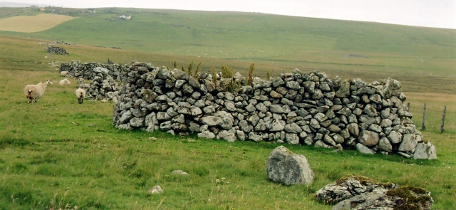
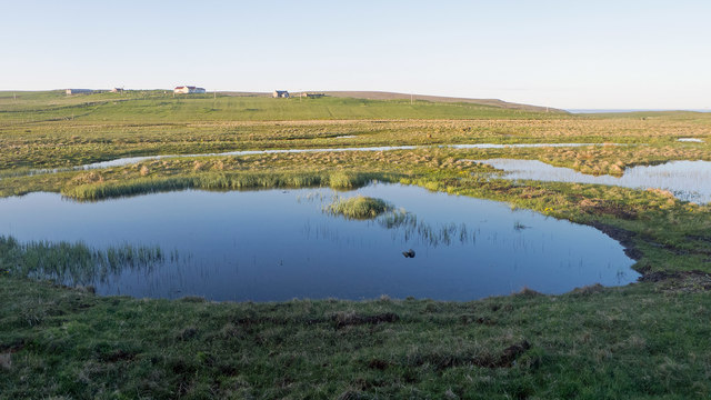
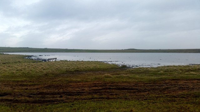
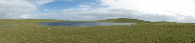
Teisti Geo is a picturesque sea inlet located in the Shetland Islands, an archipelago off the northeast coast of Scotland. This beautiful estuary, also referred to as a creek, offers a stunning natural landscape that attracts both locals and tourists alike.

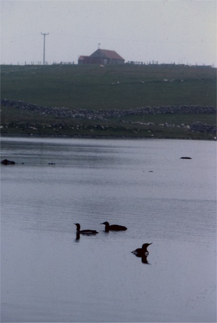
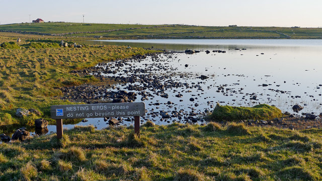
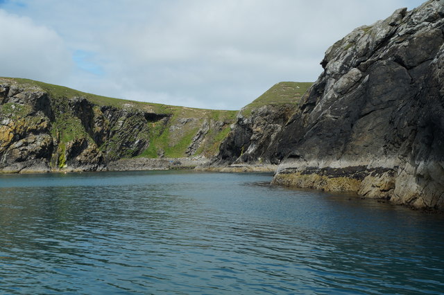
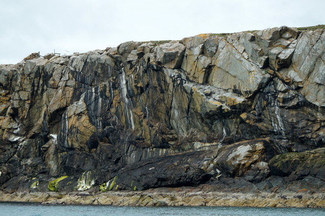
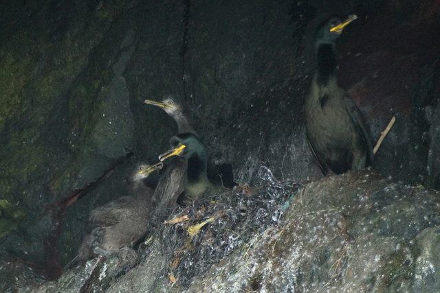
Situated on the east coast of the Shetland Mainland, Teisti Geo is surrounded by rugged cliffs and rolling green hills, providing a dramatic backdrop to its crystal-clear waters. The area is known for its abundant wildlife, making it a popular spot for birdwatching enthusiasts. Visitors can often observe various seabirds, such as puffins, guillemots, and razorbills, nesting along the cliffs.

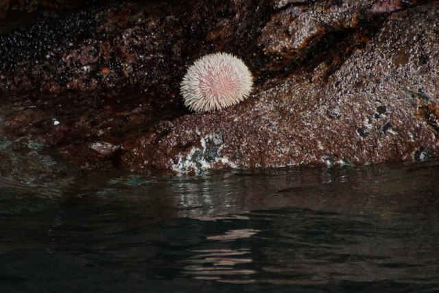
The creek itself is a haven for marine life, with seals often spotted basking on the rocks and otters playing in the shallows. The tidal nature of the estuary also means that it supports a wide range of plant and animal species, making it a significant ecological site.

Teisti Geo offers opportunities for various recreational activities. The calm waters make it an ideal spot for kayaking and paddleboarding, allowing visitors to explore the area's hidden coves and caves. The surrounding cliffs also provide excellent opportunities for rock climbing and hiking, offering breathtaking views of the surrounding coastline.

Although Teisti Geo is a remote location, it can be accessed via a short walk from the nearby village of Cunningsburgh. The area's natural beauty and tranquility make it a must-visit destination for nature lovers and those seeking a peaceful retreat in the heart of the Shetland Islands.

If you have any feedback on the listing, please let us know in the comments section below.

Teisti Geo Images

Images are sourced within 2km of 60.587548/-0.83152025 or Grid Reference HU6489. Thanks to Geograph Open Source API. All images are credited.

Fetlar Gardens On Fetlar, sheep are everywhere - so vegetables were grown inside these little 'walled gardens' to protect them from the sheep.
Fetlar Gardens
On Fetlar, sheep are everywhere - so vegetables were grown inside these little 'walled gardens' to protect them from the sheep.
Burn flowing into Wick of Aith, Fetlar
Aith Ness The cliffs below Gillis Field and the Head of Lambhoga are visible in the distance.
Aith Ness
The cliffs below Gillis Field and the Head of Lambhoga are visible in the distance.
Rain Geese on Loch of Funzie, Fetlar Rain Goose is the local name for Red-throated Diver (Gavia stellata).
Rain Geese on Loch of Funzie, Fetlar
Rain Goose is the local name for Red-throated Diver (Gavia stellata).
Aithbank, Fetlar The house has since been refurbished as a camping booth.
Aithbank, Fetlar
The house has since been refurbished as a camping booth.
Aith Ness from Wick of Tresta
The Mires of Fundy - RSPB Reserve The view from the hide at the Mires of Fundy.  All quiet on a sunny Spring evening although the red-necked phalaropes were thought to be resident.
The Mires of Fundy - RSPB Reserve
The view from the hide at the Mires of Fundy. All quiet on a sunny Spring evening although the red-necked phalaropes were thought to be resident.
Loch of Funzie exhortation A bird watcher was incensed having seen a Fetlar islander go fishing in his waders for trout in this section of Loch of Funzie.  And despite the notice!!  All for the protection of red-necked phalaropes, a bird uncommon in the UK but not so worldwide.
Loch of Funzie exhortation
A bird watcher was incensed having seen a Fetlar islander go fishing in his waders for trout in this section of Loch of Funzie. And despite the notice!! All for the protection of red-necked phalaropes, a bird uncommon in the UK but not so worldwide.
Loch of Funzie
Loch of Funzie
Unsurfaced track View along the non surfaced track near Aithbank.
Unsurfaced track
View along the non surfaced track near Aithbank.
Loch of Funzie View of the Loch of Funzie
Loch of Funzie
View of the Loch of Funzie
Beadlet Anemone (Actinia equina), Wick of Aith
Flat Periwinkle (Littorina obtusata), Wick of Aith
Geo of Litlaland, Funzie Ness, Fetlar
Multi-coloured cliff, Bight of Raabis, Fetlar
Shags (Phalacrocorax aristotelis), Muckle Cupla, Fetlar
Common Sea Urchin (Echinus esculentus), Wick of Aith, Fetlar Not usually seen above water, even at low tide.
Common Sea Urchin (Echinus esculentus), Wick of Aith, Fetlar
Not usually seen above water, even at low tide.
Line of planticrubs Anyone familiar with the landscape of northern England or Scotland will assume first of all that these are drystone sheep fanks but actually they are planticrubs, probably unique to Shetland.  This was the only place I saw a whole row of them.  Planticrubs were built to shelter kale seedlings from the wind so serve as primitive greenhouses.
Line of planticrubs
Anyone familiar with the landscape of northern England or Scotland will assume first of all that these are drystone sheep fanks but actually they are planticrubs, probably unique to Shetland. This was the only place I saw a whole row of them. Planticrubs were built to shelter kale seedlings from the wind so serve as primitive greenhouses.
Show me another place!

Teisti Geo is located at Grid Ref: HU6489 (Lat: 60.587548, Lng: -0.83152025)

Unitary Authority: Shetland Islands

Police Authority: Highlands and Islands

What 3 Words

///combines.increment.remaking. Near Houbie, Shetland Islands

Related Wikis

Fetlar

Fetlar (Scots: Fetlar) is one of the North Isles of Shetland, Scotland, with a usually resident population of 61 at the time of the 2011 census. Its main...

Haltadans

Haltadans, also known as Fairy Ring or Haltadans stone circle, is a stone circle on the island of Fetlar in Shetland, Scotland. This site is a ring of...

Funzie Girt

Funzie Girt (; Scots: Funyie Girt "Finns' dyke") is an ancient dividing wall that was erected from north to south across the island of Fetlar in Shetland...

Brough Lodge

Brough Lodge is a 19th-century Gothic mansion on Fetlar, one of the Shetland Islands, in northern Scotland. Built by the Nicolson family, who were responsible...

Urie Lingey

For other islands with similar names, see Linga (disambiguation) Urie Lingey is one of the Shetland Islands. It is between Fetlar and Unst, and Yell is...

Hamars Ness

Hamars Ness is a headland on the island of Fetlar in Shetland, Scotland. The name is from the Old Norse Hamarsnes meaning "craggy headland". A ro-ro ferry...

Haaf Gruney

Haaf Gruney is a small island in the north east of the Shetland Islands. == Geography and geology == The island is between Unst and Fetlar which are to...

Sound Gruney

For other islands with similar names, see Gruney (disambiguation) Sound Gruney is one of the Shetland islands. It lies about 1.5 kilometres (0.93 mi)...

Nearby Amenities

Located within 500m of 60.587548,-0.83152025
Passing Place
Lat/Long: 60.5903845/-0.8383828
Aith
Place: hamlet
Lat/Long: 60.5898398/-0.8384938
Toilets
Lat/Long: 60.5880104/-0.8293247
Aithbank Camping Böd
Opening Hours: Mar 1-Oct 31 00:00-24:00
Tourism: hostel
Website: http://www.camping-bods.co.uk
Lat/Long: 60.5880818/-0.8293136
Power: pole
Lat/Long: 60.5904853/-0.8380297
Power: pole
Lat/Long: 60.5903215/-0.8371739
Power: pole
Lat/Long: 60.5900241/-0.8356238
Power: pole
Lat/Long: 60.5895986/-0.8343536
Passing Place
Lat/Long: 60.589339/-0.8337103
Power: pole
Lat/Long: 60.5891704/-0.8330699
Passing Place
Lat/Long: 60.588639/-0.8315398
Power: pole
Lat/Long: 60.5887462/-0.8317889
Power: pole
Lat/Long: 60.5885229/-0.8297705
Power: pole
Lat/Long: 60.5886326/-0.8307098
Barrier: cattle_grid
Lat/Long: 60.588272/-0.8275608
Power: pole
Lat/Long: 60.5883973/-0.8286726
Power: pole
Lat/Long: 60.5878608/-0.8261456
Power: pole
Lat/Long: 60.5876295/-0.8247704
Power: pole
Lat/Long: 60.5874947/-0.8240088
Power: pole
Lat/Long: 60.5873929/-0.823406
Power: pole
Lat/Long: 60.5872766/-0.8226686
Power: pole
Lat/Long: 60.5881027/-0.8275622
The data included in this document is from www.openstreetmap.org. The data is made available under ODbL.

Have you been to Teisti Geo?

Leave your review of Teisti Geo below (or comments, questions and feedback).