Byer's Hole
Sea, Estuary, Creek in Durham
England
Byer's Hole

Byer's Hole is a picturesque body of water located in Durham, England. It is commonly referred to as a creek or a beck, and is situated near the village of Byer's Green. The waterway is primarily known for its estuarine characteristics, as it is a tidal inlet that connects to the North Sea.
The estuary is approximately 4 kilometers long and exhibits a unique ecosystem that supports a diverse range of flora and fauna. The intertidal mudflats and salt marshes that line the banks of Byer's Hole provide an important habitat for various bird species, including waders and waterfowl. During the spring and autumn migration seasons, many birdwatchers flock to the area to observe the impressive avian diversity.
The creek is also rich in marine life, with numerous fish species, such as flounder and sea trout, inhabiting its waters. The intertidal zone is home to a variety of invertebrates, including crabs, shrimps, and worms, which serve as a vital food source for the local bird population.
Byer's Hole is not just a haven for wildlife; it also attracts visitors for recreational activities. Many people enjoy walking along the creek's banks, taking in the beautiful scenery and immersing themselves in nature. The tranquility and natural beauty of Byer's Hole make it a popular spot for boating and fishing as well.
Overall, Byer's Hole is a cherished natural feature of Durham, offering a unique blend of estuarine and coastal environments. Whether it's for birdwatching, fishing, or simply enjoying a peaceful walk, this picturesque creek provides an enriching experience for both locals and visitors alike.
If you have any feedback on the listing, please let us know in the comments section below.
Byer's Hole Images
Images are sourced within 2km of 54.968207/-1.3595971 or Grid Reference NZ4163. Thanks to Geograph Open Source API. All images are credited.


Byer's Hole is located at Grid Ref: NZ4163 (Lat: 54.968207, Lng: -1.3595971)
Unitary Authority: County Durham
Police Authority: Durham
What 3 Words
///reason.energy.kicked. Near Whitburn, Tyne & Wear
Nearby Locations
Related Wikis

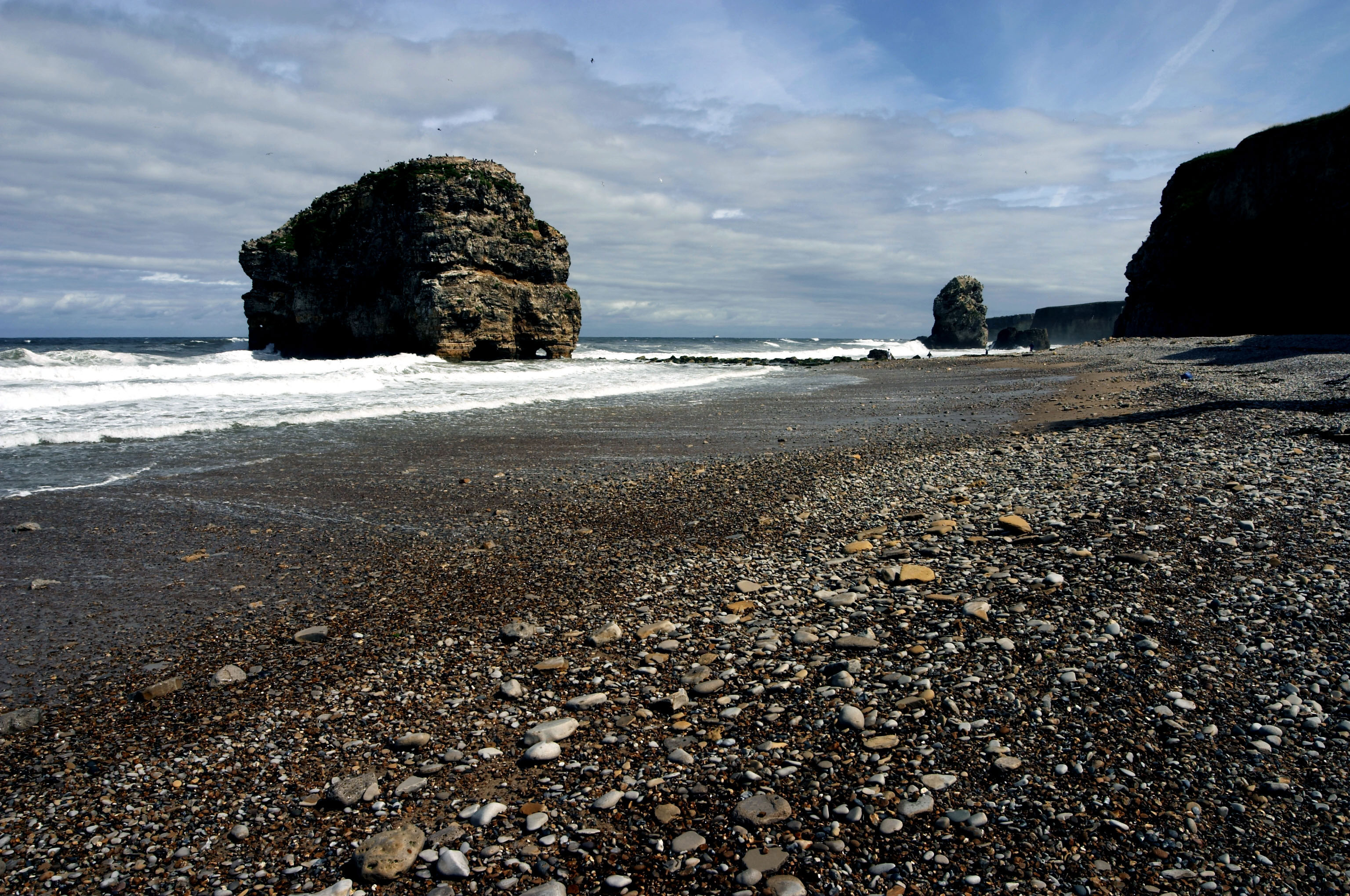
Marsden Rock
Marsden Rock is a rock in Tyne and Wear, North East England, situated in Marsden, South Shields. It is overlooked by the Marsden Grotto. The rock is a...
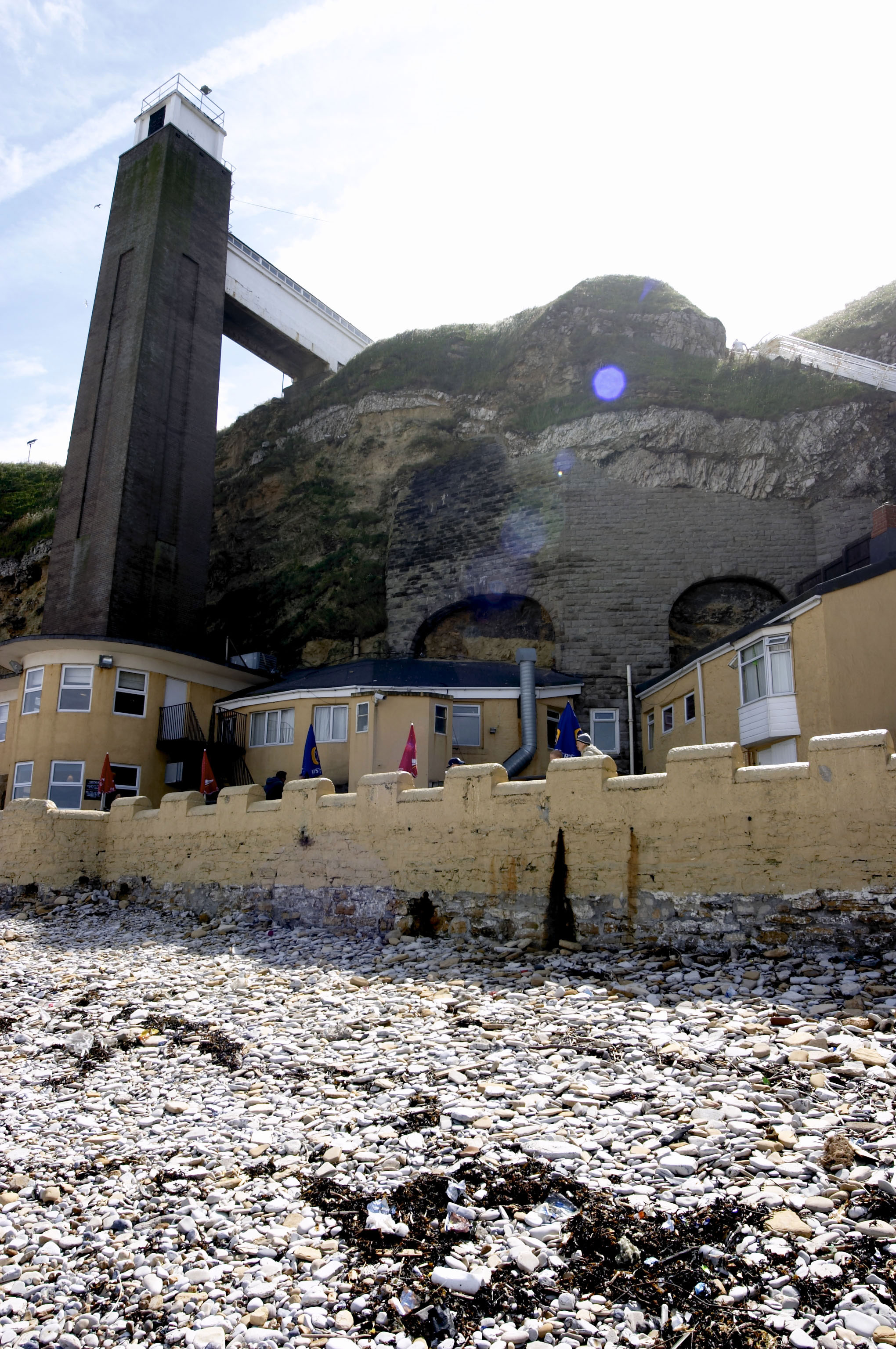
Marsden Grotto
The Marsden Grotto, locally known as The Grotto, is a gastropub located on the coast at Marsden in South Shields, Tyne & Wear, England. It is partly dug...
Marsden, Tyne and Wear
Marsden is located on the outskirts of the seaside town South Shields, North East England, located on the North Sea coast. It lies within historic County...
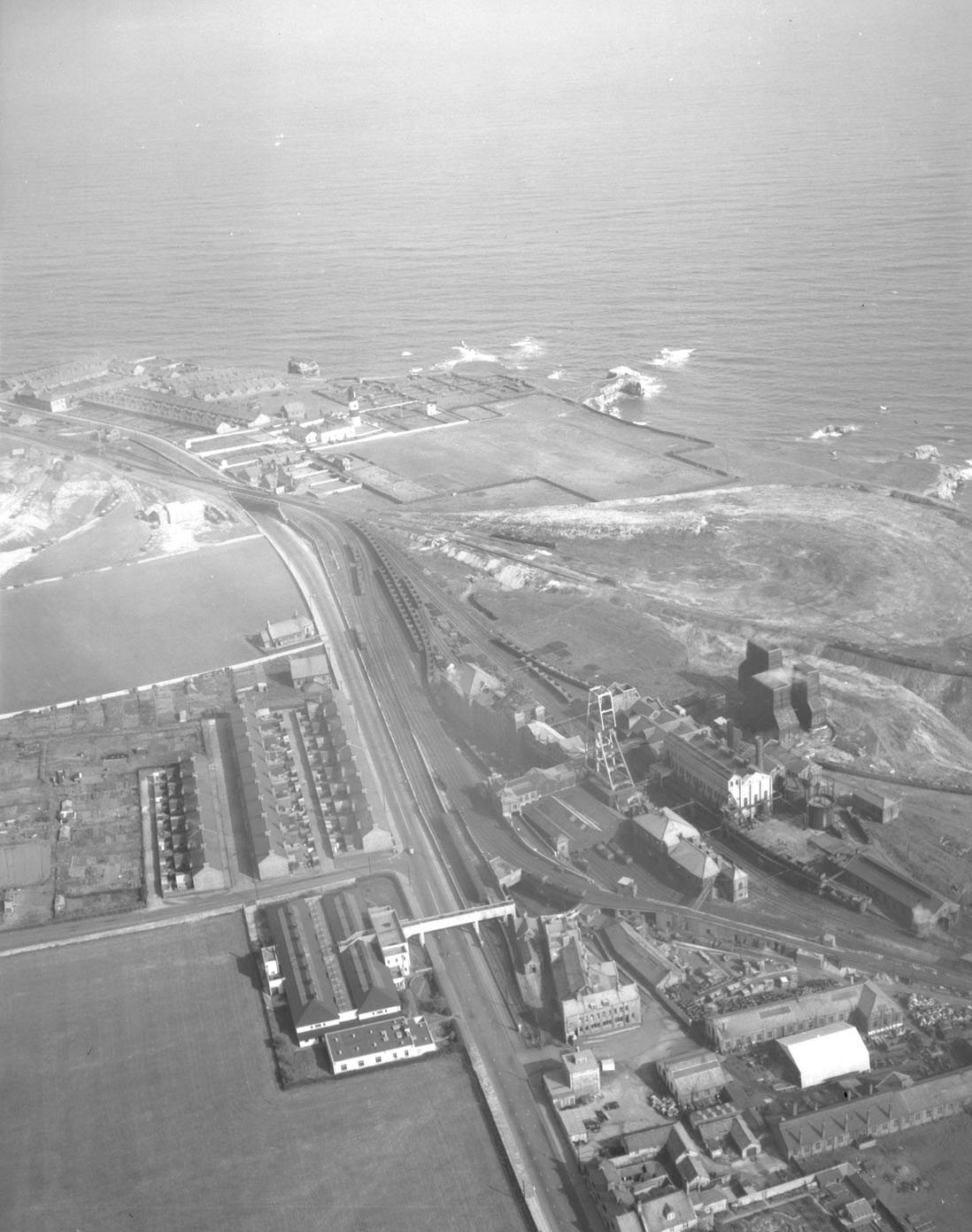
Whitburn Colliery
Whitburn Colliery was a coal mine located about three miles south of South Shields, North East England, located on the North Sea coast. == Background... ==
Nearby Amenities
Located within 500m of 54.968207,-1.3595971Have you been to Byer's Hole?
Leave your review of Byer's Hole below (or comments, questions and feedback).