Potter's Hole

Sea, Estuary, Creek in Durham

England

Potter's Hole

Souter Lighthouse
Souter Lighthouse Credit: Ann Hodgson

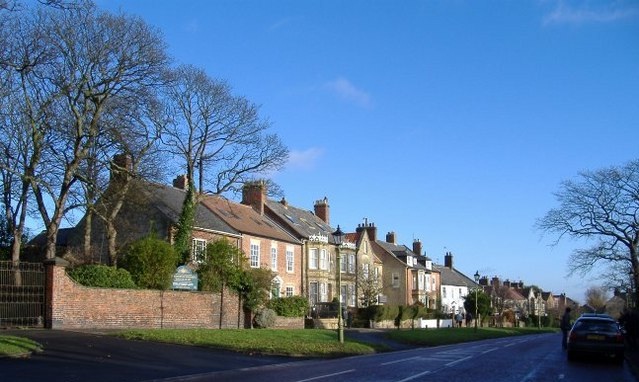
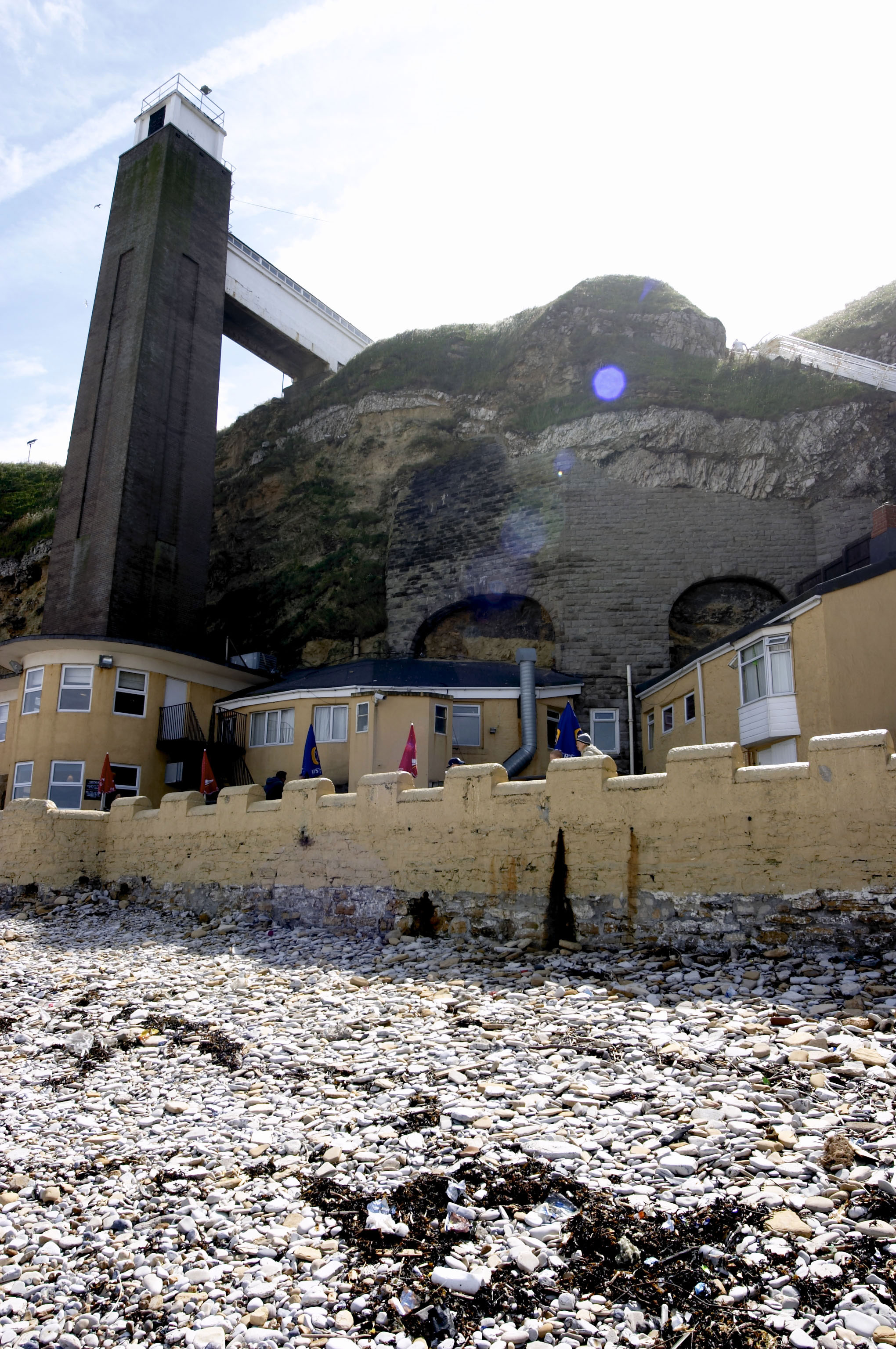
Potter's Hole is a captivating natural feature located in Durham, England. Situated along the coastline, it is a unique combination of sea, estuary, and creek. This picturesque spot is nestled between two cliffs, providing visitors with breathtaking views of the surrounding area.

As a tidal inlet, Potter's Hole is influenced by the ebb and flow of the North Sea. During high tide, the sea rushes into the inlet, creating a beautiful and serene lagoon-like environment. The crystal-clear water reflects the sky, making it a perfect spot for photographers and nature enthusiasts alike.

At low tide, the estuary becomes more visible, showcasing a diverse ecosystem of marine life. The exposed sand and mudflats are home to a variety of wading birds, such as curlews and herons, which can be observed feeding on the abundant marine organisms. The intertidal zone also provides a haven for shellfish and crustaceans, attracting local fishermen in search of a fresh catch.

The creek that flows through Potter's Hole adds another dimension to its natural beauty. The gentle babbling of water against the rocks creates a soothing atmosphere, inviting visitors to explore its meandering paths. This creek serves as a habitat for small fish and other aquatic creatures, making it a popular spot for fishing enthusiasts.

Potter's Hole offers a tranquil escape from the hustle and bustle of city life. Its unique combination of sea, estuary, and creek provides a diverse and captivating natural landscape, making it a must-visit destination for nature lovers and those seeking a serene coastal experience in Durham.

If you have any feedback on the listing, please let us know in the comments section below.

Potter's Hole Images

Images are sourced within 2km of 54.966199/-1.3555679 or Grid Reference NZ4163. Thanks to Geograph Open Source API. All images are credited.

Souter Lighthouse
Souter Lighthouse
Byer's Hole. Whitburn A short walk along the coast South from Souter Lighthouse is this rugged and interesting beach, cliff and caves..
Byer's Hole. Whitburn
A short walk along the coast South from Souter Lighthouse is this rugged and interesting beach, cliff and caves..
Marsden Rock Bird Sanctuary I was a novice at bird recognition so won't try to remember the identity of the spots.
Marsden Rock Bird Sanctuary
I was a novice at bird recognition so won't try to remember the identity of the spots.
Christmas at Souter Souter light, Christmas 2004
Christmas at Souter
Souter light, Christmas 2004
Whitburn Mill
Whitburn Mill
Marsden Rock After the unsafe stack was demolished. The black specks on the top are cormorants who nest there. Kittiwakes and fulmar nest on the side of the rock, but none are visible in this shot.
Marsden Rock
After the unsafe stack was demolished. The black specks on the top are cormorants who nest there. Kittiwakes and fulmar nest on the side of the rock, but none are visible in this shot.
Souter Lighthouse from the East Now owned by the National Trust the lighthouse was opened in 1871 and was the first to use alternating current which gave much better reliability than direct current. The dark window on the left was an innovation designed to provide a fixed two colour light across Sunderland Bay. Ships would steer along the white sector before turning into the port of Sunderland; if the light turned red they had drifted too close to the rocks.
Souter Lighthouse from the East
Now owned by the National Trust the lighthouse was opened in 1871 and was the first to use alternating current which gave much better reliability than direct current. The dark window on the left was an innovation designed to provide a fixed two colour light across Sunderland Bay. Ships would steer along the white sector before turning into the port of Sunderland; if the light turned red they had drifted too close to the rocks.
Limekilns, Marsden dating from the 1870's these kilns provided lime for agriculture and industry. Limestone was quarried behind the kilns using coal from Whitburn Colliery. The kilns operated until the 1960's although the quarries are still operated.
Limekilns, Marsden
dating from the 1870's these kilns provided lime for agriculture and industry. Limestone was quarried behind the kilns using coal from Whitburn Colliery. The kilns operated until the 1960's although the quarries are still operated.
Looking towards Lizard Farm from Lizard Lane Looking towards Lizard Farm with Cleadon Hills in the distance beyond.
Looking towards Lizard Farm from Lizard Lane
Looking towards Lizard Farm with Cleadon Hills in the distance beyond.
Stacks off Lizard Point Erosion like this is typical of this stretch of coast.
Stacks off Lizard Point
Erosion like this is typical of this stretch of coast.
Coastal footpath South of Souter Point It's possible to walk, mostly on paths like this, from the mouth of the Tyne to the mouth of the Wear.
Coastal footpath South of Souter Point
It's possible to walk, mostly on paths like this, from the mouth of the Tyne to the mouth of the Wear.
Firing range at Whitburn Camp The firing range is very little used now - perhaps not at all.  Cows and horses graze there.  Sticking up on the horizon is Whitburn Windmill (restored).
Firing range at Whitburn Camp
The firing range is very little used now - perhaps not at all. Cows and horses graze there. Sticking up on the horizon is Whitburn Windmill (restored).
Whitburn School This secondary school backs on to a cliff overlooking the North Sea.  Photo taken from the cliffside path.
Whitburn School
This secondary school backs on to a cliff overlooking the North Sea. Photo taken from the cliffside path.
Souter Lighthouse
Souter Lighthouse
Foghorn at Souter Lighthouse
Souter Lighthouse Fifth picture and quite possibly counting. I had scanned it, so was going to upload it regardless.
Souter Lighthouse
Fifth picture and quite possibly counting. I had scanned it, so was going to upload it regardless.
Marsden Rock from the south
Souter Lighthouse
Souter Lighthouse
Show me another place!

Potter's Hole is located at Grid Ref: NZ4163 (Lat: 54.966199, Lng: -1.3555679)

Unitary Authority: County Durham

Police Authority: Durham

What 3 Words

///blame.throw.cult. Near Whitburn, Tyne & Wear

Related Wikis

Whitburn, Tyne and Wear

Whitburn is a village in South Tyneside, in the metropolitan county of Tyne and Wear on the coast of North East England. It is located 3 miles (4.8 km...

Marsden Rock

Marsden Rock is a rock in Tyne and Wear, North East England, situated in Marsden, South Shields. It is overlooked by the Marsden Grotto. The rock is a...

Marsden Grotto

The Marsden Grotto, locally known as The Grotto, is a gastropub located on the coast at Marsden in South Shields, Tyne & Wear, England. It is partly dug...

Whitburn Church of England Academy

Whitburn Church of England Academy is a coeducational secondary school and sixth form located in Whitburn, South Tyneside. Its motto is "Excellence for...

Nearby Amenities

Located within 500m of 54.966199,-1.3555679
Source: PGS
Lat/Long: 54.9668058/-1.3576376
Source: PGS
Lat/Long: 54.9667057/-1.3574949
Whitburn Coastal Park Local Nature Reserve
Information: board
Tourism: information
Lat/Long: 54.9639565/-1.3595286
Whitburn Point Local Nature Reserve
Information: board
Tourism: information
Lat/Long: 54.9643284/-1.3582566
Pond Life
Information: board
Tourism: information
Lat/Long: 54.9647214/-1.3576845
The Wherry
Information: board
Tourism: information
Lat/Long: 54.9672389/-1.3609126
Leisure: bird_hide
Lat/Long: 54.9633523/-1.35879
Generator Method: photovoltaic
Generator Output Electricity: yes
Generator Source: solar
Generator Type: solar_photovoltaic_panel
Location: roof
Power: generator
Lat/Long: 54.9621536/-1.3587641
Vending Machine
Vending: parking_tickets
Lat/Long: 54.9643888/-1.3599752
Image: https://www.geograph.org.uk/photo/3549259
Leisure: bird_hide
Lat/Long: 54.9643195/-1.3576698
The Wherry
Alt Name: Byer's Hole
Image: https://www.geograph.org.uk/photo/6380069
Natural: bay
Lat/Long: 54.9673652/-1.3595179
Bench
Lat/Long: 54.9643345/-1.3576665
Barrier: entrance
Lat/Long: 54.9649767/-1.3577999
Bench
Lat/Long: 54.9652627/-1.3585737
Bench
Lat/Long: 54.9656907/-1.3585643
Bench
Lat/Long: 54.9664121/-1.3590887
Bench
Lat/Long: 54.9666985/-1.3591558
Bench
Lat/Long: 54.9667008/-1.3594159
Bench
Lat/Long: 54.9668355/-1.3601147
Bench
Lat/Long: 54.9668605/-1.3602515
Bench
Lat/Long: 54.9668917/-1.3604043
Bench
Lat/Long: 54.966921/-1.3605465
Bench
Lat/Long: 54.9669729/-1.3606766
Bench
Lat/Long: 54.9670237/-1.3607678
Bench
Lat/Long: 54.967108/-1.360859
Bench
Lat/Long: 54.9671935/-1.3609327
Bench
Lat/Long: 54.9674837/-1.3609274
Bench
Lat/Long: 54.9675838/-1.3609032
Bench
Lat/Long: 54.9676762/-1.3608898
Bench
Lat/Long: 54.9678779/-1.3608576
Bench
Lat/Long: 54.9688694/-1.3611004
Bench
Lat/Long: 54.969192/-1.3613619
Whitburn Coastal Park Local Nature Reserve
Board Type: nature
Information: board
Tourism: information
Lat/Long: 54.9623012/-1.356255
Bridleway on the Coast
Horse: yes
Information: map
Note: Horse routes shown on map don't correlate well with tracks on ground.
Operator: National Trust
Tourism: information
Lat/Long: 54.9620478/-1.3578509
Bench
Lat/Long: 54.965566/-1.3586683
Bench
Lat/Long: 54.9656915/-1.3587327
The data included in this document is from www.openstreetmap.org. The data is made available under ODbL.

Have you been to Potter's Hole?

Leave your review of Potter's Hole below (or comments, questions and feedback).