Moo Wick

Sea, Estuary, Creek in Shetland

Scotland

Moo Wick

Loch of Queyfirth from Hill of Ollaberry The loch is really an arm of the sea, with an outflow at low tide and the sea encroaching at high tide.
Loch of Queyfirth from Hill of Ollaberry Credit: Mike Pennington

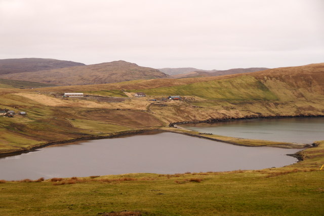
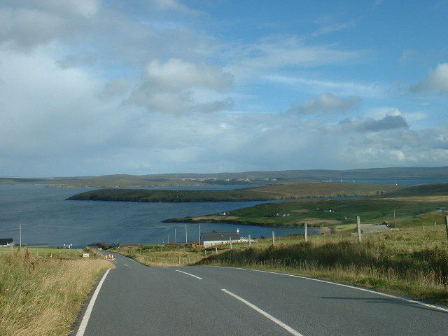
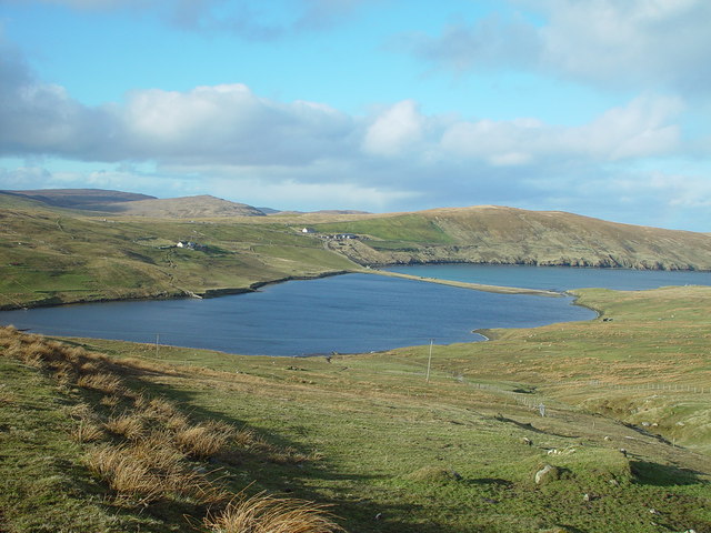
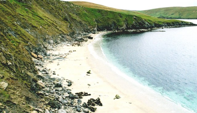
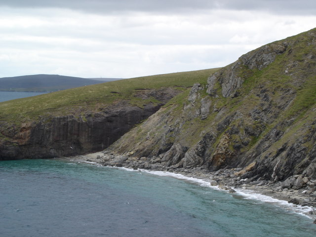
Moo Wick is a charming coastal area located on the island of Shetland, off the northeastern coast of Scotland. It is situated on the east coast of the main island, about 6 miles northeast of the town of Lerwick. Moo Wick is comprised of a sea, estuary, and creek, making it a diverse and picturesque landscape.

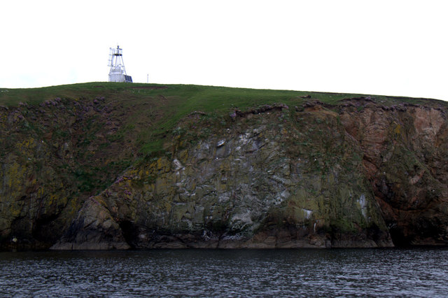
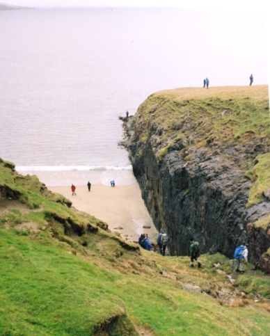
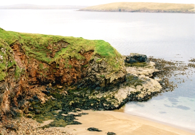
The sea surrounding Moo Wick is part of the North Sea, offering breathtaking views of the open water and distant horizons. The coastline is rugged and rocky, with cliffs and small sandy beaches dotting the area. The crashing waves and salty sea breeze create a serene and refreshing atmosphere.

The estuary at Moo Wick is formed by the convergence of several small rivers and streams, creating a shallow and marshy area. It is a haven for various species of birds, making it a popular spot for birdwatching. The estuary is also home to a variety of marine life, including seals and otters, which can often be spotted playing in the water.

The creek at Moo Wick is a narrow channel that cuts through the landscape, providing a sheltered and calm environment. It is an ideal spot for fishing and boating enthusiasts, offering opportunities for leisurely exploration of the surrounding area.

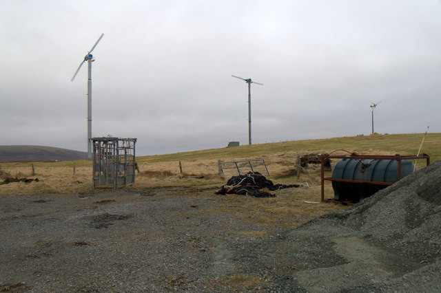
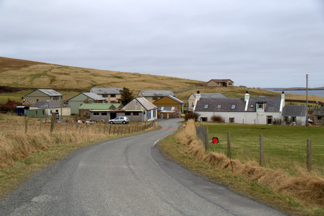
Overall, Moo Wick is a scenic and diverse coastal location, offering a mix of dramatic sea views, tranquil estuaries, and peaceful creek waters. It is a haven for nature lovers and outdoor enthusiasts, providing ample opportunities for wildlife observation, water activities, and peaceful relaxation.

If you have any feedback on the listing, please let us know in the comments section below.

Moo Wick Images

Images are sourced within 2km of 60.506681/-1.3277819 or Grid Reference HU3780. Thanks to Geograph Open Source API. All images are credited.

Loch of Queyfirth from Hill of Ollaberry The loch is really an arm of the sea, with an outflow at low tide and the sea encroaching at high tide.
Loch of Queyfirth from Hill of Ollaberry
The loch is really an arm of the sea, with an outflow at low tide and the sea encroaching at high tide.
Blythoid, Ollaberry Looking across Yell Sound to Sullom Voe Terminal.
Blythoid, Ollaberry
Looking across Yell Sound to Sullom Voe Terminal.
Wind turbines on Hill of Ollaberry
Runnadale, Ollaberry Small housing estate at the end of the road.
Runnadale, Ollaberry
Small housing estate at the end of the road.
South Head, Lamba, Yell Sound
Beacon on Lamba, Yell Sound
Common Seal (Phoca vitulina) with very young pup, Lamba, Yell Sound
Small burn entering the Bay of Ollaberry Looking across to Ollaberry and the hill the Back of Ollaberry.
Small burn entering the Bay of Ollaberry
Looking across to Ollaberry and the hill the Back of Ollaberry.
Eastwick, Ollaberry Looking across the small burn and a cabbage patch towards an old kirk.
Eastwick, Ollaberry
Looking across the small burn and a cabbage patch towards an old kirk.
Hillside, Ollaberry
Hillside, Ollaberry
Blythot, Ollaberry, Shetland Picture taken at Blythot, above Ollaberry, looking over East Ness to Gluss Isle in Sullom Voe. Sullom Voe Oil Terminal is in the background
Blythot, Ollaberry, Shetland
Picture taken at Blythot, above Ollaberry, looking over East Ness to Gluss Isle in Sullom Voe. Sullom Voe Oil Terminal is in the background
Bay of Ollaberry The B9079 leads to this small village at the northern end of the Shetland Mainland.
Bay of Ollaberry
The B9079 leads to this small village at the northern end of the Shetland Mainland.
Loch of Queyfirth, Shetland If you take the road from Upper Ollaberry signposted Leon you come over the ridge to the west the Hill of Ollaberry and are greeted with this view of the Loch of Queyfirth and Quey Firth.
Loch of Queyfirth, Shetland
If you take the road from Upper Ollaberry signposted Leon you come over the ridge to the west the Hill of Ollaberry and are greeted with this view of the Loch of Queyfirth and Quey Firth.
Saberstone This spectacular cliff is part of the Walls Boundary Fault, which cuts Shetland from north to south and may be the continuation of the Great Glen Fault in Scotland.
Saberstone
This spectacular cliff is part of the Walls Boundary Fault, which cuts Shetland from north to south and may be the continuation of the Great Glen Fault in Scotland.
Ollaberry A quiet village in Northmavine.
Ollaberry
A quiet village in Northmavine.
Otter Hadd The headland beyond Ollaberry
Otter Hadd
The headland beyond Ollaberry
Looking towards the Taing of Norwick The Taing is the headland beyond this fine but rather inaccessible beach.
Looking towards the Taing of Norwick
The Taing is the headland beyond this fine but rather inaccessible beach.
Ollaberry Fault An extension of the Great Glen Fault of Scotland, outcropping in Shetland. A must for all geologists.The cliff on the far side is granite; that on the nearside is schist.
Ollaberry Fault
An extension of the Great Glen Fault of Scotland, outcropping in Shetland. A must for all geologists.The cliff on the far side is granite; that on the nearside is schist.
Show me another place!

Moo Wick is located at Grid Ref: HU3780 (Lat: 60.506681, Lng: -1.3277819)

Unitary Authority: Shetland Islands

Police Authority: Highlands and Islands

What 3 Words

///seasonal.protected.disclose. Near Toft, Shetland Islands

Related Wikis

Ollaberry

Ollaberry (Old Norse: Olafrsberg, meaning Olaf's Hill) is a village on Mainland, Shetland, Scotland on the west shore of Yell Sound, 10.9 miles (17.5 km...

Lamba, Shetland

Lamba is an uninhabited island in Yell Sound in Shetland. It lies 1.5 km (0.93 mi) north of the entrance to the Sullom Voe inlet and 1.4 kilometres (0...

Little Roe

Little Roe is an island in Yell Sound in the Shetland Islands == History == The island's name is Norse in origin, from Rauðey Litla, meaning "small red...

Voe, Northmavine

Voe is a settlement on the Northmavine peninsula of Mainland, Shetland, Scotland. It is at the head of Ronas Voe and just off the A970 road. == Whaling... ==

Northmavine

Northmavine or Northmaven (Old Norse: Norðan Mæfeið, meaning ‘the land north of the Mavis Grind’) is a peninsula in northwest Mainland Shetland in Scotland...

Eela Water

Eela Water is a freshwater loch (lake) in Northmavine, part of the mainland of Shetland in Scotland. Besides being a freshwater fishing location, the site...

Shetland Gas Plant

The Shetland Gas Plant is a natural-gas processing plant in the Shetland Islands, Scotland. == History == The Shetland Gas Plant is the collection and...

RAF Sullom Voe

Royal Air Force Sullom Voe or more simply RAF Sullom Voe is a former Royal Air Force station near the village of Brae, in the Shetland Isles of Scotland...

Nearby Amenities

Located within 500m of 60.506681,-1.3277819
Post Office
Ollaberry Post Office
Addr City: Shetland
Addr Country: GB
Addr Postcode: ZE2 9RT
Addr Suburb: Ollaberry
Brand: Post Office
Brand Wikidata: Q1783168
Operator: Post Office
Ref Pol Id: 145857
Lat/Long: 60.5074052/-1.335412
Ollaberry
Place: village
Lat/Long: 60.5077048/-1.3344248
Post Box
Note: Box number is same as Out Skerries box
Operator: Royal Mail
Operator Wikidata: Q638098
Ref: ZE2 125
Lat/Long: 60.5074374/-1.3352413
Passing Place
Lat/Long: 60.5075441/-1.3355891
Power: pole
Lat/Long: 60.5081745/-1.3347957
Power: pole
Lat/Long: 60.5083043/-1.3353374
Power: pole
Lat/Long: 60.5073162/-1.3356585
The data included in this document is from www.openstreetmap.org. The data is made available under ODbL.

Have you been to Moo Wick?

Leave your review of Moo Wick below (or comments, questions and feedback).