Dyke-end Geo

Sea, Estuary, Creek in Shetland

Scotland

Dyke-end Geo

Loose Head, St Ninian's Isle, from the air
Loose Head, St Ninian's Isle, from the air Credit: Mike Pennington

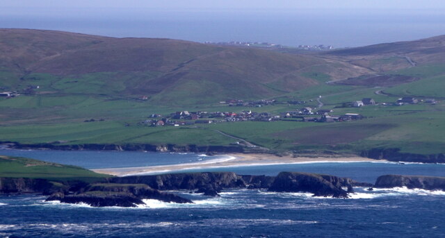
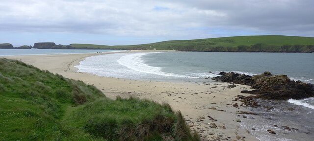
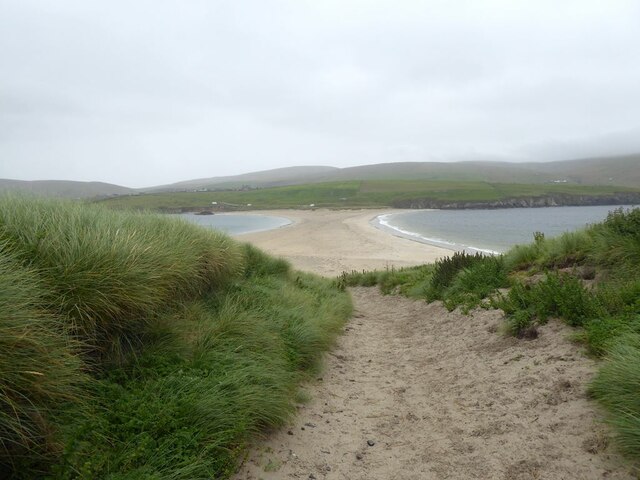
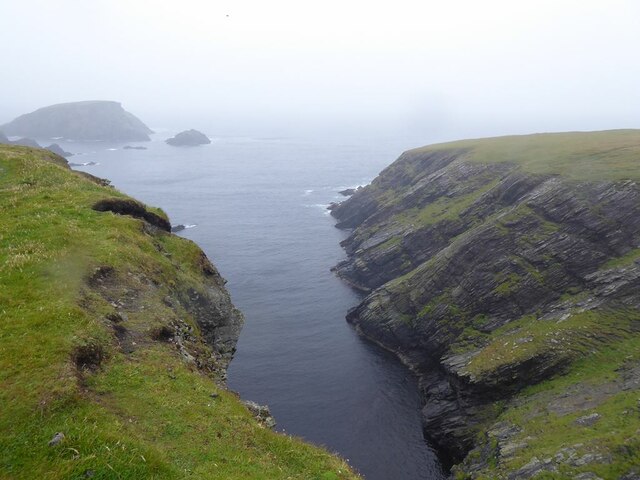
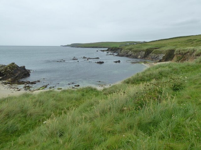
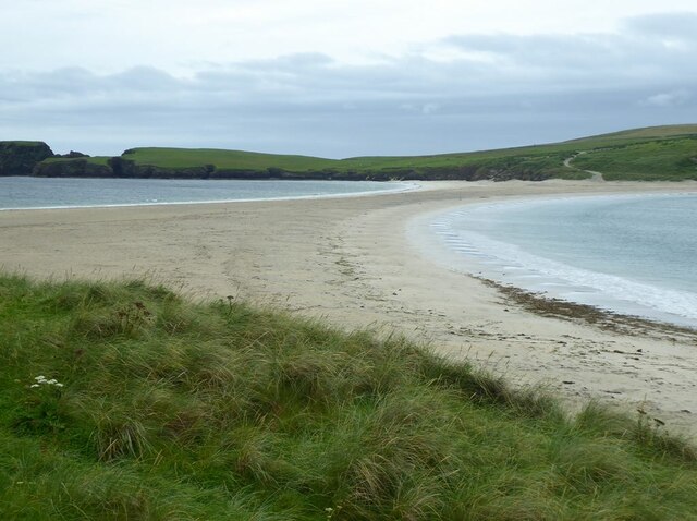
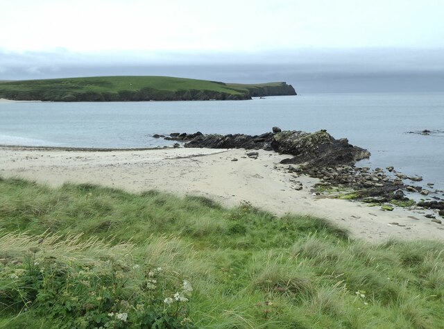
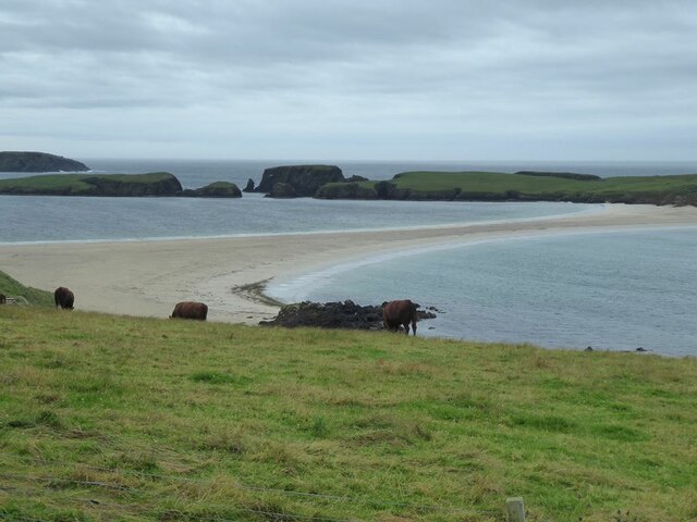
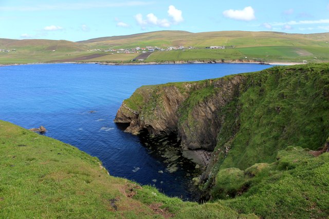
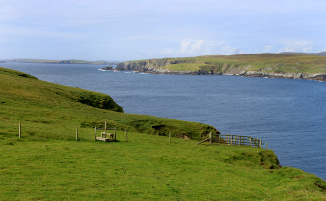
Dyke-end Geo is a picturesque inlet located on the island of Shetland in Scotland. It is classified as a sea, estuary, and creek due to its unique geographical features and its connection to the North Sea.

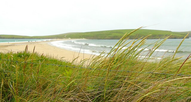
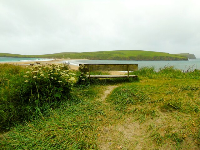
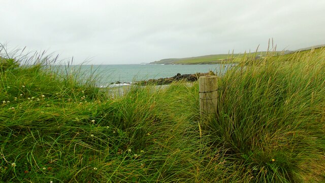
Situated on the southwestern coast of Shetland, Dyke-end Geo is known for its stunning natural beauty and diverse marine life. The area is characterized by its rocky coastline, with towering cliffs and jagged formations that provide a dramatic backdrop to the tranquil waters. The sea at Dyke-end Geo is typically calm, making it an ideal spot for various water activities such as boating, fishing, and kayaking.

The estuary aspect of Dyke-end Geo is evident in the presence of several small streams and rivulets that flow into the inlet, creating a brackish environment where freshwater and saltwater mix. This unique ecosystem supports a rich array of plant and animal species, including various types of seaweed, mollusks, and fish.

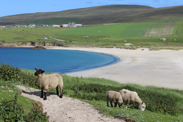
Dyke-end Geo also serves as a vital habitat for numerous bird species, with its sheltered waters and surrounding cliffs providing nesting sites and foraging grounds. Visitors can often spot seabirds such as puffins, guillemots, and gulls, as well as the occasional seal or otter.

Overall, Dyke-end Geo offers a captivating blend of natural beauty, diverse marine life, and unique geological formations. Its status as a sea, estuary, and creek makes it a fascinating destination for nature enthusiasts and those seeking a peaceful coastal retreat.

If you have any feedback on the listing, please let us know in the comments section below.

Dyke-end Geo Images

Images are sourced within 2km of 59.986025/-1.3382913 or Grid Reference HU3722. Thanks to Geograph Open Source API. All images are credited.

Loose Head, St Ninian's Isle, from the air
St Ninian's Ayre from the air
St Ninian's Ayre
St Ninian's Ayre
St Ninian's Ayre
St Ninian's Ayre
Track on St Ninian's Isle Leading down to the tombolo which ties the island to the mainland.
Track on St Ninian's Isle
Leading down to the tombolo which ties the island to the mainland.
Ruins of St Ninian's Chapel In the middle distance, the tombolo which ties St Ninian's Isle to the mainland.
Ruins of St Ninian's Chapel
In the middle distance, the tombolo which ties St Ninian's Isle to the mainland.
Inlet on the west coast of St Ninian's Isle Out to sea is the island of Hich Holm <a href="https://www.geograph.org.uk/gridref/HU3521">HU3521</a> and to the right, Fora Stack.
Inlet on the west coast of St Ninian's Isle
Out to sea is the island of Hich Holm HU3521 and to the right, Fora Stack.
Rocky shore at Bigton
Tombolo linking Mainland to St Ninian's Isle A textbook example of a tombolo. Bigton Wick to the right, St Ninian's Bay to the left.
Tombolo linking Mainland to St Ninian's Isle
A textbook example of a tombolo. Bigton Wick to the right, St Ninian's Bay to the left.
Bigton Wick Looking across the bay to St Ninian's Isle.
Bigton Wick
Looking across the bay to St Ninian's Isle.
View from Bigton Looking over the tombolo towards St Ninian's Bay and the southern end of St Ninian's Isle.
View from Bigton
Looking over the tombolo towards St Ninian's Bay and the southern end of St Ninian's Isle.
View north from Bigton Ireland Wick and the hamlet of Ireland on the far hillside.
View north from Bigton
Ireland Wick and the hamlet of Ireland on the far hillside.
Tombolo at St Ninian's Isle Taken on St Ninian's beach at Bigton, Shetland, I am looking along the tombolo linking the mainland to St Ninian's Isle, site of the remains of St Ninian's Chapel.
Tombolo at St Ninian's Isle
Taken on St Ninian's beach at Bigton, Shetland, I am looking along the tombolo linking the mainland to St Ninian's Isle, site of the remains of St Ninian's Chapel.
St Ninian's Isle I am just above the beach at Bigton Wick and looking across to the north end of St Ninian's Isle where the ruins of St Ninian's Chapel are to be found. The cliffs of Scarfi Taing are discernible to the right.
St Ninian's Isle
I am just above the beach at Bigton Wick and looking across to the north end of St Ninian's Isle where the ruins of St Ninian's Chapel are to be found. The cliffs of Scarfi Taing are discernible to the right.
Ireland Wick to Griskerry I am on St Ninian's beach, Bigton, Shetland, and looking north west along the coast past the Wick of Ireland (and the settlement of Ireland behind it) towards Griskerry, the summit of which can be glimpsed on the horizon (centre of shot).
Ireland Wick to Griskerry
I am on St Ninian's beach, Bigton, Shetland, and looking north west along the coast past the Wick of Ireland (and the settlement of Ireland behind it) towards Griskerry, the summit of which can be glimpsed on the horizon (centre of shot).
St Ninian's Sheep Looking eastwards from St Ninian's Isle over the sand bar to Bigton.
St Ninian's Sheep
Looking eastwards from St Ninian's Isle over the sand bar to Bigton.
Scarfi Taing The easternmost point of St Ninian's Isle, discounting the sand bar.
Scarfi Taing
The easternmost point of St Ninian's Isle, discounting the sand bar.
Pathway, St Ninian's Isle St Ninian's Isle seems to be mostly sandy grassland and easy to wander about on.
At least, the bits we went to were.
The Isle is home to a lot of sheep and there are a number of fences.
Pathway, St Ninian's Isle
St Ninian's Isle seems to be mostly sandy grassland and easy to wander about on. At least, the bits we went to were. The Isle is home to a lot of sheep and there are a number of fences.
Show me another place!

Dyke-end Geo is located at Grid Ref: HU3722 (Lat: 59.986025, Lng: -1.3382913)

Unitary Authority: Shetland Islands

Police Authority: Highlands and Islands

What 3 Words

///laminated.frantic.means. Near Sandwick, Shetland Islands

Related Wikis

Bigton

Bigton is a small settlement on South Mainland, Shetland, UK. Bigton is within the civil parish of Dunrossness.Bigton lies on the Atlantic coast of the...

St Ninian's Isle

St Ninian's Isle is a small tied island connected by the largest tombolo in the UK to the south-western coast of the Mainland, Shetland, in Scotland. It...

Colsay

Colsay is an uninhabited island off the South West coast of Mainland, Shetland. Fora Ness lies to the south, across the Muckle Sound. The highest elevation...

Levenwick

Levenwick is a small village about 17 miles (27 km) south of Lerwick, on the east side of the South Mainland of Shetland, Scotland. It is part of the parish...

Little Havra

Little Havra is a small island off the west of South Mainland in Shetland. It is 35 metres (115 ft) at its highest point, upon which there is a cairn....

South Havra

South Havra (Scots: Sooth Haevra; Old Norse: Hafrey), formerly Hevera, is an uninhabited island in the Scalloway Islands, Shetland, Scotland. == Geography... ==

Scousburgh

Scousburgh is a small community in the parish of Dunrossness, in the South Mainland of Shetland, Scotland, overlooking the picturesque Scousburgh Sand...

Hoswick

Hoswick is a settlement in Sandwick in the south mainland of Shetland, Scotland, on the eastern part of the Dunrossness civil parish. It is separated from...

Nearby Amenities

Located within 500m of 59.986025,-1.3382913
Barrier: cattle_grid
Lat/Long: 59.9854217/-1.3294395
Griskerry
Place: islet
Lat/Long: 59.9895871/-1.3431524
The data included in this document is from www.openstreetmap.org. The data is made available under ODbL.

Have you been to Dyke-end Geo?

Leave your review of Dyke-end Geo below (or comments, questions and feedback).