West Bergaroo

Sea, Estuary, Creek in Shetland

Scotland

West Bergaroo

The north east of Fair Isle The North Light in the distance.
The north east of Fair Isle Credit: David Purchase

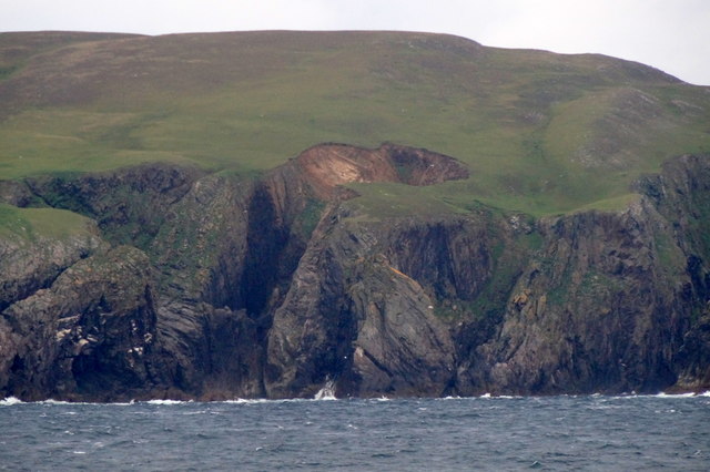
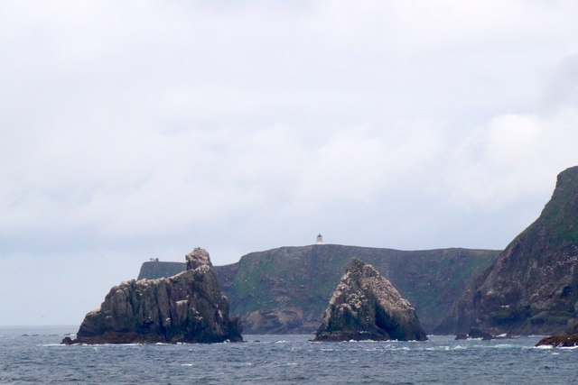
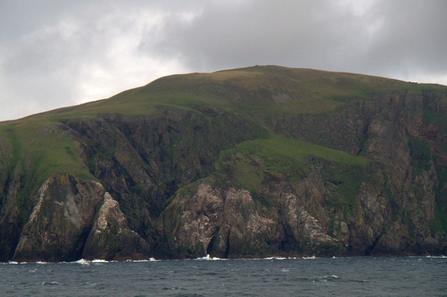
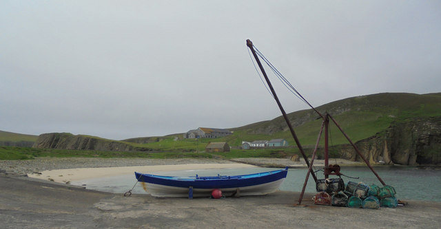
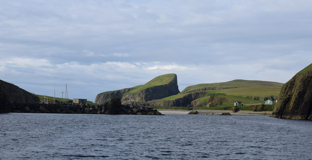
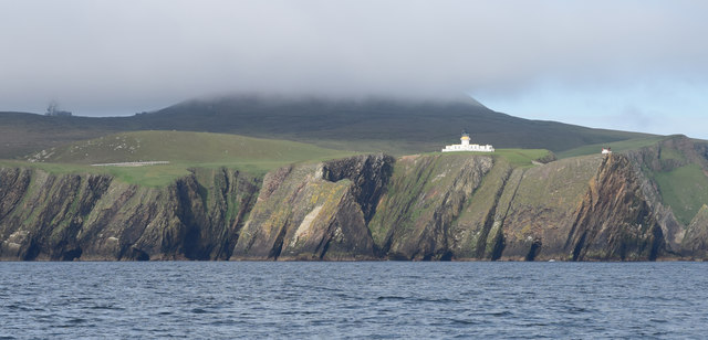
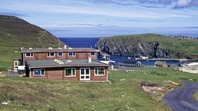
West Bergaroo is a picturesque coastal area located on the island of Shetland, Scotland. Nestled along the rugged North Atlantic coastline, it encompasses a diverse range of natural features including a sea, estuary, and creek. Its stunning beauty and unique ecosystem make it a popular destination for nature enthusiasts and photographers.

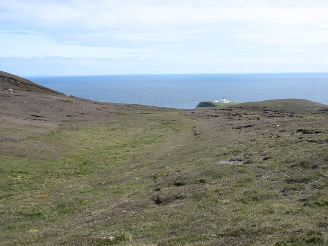
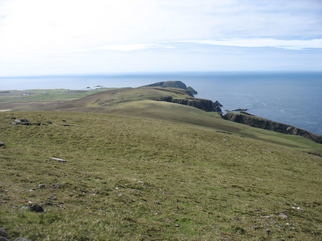
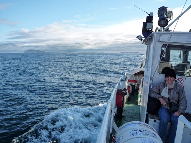
The sea surrounding West Bergaroo is the North Atlantic Ocean, known for its pristine blue waters and rich marine life. Visitors can witness breathtaking views of the open sea, with waves crashing against the rocky shoreline and seabirds soaring above.

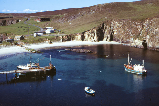
The area also features an estuary, where a river meets the sea. This estuary is a vital habitat for numerous species of flora and fauna, as well as a feeding ground for migratory birds. During low tide, the estuary reveals an expansive mudflat teeming with wading birds, such as curlews and oystercatchers.

A creek, or small stream, flows through West Bergaroo, adding to its natural charm. The creek meanders through the landscape, creating a peaceful and serene atmosphere. It provides a freshwater source for wildlife and contributes to the overall biodiversity of the area.

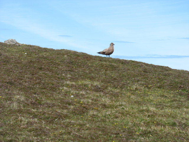
West Bergaroo is blessed with diverse wildlife, including seals, otters, and a variety of seabirds. The area is also home to a range of plant species, including wildflowers and grasses that thrive in the coastal environment.

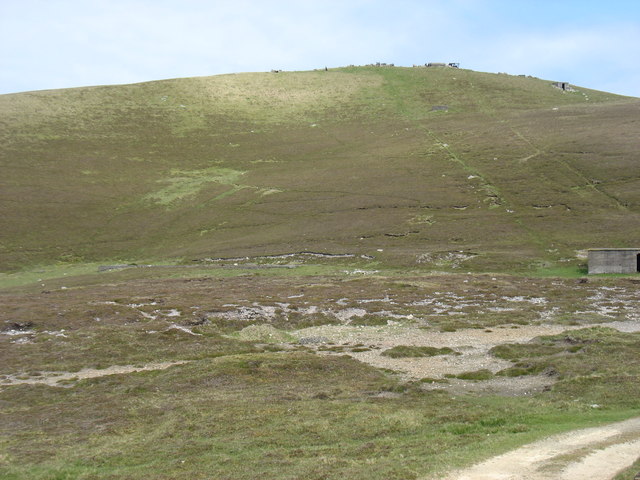
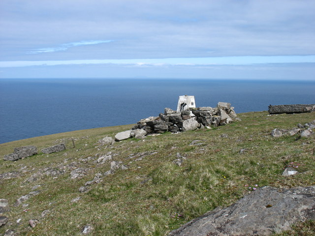
Visitors to West Bergaroo can enjoy walking trails that offer panoramic views of the sea, estuary, and creek. The area's natural beauty, combined with its peaceful ambiance, makes it a haven for those seeking tranquility and a connection with nature.

If you have any feedback on the listing, please let us know in the comments section below.

West Bergaroo Images

Images are sourced within 2km of 59.551047/-1.6156942 or Grid Reference HZ2173. Thanks to Geograph Open Source API. All images are credited.

The north east of Fair Isle The North Light in the distance.
The north east of Fair Isle
The North Light in the distance.
Western Fair Isle Seen from near the summit of Ward Hill.
Western Fair Isle
Seen from near the summit of Ward Hill.
The middle of the Fair Isle landing strip Flight DFL002 for Tingwall had just departed, and the next flight wasn't due to arrive for about six hours. So it was deemed quite safe for me to cross the strip on my way to the track to Ward Hill.

Amusingly, when that next flight arrived, the landing was aborted at the last minute, and the pilot went round for another attempt. The reason? There was a sheep on the strip!

The trip reminded me of my visit to the Isles of Scilly, at the other end of the country, in 2013. Similar small and rather noisy planes, and a runway (in <a href="https://www.geograph.org.uk/gridref/SV9110">SV9110</a>) on a convex slope so that the pilots couldn't see that far ahead.
The middle of the Fair Isle landing strip
Flight DFL002 for Tingwall had just departed, and the next flight wasn't due to arrive for about six hours. So it was deemed quite safe for me to cross the strip on my way to the track to Ward Hill. Amusingly, when that next flight arrived, the landing was aborted at the last minute, and the pilot went round for another attempt. The reason? There was a sheep on the strip! The trip reminded me of my visit to the Isles of Scilly, at the other end of the country, in 2013. Similar small and rather noisy planes, and a runway (in SV9110) on a convex slope so that the pilots couldn't see that far ahead.
Looking to Ward Hill, Fair Isle From near the transmission station. The two diagonal lines are clearly the routes of the cables used to haul goods up to the former radar station on the summit. What a shame that they weren't used to bring down some of the debris left on the summit after closure!

Although one can argue about "What is a hill?", I think there are five hills of any significance on Fair Isle. At 217m, Ward Hill is clearly the highest.
Looking to Ward Hill, Fair Isle
From near the transmission station. The two diagonal lines are clearly the routes of the cables used to haul goods up to the former radar station on the summit. What a shame that they weren't used to bring down some of the debris left on the summit after closure! Although one can argue about "What is a hill?", I think there are five hills of any significance on Fair Isle. At 217m, Ward Hill is clearly the highest.
The trig point on Ward Hill This makes the hill look a pleasant spot. But the summit area, off to the right of this photo and about 3m higher than the trig, is littered with the debris of a former military establishment.
The trig point on Ward Hill
This makes the hill look a pleasant spot. But the summit area, off to the right of this photo and about 3m higher than the trig, is littered with the debris of a former military establishment.
An unaggressive Bonxie I was rather surprised that this bonxie did not circle above my head and try to drive me away. Perhaps it was a rare bird with no nest to protect.
An unaggressive Bonxie
I was rather surprised that this bonxie did not circle above my head and try to drive me away. Perhaps it was a rare bird with no nest to protect.
North Naaversgill, Fair Isle, from the sea There appears to have been a new cliff fall at North Naaversgill. Taken from several km to the west from the ferry between Shetland and Orkney.
North Naaversgill, Fair Isle, from the sea
There appears to have been a new cliff fall at North Naaversgill. Taken from several km to the west from the ferry between Shetland and Orkney.
Kirk Stack, Fair Isle, from the sea Taken from the ferry to Aberdeen, a few km west.
Kirk Stack, Fair Isle, from the sea
Taken from the ferry to Aberdeen, a few km west.
Toor o' da Ward Hill, Fair Isle, from the sea Taken from the ferry en route to Orkney, a couple of km to the west.
Toor o' da Ward Hill, Fair Isle, from the sea
Taken from the ferry en route to Orkney, a couple of km to the west.
Fair Isle from the air Taken from a plane en route between Sumburgh and Aberdeen. The closest part of the island is Buness.
Fair Isle from the air
Taken from a plane en route between Sumburgh and Aberdeen. The closest part of the island is Buness.
Evening at North Haven, Fair Isle Even the bonxie looked relaxed, but watchful.

Fair Isle experiences extremely strong winds and even heavy wooden rowing boats have to be securely tied down.
Evening at North Haven, Fair Isle
Even the bonxie looked relaxed, but watchful. Fair Isle experiences extremely strong winds and even heavy wooden rowing boats have to be securely tied down.
Mavers Geo, South Haven, Fair Isle
Harbour and beach, North Haven, Fair Isle The Bird Observatory and hostel can be seen on the skyline
Harbour and beach, North Haven, Fair Isle
The Bird Observatory and hostel can be seen on the skyline
Sea Entrance to North Haven, Fair Isle The harbour lies behind the breakwater
Sea Entrance to North Haven, Fair Isle
The harbour lies behind the breakwater
Fair Isle North Lighthouse Radio station on Ward Hill in the background.

"On 28 March 1941 the dwelling houses were machine gunned by an enemy plane. Two bombs were also dropped but landed 60 yards south east of the tower and damage was confined to broken glass. The second main attack happened on 18 April 1941 when a single enemy plane machine gunned the buildings and dropped two HE bombs one of which registered a direct hit on the buildings situated 30 feet from the back wall of the dwelling houses. The outhouses, comprising store houses and closets were completely demolished and all contents destroyed, plus 24 feet of boundary wall which was also demolished. 

"Roderick Macaulay, Assistant Lightkeeper, walked 3 miles from North Lighthouse, where he and his daughter had a narrow escape in the former raid, through snowdrifts and gale-force winds to lend a hand in restoring the South Light to operational order, and returned in the dark to take his own regular watch at the North Light: he received the BEM for his outstanding services" - <span class="nowrap"><a title="https://www.nlb.org.uk/LighthouseLibrary/Lighthouse/Fair-Isle-North/" rel="nofollow ugc noopener" href="https://www.nlb.org.uk/LighthouseLibrary/Lighthouse/Fair-Isle-North/">Link</a><img style="margin-left:2px;" alt="External link" title="External link - shift click to open in new window" src="https://s1.geograph.org.uk/img/external.png" width="10" height="10"/></span>
Fair Isle North Lighthouse
Radio station on Ward Hill in the background. "On 28 March 1941 the dwelling houses were machine gunned by an enemy plane. Two bombs were also dropped but landed 60 yards south east of the tower and damage was confined to broken glass. The second main attack happened on 18 April 1941 when a single enemy plane machine gunned the buildings and dropped two HE bombs one of which registered a direct hit on the buildings situated 30 feet from the back wall of the dwelling houses. The outhouses, comprising store houses and closets were completely demolished and all contents destroyed, plus 24 feet of boundary wall which was also demolished. "Roderick Macaulay, Assistant Lightkeeper, walked 3 miles from North Lighthouse, where he and his daughter had a narrow escape in the former raid, through snowdrifts and gale-force winds to lend a hand in restoring the South Light to operational order, and returned in the dark to take his own regular watch at the North Light: he received the BEM for his outstanding services" - LinkExternal link
Fair Isle Bird Observatory, 1974 The purpose-built Bird  Observatory was opened in 1969 and encased in blockwork in 1989.  The current observatory was opened in July 2010.

By 1982 the wood fascia of the observatory had been stained a darker hue <a href="https://www.geograph.org.uk/photo/3830582">HZ2272 : Fair Isle Bird Observatory in 1982</a>.  New observatory buildings were opened in July 2010.  I visited it within a month of its opening.  <a href="https://www.geograph.org.uk/photo/1999001">HZ2272 : Fair Isle Bird Observatory reopened June 2010</a>.
Fair Isle Bird Observatory, 1974
The purpose-built Bird Observatory was opened in 1969 and encased in blockwork in 1989. The current observatory was opened in July 2010. By 1982 the wood fascia of the observatory had been stained a darker hue HZ2272 : Fair Isle Bird Observatory in 1982. New observatory buildings were opened in July 2010. I visited it within a month of its opening. HZ2272 : Fair Isle Bird Observatory reopened June 2010.
Good Shepherd IV between Fair Isle and Lerwick This image was taken on the high seas.  Exact position unknown with Mainland Shetland still ahead.  I have located this at Fair Isle as one of its two main ports. A sunny day with hardly a breeze but certainly cool on the high seas.
Good Shepherd IV between Fair Isle and Lerwick
This image was taken on the high seas. Exact position unknown with Mainland Shetland still ahead. I have located this at Fair Isle as one of its two main ports. A sunny day with hardly a breeze but certainly cool on the high seas.
North Haven, Fair Isle The Fair Isle ferry, Good Shepherd III, lies at the pier and a trawler is also in North Haven.  The Fair Isle Bird Observatory is the flat-roofed brown building on the road heading south.
North Haven, Fair Isle
The Fair Isle ferry, Good Shepherd III, lies at the pier and a trawler is also in North Haven. The Fair Isle Bird Observatory is the flat-roofed brown building on the road heading south.
Show me another place!

West Bergaroo is located at Grid Ref: HZ2173 (Lat: 59.551047, Lng: -1.6156942)

Unitary Authority: Shetland Islands

Police Authority: Highlands and Islands

What 3 Words

///pancake.dart.procures. Near Sumburgh, Shetland Islands

Related Wikis

Fair Isle

Fair Isle (; Scots: Fair Isle; Old Norse: FriĆ°arey; Scottish Gaelic: Fara), sometimes Fairisle, is the southernmost Shetland island, situated roughly 38km...

North Haven (harbour)

North Haven is a natural cove, developed in the 20th century as one of the primary ports of Fair Isle, an outlying island of the Shetland Isles in the...

Fair Isle Airport

Fair Isle Airport (IATA: FIE, ICAO: EGEF), is a small airport located in Fair Isle, Shetland, Scotland. It is owned by the National Trust for Scotland...

Stroms Hellier

Stroms Hellier (Stroms Heelor) is a steep-sided rocky cove located off the Swartz Geo inlet on Fair Isle in the Scottish Shetland Islands.On 27 September...

Nearby Amenities

Located within 500m of 59.551047,-1.6156942
Skroo North Lighthouse
Man Made: lighthouse
Seamark Light 1 Character: Fl
Seamark Light 1 Colour: white
Seamark Light 1 Group: 2
Seamark Light 1 Height: 80
Seamark Light 1 Period: 30
Seamark Light 1 Range: 22
Seamark Light 1 Sector End: 358
Seamark Light 1 Sector Start: 86.7
Seamark Light 1 Sequence: 0.6+(2),0.6+(26.8)
Seamark Light Reference: A 3756
Seamark Name: Skroo
Seamark Type: light_major
Wikidata: Q17851868
Lat/Long: 59.5521244/-1.6095722
Aeroway: helipad
Lat/Long: 59.5523323/-1.6091484
The data included in this document is from www.openstreetmap.org. The data is made available under ODbL.

Have you been to West Bergaroo?

Leave your review of West Bergaroo below (or comments, questions and feedback).