Baumber

Settlement in Lincolnshire East Lindsey

England

Baumber

Ridge and furrow north of Hemingby: aerial 2021 (1) There seems to be no listing in the HER for this.

The grid-like structure bottom left are part of a flood prevention project - see <a href="https://www.geograph.org.uk/photo/4750959">TF2375 : Horncastle's new flood defences near Watermill Farm, Hemingby: aerial November 2015</a>.
Ridge and furrow north of Hemingby: aerial 2021 (1) Credit: Simon Tomson

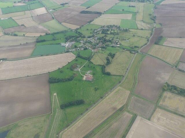
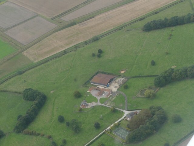
Baumber is a small village located in the East Lindsey district of Lincolnshire, England. Situated approximately 17 miles northeast of Lincoln, it is nestled amidst the picturesque Lincolnshire Wolds, an Area of Outstanding Natural Beauty. Baumber encompasses an area of around 3.5 square miles and is home to a population of just over 200 people.

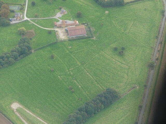
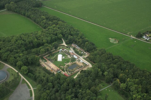
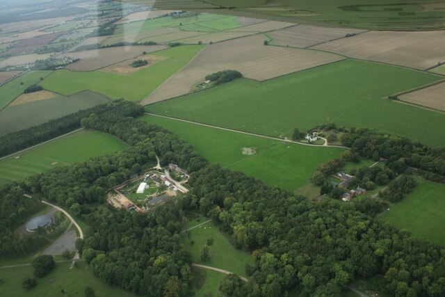
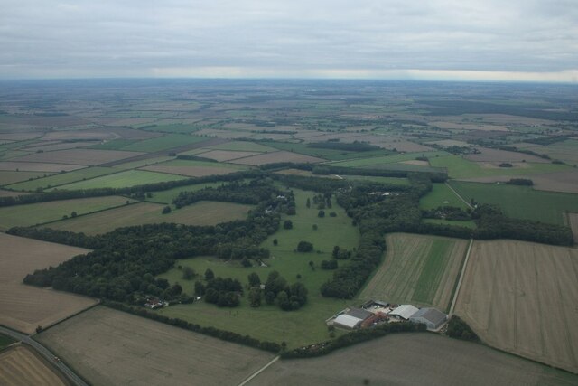
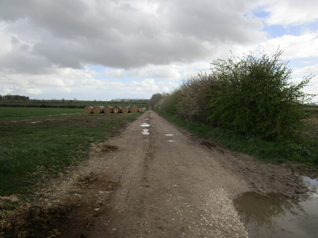
The village is renowned for its tranquil and scenic beauty, offering stunning panoramic views of the surrounding countryside. Its idyllic location attracts nature enthusiasts and hikers, who can explore the numerous footpaths and bridleways that crisscross the area. The nearby Baumber Walled Garden is a popular visitor attraction, featuring beautifully landscaped gardens, a tearoom, and a plant nursery.

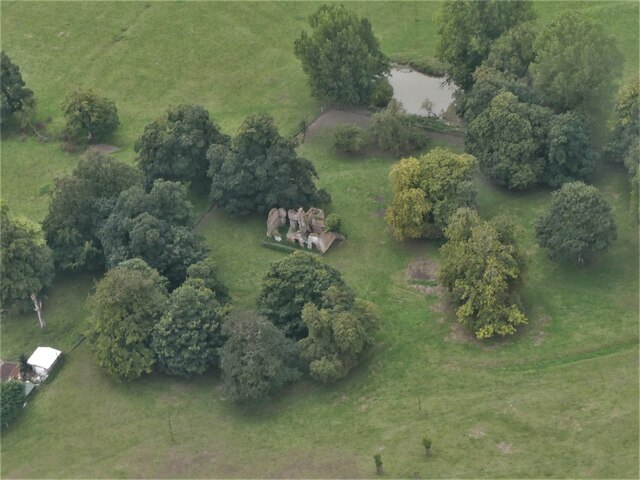
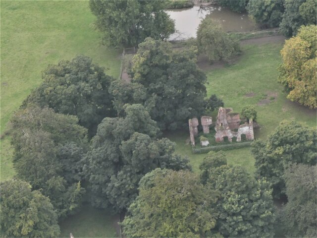
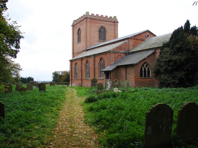
Baumber boasts a rich history, with records dating back to the Domesday Book of 1086. The village is dotted with charming historic buildings, including the Grade II listed St. Swithin's Church, which dates back to the 13th century. This striking church features an impressive tower and hosts regular services and community events.

Despite its small size, Baumber offers a tight-knit community spirit, with various social activities and events organized throughout the year. The village has limited amenities, including a village hall and a pub, providing a cozy gathering place for locals and visitors alike.

In conclusion, Baumber is a picturesque village situated in the heart of the Lincolnshire Wolds, offering a peaceful retreat for nature lovers and history enthusiasts. Its stunning landscapes, historic buildings, and close-knit community make it a hidden gem within Lincolnshire.

If you have any feedback on the listing, please let us know in the comments section below.
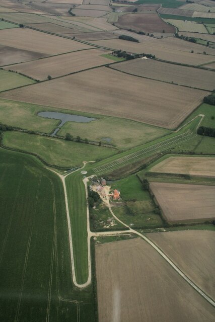
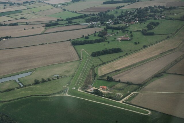
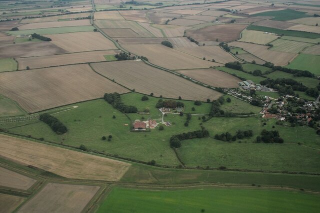
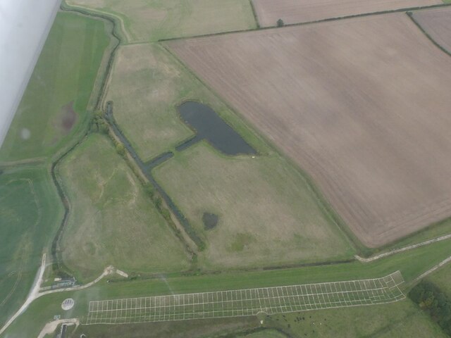
Baumber Images

Images are sourced within 2km of 53.251168/-0.168757 or Grid Reference TF2274. Thanks to Geograph Open Source API. All images are credited.

Ridge and furrow north of Hemingby: aerial 2021 (1) There seems to be no listing in the HER for this.

The grid-like structure bottom left are part of a flood prevention project - see <a href="https://www.geograph.org.uk/photo/4750959">TF2375 : Horncastle's new flood defences near Watermill Farm, Hemingby: aerial November 2015</a>.
Ridge and furrow north of Hemingby: aerial 2021 (1)
There seems to be no listing in the HER for this. The grid-like structure bottom left are part of a flood prevention project - see TF2375 : Horncastle's new flood defences near Watermill Farm, Hemingby: aerial November 2015.
Ridge and furrow north of Hemingby: aerial 2021 (2) There seems to be no listing in the HER for this.

The grid-like structure bottom left are part of a flood prevention project - see <a href="https://www.geograph.org.uk/photo/4750959">TF2375 : Horncastle's new flood defences near Watermill Farm, Hemingby: aerial November 2015</a>.
Ridge and furrow north of Hemingby: aerial 2021 (2)
There seems to be no listing in the HER for this. The grid-like structure bottom left are part of a flood prevention project - see TF2375 : Horncastle's new flood defences near Watermill Farm, Hemingby: aerial November 2015.
Grass field near Cade's Corner Just visible is part of a herd of Lincoln Red cattle <span class="nowrap"><a title="https://en.wikipedia.org/wiki/Lincoln_Red" rel="nofollow ugc noopener" href="https://en.wikipedia.org/wiki/Lincoln_Red">Link</a><img style="margin-left:2px;" alt="External link" title="External link - shift click to open in new window" src="https://s1.geograph.org.uk/img/external.png" width="10" height="10"/></span>
Grass field near Cade's Corner
Just visible is part of a herd of Lincoln Red cattle LinkExternal link
Little Stourton Old Hall: aerial 2022 (1) Stourton Old Hall represents the extinct village of Little Stourton. It is the fragmentary ruin of a country house, dating to the 16th century with 18th century alterations. The house was deserted by 1810 when the Livesey family bought the Estate and built the new Hall in Stourton Park.

See <span class="nowrap"><a title="https://www.heritagegateway.org.uk/Gateway/Results_Single.aspx?uid=MLI40286&resourceID=1006" rel="nofollow ugc noopener" href="https://www.heritagegateway.org.uk/Gateway/Results_Single.aspx?uid=MLI40286&resourceID=1006">Link</a><img style="margin-left:2px;" alt="External link" title="External link - shift click to open in new window" src="https://s1.geograph.org.uk/img/external.png" width="10" height="10"/></span> and
<span class="nowrap"><a title="https://www.heritagegateway.org.uk/Gateway/Results_Single.aspx?uid=1359926&resourceID=5" rel="nofollow ugc noopener" href="https://www.heritagegateway.org.uk/Gateway/Results_Single.aspx?uid=1359926&resourceID=5">Link</a><img style="margin-left:2px;" alt="External link" title="External link - shift click to open in new window" src="https://s1.geograph.org.uk/img/external.png" width="10" height="10"/></span>
Little Stourton Old Hall: aerial 2022 (1)
Stourton Old Hall represents the extinct village of Little Stourton. It is the fragmentary ruin of a country house, dating to the 16th century with 18th century alterations. The house was deserted by 1810 when the Livesey family bought the Estate and built the new Hall in Stourton Park. See LinkExternal link and LinkExternal link
Little Stourton Old Hall: aerial 2022 (2) Stourton Old Hall represents the extinct village of Little Stourton. It is the fragmentary ruin of a country house, dating to the 16th century with 18th century alterations. The house was deserted by 1810 when the Livesey family bought the Estate and built the new Hall in Stourton Park.

See <span class="nowrap"><a title="https://www.heritagegateway.org.uk/Gateway/Results_Single.aspx?uid=MLI40286&resourceID=1006" rel="nofollow ugc noopener" href="https://www.heritagegateway.org.uk/Gateway/Results_Single.aspx?uid=MLI40286&resourceID=1006">Link</a><img style="margin-left:2px;" alt="External link" title="External link - shift click to open in new window" src="https://s1.geograph.org.uk/img/external.png" width="10" height="10"/></span> and
<span class="nowrap"><a title="https://www.heritagegateway.org.uk/Gateway/Results_Single.aspx?uid=1359926&resourceID=5" rel="nofollow ugc noopener" href="https://www.heritagegateway.org.uk/Gateway/Results_Single.aspx?uid=1359926&resourceID=5">Link</a><img style="margin-left:2px;" alt="External link" title="External link - shift click to open in new window" src="https://s1.geograph.org.uk/img/external.png" width="10" height="10"/></span>
Little Stourton Old Hall: aerial 2022 (2)
Stourton Old Hall represents the extinct village of Little Stourton. It is the fragmentary ruin of a country house, dating to the 16th century with 18th century alterations. The house was deserted by 1810 when the Livesey family bought the Estate and built the new Hall in Stourton Park. See LinkExternal link and LinkExternal link
Garden House on the Stourton Estate: aerial 2022 (1)
Garden House on the Stourton Estate: aerial 2022 (2)
Fields east of Stourton Wood: aerial 2022
Part of the Stourton Estate: aerial 2022
Horncastle's Flood Alleviation Scheme at Watermill Farm, Hemingby: aerial 2022 (1) The £8.8m flood alleviation scheme is based on farmland close to Watermill Farm. It features a 720-metre long embankment five metres high with a 4m wide ‘crest’.

The project was a multi-agency scheme which involved the Environment Agency, East Lindsey District Council, Lincolnshire County Council, Horncastle Town Council, the Witham Drainage Board and Anglian Water.

The River Bain is channelled through the embankment, and in times of heavy rain, potential flood water is held back and allowed to create new holding lakes. Once the heavy rain has stopped - and the threat of flooding receded - the water is allowed to drain back into the river.

The scheme was completed in 2017, but failed dramatically following Storm Babet in October 2023, when the gate into the holding lake failed to open.

However, finally, it seemed to have saved the day at the beginning of January 2024 when, despite high river levels, the water seems to have covered only a footpath alongside a park - people were able to find another way to Tesco's - see <a href="https://www.geograph.org.uk/photo/7682342">TF2569 : It worked: Horncastle is not flooded - quite (3)</a>, 
<a href="https://www.geograph.org.uk/photo/7682339">TF2569 : It worked: Horncastle is not flooded - quite (2)</a> 
and <a href="https://www.geograph.org.uk/photo/7682337">TF2569 : It worked: Horncastle is not flooded - quite (1)</a>.
Horncastle's Flood Alleviation Scheme at Watermill Farm, Hemingby: aerial 2022 (1)
The £8.8m flood alleviation scheme is based on farmland close to Watermill Farm. It features a 720-metre long embankment five metres high with a 4m wide ‘crest’. The project was a multi-agency scheme which involved the Environment Agency, East Lindsey District Council, Lincolnshire County Council, Horncastle Town Council, the Witham Drainage Board and Anglian Water. The River Bain is channelled through the embankment, and in times of heavy rain, potential flood water is held back and allowed to create new holding lakes. Once the heavy rain has stopped - and the threat of flooding receded - the water is allowed to drain back into the river. The scheme was completed in 2017, but failed dramatically following Storm Babet in October 2023, when the gate into the holding lake failed to open. However, finally, it seemed to have saved the day at the beginning of January 2024 when, despite high river levels, the water seems to have covered only a footpath alongside a park - people were able to find another way to Tesco's - see TF2569 : It worked: Horncastle is not flooded - quite (3), TF2569 : It worked: Horncastle is not flooded - quite (2) and TF2569 : It worked: Horncastle is not flooded - quite (1).
Watermill Farm, Hemingby: aerial 2022 (2) The £8.8m flood alleviation scheme is based on farmland close to Watermill Farm. It features a 720-metre long embankment five metres high with a 4m wide ‘crest’.

The project was a multi-agency scheme which involved the Environment Agency, East Lindsey District Council, Lincolnshire County Council, Horncastle Town Council, the Witham Drainage Board and Anglian Water.

The River Bain is channelled through the embankment, and in times of heavy rain, potential flood water is held back and allowed to create new holding lakes. Once the heavy rain has stopped - and the threat of flooding receded - the water is allowed to drain back into the river.

The scheme was completed in 2017, but failed dramatically following Storm Babet in October 2023, when the gate into the holding lake failed to open.

However, finally, it seemed to have saved the day at the beginning of January 2024 when, despite high river levels, the water seems to have covered only a footpath alongside a park - people were able to find another way to Tesco's - see <a href="https://www.geograph.org.uk/photo/7682342">TF2569 : It worked: Horncastle is not flooded - quite (3)</a>, 
<a href="https://www.geograph.org.uk/photo/7682339">TF2569 : It worked: Horncastle is not flooded - quite (2)</a> 
and <a href="https://www.geograph.org.uk/photo/7682337">TF2569 : It worked: Horncastle is not flooded - quite (1)</a>.
Watermill Farm, Hemingby: aerial 2022 (2)
The £8.8m flood alleviation scheme is based on farmland close to Watermill Farm. It features a 720-metre long embankment five metres high with a 4m wide ‘crest’. The project was a multi-agency scheme which involved the Environment Agency, East Lindsey District Council, Lincolnshire County Council, Horncastle Town Council, the Witham Drainage Board and Anglian Water. The River Bain is channelled through the embankment, and in times of heavy rain, potential flood water is held back and allowed to create new holding lakes. Once the heavy rain has stopped - and the threat of flooding receded - the water is allowed to drain back into the river. The scheme was completed in 2017, but failed dramatically following Storm Babet in October 2023, when the gate into the holding lake failed to open. However, finally, it seemed to have saved the day at the beginning of January 2024 when, despite high river levels, the water seems to have covered only a footpath alongside a park - people were able to find another way to Tesco's - see TF2569 : It worked: Horncastle is not flooded - quite (3), TF2569 : It worked: Horncastle is not flooded - quite (2) and TF2569 : It worked: Horncastle is not flooded - quite (1).
Manor Farm and earthworks. Hemingby: aerial 2022 See: <span class="nowrap"><a title="https://www.heritagegateway.org.uk/Gateway/Results_Single.aspx?uid=MLI119012&resourceID=1006" rel="nofollow ugc noopener" href="https://www.heritagegateway.org.uk/Gateway/Results_Single.aspx?uid=MLI119012&resourceID=1006">Link</a><img style="margin-left:2px;" alt="External link" title="External link - shift click to open in new window" src="https://s1.geograph.org.uk/img/external.png" width="10" height="10"/></span>
Manor Farm and earthworks. Hemingby: aerial 2022
See: LinkExternal link
Horncastle's Flood Alleviation Scheme at Watermill Farm, Hemingby: aerial 2022 (3) The £8.8m flood alleviation scheme is based on farmland close to Watermill Farm. It features a 720-metre long embankment five metres high with a 4m wide ‘crest’.

The project was a multi-agency scheme which involved the Environment Agency, East Lindsey District Council, Lincolnshire County Council, Horncastle Town Council, the Witham Drainage Board and Anglian Water.

The River Bain is channelled through the embankment, and in times of heavy rain, potential flood water is held back and allowed to create new holding lakes. Once the heavy rain has stopped - and the threat of flooding receded - the water is allowed to drain back into the river.

The scheme was completed in 2017, but failed dramatically following Storm Babet in October 2023, when the gate into the holding lake failed to open.

However, finally, it seemed to have saved the day at the beginning of January 2024 when, despite high river levels, the water seems to have covered only a footpath alongside a park - people were able to find another way to Tesco's - see <a href="https://www.geograph.org.uk/photo/7682342">TF2569 : It worked: Horncastle is not flooded - quite (3)</a>, 
<a href="https://www.geograph.org.uk/photo/7682339">TF2569 : It worked: Horncastle is not flooded - quite (2)</a> 
and <a href="https://www.geograph.org.uk/photo/7682337">TF2569 : It worked: Horncastle is not flooded - quite (1)</a>.
Horncastle's Flood Alleviation Scheme at Watermill Farm, Hemingby: aerial 2022 (3)
The £8.8m flood alleviation scheme is based on farmland close to Watermill Farm. It features a 720-metre long embankment five metres high with a 4m wide ‘crest’. The project was a multi-agency scheme which involved the Environment Agency, East Lindsey District Council, Lincolnshire County Council, Horncastle Town Council, the Witham Drainage Board and Anglian Water. The River Bain is channelled through the embankment, and in times of heavy rain, potential flood water is held back and allowed to create new holding lakes. Once the heavy rain has stopped - and the threat of flooding receded - the water is allowed to drain back into the river. The scheme was completed in 2017, but failed dramatically following Storm Babet in October 2023, when the gate into the holding lake failed to open. However, finally, it seemed to have saved the day at the beginning of January 2024 when, despite high river levels, the water seems to have covered only a footpath alongside a park - people were able to find another way to Tesco's - see TF2569 : It worked: Horncastle is not flooded - quite (3), TF2569 : It worked: Horncastle is not flooded - quite (2) and TF2569 : It worked: Horncastle is not flooded - quite (1).
Manor Farm and earthworks. Hemingby: aerial 2022 (2) See <span class="nowrap"><a title="https://www.heritagegateway.org.uk/Gateway/Results_Single.aspx?uid=MLI119012&resourceID=1006" rel="nofollow ugc noopener" href="https://www.heritagegateway.org.uk/Gateway/Results_Single.aspx?uid=MLI119012&resourceID=1006">Link</a><img style="margin-left:2px;" alt="External link" title="External link - shift click to open in new window" src="https://s1.geograph.org.uk/img/external.png" width="10" height="10"/></span>
Manor Farm and earthworks. Hemingby: aerial 2022 (2)
See LinkExternal link
Farm track near Baumber Park
St Margaret's church, Hemingby View from the south east.
St Margaret's church, Hemingby
View from the south east.
Interior, St Margaret's church, Hemingby Looking east.
Interior, St Margaret's church, Hemingby
Looking east.
Organ, St Margaret's church, Hemingby A Casson positive single manual organ with 10 stops. It came from an unknown private residence.
Organ, St Margaret's church, Hemingby
A Casson positive single manual organ with 10 stops. It came from an unknown private residence.
Show me another place!

Baumber is located at Grid Ref: TF2274 (Lat: 53.251168, Lng: -0.168757)

Division: Parts of Lindsey

Administrative County: Lincolnshire

District: East Lindsey

Police Authority: Lincolnshire

What 3 Words

///hotspots.spell.stopped. Near Horncastle, Lincolnshire

Nearby Locations

Baumber

Related Wikis

Baumber

Baumber ( BAWM-bər) is a village and civil parish in the East Lindsey district of Lincolnshire, England. It is situated approximately 4 miles (6 km) north...

Hemingby

Hemingby is a dispersed village and civil parish in the East Lindsey district of Lincolnshire, England. It is situated approximately 3 miles (5 km) north...

Hanby Hall

Hanby Hall is a Grade II* listed early 18th-century building in Alford, Lincolnshire. Hanby Hall was built by John Andrews. It is situated opposite St...

Great Sturton

Great Sturton is a hamlet and civil parish in the East Lindsey district of Lincolnshire, England. It is situated approximately 7 miles (11 km) from the...

Nearby Amenities

Located within 500m of 53.251168,-0.168757
Baumber
Is In: Lincolnshire, England, UK
Old Name: Bamburgh
Old Name2: Badeburg
Place: village
Source: Bing
Lat/Long: 53.2512446/-0.1694631
Bus Stop
West Lane
Naptan AtcoCode: 270000008903
Naptan Bearing: NW
Naptan CommonName: West Lane
Naptan Indicator: opp
Naptan Landmark: West Lane
Naptan NaptanCode: lingwgmd
Naptan Street: A158
Naptan Verified: no
Shelter: yes
Source: naptan_import
Lat/Long: 53.2503854/-0.1696658
West Lane
Naptan AtcoCode: 270002701492
Naptan Bearing: SE
Naptan BusStopType: CUS
Naptan CommonName: West Lane
Naptan Indicator: opp
Naptan Landmark: West Lane
Naptan Street: Silver Street
Naptan Verified: no
Source: naptan_import
Lat/Long: 53.2517414/-0.1638799
West Lane
Naptan AtcoCode: 270002701493
Naptan Bearing: NW
Naptan BusStopType: CUS
Naptan CommonName: West Lane
Naptan Indicator: adj
Naptan Landmark: West Lane
Naptan Street: Silver Street
Naptan Verified: no
Source: naptan_import
Lat/Long: 53.2516259/-0.1639747
Bus Stop
Red Lion PH
Naptan AtcoCode: 2700LBPS5096
Naptan Bearing: SE
Naptan CommonName: Red Lion PH
Naptan Indicator: opp
Naptan Landmark: Red Lion PH
Naptan NaptanCode: lindptaw
Naptan Street: A158
Naptan Verified: no
Source: naptan_import
Lat/Long: 53.2515312/-0.1711478
Power: pole
Source: Bing
Lat/Long: 53.2519404/-0.1688974
Power: pole
Lat/Long: 53.2530517/-0.1690825
Power: pole
Source: Bing
Lat/Long: 53.2525252/-0.1678327
Power: pole
Lat/Long: 53.2513475/-0.1699971
Power: pole
Source: Bing
Lat/Long: 53.2531999/-0.1640481
Power: pole
Source: Bing
Lat/Long: 53.2531568/-0.1652925
Power: pole
Source: Bing
Lat/Long: 53.2538908/-0.1673915
Power: pole
Lat/Long: 53.2544334/-0.1678164
Power: pole
Source: Bing
Lat/Long: 53.2547214/-0.1680592
Power: pole
Source: Bing
Lat/Long: 53.2530982/-0.1667731
Power: pole
Source: Bing
Lat/Long: 53.2532459/-0.1627417
Barrier: cattle_grid
Source: Bing
Lat/Long: 53.2488148/-0.1716123
Power: pole
Source: Bing
Lat/Long: 53.2546452/-0.1705348
Power: pole
Source: Bing
Lat/Long: 53.2555414/-0.1687002
Power: pole
Source: Bing
Lat/Long: 53.2545962/-0.1721334
Baumber Park
Place: locality
Source: Bing
Lat/Long: 53.2496024/-0.1748218
Power: pole
Lat/Long: 53.2504659/-0.1747782
Power: pole
Lat/Long: 53.2506222/-0.1737913
Power: pole
Lat/Long: 53.2508344/-0.1723903
Power: pole
Lat/Long: 53.2510073/-0.1711901
Power: pole
Source: Bing
Lat/Long: 53.2545535/-0.1736217
Barrier: stile
Source: Bing
Lat/Long: 53.2524345/-0.1645375
Barrier: bollard
Source: Bing
Lat/Long: 53.2514432/-0.1709347
Barrier: bollard
Source: Bing
Lat/Long: 53.2514519/-0.1709191
Barrier: bollard
Source: Bing
Lat/Long: 53.2514584/-0.170908
Barrier: bollard
Source: Bing
Lat/Long: 53.2514715/-0.170887
Pub
The Red Lion
Source: Bing
Lat/Long: 53.2513247/-0.1712957
The data included in this document is from www.openstreetmap.org. The data is made available under ODbL.

Have you been to Baumber?

Leave your review of Baumber below (or comments, questions and feedback).