Baulking

Settlement in Berkshire Vale of White Horse

England

Baulking

Uffington railway station (site), Oxfordshire Opened in 1844 by the Great Western Railway on the line from Reading to Swindon, this station closed in 1964.
View east towards Challow and Reading, some 4 years after the line had been electrified. Between 1864 and 1951, passengers could change here for the short branch to Faringdon. The branch curved away sharply to the left of the image.
See <a href="https://www.geograph.org.uk/photo/3841295">SU3190 : Uffington railway station (site), Oxfordshire, 2014</a> for a pre-electrification view from a similar camera position.
Uffington railway station (site), Oxfordshire Credit: Nigel Thompson

Baulking is a small village located in West Berkshire, England. Situated approximately 6 miles southwest of the market town of Faringdon, it is nestled in the heart of the Oxfordshire Cotswolds.

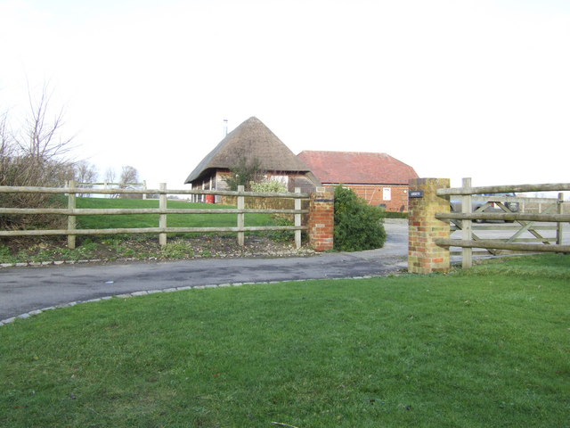
With a population of around 300, Baulking retains its traditional charm and offers a peaceful and rural setting for its residents. The village is characterized by picturesque thatched cottages, historic buildings, and scenic countryside views.

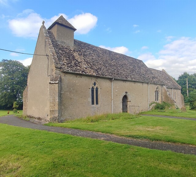
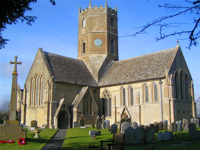
Baulking is well-known for its rich history, dating back to the medieval period. The village is home to the St. Nicholas Church, a Grade II* listed building built in the 13th century. The church features notable architectural elements, including a 14th-century tower and a Norman font.

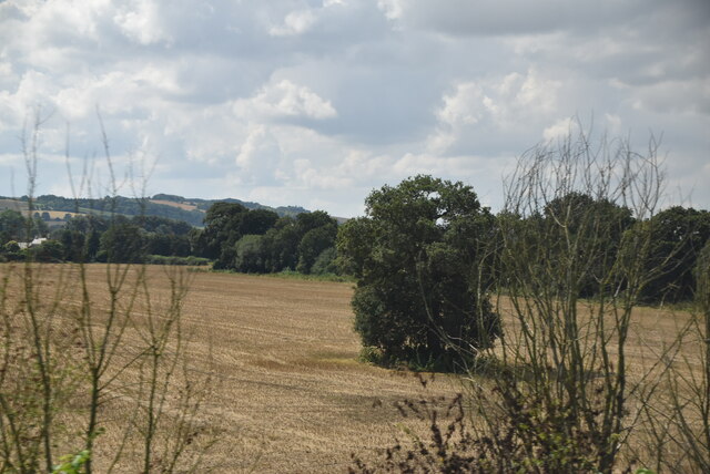
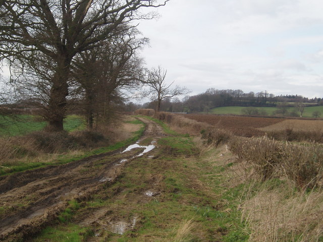
Nature lovers and outdoor enthusiasts will appreciate the village’s proximity to the surrounding countryside. The area offers ample opportunities for walking, hiking, and exploring the Cotswold Area of Outstanding Natural Beauty. Nearby attractions include the ancient Uffington White Horse, a prehistoric chalk figure, and the Ridgeway National Trail, a famous long-distance path.

While Baulking itself is a quiet and tranquil village, it benefits from its convenient location. The larger towns of Faringdon and Wantage are just a short drive away and provide access to a wider range of amenities, including shops, schools, and healthcare services.

In summary, Baulking is a charming rural village in West Berkshire, known for its historic buildings, natural beauty, and peaceful atmosphere. It offers a delightful escape from the hustle and bustle of city life while providing easy access to nearby amenities.

If you have any feedback on the listing, please let us know in the comments section below.

Baulking Images

Images are sourced within 2km of 51.614456/-1.541702 or Grid Reference SU3190. Thanks to Geograph Open Source API. All images are credited.

Uffington railway station (site), Oxfordshire Opened in 1844 by the Great Western Railway on the line from Reading to Swindon, this station closed in 1964.
View east towards Challow and Reading, some 4 years after the line had been electrified. Between 1864 and 1951, passengers could change here for the short branch to Faringdon. The branch curved away sharply to the left of the image.
See <a href="https://www.geograph.org.uk/photo/3841295">SU3190 : Uffington railway station (site), Oxfordshire, 2014</a> for a pre-electrification view from a similar camera position.
Uffington railway station (site), Oxfordshire
Opened in 1844 by the Great Western Railway on the line from Reading to Swindon, this station closed in 1964. View east towards Challow and Reading, some 4 years after the line had been electrified. Between 1864 and 1951, passengers could change here for the short branch to Faringdon. The branch curved away sharply to the left of the image. See SU3190 : Uffington railway station (site), Oxfordshire, 2014 for a pre-electrification view from a similar camera position.
Baulking Grange Farm
Isolated tree
Isolated tree
House on the green, Baulking
Church of St Nicholas, Baulking
Oldfield Farm Looking NW from Baulking Lane.
Oldfield Farm
Looking NW from Baulking Lane.
Railway bridge near Baulking Situated on the road between Baulking Lane and Kingston Lisle. Looking north towards Baulking Lane.
Railway bridge near Baulking
Situated on the road between Baulking Lane and Kingston Lisle. Looking north towards Baulking Lane.
St. Nicholas Church, Baulking
Road and rail in parallel Baulking Lane on the left, London to Swindon main line on the right.
Road and rail in parallel
Baulking Lane on the left, London to Swindon main line on the right.
Footpath and stile The footpath heads north towards Baulking Hill. The lake in the background is a result of gravel workings.
Footpath and stile
The footpath heads north towards Baulking Hill. The lake in the background is a result of gravel workings.
Stone house by Church Farm
The Green, Baulking This piece of common land is bounded by cottages and Manor Farm
The Green, Baulking
This piece of common land is bounded by cottages and Manor Farm
Lockeys This thatched building is set back from the lane opposite Moor Mill Farm.
Lockeys
This thatched building is set back from the lane opposite Moor Mill Farm.
Old fullers earth works Photo taken from gate to old workings now closed, This shows the reclamation work that is being undertaken to return the excavations to normal.
Old fullers earth works
Photo taken from gate to old workings now closed, This shows the reclamation work that is being undertaken to return the excavations to normal.
Barrowbush bridleway View from the bridle way facing toward Fernham with Ringdale hill in the background
Barrowbush bridleway
View from the bridle way facing toward Fernham with Ringdale hill in the background
Baulking Bridge
Baulking Bridge
Crossover by Uffington Trading Estate
Bridge by Oldland Copse
Show me another place!

Baulking is located at Grid Ref: SU3190 (Lat: 51.614456, Lng: -1.541702)

Administrative County: Oxfordshire

District: Vale of White Horse

Police Authority: Thames Valley

What 3 Words

///proofread.joys.imposes. Near Stanford in the Vale, Oxfordshire

Related Wikis

Baulking

Baulking or Balking is a village and civil parish about 3+1⁄2 miles (5.6 km) southeast of Faringdon in the Vale of White Horse district of Oxfordshire...

Uffington railway station

Uffington railway station (sometimes marked as Uffington Junction) is a former station on the Great Western Main Line. The station was located north-east...

Uffington, Oxfordshire

Uffington is a village and civil parish in Oxfordshire, about 4 miles (6.4 km) south of Faringdon and 6 miles (10 km) west of Wantage. The 2011 Census...

Tom Brown's School Museum

Tom Brown's School Museum is a local museum in the village of Uffington (near Faringdon), Oxfordshire, England. It was opened in 1984.The museum covers...

Shellingford

Shellingford, historically also spelt Shillingford, is a village and civil parish about 2+1⁄2 miles (4 km) south-east of Faringdon in the Vale of White...

Fernham

Fernham is a village and civil parish about 2 miles (3 km) south of Faringdon in the Vale of White Horse, Oxfordshire, England. Fernham was historically...

RAF Shellingford

RAF Shellingford was a Royal Air Force station located approximately 4 miles east of the town of Faringdon in Oxfordshire. It occupied land adjacent to...

Kingston Lisle

Kingston Lisle is a village and civil parish in the Vale of White Horse, England, about 4+1⁄2 miles (7 km) west of Wantage and 5 miles (8 km) south-southeast...

Nearby Amenities

Located within 500m of 51.614456,-1.541702
Railway: switch
Lat/Long: 51.6121123/-1.5472495
Baulking
Place: hamlet
Lat/Long: 51.6147907/-1.5428752
Power: pole
Source: Bing
Lat/Long: 51.6115627/-1.5451092
Power: pole
Source: Bing
Lat/Long: 51.6117959/-1.5441302
Power: pole
Source: Bing
Lat/Long: 51.611486/-1.5428549
Power: pole
Source: Bing
Lat/Long: 51.6114378/-1.5433282
Power: pole
Source: Bing
Lat/Long: 51.6179015/-1.5451162
Power: pole
Source: Bing
Lat/Long: 51.6115061/-1.5441946
Power: pole
Source: Bing
Lat/Long: 51.6111479/-1.5430239
Power: pole
Source: Bing
Lat/Long: 51.6152685/-1.5450008
Power: pole
Source: Bing
Lat/Long: 51.6113395/-1.5461338
Material: wood
Power: pole
Source: Bing
Lat/Long: 51.612452/-1.5443033
Power: pole
Source: Bing
Lat/Long: 51.6172204/-1.5454756
Power: pole
Source: Bing
Lat/Long: 51.6145623/-1.5448238
Power: pole
Source: Bing
Lat/Long: 51.6138544/-1.544636
Power: pole
Source: Bing
Lat/Long: 51.6131699/-1.5444643
Power: pole
Source: Bing
Lat/Long: 51.61044/-1.5414614
Power: pole
Source: Bing
Lat/Long: 51.615933/-1.5451403
Power: pole
Source: Bing
Lat/Long: 51.6165726/-1.5452905
Give Way
Source: Bing
Lat/Long: 51.6127352/-1.5424465
Give Way
Source: Bing
Lat/Long: 51.6128202/-1.5423158
Bus Stop
Lat/Long: 51.6123255/-1.5425409
Give Way
Source: Bing
Lat/Long: 51.6128504/-1.542446
Telephone
Defibrillator
Booth: K6
Covered: booth
Defibrillator Location: inside red phone box, Baulking
Emergency: defibrillator
Man Made: telephone_box
Lat/Long: 51.6138104/-1.543106
Advertising: board
Lat/Long: 51.6138487/-1.5431221
The data included in this document is from www.openstreetmap.org. The data is made available under ODbL.

Have you been to Baulking?

Leave your review of Baulking below (or comments, questions and feedback).