Ness Cove

Sea, Estuary, Creek in Devon

England

Ness Cove

Teignmouth Lido temporarily closed Closed during the pandemic, the Lido will remain closed until 2022. Teignbridge Council explains that it has been "successful in a grant funding bid to the Public Sector Decarbonisation Scheme which will enable us to reduce energy costs and carbon emissions by installing new, green technology at Newton Abbot Leisure Centre, Teignmouth Lido and Broadmeadow Sports Centre [Dawlish]". The deadline for completing the work is September 2021: watch this space. <a href="https://www.geograph.org.uk/photo/3463487">SX9473 : Early morning lane swimming, Teignmouth Lido</a>.
Teignmouth Lido temporarily closed Credit: Robin Stott

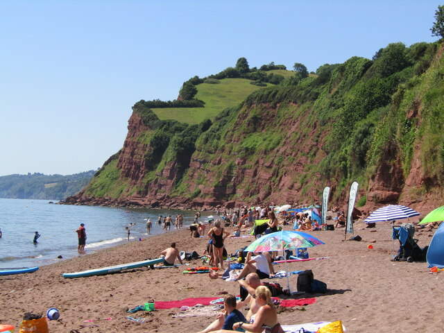
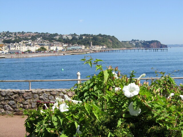
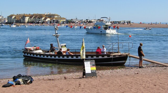
Ness Cove is a picturesque coastal area located in Devon, England. Nestled along the stunning south coast, this hidden gem offers a tranquil and scenic escape for locals and tourists alike. With its breathtaking views of the sea, estuary, and creek, Ness Cove is a haven for nature lovers and outdoor enthusiasts.

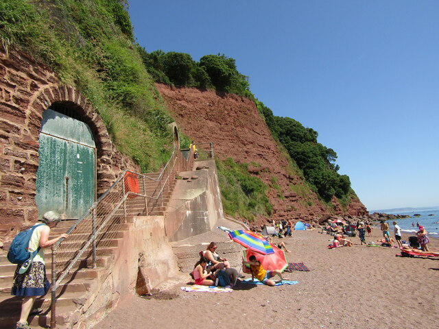
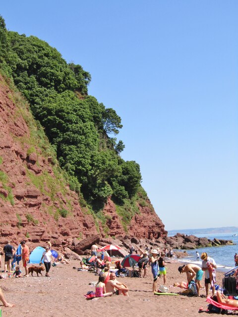
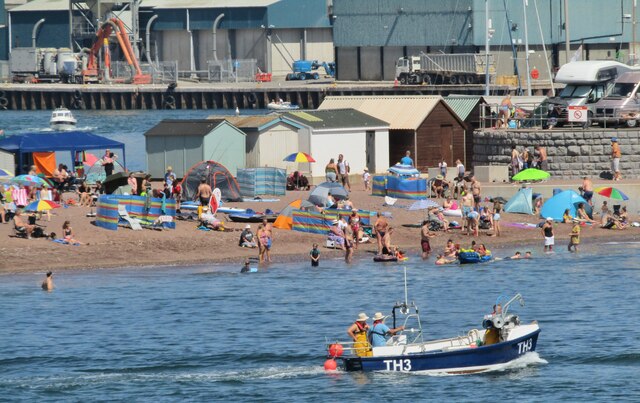
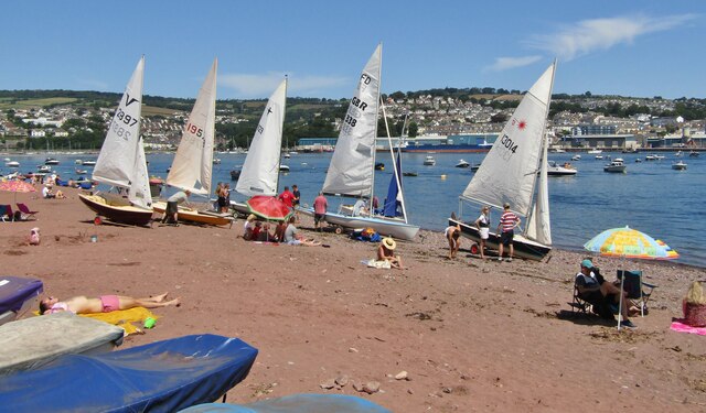
The main attraction of Ness Cove is its pristine beach, which is a hidden gem tucked away beneath towering cliffs. The beach is accessible via a smugglers' tunnel carved into the limestone cliffs, adding a touch of adventure to the visit. The sheltered cove provides a safe and family-friendly environment for swimming, sunbathing, and picnicking.

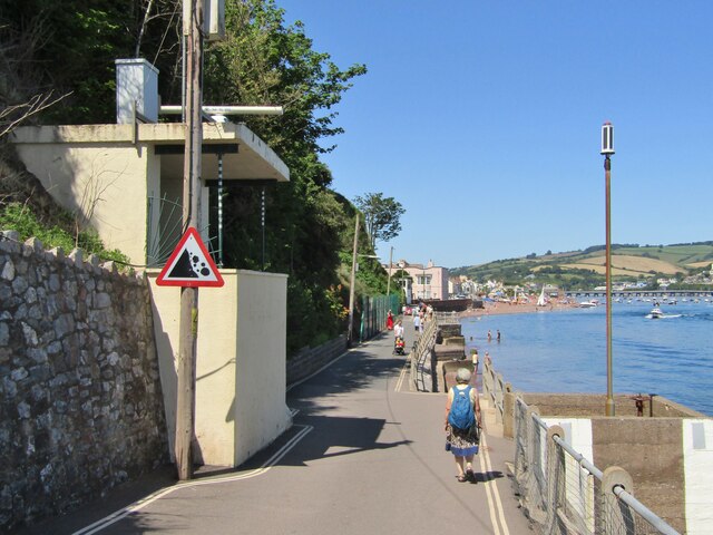
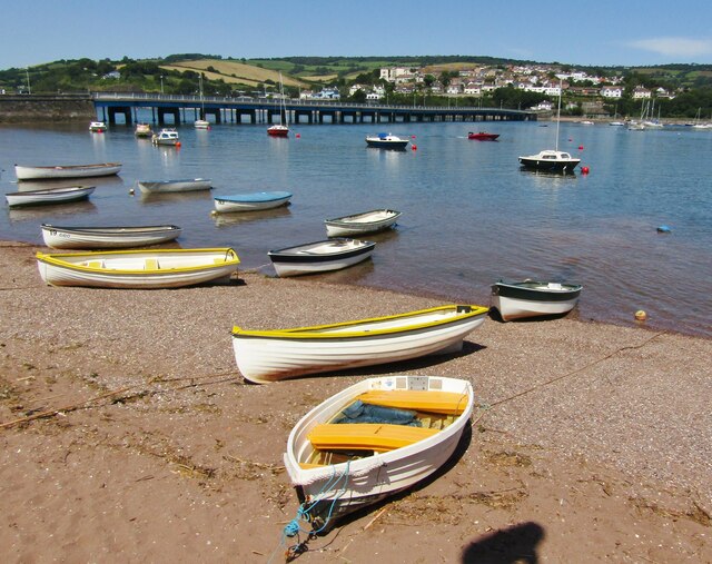
The estuary and creek that surround Ness Cove offer ample opportunities for exploring the diverse marine life and bird species that call this area home. The estuary is a haven for birdwatchers, with numerous species of waders and waterfowl found here throughout the year. Visitors can enjoy leisurely walks along the coastal paths, taking in the breathtaking views of the estuary and creek.

Ness Cove is also steeped in history, with remnants of its smuggling past still visible. The smugglers' tunnel that leads to the beach was once used by smugglers to transport contraband goods under the cover of darkness. Today, visitors can learn about this intriguing history through guided tours and displays at the nearby museum.

Overall, Ness Cove is a tranquil and idyllic destination that offers a harmonious blend of natural beauty, history, and outdoor activities. Whether you're seeking a peaceful day at the beach or an adventure-filled exploration of the estuary, Ness Cove has something to offer everyone.

If you have any feedback on the listing, please let us know in the comments section below.

Ness Cove Images

Images are sourced within 2km of 50.534956/-3.498256 or Grid Reference SX9371. Thanks to Geograph Open Source API. All images are credited.

Teignmouth Lido temporarily closed Closed during the pandemic, the Lido will remain closed until 2022. Teignbridge Council explains that it has been "successful in a grant funding bid to the Public Sector Decarbonisation Scheme which will enable us to reduce energy costs and carbon emissions by installing new, green technology at Newton Abbot Leisure Centre, Teignmouth Lido and Broadmeadow Sports Centre [Dawlish]". The deadline for completing the work is September 2021: watch this space. <a href="https://www.geograph.org.uk/photo/3463487">SX9473 : Early morning lane swimming, Teignmouth Lido</a>.
Teignmouth Lido temporarily closed
Closed during the pandemic, the Lido will remain closed until 2022. Teignbridge Council explains that it has been "successful in a grant funding bid to the Public Sector Decarbonisation Scheme which will enable us to reduce energy costs and carbon emissions by installing new, green technology at Newton Abbot Leisure Centre, Teignmouth Lido and Broadmeadow Sports Centre [Dawlish]". The deadline for completing the work is September 2021: watch this space. SX9473 : Early morning lane swimming, Teignmouth Lido.
Shaldon - Ness Cove Ness Cove is a long sandy beach, accessible through a tunnel from Shaldon car park. It is backed by high old red sandstone cliffs.
Shaldon - Ness Cove
Ness Cove is a long sandy beach, accessible through a tunnel from Shaldon car park. It is backed by high old red sandstone cliffs.
Shaldon - The Ness Steep old red sandstone cliff at the northern end of Ness Cove.
Shaldon - The Ness
Steep old red sandstone cliff at the northern end of Ness Cove.
Shaldon - Ness Cove Ness Cove is a long sandy beach, accessible through a tunnel from Shaldon car park. It is backed by high old red sandstone cliffs.
Shaldon - Ness Cove
Ness Cove is a long sandy beach, accessible through a tunnel from Shaldon car park. It is backed by high old red sandstone cliffs.
Shaldon - The Ness Pub double sign on Marine Parade - "The Ness" takes its name from the nearby promontory and the pub has sweeping views across the water to Teignmouth.
Shaldon - The Ness
Pub double sign on Marine Parade - "The Ness" takes its name from the nearby promontory and the pub has sweeping views across the water to Teignmouth.
Shaldon - Teign River Mouth View from The Ness at Shaldon, across the Teign estuary, towards Teignmouth Pier.
Shaldon - Teign River Mouth
View from The Ness at Shaldon, across the Teign estuary, towards Teignmouth Pier.
Teignmouth - St Michael's Church Historic church tower seen here from The Ness at Shaldon.
Teignmouth - St Michael's Church
Historic church tower seen here from The Ness at Shaldon.
Shaldon - Navigation Beacon Maritime aid at the southern side of the Teign river mouth. Teignmouth is in the background.
Shaldon - Navigation Beacon
Maritime aid at the southern side of the Teign river mouth. Teignmouth is in the background.
Teignmouth - The Point Promontory and honeypot for tourists at the northern bank where the River Teign enters the sea. Seen here from The Ness at Shaldon.
Teignmouth - The Point
Promontory and honeypot for tourists at the northern bank where the River Teign enters the sea. Seen here from The Ness at Shaldon.
Shaldon - Searchlight Emplacement WW2 relic on Marine Parade, overlooking the mouth of the River Teign.
Shaldon - Searchlight Emplacement
WW2 relic on Marine Parade, overlooking the mouth of the River Teign.
Shaldon - Pleasure Boat "Restless" heads out to sea from Teignmouth harbour.
Shaldon - Pleasure Boat
"Restless" heads out to sea from Teignmouth harbour.
Teignmouth - Old Quay General cargo ship, "Conformity", moored in Teignmouth Harbour.
Teignmouth - Old Quay
General cargo ship, "Conformity", moored in Teignmouth Harbour.
Shaldon - Dinghies White sails in the sunshine at Shaldon. Teignmouth is in the background.
Shaldon - Dinghies
White sails in the sunshine at Shaldon. Teignmouth is in the background.
Teignmouth-Shaldon Ferry Ferry No. 4 at Shaldon preparing to cross the mouth of the Teign, carrying foot passengers to Teignmouth.
Teignmouth-Shaldon Ferry
Ferry No. 4 at Shaldon preparing to cross the mouth of the Teign, carrying foot passengers to Teignmouth.
Shaldon - War Memorial WW1 memorial in the centre of Shaldon village.
Shaldon - War Memorial
WW1 memorial in the centre of Shaldon village.
Shaldon - Teign Estuary Rowing boats pulled up on the beach during high tide on the Teign at Shaldon. The bridge to Teignmouth is in the background.
Shaldon - Teign Estuary
Rowing boats pulled up on the beach during high tide on the Teign at Shaldon. The bridge to Teignmouth is in the background.
Shaldon - Church Ornate figure holding a clam shell inside the Victorian village church.
Shaldon - Church
Ornate figure holding a clam shell inside the Victorian village church.
Shaldon - Milestone Historic stone by the southern end of the Shaldon-Teignmouth Bridge showing distances in miles, furlongs and poles.
To Torquay 7.2.12
Brixham 15.2.21
Dartmouth 17.5.26
Totnes 15.0.21
Shaldon - Milestone
Historic stone by the southern end of the Shaldon-Teignmouth Bridge showing distances in miles, furlongs and poles. To Torquay 7.2.12 Brixham 15.2.21 Dartmouth 17.5.26 Totnes 15.0.21
Show me another place!

Ness Cove is located at Grid Ref: SX9371 (Lat: 50.534956, Lng: -3.498256)

Administrative County: Devon

Police Authority: Devon and Cornwall

What 3 Words

///scavenger.trendy.jigging. Near Teignmouth, Devon

Related Wikis

River Teign

The River Teign is a river in the county of Devon, England. It is 31 mi (50 km) long and rises on Dartmoor, becomes an estuary just below Newton Abbot...

Shaldon

Shaldon is a village and civil parish in the Teignbridge district, in south Devon, England, on the south bank of the estuary of the River Teign, opposite...

Teignmouth Lifeboat Station

Teignmouth Lifeboat Station is the base for Royal National Lifeboat Institution (RNLI) search and rescue operations at Teignmouth, Devon in England. The...

Teignmouth Lighthouse

Teignmouth lighthouse is a lighthouse situated on the south end of the Den promenade at Teignmouth, Devon, England. It is paired with a red polycarbonate...

Nearby Amenities

Located within 500m of 50.534956,-3.498256
Source: PGS
Lat/Long: 50.5381034/-3.4963549
Source: PGS
Lat/Long: 50.5381171/-3.4977818
Source: PGS
Lat/Long: 50.538158/-3.4985758
Source: PGS
Lat/Long: 50.5383179/-3.4988043
Source: PGS
Lat/Long: 50.5384908/-3.4993324
Kerb: raised
Lat/Long: 50.5365676/-3.5022429
Ness Beach
Dog: yes
Tourism: attraction
Lat/Long: 50.5355905/-3.4985447
The Ness
Is In: Devon, England, UK
Natural: headland
Place: locality
Source: NPE
Lat/Long: 50.5376168/-3.4969898
Bundle Head
Is In: Devon, England, UK
Natural: headland
Place: locality
Source: NPE
Lat/Long: 50.5311567/-3.5016026
Ness Cove
Natural: bay
Lat/Long: 50.5348159/-3.4971562
Pub
The Ness
Addr Country: GB
Brand: Hall & Woodhouse
Brand Wikidata: Q5642555
Brand Wikipedia: en:Hall & Woodhouse
Check Date: 2023-04-15
Lat/Long: 50.5379137/-3.4991291
Seamark Beacon Special Purpose Colour: white
Seamark Light Character: Oc
Seamark Light Colour: red
Seamark Light Height: 4
Seamark Light Period: 6
Seamark Light Range: 3
Seamark Light Reference: A 0263
Seamark Type: beacon_special_purpose
Source: US NGA Pub. 114. 2011-05-26.
Lat/Long: 50.5388353/-3.4987376
Source: PGS
Lat/Long: 50.5377679/-3.4959873
Source: PGS
Lat/Long: 50.5379789/-3.4957282
Direction: NE
Tourism: viewpoint
Lat/Long: 50.5377216/-3.4966789
Cafe
Cafe Ode
Lat/Long: 50.5369023/-3.4996324
Shaldon Zoo (Shaldon Wildlife Trust)
Tourism: zoo
Lat/Long: 50.5366849/-3.4988344
Barrier: kissing_gate
Lat/Long: 50.5320972/-3.5015357
Bench
Backrest: yes
Lat/Long: 50.5321463/-3.5015721
Barrier: bollard
Bollard: fixed
Lat/Long: 50.5377994/-3.5027662
Board Type: history
Information: board
Tourism: information
Lat/Long: 50.5383572/-3.5015496
Bench
Backrest: yes
Lat/Long: 50.5383153/-3.5015089
Man Made: flagpole
Lat/Long: 50.5384067/-3.5025181
Bench
Lat/Long: 50.538401/-3.5026343
Bench
Backrest: no
Survey Date: 2022-11-12
Lat/Long: 50.5365417/-3.4982621
Bench
Backrest: no
Lat/Long: 50.5377086/-3.4966002
Shaldon Tourist Information
Information: office
Tourism: information
Lat/Long: 50.5375496/-3.4995902
Bench
Backrest: yes
Lat/Long: 50.5358856/-3.5010608
Bench
Backrest: yes
Lat/Long: 50.5354389/-3.499379
Bench
Backrest: yes
Lat/Long: 50.5383301/-3.5027366
Bench
Backrest: yes
Lat/Long: 50.5383054/-3.5029269
Lime Kiln
Man Made: kiln
Product: lime
Lat/Long: 50.5367665/-3.4988066
Telephone
Defibrillator
Booth: K6
Covered: booth
Defibrillator Location: inside old red phone box, Ness Drive, Shaldon
Emergency: defibrillator
Indoor: yes
Man Made: telephone_box
Lat/Long: 50.5373318/-3.4990949
Generator Method: photovoltaic
Generator Output Electricity: yes
Generator Source: solar
Generator Type: solar_photovoltaic_panel
Location: roof
Power: generator
Lat/Long: 50.5378824/-3.4991457
Generator Method: photovoltaic
Generator Output Electricity: yes
Generator Source: solar
Generator Type: solar_photovoltaic_panel
Location: roof
Power: generator
Lat/Long: 50.5378295/-3.4991726
Generator Method: photovoltaic
Generator Output Electricity: yes
Generator Source: solar
Generator Type: solar_photovoltaic_panel
Location: roof
Power: generator
Lat/Long: 50.5359993/-3.5030697
Seamark Buoy Lateral Colour: red
Seamark Type: buoy_lateral
Lat/Long: 50.5389835/-3.496416
Bench
Backrest: yes
Lat/Long: 50.5373786/-3.4991557
Bench
Backrest: yes
Lat/Long: 50.5383493/-3.4993054
Bench
Backrest: yes
Lat/Long: 50.538342/-3.4992718
Bench
Backrest: yes
Lat/Long: 50.538328/-3.499239
Bench
Backrest: yes
Lat/Long: 50.5383111/-3.4991966
Bench
Backrest: yes
Lat/Long: 50.5382931/-3.4991479
Bench
Backrest: yes
Lat/Long: 50.5382717/-3.4991001
Bench
Backrest: yes
Lat/Long: 50.5382509/-3.4990559
Bench
Backrest: yes
Lat/Long: 50.5382307/-3.4990046
Life Ring
Emergency: life_ring
Survey Date: 2022-11-12
Lat/Long: 50.5383828/-3.499192
Waste Basket
Survey Date: 2022-11-12
Lat/Long: 50.5383478/-3.4993976
Bench
Backrest: yes
Survey Date: 2022-11-12
Lat/Long: 50.5381518/-3.4988347
Noexit: yes
Lat/Long: 50.5385119/-3.4994095
The data included in this document is from www.openstreetmap.org. The data is made available under ODbL.

Have you been to Ness Cove?

Leave your review of Ness Cove below (or comments, questions and feedback).