Cherryred Beach

Beach in Devon Teignbridge

England

Cherryred Beach

Shaldon - Ness Cove Ness Cove is a long sandy beach, accessible through a tunnel from Shaldon car park. It is backed by high old red sandstone cliffs.
Shaldon - Ness Cove Credit: Colin Smith

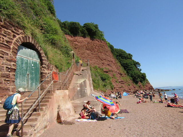
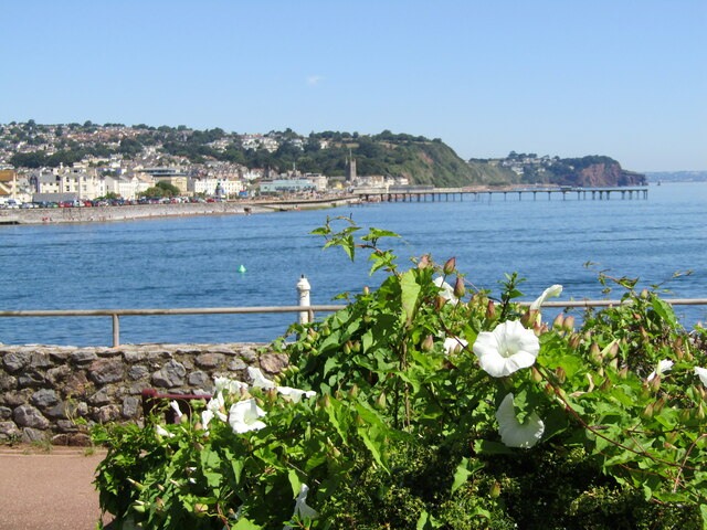
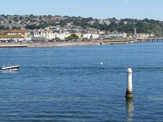
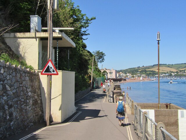
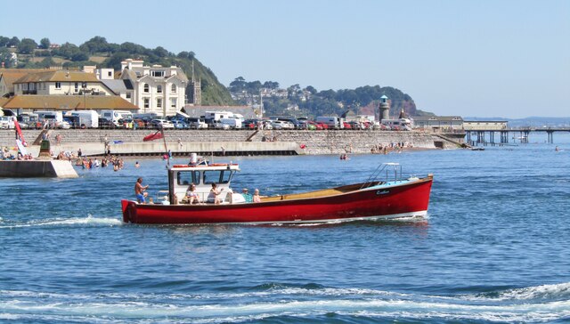
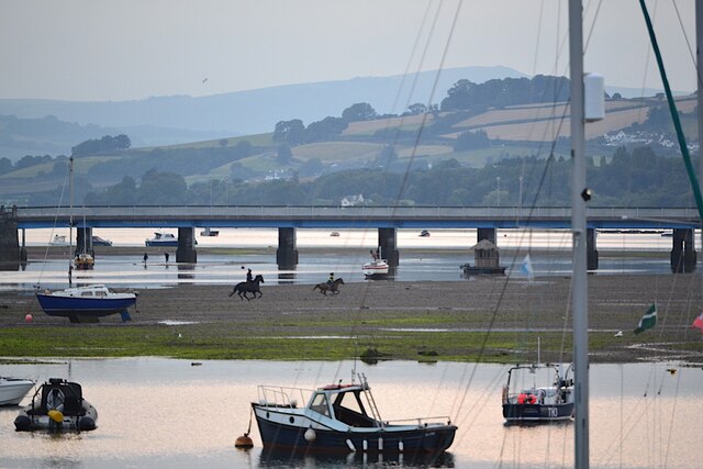
Cherryred Beach is a picturesque coastal gem located in the county of Devon, England. Situated on the South West Coast Path, this stunning beach offers visitors a tranquil and idyllic retreat from the hustle and bustle of everyday life.

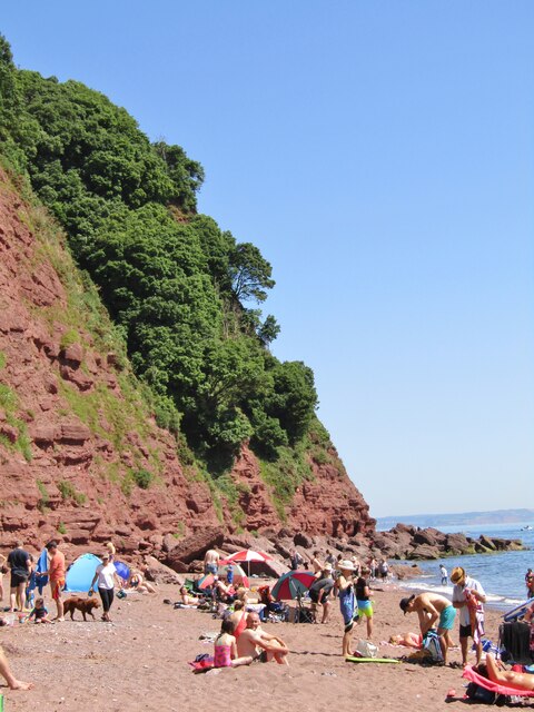
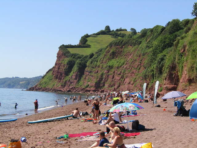
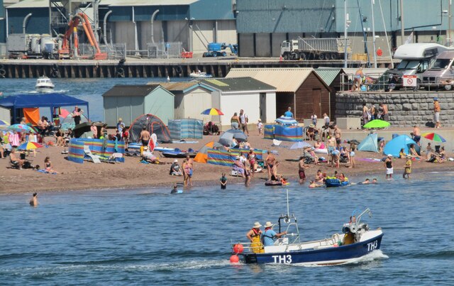
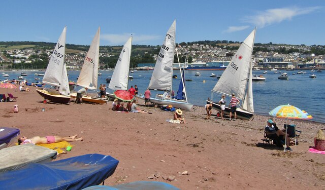
With its soft golden sands stretching for approximately one mile, Cherryred Beach is the perfect spot for sunbathing, building sandcastles, or simply taking a leisurely stroll along the shore. The crystal-clear waters gently lap against the shore, making it an ideal spot for paddling and swimming, particularly during the summer months when the water temperature is at its warmest.

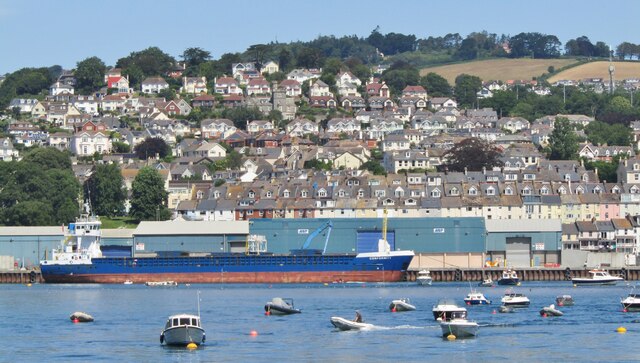
Surrounded by dramatic cliffs and rolling green hills, the beach provides a breathtaking backdrop for relaxation and enjoyment. Nature enthusiasts will be delighted by the diverse wildlife that can be spotted in the area, including seabirds, seals, and even the occasional dolphin or porpoise.

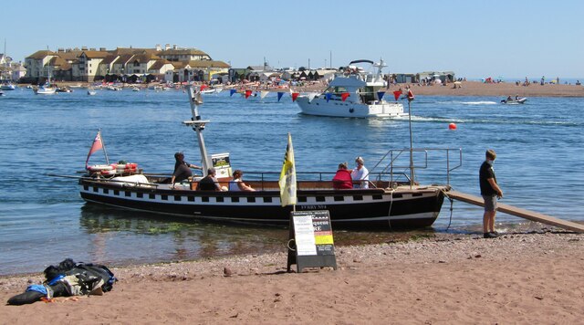
Facilities at Cherryred Beach are well-maintained, with ample parking available nearby and clean public toilets for visitors to use. There are also several quaint beachside cafes and shops where visitors can indulge in local delicacies and purchase souvenirs.

Whether you are seeking a peaceful day by the sea, a romantic sunset stroll, or a fun-filled family adventure, Cherryred Beach is sure to fulfill your desires. Its natural beauty and serene atmosphere make it a must-visit destination for those exploring the Devon coastline.

If you have any feedback on the listing, please let us know in the comments section below.

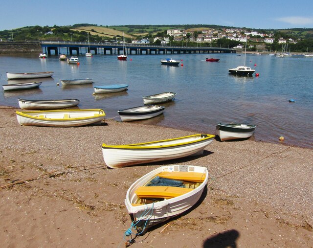
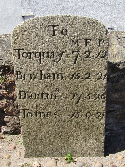
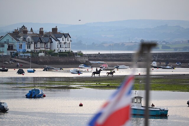
Cherryred Beach Images

Images are sourced within 2km of 50.52955/-3.5017814 or Grid Reference SX9371. Thanks to Geograph Open Source API. All images are credited.

Shaldon - Ness Cove Ness Cove is a long sandy beach, accessible through a tunnel from Shaldon car park. It is backed by high old red sandstone cliffs.
Shaldon - Ness Cove
Ness Cove is a long sandy beach, accessible through a tunnel from Shaldon car park. It is backed by high old red sandstone cliffs.
Shaldon - The Ness Steep old red sandstone cliff at the northern end of Ness Cove.
Shaldon - The Ness
Steep old red sandstone cliff at the northern end of Ness Cove.
Shaldon - Ness Cove Ness Cove is a long sandy beach, accessible through a tunnel from Shaldon car park. It is backed by high old red sandstone cliffs.
Shaldon - Ness Cove
Ness Cove is a long sandy beach, accessible through a tunnel from Shaldon car park. It is backed by high old red sandstone cliffs.
Shaldon - The Ness Pub double sign on Marine Parade - "The Ness" takes its name from the nearby promontory and the pub has sweeping views across the water to Teignmouth.
Shaldon - The Ness
Pub double sign on Marine Parade - "The Ness" takes its name from the nearby promontory and the pub has sweeping views across the water to Teignmouth.
Shaldon - Teign River Mouth View from The Ness at Shaldon, across the Teign estuary, towards Teignmouth Pier.
Shaldon - Teign River Mouth
View from The Ness at Shaldon, across the Teign estuary, towards Teignmouth Pier.
Shaldon - Navigation Beacon Maritime aid at the southern side of the Teign river mouth. Teignmouth is in the background.
Shaldon - Navigation Beacon
Maritime aid at the southern side of the Teign river mouth. Teignmouth is in the background.
Teignmouth - The Point Promontory and honeypot for tourists at the northern bank where the River Teign enters the sea. Seen here from The Ness at Shaldon.
Teignmouth - The Point
Promontory and honeypot for tourists at the northern bank where the River Teign enters the sea. Seen here from The Ness at Shaldon.
Shaldon - Searchlight Emplacement WW2 relic on Marine Parade, overlooking the mouth of the River Teign.
Shaldon - Searchlight Emplacement
WW2 relic on Marine Parade, overlooking the mouth of the River Teign.
Shaldon - Pleasure Boat "Restless" heads out to sea from Teignmouth harbour.
Shaldon - Pleasure Boat
"Restless" heads out to sea from Teignmouth harbour.
Teignmouth - Old Quay General cargo ship, "Conformity", moored in Teignmouth Harbour.
Teignmouth - Old Quay
General cargo ship, "Conformity", moored in Teignmouth Harbour.
Shaldon - Dinghies White sails in the sunshine at Shaldon. Teignmouth is in the background.
Shaldon - Dinghies
White sails in the sunshine at Shaldon. Teignmouth is in the background.
Teignmouth-Shaldon Ferry Ferry No. 4 at Shaldon preparing to cross the mouth of the Teign, carrying foot passengers to Teignmouth.
Teignmouth-Shaldon Ferry
Ferry No. 4 at Shaldon preparing to cross the mouth of the Teign, carrying foot passengers to Teignmouth.
Shaldon - War Memorial WW1 memorial in the centre of Shaldon village.
Shaldon - War Memorial
WW1 memorial in the centre of Shaldon village.
Shaldon - Teign Estuary Rowing boats pulled up on the beach during high tide on the Teign at Shaldon. The bridge to Teignmouth is in the background.
Shaldon - Teign Estuary
Rowing boats pulled up on the beach during high tide on the Teign at Shaldon. The bridge to Teignmouth is in the background.
Shaldon - Church Ornate figure holding a clam shell inside the Victorian village church.
Shaldon - Church
Ornate figure holding a clam shell inside the Victorian village church.
Shaldon - Milestone Historic stone by the southern end of the Shaldon-Teignmouth Bridge showing distances in miles, furlongs and poles.
To Torquay 7.2.12
Brixham 15.2.21
Dartmouth 17.5.26
Totnes 15.0.21
Shaldon - Milestone
Historic stone by the southern end of the Shaldon-Teignmouth Bridge showing distances in miles, furlongs and poles. To Torquay 7.2.12 Brixham 15.2.21 Dartmouth 17.5.26 Totnes 15.0.21
Riders on the Salty, low tide, Teignmouth The Salty is a two-hectare sandbank near the mouth of the River Teign. It is accessible for a couple of hours either side of low tide. These two riders could have reached it from two or three places along the Shaldon shore. They had ventured into the channel but turned back for a gallop on the firm sand and mud.
Riders on the Salty, low tide, Teignmouth
The Salty is a two-hectare sandbank near the mouth of the River Teign. It is accessible for a couple of hours either side of low tide. These two riders could have reached it from two or three places along the Shaldon shore. They had ventured into the channel but turned back for a gallop on the firm sand and mud.
Riders on the Salty, low tide, Teignmouth The Salty is a two-hectare sandbank near the mouth of the River Teign. It is accessible for a couple of hours either side of low tide. These two riders could have reached it from two or three places along the Shaldon shore. They had ventured into the channel but turned back for a gallop on the firm sand and mud. Other people may be visiting for exercise or for the remarkable peace and quiet, or to forage for shellfish. Rippon Tor, Dartmoor, on the skyline.
Riders on the Salty, low tide, Teignmouth
The Salty is a two-hectare sandbank near the mouth of the River Teign. It is accessible for a couple of hours either side of low tide. These two riders could have reached it from two or three places along the Shaldon shore. They had ventured into the channel but turned back for a gallop on the firm sand and mud. Other people may be visiting for exercise or for the remarkable peace and quiet, or to forage for shellfish. Rippon Tor, Dartmoor, on the skyline.
Show me another place!

Cherryred Beach is located at Grid Ref: SX9371 (Lat: 50.52955, Lng: -3.5017814)

Administrative County: Devon

District: Teignbridge

Police Authority: Devon and Cornwall

What 3 Words

///desktop.opened.unheated. Near Teignmouth, Devon

Related Wikis

River Teign

The River Teign is a river in the county of Devon, England. It is 31 mi (50 km) long and rises on Dartmoor, becomes an estuary just below Newton Abbot...

Shaldon

Shaldon is a village and civil parish in the Teignbridge district, in south Devon, England, on the south bank of the estuary of the River Teign, opposite...

Teignmouth Lifeboat Station

Teignmouth Lifeboat Station is the base for Royal National Lifeboat Institution (RNLI) search and rescue operations at Teignmouth, Devon in England. The...

Teignmouth Lighthouse

Teignmouth lighthouse is a lighthouse situated on the south end of the Den promenade at Teignmouth, Devon, England. It is paired with a red polycarbonate...

Nearby Amenities

Located within 500m of 50.52955,-3.5017814
Bundle Head
Is In: Devon, England, UK
Natural: headland
Place: locality
Source: NPE
Lat/Long: 50.5311567/-3.5016026
Smugglers Cove
Natural: bay
Lat/Long: 50.528672/-3.5011829
Labrador Bay
Natural: bay
Lat/Long: 50.5272397/-3.501612
Barrier: kissing_gate
Lat/Long: 50.5320972/-3.5015357
Bench
Backrest: yes
Lat/Long: 50.5321463/-3.5015721
The data included in this document is from www.openstreetmap.org. The data is made available under ODbL.

Have you been to Cherryred Beach?

Leave your review of Cherryred Beach below (or comments, questions and feedback).