Piper's Cove

Sea, Estuary, Creek in Kirkcudbrightshire

Scotland

Piper's Cove

Shell lag Empty cockle shells have been winnowed out of the fine sand by the tidal flow and left in this impressive strew on the surface. The place abounds in lessons for the geological interpretation of ancient fossil and sediment deposits.
Shell lag Credit: Jonathan Wilkins

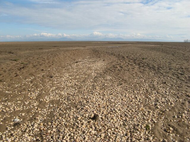
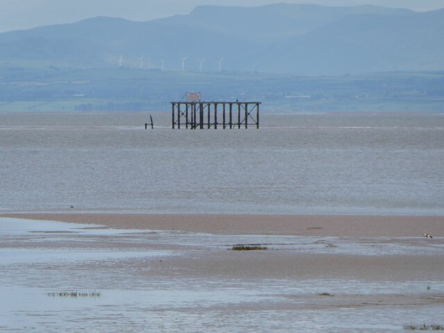
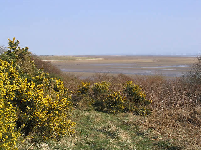
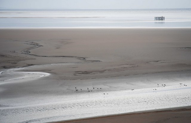
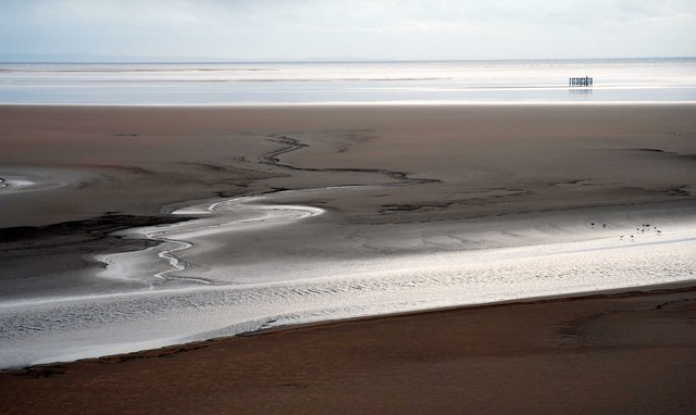
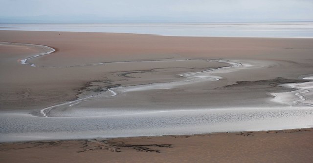
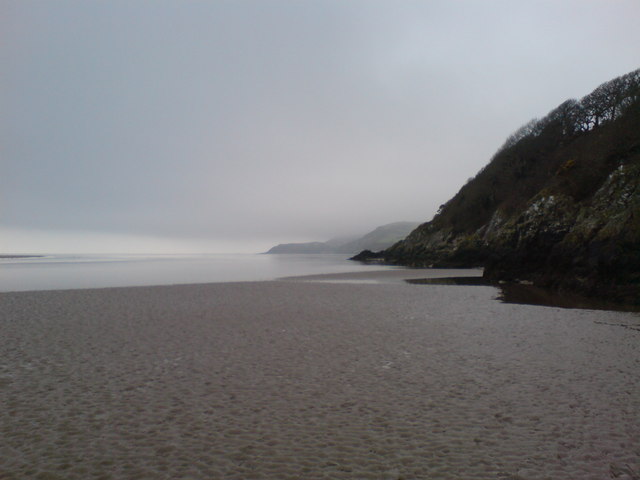
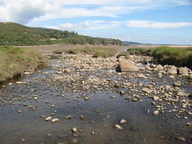
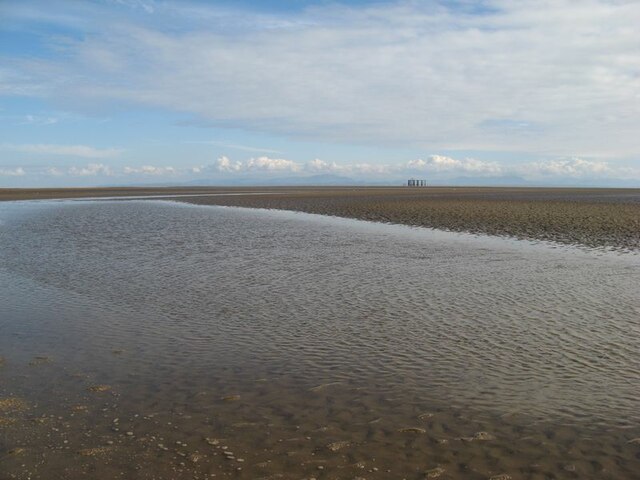
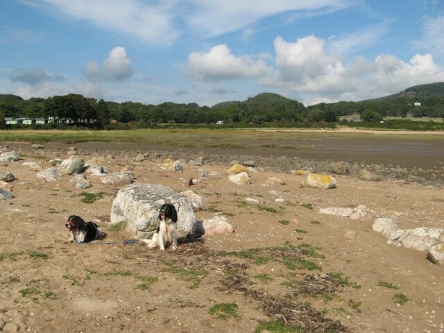
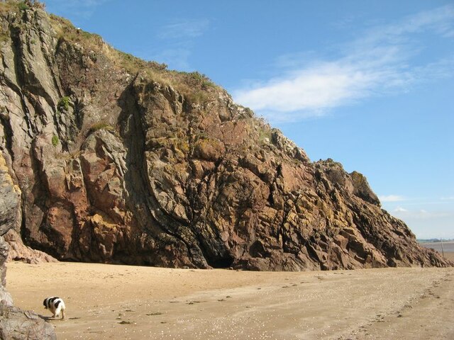
Piper's Cove is a picturesque coastal destination located in Kirkcudbrightshire, Scotland. Situated on the southern coast, it is renowned for its stunning views of the sea, estuary, and creek.

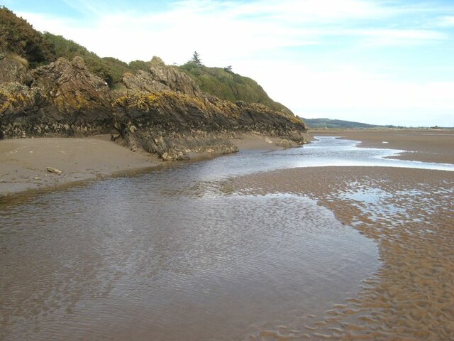
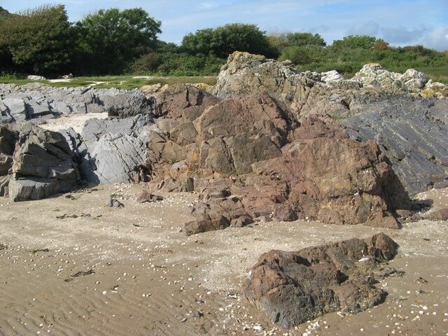
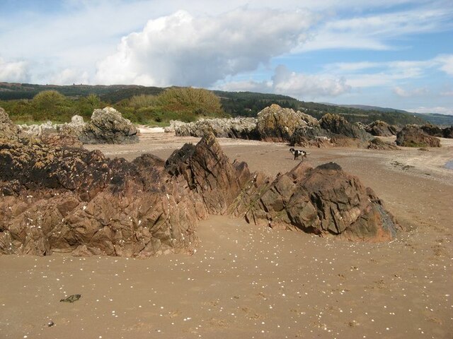
The cove is nestled between rugged cliffs, offering visitors a tranquil and idyllic setting to enjoy nature. The coastline is characterized by its sandy beaches, rocky outcrops, and crystal-clear waters. The sea, with its ever-changing hues, provides a mesmerizing backdrop for sunsets and offers opportunities for swimming, snorkeling, and other water activities.

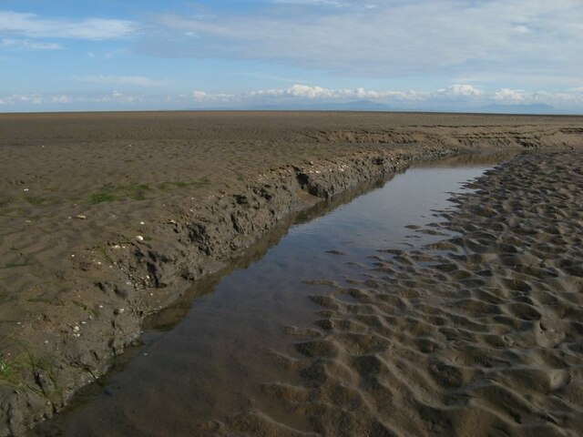
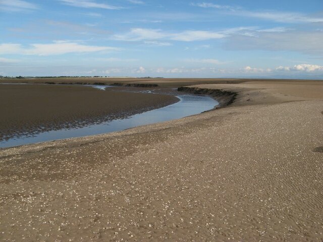
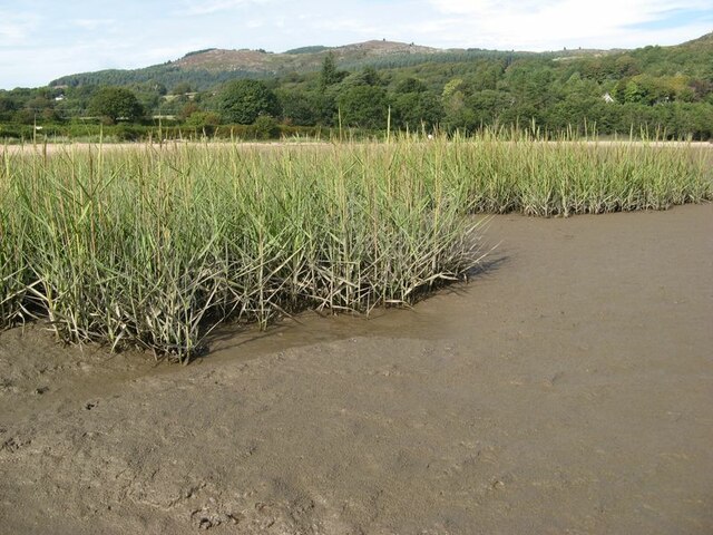
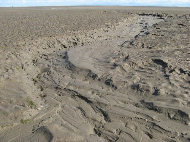
Adjacent to the sea is the estuary, a tidal inlet where a river meets the sea. This unique ecosystem is home to a diverse range of marine and bird species, making it a haven for wildlife enthusiasts and birdwatchers. Visitors can spot various wading birds, including herons and oystercatchers, as well as seals and dolphins that occasionally visit the estuary.

Piper's Cove also boasts a charming creek that winds its way through the surrounding landscape. The creek is lined with lush vegetation, creating a serene and peaceful atmosphere. It is a popular spot for fishing and boating, with many visitors taking advantage of the calm waters and abundance of fish.

For those seeking a tranquil coastal retreat, Piper's Cove in Kirkcudbrightshire offers a captivating blend of sea, estuary, and creek, providing a perfect escape for nature lovers and outdoor enthusiasts alike.

If you have any feedback on the listing, please let us know in the comments section below.

Piper's Cove Images

Images are sourced within 2km of 54.873253/-3.731703 or Grid Reference NX8854. Thanks to Geograph Open Source API. All images are credited.

Shell lag Empty cockle shells have been winnowed out of the fine sand by the tidal flow and left in this impressive strew on the surface. The place abounds in lessons for the geological interpretation of ancient fossil and sediment deposits.
Shell lag
Empty cockle shells have been winnowed out of the fine sand by the tidal flow and left in this impressive strew on the surface. The place abounds in lessons for the geological interpretation of ancient fossil and sediment deposits.
Erosion features The extent of re-working by tidal currents is a surprise. Here a channel can be seen eating its way through layered, muddy sand with cockle shell layers.
Erosion features
The extent of re-working by tidal currents is a surprise. Here a channel can be seen eating its way through layered, muddy sand with cockle shell layers.
Tidal river channel Part of the meandering course of Southwick Water as it makes its way across the sand at low tide.
Tidal river channel
Part of the meandering course of Southwick Water as it makes its way across the sand at low tide.
Rocks by Southwick Water The principal outfall of Southwick Water hugs the steep coastal rocks to form a channel which is intermittently quite deep for the unwary.
Rocks by Southwick Water
The principal outfall of Southwick Water hugs the steep coastal rocks to form a channel which is intermittently quite deep for the unwary.
Bombing range target Well out on Mersehead Sands.
'During World War 2 the airfield at Dumfries trained bomb aimers and air gunners, preparing them for their future role in Bomber Command. There were a few bombing ranges in the area which generally consisted of a wooden target situated away from towns and villages.' 
<span class="nowrap"><a title="https://www.solwaymilitarytrail.co.uk/trail-attractions/sandyhills-bombing-range/" rel="nofollow ugc noopener" href="https://www.solwaymilitarytrail.co.uk/trail-attractions/sandyhills-bombing-range/">Link</a><img style="margin-left:2px;" alt="External link" title="External link - shift click to open in new window" src="https://s1.geograph.org.uk/img/external.png" width="10" height="10"/></span>
Walter Baxter risked life and limb for a closer look <a title="https://www.geograph.org.uk/photo/2988812" href="https://www.geograph.org.uk/photo/2988812">Link</a>
Bombing range target
Well out on Mersehead Sands. 'During World War 2 the airfield at Dumfries trained bomb aimers and air gunners, preparing them for their future role in Bomber Command. There were a few bombing ranges in the area which generally consisted of a wooden target situated away from towns and villages.' LinkExternal link Walter Baxter risked life and limb for a closer look Link
The Solway Firth Southwick Water at low tide with the Mersehead Sands beyond in the Solway Firth.
The Solway Firth
Southwick Water at low tide with the Mersehead Sands beyond in the Solway Firth.
Looking over the Solway Sands
Solway Sands
Solway Sands
Looking over the Solway Firth Sands
The Solway Coast The Solway coast looking towards Sandyhills Bay.
The Solway Coast
The Solway coast looking towards Sandyhills Bay.
Reed bed Not the most popular part of this wonderful bay, by virtue of the sticky, muddy substrate which is sufficiently rarely covered by the tide to support a significant bed of reeds which are just coming into flower.
Reed bed
Not the most popular part of this wonderful bay, by virtue of the sticky, muddy substrate which is sufficiently rarely covered by the tide to support a significant bed of reeds which are just coming into flower.
Dry channel Water drains off the sands rapidly as the tide falls, causing deep channels to form. The channel, now dried-out completely, shows a wonderful collection of intricate bedforms indicative of flowing water and sediment transport. A sedimentologist's dream?
Dry channel
Water drains off the sands rapidly as the tide falls, causing deep channels to form. The channel, now dried-out completely, shows a wonderful collection of intricate bedforms indicative of flowing water and sediment transport. A sedimentologist's dream?
Barnhourie Burn outlet The wide, shallow outlet of the burn at low tide.
Barnhourie Burn outlet
The wide, shallow outlet of the burn at low tide.
Outflow channel Water flowing out from the Barnhourie burn on the vast inter-tidal plain. The topography is much more complex than the map suggests!
Outflow channel
Water flowing out from the Barnhourie burn on the vast inter-tidal plain. The topography is much more complex than the map suggests!
Erratic boulder shore The strip above the normal tide level is strewn with very pleasing, rounded glacial erratic boulders. Their concentration at the two extremities of the shore at Sandyhills Bay is surprising.
Erratic boulder shore
The strip above the normal tide level is strewn with very pleasing, rounded glacial erratic boulders. Their concentration at the two extremities of the shore at Sandyhills Bay is surprising.
Red granite vein Grey rocks which are sedimentary in origin are intruded here by a wide vein of reddened granite. The contrast is very pleasing.
Red granite vein
Grey rocks which are sedimentary in origin are intruded here by a wide vein of reddened granite. The contrast is very pleasing.
Piper's Cove A fabulous cove, in which one wall shows how red granite intrusion has followed the structure of the folded rocks which it has forced its way into.
Piper's Cove
A fabulous cove, in which one wall shows how red granite intrusion has followed the structure of the folded rocks which it has forced its way into.
Sea-washed rocks Rock outcrop on the upper shore comprising red-coloured granite amid grey coloured sedimentary strata. Salt-making was apparently practised on the shore until the 18th century.
Sea-washed rocks
Rock outcrop on the upper shore comprising red-coloured granite amid grey coloured sedimentary strata. Salt-making was apparently practised on the shore until the 18th century.
Show me another place!

Piper's Cove is located at Grid Ref: NX8854 (Lat: 54.873253, Lng: -3.731703)

Unitary Authority: Dumfries and Galloway

Police Authority: Dumfries and Galloway

What 3 Words

///reversed.frozen.scribble. Near Dalbeattie, Dumfries & Galloway

Related Wikis

Colvend and Southwick

Colvend and Southwick is a community council area and civil parish within the Stewartry area of Dumfries and Galloway, Scotland. It is also part of the...

Rough Island, Scotland

"Rough Island" is also used as a translation of "Garbh Eilean", a common Scottish name for islandsRough Island is a 20-acre (8 ha) uninhabited tidal island...

Rockcliffe, Dumfries and Galloway

Rockcliffe is a small, coastal village in Kirkcudbrightshire, Dumfries and Galloway in Scotland, with a view of Rough Island, Hestan Island, the Solway...

Kippford

Kippford (/ˈkɪpfəd/; otherwise Scaur) is a small village along the Solway coast, in the historic county of Kirkcudbrightshire in Dumfries and Galloway...

Rough Firth

Rough Firth is an inlet on the northern coast of the Solway Firth in the Stewartry area of Dumfries and Galloway, Scotland. The firth lies between Almorness...

Hestan Island

Hestan Island is a small coastal island at the southern foot of the River Urr estuary in the Solway Firth, in the historical county of Kirkcudbrightshire...

Palnackie

Palnackie is a village in the parish of Buittle in the historical county of Kirkcudbrightshire in Dumfries and Galloway, Scotland. It has a population...

Urr Water

Urr Water or River Urr (arc. River Orr) is a river in which flows through the counties of Dumfriesshire and Kirkcudbrightshire in southwest Scotland....

Nearby Amenities

Located within 500m of 54.873253,-3.731703
Source: PGS
Lat/Long: 54.8706977/-3.7365228
Source: PGS
Lat/Long: 54.8709419/-3.7359784
Source: PGS
Lat/Long: 54.8711648/-3.7356848
Source: PGS
Lat/Long: 54.8713675/-3.7352024
Source: PGS
Lat/Long: 54.8714466/-3.7349392
Source: PGS
Lat/Long: 54.8715501/-3.7347634
Source: PGS
Lat/Long: 54.8717257/-3.7341631
Source: PGS
Lat/Long: 54.871931/-3.7341072
Source: PGS
Lat/Long: 54.8720843/-3.7339175
Source: PGS
Lat/Long: 54.8723141/-3.7332106
Source: PGS
Lat/Long: 54.8727152/-3.7329127
Source: PGS
Lat/Long: 54.8727137/-3.7327072
Source: PGS
Lat/Long: 54.8728242/-3.7323337
Source: PGS
Lat/Long: 54.8728838/-3.73212
Source: PGS
Lat/Long: 54.8731499/-3.7321326
Source: PGS
Lat/Long: 54.8732317/-3.7318185
Source: PGS
Lat/Long: 54.8733756/-3.7315923
Source: PGS
Lat/Long: 54.8737954/-3.7310782
Source: PGS
Lat/Long: 54.8739191/-3.7306057
Source: PGS
Lat/Long: 54.8741179/-3.7291954
Source: PGS
Lat/Long: 54.8743973/-3.7291152
Source: PGS
Lat/Long: 54.8747318/-3.7288274
Source: PGS
Lat/Long: 54.8750385/-3.7285253
Source: PGS
Lat/Long: 54.8752811/-3.7279237
Source: PGS
Lat/Long: 54.8755976/-3.726779
Source: PGS
Lat/Long: 54.8757054/-3.7265745
Source: PGS
Lat/Long: 54.8761379/-3.7261371
Source: PGS
Lat/Long: 54.8763924/-3.7288411
Source: PGS
Lat/Long: 54.8766708/-3.7283669
Source: PGS
Lat/Long: 54.8702215/-3.7371836
Toors Hill
Natural: peak
Lat/Long: 54.872871/-3.7361981
Power: pole
Lat/Long: 54.8774414/-3.7327737
Power: pole
Lat/Long: 54.8769862/-3.7320567
Power: pole
Lat/Long: 54.8771229/-3.7314478
The data included in this document is from www.openstreetmap.org. The data is made available under ODbL.

Have you been to Piper's Cove?

Leave your review of Piper's Cove below (or comments, questions and feedback).