Portling Bay

Bay in Kirkcudbrightshire

Scotland

Portling Bay

Reed bed Not the most popular part of this wonderful bay, by virtue of the sticky, muddy substrate which is sufficiently rarely covered by the tide to support a significant bed of reeds which are just coming into flower.
Reed bed Credit: Jonathan Wilkins

Portling Bay is a picturesque coastal area located in the historic county of Kirkcudbrightshire, Scotland. Situated along the Solway Firth, the bay offers stunning views of the surrounding landscape and is a popular destination for outdoor enthusiasts and nature lovers.

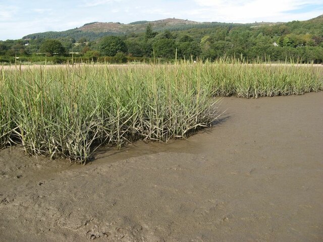
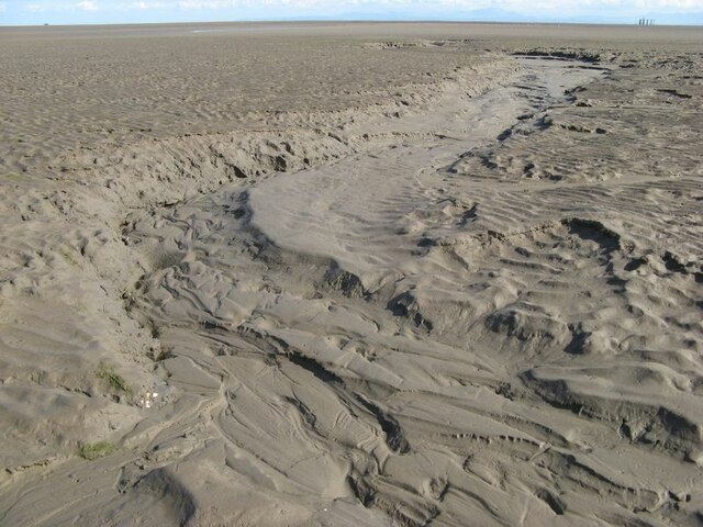
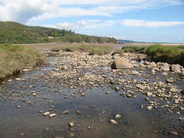
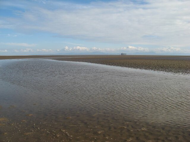
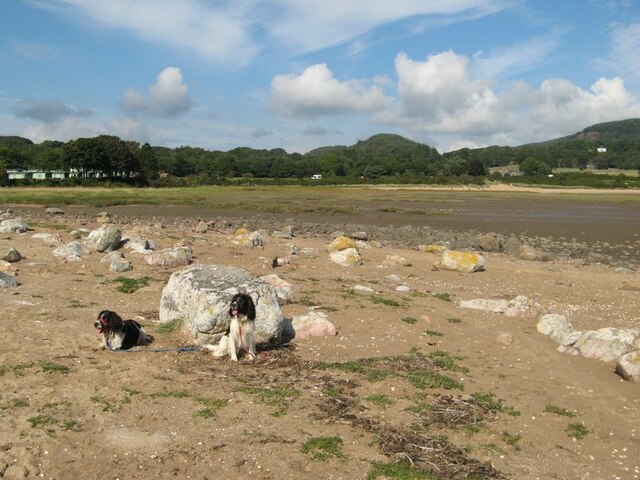
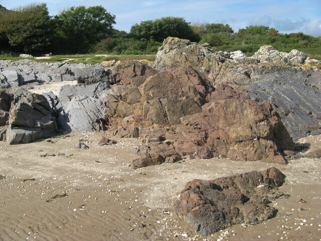
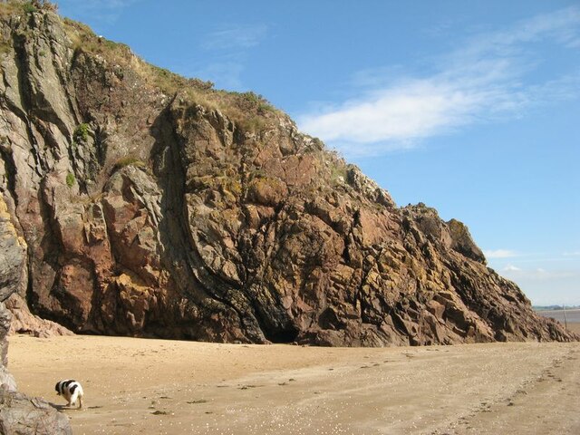
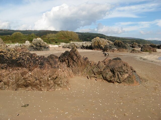
The bay is characterized by its sandy beaches, rocky cliffs, and crystal-clear waters. It is known for its tranquility and unspoiled natural beauty, attracting visitors looking to escape the hustle and bustle of everyday life. The bay is also home to a diverse range of wildlife, including seabirds, seals, and occasionally dolphins.

Portling Bay is a haven for water sports enthusiasts, with activities such as kayaking, sailing, and windsurfing being popular choices among visitors. The bay is also a great spot for fishing, with a variety of fish species inhabiting its waters.

For those who prefer land-based activities, Portling Bay offers scenic coastal walks and hiking trails that provide breathtaking views of the bay and its surroundings. The area is dotted with charming villages and historical landmarks, making it an ideal destination for exploring the local culture and heritage.

In terms of amenities, Portling Bay offers limited facilities, including a small car park and public toilets. However, nearby towns such as Kirkcudbright provide additional services, including accommodation, restaurants, and shops.

Overall, Portling Bay in Kirkcudbrightshire is a hidden gem on Scotland's coastline, offering visitors a peaceful and idyllic retreat with its natural beauty, outdoor activities, and rich wildlife.

If you have any feedback on the listing, please let us know in the comments section below.

Portling Bay Images

Images are sourced within 2km of 54.86847/-3.739991 or Grid Reference NX8854. Thanks to Geograph Open Source API. All images are credited.

Reed bed Not the most popular part of this wonderful bay, by virtue of the sticky, muddy substrate which is sufficiently rarely covered by the tide to support a significant bed of reeds which are just coming into flower.
Reed bed
Not the most popular part of this wonderful bay, by virtue of the sticky, muddy substrate which is sufficiently rarely covered by the tide to support a significant bed of reeds which are just coming into flower.
Dry channel Water drains off the sands rapidly as the tide falls, causing deep channels to form. The channel, now dried-out completely, shows a wonderful collection of intricate bedforms indicative of flowing water and sediment transport. A sedimentologist's dream?
Dry channel
Water drains off the sands rapidly as the tide falls, causing deep channels to form. The channel, now dried-out completely, shows a wonderful collection of intricate bedforms indicative of flowing water and sediment transport. A sedimentologist's dream?
Barnhourie Burn outlet The wide, shallow outlet of the burn at low tide.
Barnhourie Burn outlet
The wide, shallow outlet of the burn at low tide.
Outflow channel Water flowing out from the Barnhourie burn on the vast inter-tidal plain. The topography is much more complex than the map suggests!
Outflow channel
Water flowing out from the Barnhourie burn on the vast inter-tidal plain. The topography is much more complex than the map suggests!
Erratic boulder shore The strip above the normal tide level is strewn with very pleasing, rounded glacial erratic boulders. Their concentration at the two extremities of the shore at Sandyhills Bay is surprising.
Erratic boulder shore
The strip above the normal tide level is strewn with very pleasing, rounded glacial erratic boulders. Their concentration at the two extremities of the shore at Sandyhills Bay is surprising.
Red granite vein Grey rocks which are sedimentary in origin are intruded here by a wide vein of reddened granite. The contrast is very pleasing.
Red granite vein
Grey rocks which are sedimentary in origin are intruded here by a wide vein of reddened granite. The contrast is very pleasing.
Piper's Cove A fabulous cove, in which one wall shows how red granite intrusion has followed the structure of the folded rocks which it has forced its way into.
Piper's Cove
A fabulous cove, in which one wall shows how red granite intrusion has followed the structure of the folded rocks which it has forced its way into.
Sea-washed rocks Rock outcrop on the upper shore comprising red-coloured granite amid grey coloured sedimentary strata. Salt-making was apparently practised on the shore until the 18th century.
Sea-washed rocks
Rock outcrop on the upper shore comprising red-coloured granite amid grey coloured sedimentary strata. Salt-making was apparently practised on the shore until the 18th century.
Tilted strata Strata belonging to the Ross Formation (Silurian, Wenlock) are standing almost vertical on the cliffs here.
Tilted strata
Strata belonging to the Ross Formation (Silurian, Wenlock) are standing almost vertical on the cliffs here.
Sea stacks at Brandy Cove Fabulous sea-stacks and rugged coast which is well on the way to producing more!
Sea stacks at Brandy Cove
Fabulous sea-stacks and rugged coast which is well on the way to producing more!
Needle's Eye A fabulous natural arch formed by failure of the rocks and erosion at sea level. What is particularly satisfying is that the fault responsible for the failure is clearly visible, running slightly obliquely up the cliff above the crown of the arch.
Needle's Eye
A fabulous natural arch formed by failure of the rocks and erosion at sea level. What is particularly satisfying is that the fault responsible for the failure is clearly visible, running slightly obliquely up the cliff above the crown of the arch.
Fault failure Erosion of the cliff is proceeding where the presence of a fault plane has created weakness in the rocks. A nice cave is developing at the tide mark.
Fault failure
Erosion of the cliff is proceeding where the presence of a fault plane has created weakness in the rocks. A nice cave is developing at the tide mark.
Ripples and mirage Quite by accident I succeeded in capturing a classic mirage by kneeling for this shot of the rippled sand running out from the coast, apparently without end. The distant promontory of Southerness appears to float above the horizon. My assistant Tegid is the other feature on the horizon, stretching his legs at a gallop.
Ripples and mirage
Quite by accident I succeeded in capturing a classic mirage by kneeling for this shot of the rippled sand running out from the coast, apparently without end. The distant promontory of Southerness appears to float above the horizon. My assistant Tegid is the other feature on the horizon, stretching his legs at a gallop.
Carboniferous strata Rocks on the shore to the south of Portling are much younger than those forming the adjacent cliffs which run along the coast. It is immediately obvious that they are not steeply inclined, and in fact they are unconformable with the immediately adjacent Silurian strata (see <a href="https://www.geograph.org.uk/photo/6970240">NX8954 : Tilted strata</a> for a good contrasting example) and post-date the continental collision responsible for the deformation of the older rocks. Sadly, it is not possible to see the older and younger rocks anywhere in contact, and generally here a steeply-inclined fault separates them. See also <a href="https://www.geograph.org.uk/photo/6970311">NX8853 : Carboniferous strata 2</a> for another view of the Carboniferous rocks.
Carboniferous strata
Rocks on the shore to the south of Portling are much younger than those forming the adjacent cliffs which run along the coast. It is immediately obvious that they are not steeply inclined, and in fact they are unconformable with the immediately adjacent Silurian strata (see NX8954 : Tilted strata for a good contrasting example) and post-date the continental collision responsible for the deformation of the older rocks. Sadly, it is not possible to see the older and younger rocks anywhere in contact, and generally here a steeply-inclined fault separates them. See also NX8853 : Carboniferous strata 2 for another view of the Carboniferous rocks.
Carboniferous strata 2 The rocks here, of Carboniferous (Arundian to Holkerian) age are the Rascarrel Member of the Fell Sandstone Formation. The beds are of sandstone and conglomerate, which include angular clasts of granite and other igneous material eroded from the exposed granite pluton nearby, indicating rapid uplift on the faults which run along its margin to form a faulted unconformity on the norther margin of the Upper Palaeozoic Solway Basin. See also <a href="https://www.geograph.org.uk/photo/6970289">NX8853 : Carboniferous strata</a>.
Carboniferous strata 2
The rocks here, of Carboniferous (Arundian to Holkerian) age are the Rascarrel Member of the Fell Sandstone Formation. The beds are of sandstone and conglomerate, which include angular clasts of granite and other igneous material eroded from the exposed granite pluton nearby, indicating rapid uplift on the faults which run along its margin to form a faulted unconformity on the norther margin of the Upper Palaeozoic Solway Basin. See also NX8853 : Carboniferous strata.
Portling shore Looking from the intertidal sands to the houses on the Portling Shore. I was impressed by the sky that had developed.
Portling shore
Looking from the intertidal sands to the houses on the Portling Shore. I was impressed by the sky that had developed.
Lichens on sandstone Still in the splash zone, these rocks bear a fantastic community of lichens including Caloplaca, Ramalina and Ochrolechia. What a fabulous garden!
Lichens on sandstone
Still in the splash zone, these rocks bear a fantastic community of lichens including Caloplaca, Ramalina and Ochrolechia. What a fabulous garden!
Sandyhills east end The eastern end of the shore at Sandyhills is showing distinct signs of erosive action, with granite boulders and tree roots in the sand - but still a fabulous place to be on the hottest September day in Scotland since 1906. Eventually we were forced to find shade!
Sandyhills east end
The eastern end of the shore at Sandyhills is showing distinct signs of erosive action, with granite boulders and tree roots in the sand - but still a fabulous place to be on the hottest September day in Scotland since 1906. Eventually we were forced to find shade!
Show me another place!

Portling Bay is located at Grid Ref: NX8854 (Lat: 54.86847, Lng: -3.739991)

Unitary Authority: Dumfries and Galloway

Police Authority: Dumfries and Galloway

What 3 Words

///crops.lived.postings. Near Dalbeattie, Dumfries & Galloway

Related Wikis

Colvend and Southwick

Colvend and Southwick is a community council area and civil parish within the Stewartry area of Dumfries and Galloway, Scotland. It is also part of the...

Rough Island, Scotland

"Rough Island" is also used as a translation of "Garbh Eilean", a common Scottish name for islandsRough Island is a 20-acre (8 ha) uninhabited tidal island...

Rockcliffe, Dumfries and Galloway

Rockcliffe is a small, coastal village in Kirkcudbrightshire, Dumfries and Galloway in Scotland, with a view of Rough Island, Hestan Island, the Solway...

Kippford

Kippford (/ˈkɪpfəd/; otherwise Scaur) is a small village along the Solway coast, in the historic county of Kirkcudbrightshire in Dumfries and Galloway...

Rough Firth

Rough Firth is an inlet on the northern coast of the Solway Firth in the Stewartry area of Dumfries and Galloway, Scotland. The firth lies between Almorness...

Hestan Island

Hestan Island is a small coastal island at the southern foot of the River Urr estuary in the Solway Firth, in the historical county of Kirkcudbrightshire...

Palnackie

Palnackie is a village in the parish of Buittle in the historical county of Kirkcudbrightshire in Dumfries and Galloway, Scotland. It has a population...

Urr Water

Urr Water or River Urr (arc. River Orr) is a river in which flows through the counties of Dumfriesshire and Kirkcudbrightshire in southwest Scotland....

Nearby Amenities

Located within 500m of 54.86847,-3.739991
Source: PGS
Lat/Long: 54.8706977/-3.7365228
Source: PGS
Lat/Long: 54.8709419/-3.7359784
Source: PGS
Lat/Long: 54.8711648/-3.7356848
Source: PGS
Lat/Long: 54.8713675/-3.7352024
Source: PGS
Lat/Long: 54.8714466/-3.7349392
Source: PGS
Lat/Long: 54.8715501/-3.7347634
Source: PGS
Lat/Long: 54.8641878/-3.7418105
Source: PGS
Lat/Long: 54.8645484/-3.7410728
Source: PGS
Lat/Long: 54.8648504/-3.7408191
Source: PGS
Lat/Long: 54.8651239/-3.7408878
Source: PGS
Lat/Long: 54.8652397/-3.7413867
Source: PGS
Lat/Long: 54.8654496/-3.7414591
Source: PGS
Lat/Long: 54.8660624/-3.7414966
Source: PGS
Lat/Long: 54.866644/-3.7411898
Source: PGS
Lat/Long: 54.8670713/-3.7407563
Source: PGS
Lat/Long: 54.867359/-3.7401942
Source: PGS
Lat/Long: 54.8687605/-3.7402843
Source: PGS
Lat/Long: 54.8695411/-3.7390409
Source: PGS
Lat/Long: 54.8696366/-3.7378275
Source: PGS
Lat/Long: 54.8697686/-3.7380715
Source: PGS
Lat/Long: 54.8701965/-3.7375068
Source: PGS
Lat/Long: 54.8702215/-3.7371836
Post Box
Ref: DG5 46
Royal Cypher: GR
Royal Cypher Wikidata: Q33102273
Source: Flickr
Lat/Long: 54.8690205/-3.7446945
Power: pole
Lat/Long: 54.8710674/-3.7451163
Power: pole
Lat/Long: 54.8704607/-3.7450675
Power: pole
Lat/Long: 54.8698308/-3.7449996
Power: pole
Lat/Long: 54.8691227/-3.7449169
Power: pole
Lat/Long: 54.868798/-3.7444756
Power: pole
Lat/Long: 54.8679398/-3.7432579
Power: pole
Lat/Long: 54.8694914/-3.7452118
Power: pole
Lat/Long: 54.8689201/-3.7456085
Power: pole
Lat/Long: 54.8680154/-3.746194
Power: pole
Lat/Long: 54.8674917/-3.7462216
Power: pole
Lat/Long: 54.8666628/-3.7462746
Power: pole
Lat/Long: 54.8660169/-3.7465037
The data included in this document is from www.openstreetmap.org. The data is made available under ODbL.

Have you been to Portling Bay?

Leave your review of Portling Bay below (or comments, questions and feedback).