Poll na Cùile
Sea, Estuary, Creek in Sutherland
Scotland
Poll na Cùile
Poll na Cùile is a picturesque sea inlet located in Sutherland, Scotland. Also known as a sea loch, estuary, or creek, it is a natural body of water that extends inland from the sea, forming a deep and narrow channel. The name "Poll na Cùile" translates to "cove of the corner" in Gaelic, which accurately describes its secluded and tucked-away location.
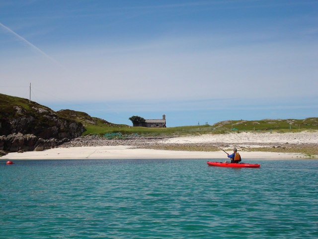
Situated amidst stunning coastal landscapes, Poll na Cùile offers breathtaking views of the surrounding mountains and cliffs. The calm and tranquil waters of the inlet are a haven for various marine species, making it a popular spot for fishing and wildlife observation.
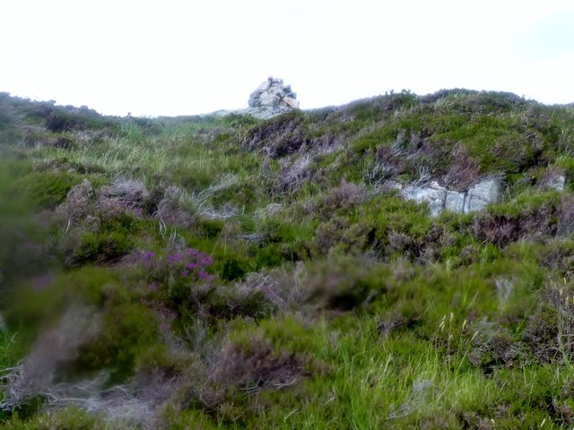
The inlet is characterized by its rocky shores and shallow sandy areas, which provide a habitat for a diverse range of marine life. Seals, otters, and a variety of seabirds are often spotted along the shores. The crystal-clear waters allow for excellent visibility, making it a favorite destination for snorkelers and divers.
Poll na Cùile is also of historical significance, as it has been a crucial transportation route for centuries. The narrow channel has witnessed the passage of fishing boats, cargo vessels, and even Viking longships in the past. Today, visitors can still see remnants of old fishing villages and stone structures that once thrived along its shores.
Whether it's the stunning natural beauty, abundant wildlife, or rich history, Poll na Cùile continues to captivate visitors with its charm and allure. It is a must-visit destination for nature lovers and those seeking a peaceful retreat amidst the rugged Scottish coastline.
If you have any feedback on the listing, please let us know in the comments section below.
Poll na Cùile Images
Images are sourced within 2km of 58.26327/-5.2571381 or Grid Reference NC0935. Thanks to Geograph Open Source API. All images are credited.

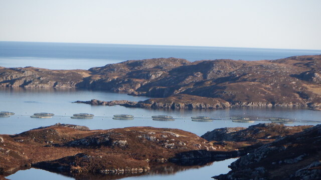
![Towards Oldany Island In the centre of the photo is the narrow channel that separates Oldany Island [right] from the mainland. I am informed that when there are low spring tides it is possible to cross at the narrowest point, but that time on Oldany is very limited before one is cut off.](https://s2.geograph.org.uk/geophotos/05/78/44/5784442_bd890c77.jpg)


Poll na Cùile is located at Grid Ref: NC0935 (Lat: 58.26327, Lng: -5.2571381)
Unitary Authority: Highland
Police Authority: Highlands and Islands
What 3 Words
///clerics.hires.stag. Near Clachtoll, Highland
Nearby Locations
Related Wikis

Oldany Island
Oldany Island (formerly Oldney Island) is an uninhabited island in Assynt, Sutherland, north-west Scotland. The name is Norse in origin and possibly means...
Culkein Drumbeg
Culkein Drumbeg (Scottish Gaelic: Cùl-cinn an Droma Bhig) is a remote village on the north west coast of Scotland. It is located 0.93 miles (1.50 km) north...

MV Bermuda
MV Bermuda was a passenger motor ship that Furness, Withy's Furness Bermuda Line operated between New York and Bermuda from 1928 until 1931. She was damaged...

Eddrachillis Bay
Eddrachillis Bay (Scottish Gaelic: Eadar Dà Chaolas- "between two kyles", Kylesku and Laxford) is a bay on the north-west coast of Sutherland, Scotland...

Drumbeg, Sutherland
Drumbeg (Scottish Gaelic: An Druim Beag) is a remote crofting village on the north west coast of Scotland in Assynt, Sutherland, Scottish Highlands and...

Clashnessie
Clashnessie (Scottish Gaelic: Clais an Easaidh) is a small crofting community on the North-West coast of Scotland; specifically in the Assynt area of Sutherland...

Nedd
Nedd (Scottish Gaelic: An Nead) is a small village, which lies on the western head of Loch Nedd in Lairg, western Sutherland, Scottish Highlands and is...
Achnacarnin
Achnacarnin (Scottish Gaelic: Achadh nan Càrnan) is a village on the headland of Point of Stoer in Lairg, Sutherland, within the Scottish local authority...
Nearby Amenities
Located within 500m of 58.26327,-5.2571381Have you been to Poll na Cùile?
Leave your review of Poll na Cùile below (or comments, questions and feedback).