Nelson's Cove

Sea, Estuary, Creek in Ayrshire

Scotland

Nelson's Cove

Garry Point and Finnarts Bay Viewed from P&O Ferry 'European Causeway'.
See Billy McCrorie's <a title="https://www.geograph.org.uk/photo/5554327" href="https://www.geograph.org.uk/photo/5554327">Link</a>
On a better weather day!
Garry Point and Finnarts Bay Credit: Russel Wills

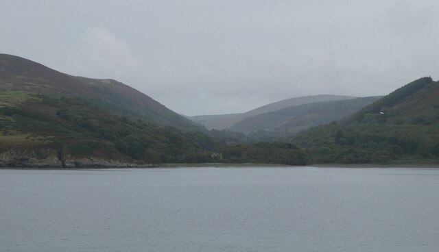
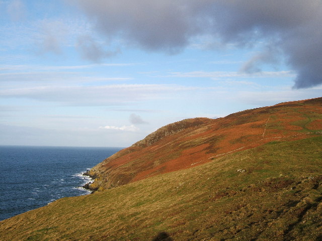
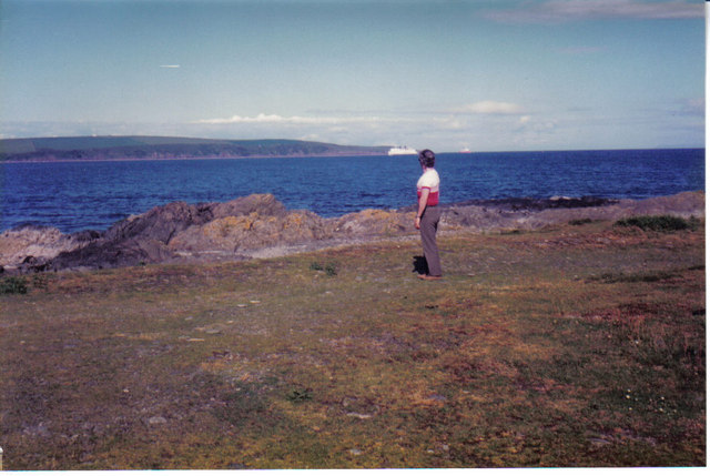
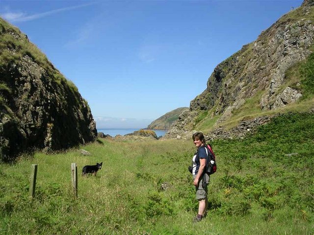
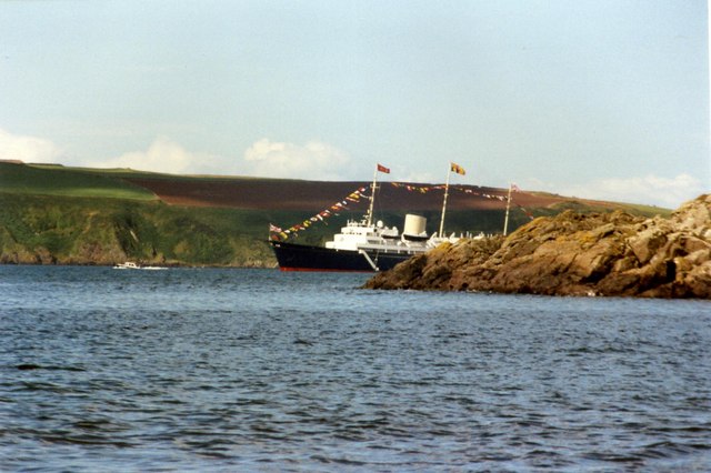
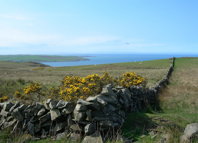
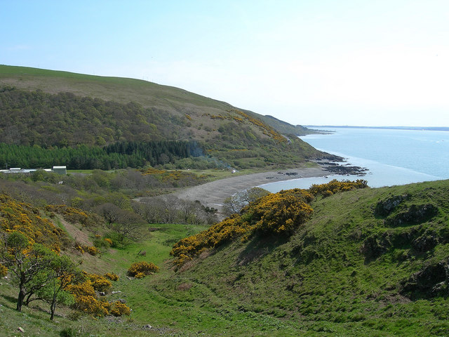
Nelson's Cove is a picturesque coastal area located in Ayrshire, Scotland. Situated along the western coast of the country, this idyllic spot offers breathtaking views of the sea, estuary, and creek.

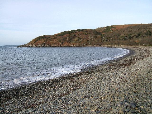
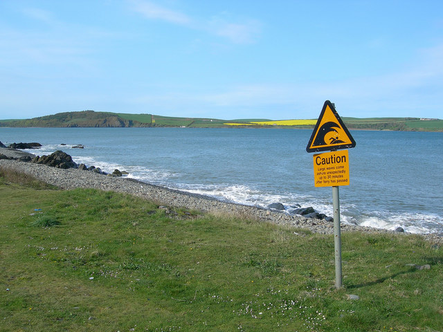
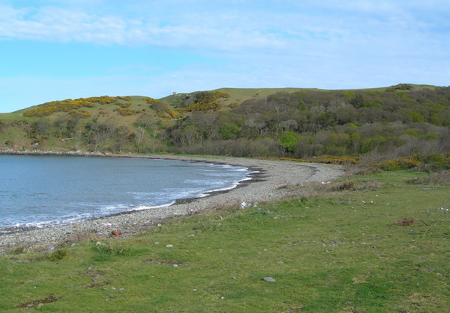
The cove is characterized by its pristine sandy beach, which stretches for approximately 1.5 kilometers. The sands are soft and golden, making it a popular destination for beachgoers and sun-seekers during the summer months. The calm and clear waters of the sea provide an ideal environment for swimming and other water activities.

At the southern end of Nelson's Cove, an estuary flows into the sea, creating a unique ecosystem that supports a variety of marine life. The estuary is home to numerous species of fish, crustaceans, and birds, making it a haven for nature enthusiasts and birdwatchers.

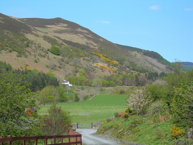
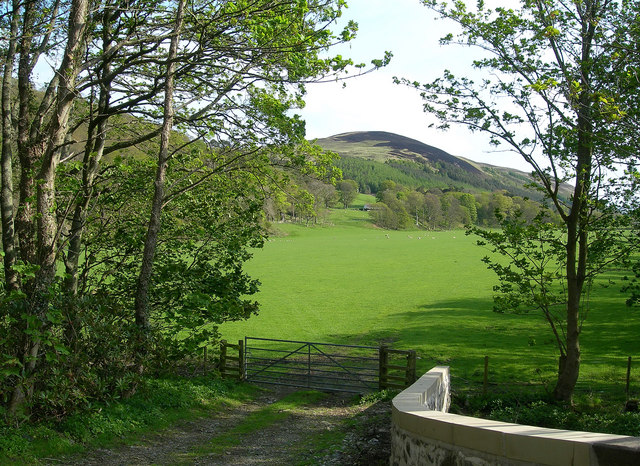
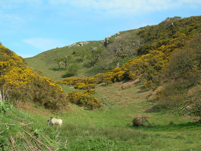
In addition to its natural beauty, Nelson's Cove boasts a small creek that winds its way through the surrounding countryside. The creek is a haven for wildlife, with lush vegetation lining its banks and providing a habitat for a diverse range of animals and plants.

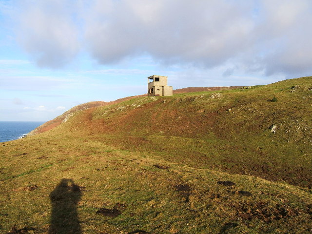
Visitors to Nelson's Cove can enjoy a range of outdoor activities, including walking along the beach, exploring the estuary, or following the creek's path through the countryside. The area is also dotted with picnic spots and coastal trails, offering opportunities for relaxation and exploration.

Overall, Nelson's Cove in Ayrshire is a hidden gem, combining stunning coastal scenery, diverse wildlife, and a range of outdoor activities, making it a must-visit destination for nature lovers and beach enthusiasts.

If you have any feedback on the listing, please let us know in the comments section below.

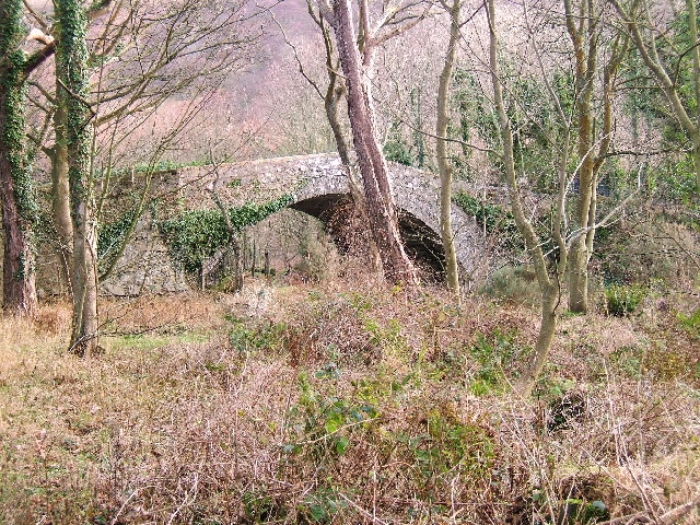
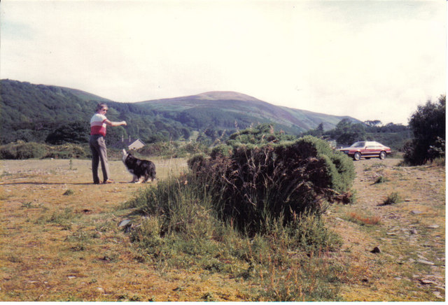
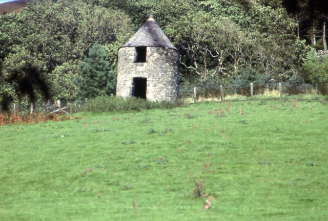
Nelson's Cove Images

Images are sourced within 2km of 55.020737/-5.0572361 or Grid Reference NX0473. Thanks to Geograph Open Source API. All images are credited.

Garry Point and Finnarts Bay Viewed from P&O Ferry 'European Causeway'.
See Billy McCrorie's <a title="https://www.geograph.org.uk/photo/5554327" href="https://www.geograph.org.uk/photo/5554327">Link</a>
On a better weather day!
Garry Point and Finnarts Bay
Viewed from P&O Ferry 'European Causeway'. See Billy McCrorie's Link On a better weather day!
Finnarts Bay and Garry Point North of Cairnryan Finnarts Bay on Loch Ryan where the river App enters the Loch, Garry Point can be seen in the background.
Finnarts Bay and Garry Point North of Cairnryan
Finnarts Bay on Loch Ryan where the river App enters the Loch, Garry Point can be seen in the background.
A wartime observation post overlooking the entrance to Lochryan. A wartime observation post overlooking the entrance to Lochryan above Finnarts Bay, North of Cairnryan near Stranraer.
A wartime observation post overlooking the entrance to Lochryan.
A wartime observation post overlooking the entrance to Lochryan above Finnarts Bay, North of Cairnryan near Stranraer.
Finnarts Hill above Finnarts Point, Lochryan near Stranraer Finnarts Hill (143 metres) which sits overlooking Lochryan above Finnarts Point. Photo taken on a lovely Winter's day with some low cloud.
Finnarts Hill above Finnarts Point, Lochryan near Stranraer
Finnarts Hill (143 metres) which sits overlooking Lochryan above Finnarts Point. Photo taken on a lovely Winter's day with some low cloud.
Blarbuie Hill between Finnarts Hill and Sandloch Hill This hill is about 650 feet high and sits in between Finnarts Hill and Sandloch Hill above Lochryan.
Blarbuie Hill between Finnarts Hill and Sandloch Hill
This hill is about 650 feet high and sits in between Finnarts Hill and Sandloch Hill above Lochryan.
The old bridge over Water of App at Finnarts Bay near Cairnryan
Parking area next to a beach This area is at Finnart's Bay. The photographer is standing on the beach and the photo shows an area that was once beach but is now scrubby vegetation. It is used as a parking/picnic area. In the distance is the entrance to Glen App.
Parking area next to a beach
This area is at Finnart's Bay. The photographer is standing on the beach and the photo shows an area that was once beach but is now scrubby vegetation. It is used as a parking/picnic area. In the distance is the entrance to Glen App.
Sea Loch The head of Loch Ryan as seen from Finnart's Bay.
Sea Loch
The head of Loch Ryan as seen from Finnart's Bay.
Portandea Looking North from Portandea. A strange sheltered but remote part of the coast with an abandoned house on it and a sandy beach on the South side.
Portandea
Looking North from Portandea. A strange sheltered but remote part of the coast with an abandoned house on it and a sandy beach on the South side.
Doocot at Finnarts Farm Glenapp Possibly once used by inhabitants of Finnarts House (long since demolished) 
Note rabbit in the foreground!
Doocot at Finnarts Farm Glenapp
Possibly once used by inhabitants of Finnarts House (long since demolished) Note rabbit in the foreground!
Royal Yacht Britannia rounding Garry Point Yacht on way to visit Stranraer before decommissioning.
Royal Yacht Britannia rounding Garry Point
Yacht on way to visit Stranraer before decommissioning.
Towards Corsewall Point Looking across the Firth of Clyde at the entrance to Loch Ryan.  Corsewall Point is the second promontory from the left.  Northern Ireland is just visible on the horizon.
Towards Corsewall Point
Looking across the Firth of Clyde at the entrance to Loch Ryan. Corsewall Point is the second promontory from the left. Northern Ireland is just visible on the horizon.
Drumbo Looking towards Penderry Hill.
Drumbo
Looking towards Penderry Hill.
Warning Sign at Finnarts Bay The sign warns of unexpectedly large waves that reach the shore approximately 30 minutes after a ferry has passed.  Although not quite of tsunami size, these large waves can produce a risk to children on the shore.  Loch Ryan is busy with ferry traffic, from Stranraer and Cairnryan.
Warning Sign at Finnarts Bay
The sign warns of unexpectedly large waves that reach the shore approximately 30 minutes after a ferry has passed. Although not quite of tsunami size, these large waves can produce a risk to children on the shore. Loch Ryan is busy with ferry traffic, from Stranraer and Cairnryan.
Finnarts Bay Looking north along the shore on a fine late-April morning.
Finnarts Bay
Looking north along the shore on a fine late-April morning.
Looking Up Glen App Looking up the glen from the refurbished bridge over the Water of App.  Sandloch Hill is in the background.
Looking Up Glen App
Looking up the glen from the refurbished bridge over the Water of App. Sandloch Hill is in the background.
A Wee Gap Looking inland on the way to Garry Point on a fine late-April morning.
A Wee Gap
Looking inland on the way to Garry Point on a fine late-April morning.
Towards Finnarts Bay Looking south into Finnarts Bay and Loch Ryan.
Towards Finnarts Bay
Looking south into Finnarts Bay and Loch Ryan.
Show me another place!

Nelson's Cove is located at Grid Ref: NX0473 (Lat: 55.020737, Lng: -5.0572361)

Unitary Authority: South Ayrshire

Police Authority: Ayrshire

What 3 Words

///marine.kingdom.contained. Near Cairnryan, Dumfries & Galloway

Related Wikis

Loch Ryan

Loch Ryan (Scottish Gaelic: Loch Rìoghaine, pronounced [l̪ˠɔx ˈrˠiː.ɛɲə]) is a Scottish sea loch that acts as an important natural harbour for shipping...

Kirkcolm

Kirkcolm (Scots: Kirkcoam) is a village and civil parish on the northern tip of the Rhinns of Galloway peninsula, south-west Scotland. It is in Dumfries...

Cairnryan Harbour

Cairnryan Harbour is a roll-on ferry terminal on Loch Ryan in south west Scotland north of Stranraer. In World War II it was developed as an emergency...

RAF Wig Bay

Royal Air Force Wig Bay, or more simply RAF Wig Bay, is a former Royal Air Force station near Stranraer, Dumfries and Galloway, Scotland The following...

Nearby Amenities

Located within 500m of 55.020737,-5.0572361
Created By: dmgroom_coastlines
Source: PGS
Lat/Long: 55.0244122/-5.059755
Created By: dmgroom_coastlines
Source: PGS
Lat/Long: 55.02398/-5.05945
Created By: dmgroom_coastlines
Source: PGS
Lat/Long: 55.023857/-5.059221
Created By: dmgroom_coastlines
Source: PGS
Lat/Long: 55.022072/-5.058684
Created By: dmgroom_coastlines
Source: PGS
Lat/Long: 55.021816/-5.058671
Created By: dmgroom_coastlines
Source: PGS
Lat/Long: 55.021561/-5.058658
Created By: dmgroom_coastlines
Source: PGS
Lat/Long: 55.021436/-5.058428
Created By: dmgroom_coastlines
Source: PGS
Lat/Long: 55.021323/-5.05753
Created By: dmgroom_coastlines
Source: PGS
Lat/Long: 55.020559/-5.057269
Created By: dmgroom_coastlines
Source: PGS
Lat/Long: 55.019287/-5.056758
Created By: dmgroom_coastlines
Source: PGS
Lat/Long: 55.018783/-5.056286
Created By: dmgroom_coastlines
Source: PGS
Lat/Long: 55.018278/-5.055815
Created By: dmgroom_coastlines
Source: PGS
Lat/Long: 55.017006/-5.055304
The data included in this document is from www.openstreetmap.org. The data is made available under ODbL.

Have you been to Nelson's Cove?

Leave your review of Nelson's Cove below (or comments, questions and feedback).