Lambshouse Cove
Sea, Estuary, Creek in Cornwall
England
Lambshouse Cove

Lambshouse Cove is a picturesque coastal area located in Cornwall, England. Situated on the southern coast of the county, Lambshouse Cove offers a diverse and stunning landscape that combines the beauty of the sea, estuary, and creek.
The area is known for its serene and tranquil atmosphere, making it a popular destination for those seeking a peaceful retreat. The cove is surrounded by lush green hills and cliffs, providing a breathtaking backdrop to the sparkling waters.
The sea at Lambshouse Cove is known for its crystal-clear blue hues and gentle waves. It is a haven for water enthusiasts, offering opportunities for swimming, snorkeling, and even surfing. The coastal path that winds along the edge of the cove provides stunning panoramic views and is perfect for leisurely walks or cycling.
The estuary at Lambshouse Cove is formed by the convergence of a river and the sea, creating a unique ecosystem and a haven for wildlife. It is home to a variety of bird species, including herons and kingfishers, making it a popular spot for birdwatching. The estuary also supports a rich marine life, with occasional sightings of seals and dolphins.
The creek at Lambshouse Cove is a tranquil and sheltered area, with calm waters ideal for boating and kayaking. It is a peaceful spot to enjoy the serenity of nature and explore the hidden corners of the coastline.
Overall, Lambshouse Cove in Cornwall offers a captivating blend of sea, estuary, and creek, making it a must-visit destination for nature lovers and those seeking a peaceful escape.
If you have any feedback on the listing, please let us know in the comments section below.
Lambshouse Cove Images
Images are sourced within 2km of 50.658513/-4.7649543 or Grid Reference SX0487. Thanks to Geograph Open Source API. All images are credited.


Lambshouse Cove is located at Grid Ref: SX0487 (Lat: 50.658513, Lng: -4.7649543)
Unitary Authority: Cornwall
Police Authority: Devon and Cornwall
What 3 Words
///dragonfly.tries.pint. Near Tintagel, Cornwall
Nearby Locations
Related Wikis
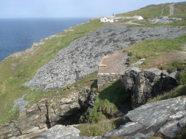
Lambshouse and Gull Point Quarry
Lambshouse and Gull Point Quarries are two disused slate quarries between Tintagel and Trebarwith at Lambshouse Cove on the north coast of Cornwall, South...

Long Grass Quarry
Long Grass Quarry (also known as Cliff Quarry) is a small, disused slate quarry between Tintagel and Trebarwith on the north coast of Cornwall, South West...
Penhallick Wharf
Penhallick Wharf is a disused coastal loading dock between Tintagel Castle and Trebarwith Strand on the north coast of Cornwall in South West England....
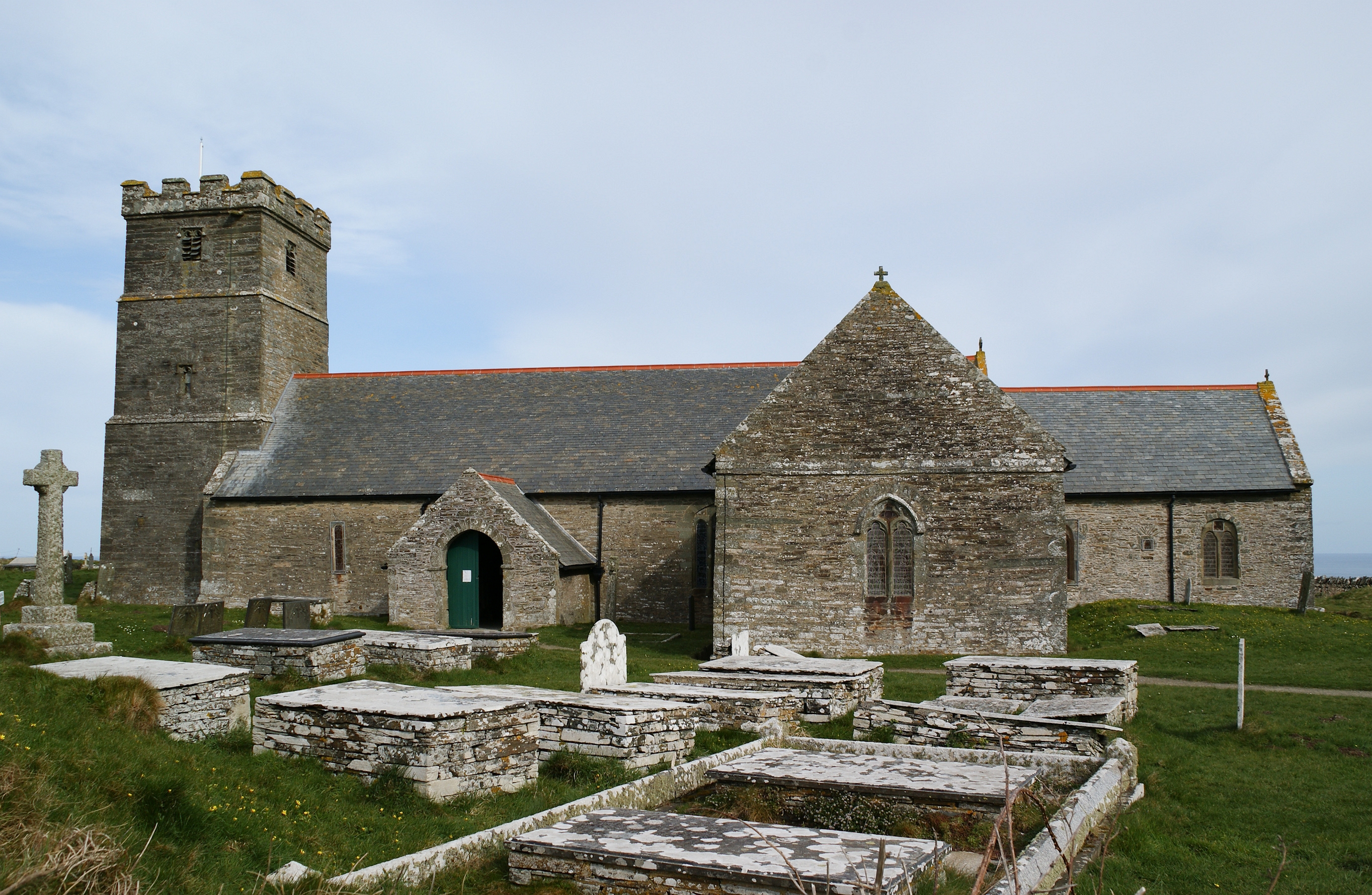
St Materiana's Church, Tintagel
The Parish Church of Saint Materiana at Tintagel is a Church of England parish church in the Church of England Diocese of Truro in Cornwall, England, UK...
Nearby Amenities
Located within 500m of 50.658513,-4.7649543Have you been to Lambshouse Cove?
Leave your review of Lambshouse Cove below (or comments, questions and feedback).