Port Allt a' Ruisteal

Sea, Estuary, Creek in Cromartyshire

Scotland

Port Allt a' Ruisteal

Road passing Fisk Gallery, Polbain Looking south-eastward.
Road passing Fisk Gallery, Polbain Credit: Peter Wood

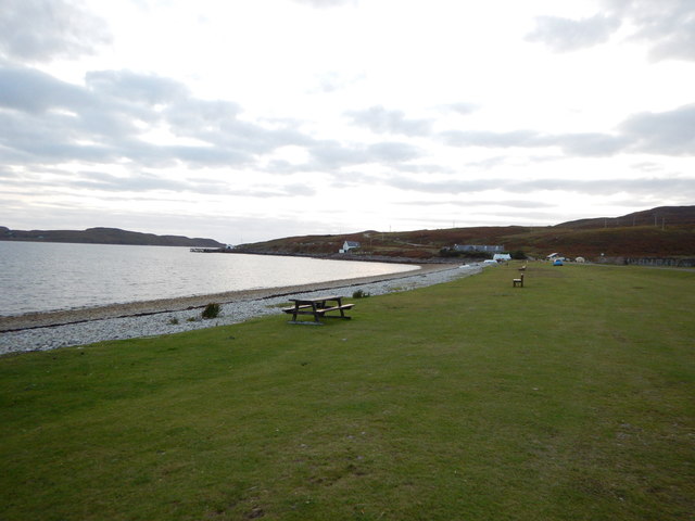
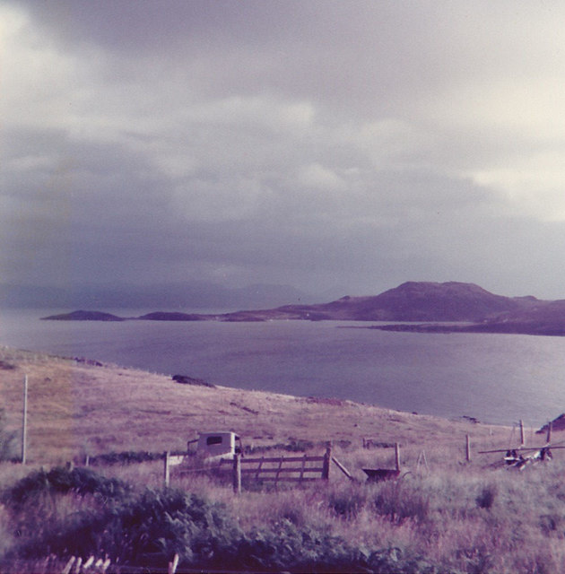
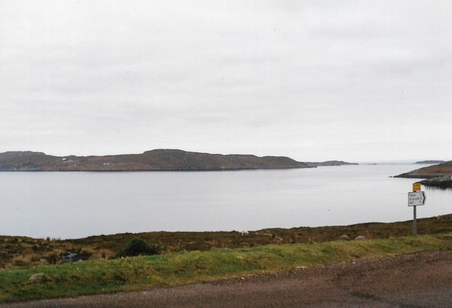
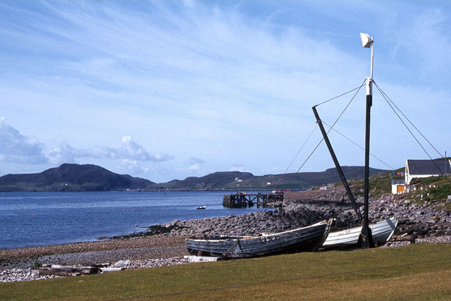
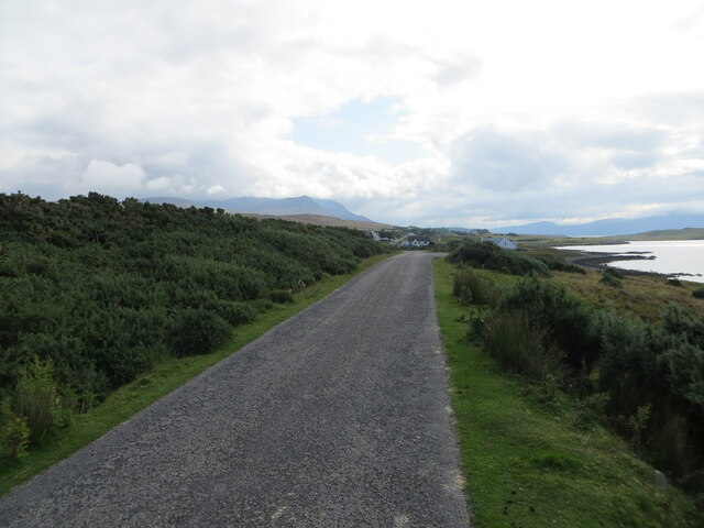
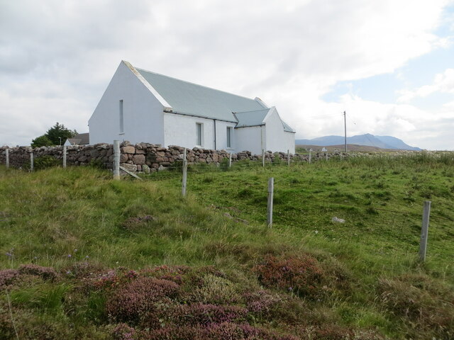
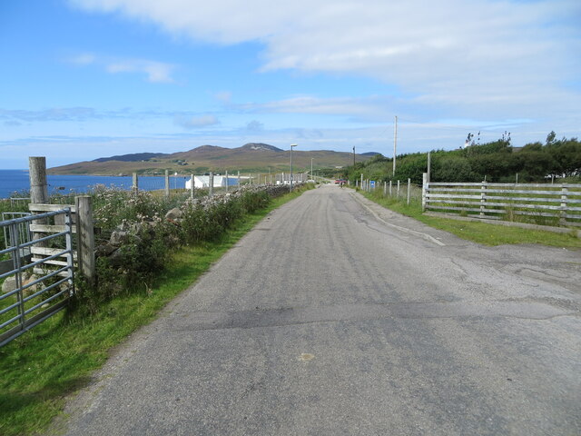
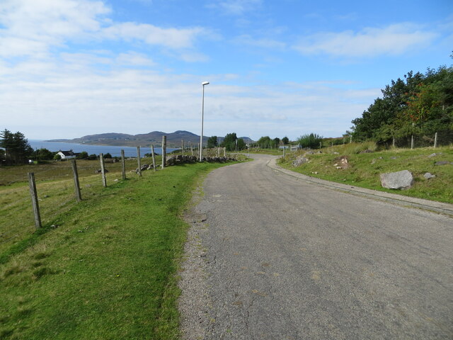
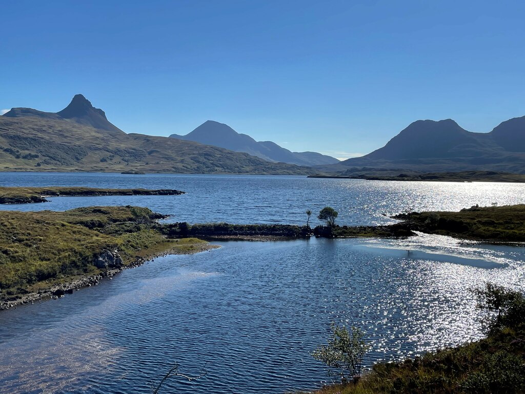
Port Allt a' Ruisteal is a picturesque coastal location situated in Cromartyshire, Scotland. Nestled amidst the stunning natural beauty of the Scottish Highlands, this small port town is renowned for its breathtaking sea, estuary, and creek.

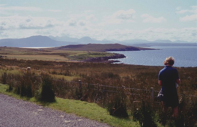
The town's name, Port Allt a' Ruisteal, translates to "the port of the burn of the waterfall," which is a testament to the area's awe-inspiring geography. The sea surrounding Port Allt a' Ruisteal is a mesmerizing blend of deep blues and greens, offering a captivating sight for visitors. The serene and calm waters are a haven for marine life, making it a popular spot for fishing and other water-based activities.

The estuary in Port Allt a' Ruisteal is a haven for birdwatching enthusiasts, as it attracts an array of both local and migratory bird species. The diverse ecosystem of the estuary provides an ideal habitat for wading birds, including herons and curlews, as well as various species of ducks and geese.

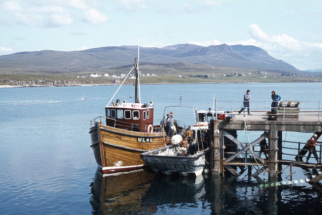
The creek in Port Allt a' Ruisteal is a charming waterway that winds its way through the town, providing a tranquil and picturesque setting for leisurely walks. Lined with lush vegetation and dotted with quaint fishing boats, the creek offers a peaceful escape from the bustling town center.

Overall, Port Allt a' Ruisteal is a hidden gem in Cromartyshire, offering visitors the chance to immerse themselves in the beauty of Scotland's coastal landscape. Whether it's exploring the sea, observing the diverse wildlife in the estuary, or strolling along the peaceful creek, this idyllic location is a must-visit for nature lovers and those seeking a serene and rejuvenating experience.

If you have any feedback on the listing, please let us know in the comments section below.

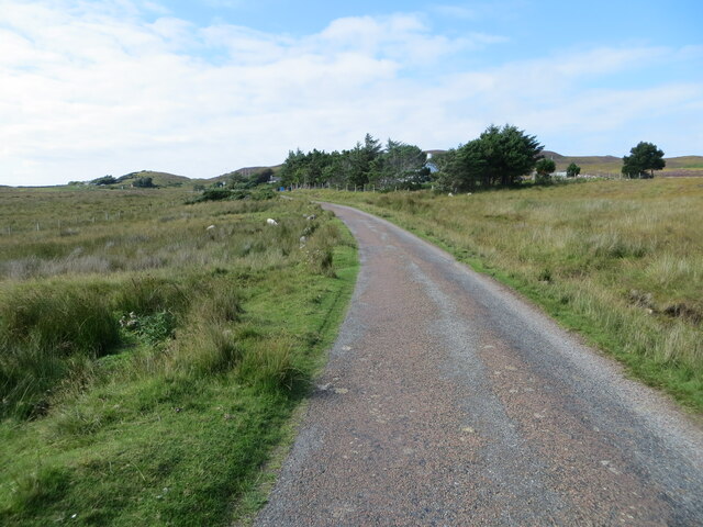
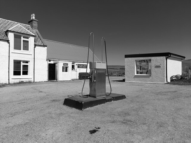
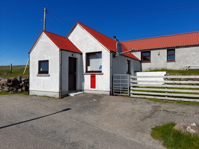
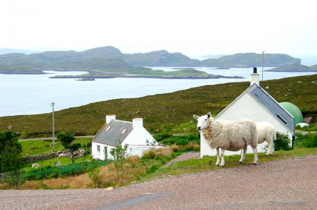
Port Allt a' Ruisteal Images

Images are sourced within 2km of 58.026565/-5.3589424 or Grid Reference NC0109. Thanks to Geograph Open Source API. All images are credited.

Road passing Fisk Gallery, Polbain Looking south-eastward.
Road passing Fisk Gallery, Polbain
Looking south-eastward.
Polbain Beach and Pier
Achilibuie view We stayed in a caravan on a small croft in 1977 with our friends who had another caravan. Both families had two small children and we all enjoyed superb weather for the two weeks we stayed here.
Achilibuie view
We stayed in a caravan on a small croft in 1977 with our friends who had another caravan. Both families had two small children and we all enjoyed superb weather for the two weeks we stayed here.
Badentarbat Bay, Achiltibuie
Boats on the beach near Badentarbat Pier
'MV Hectoria' at Badentarbet Pier, Achiltibuie
Rough pastures at Achiltibuie
Polbain Store
Polbain Store
Polbain Stores, Polbain
Polbain at Polbain Stores
Minor road crossing Fèith Ruadh Looking south-westward.
Minor road crossing Fèith Ruadh
Looking south-westward.
Minor road near to Glac an Eich Bhain Looking south-eastward towards Achiltibuie.
Minor road near to Glac an Eich Bhain
Looking south-eastward towards Achiltibuie.
Coigach Free Church, Achiltibuie Viewed from the west.
Coigach Free Church, Achiltibuie
Viewed from the west.
The road through Achiltibuie Looking north-westward.
The road through Achiltibuie
Looking north-westward.
Road between Polglass and Achiltibuie Looking north-westward.
Road between Polglass and Achiltibuie
Looking north-westward.
Minor road approaching Blair Looking north-westward.
Minor road approaching Blair
Looking north-westward.
Study of a Gasoline Station Achiltibuie Stores, Achiltibuie.

 This photograph is part of a series taken in homage to the American artist Ed Ruscha's 1963 publication of 'Twentysix Gasoline Stations'.
 More properly known as filling stations in the UK, I am attempting to photograph as many as possible to mark the sixty year anniversary.
Study of a Gasoline Station
Achiltibuie Stores, Achiltibuie. This photograph is part of a series taken in homage to the American artist Ed Ruscha's 1963 publication of 'Twentysix Gasoline Stations'. More properly known as filling stations in the UK, I am attempting to photograph as many as possible to mark the sixty year anniversary.
Post Office, Achiltibuie Taken on a glorious day showing off the divine colour of that roof!
Post Office, Achiltibuie
Taken on a glorious day showing off the divine colour of that roof!
Show me another place!

Port Allt a' Ruisteal is located at Grid Ref: NC0109 (Lat: 58.026565, Lng: -5.3589424)

Unitary Authority: Highland

Police Authority: Highlands and Islands

What 3 Words

///values.petulant.script. Near Ullapool, Highland

Related Wikis

Badentarbat Bay

Badentarbat Bay, or Badentarbet Bay, is a bay in northern Scotland. The village of Achiltibuie overlooks it. Marian Leven painted scenes of the bay....

Polbain

Polbain is a remote crofting township, located on the north Badentarbat Bay on the west coast of Scotland, in western Ross-shire, Scottish Highlands and...

Achiltibuie

Achiltibuie (; Scottish Gaelic: Achd Ille Bhuidhe or Field of the yellow-haired boy) is a long linear village in Ross and Cromarty, Highland, on the Coigach...

Coigach

Coigach (Scottish Gaelic: A' Chòigeach) is a peninsula north of Ullapool, in Wester Ross in the Northwest Highlands of Scotland. The area consists of a...
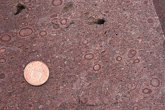
Stac Fada Member

The Stac Fada Member is a distinctive layer towards the top of the Mesoproterozoic Bay of Stoer Formation, part of the Stoer Group (lowermost Torridonian...

Polglass

Polglass (Scottish Gaelic: Am Poll Glas) is a long crofting township, lying on the north shore of the sea loch, Loch Broom in Ullapool Ross-shire, Scottish...

Tanera Mòr

Tanera Mòr (Scottish Gaelic: Tannara Mòr) is a sporadically inhabited island in Loch Broom in the Inner Hebrides of Scotland, the largest of the Summer...

Loch Osgaig

Loch Osgaig (Loch Owskeich) is a small remote and deep freshwater loch, orientated on north-west to south-east axis, that is located 1 miles south of Enard...

Nearby Amenities

Located within 500m of 58.026565,-5.3589424
Source: PGS
Lat/Long: 58.029413/-5.3650055
Source: PGS
Lat/Long: 58.028918/-5.3635678
Source: PGS
Lat/Long: 58.0283474/-5.3621024
Source: PGS
Lat/Long: 58.0281071/-5.3618464
Source: PGS
Lat/Long: 58.0278863/-5.3610086
Source: PGS
Lat/Long: 58.0271938/-5.3596705
Source: PGS
Lat/Long: 58.0260289/-5.3581073
Source: PGS
Lat/Long: 58.0262649/-5.3574415
Source: PGS
Lat/Long: 58.0258625/-5.3578421
Source: PGS
Lat/Long: 58.0251493/-5.3571446
Source: PGS
Lat/Long: 58.0246362/-5.3562654
Source: PGS
Lat/Long: 58.0240365/-5.3559655
Source: PGS
Lat/Long: 58.0233442/-5.3559059
Source: PGS
Lat/Long: 58.0232286/-5.3552686
Power: pole
Lat/Long: 58.0309769/-5.3599176
Power: pole
Lat/Long: 58.0306205/-5.3612304
Fuel
Fuel Diesel: yes
Fuel Octane 95: yes
Lat/Long: 58.025801/-5.3533213
Toilets
Fee: no
Female: yes
Male: yes
Operator: Highland Council
Wheelchair: yes
Lat/Long: 58.030035/-5.361161
Barrier: cattle_grid
Lat/Long: 58.024666/-5.3524693
Historic: memorial
Memorial: war_memorial
Lat/Long: 58.0266991/-5.3562727
Power: pole
Lat/Long: 58.0257313/-5.3514683
Power: pole
Lat/Long: 58.0260466/-5.3519753
Power: pole
Lat/Long: 58.0265721/-5.3528202
Power: pole
Lat/Long: 58.0270351/-5.3535524
Power: pole
Lat/Long: 58.0275195/-5.3545073
Power: pole
Lat/Long: 58.0283503/-5.356181
Power: pole
Lat/Long: 58.0288076/-5.3570634
Power: pole
Lat/Long: 58.0292209/-5.3578922
Power: pole
Lat/Long: 58.0296853/-5.3588498
Power: pole
Lat/Long: 58.0301802/-5.3598113
Power: pole
Lat/Long: 58.0306553/-5.3607595
Power: pole
Lat/Long: 58.0307999/-5.3608711
The data included in this document is from www.openstreetmap.org. The data is made available under ODbL.

Have you been to Port Allt a' Ruisteal?

Leave your review of Port Allt a' Ruisteal below (or comments, questions and feedback).