Battramsley

Settlement in Hampshire New Forest

England

Battramsley

Path on Setley Plain
Path on Setley Plain Credit: David Martin

Battramsley is a small village located in the New Forest district of Hampshire, England. Situated approximately 5 miles southwest of the town of Lymington, Battramsley is nestled within the beautiful countryside of the New Forest National Park.

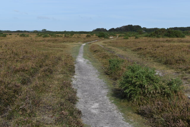
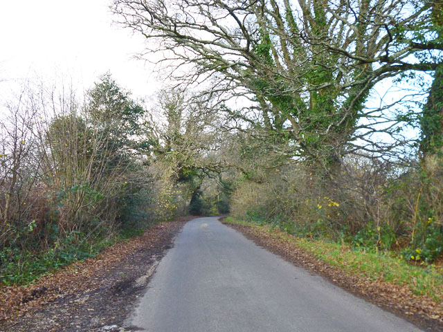
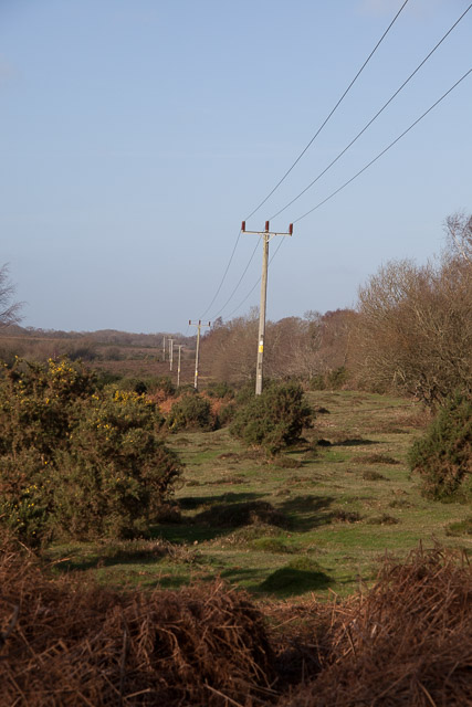
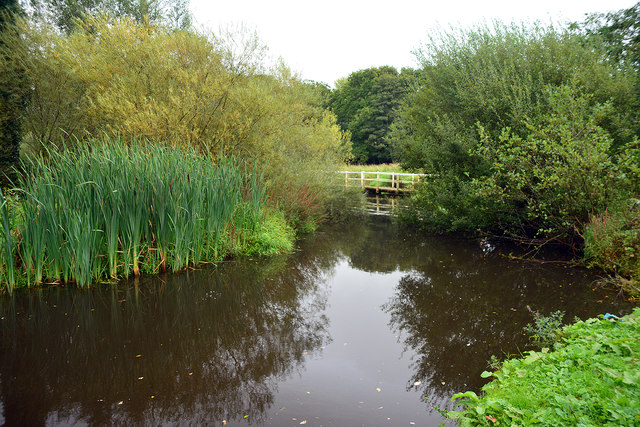
The village is known for its peaceful and picturesque surroundings, with stunning views of open fields, woodlands, and heathlands. It offers a tranquil escape from the hustle and bustle of city life, attracting nature enthusiasts and visitors seeking a rural retreat.

Battramsley is home to a small population, with a tight-knit community that cherishes its rural lifestyle. The village primarily consists of charming cottages and farmhouses, adding to its traditional and rustic appeal.

Surrounded by nature reserves and walking trails, Battramsley offers ample opportunities for outdoor activities. Visitors can enjoy exploring the New Forest on foot, horseback, or by cycling along the numerous paths that crisscross the area. The nearby Solent coast is also easily accessible, providing opportunities for water sports and coastal walks.

While Battramsley itself does not have many amenities, the nearby town of Lymington offers a range of facilities including shops, restaurants, and a marina. This makes it convenient for residents to access essential services and provides a hub for social activities.

Overall, Battramsley is a quintessentially English village that offers a tranquil escape into nature. Its idyllic setting, friendly community, and proximity to the New Forest and Solent coast make it an attractive destination for those seeking a peaceful retreat or a base for exploring the surrounding natural beauty.

If you have any feedback on the listing, please let us know in the comments section below.
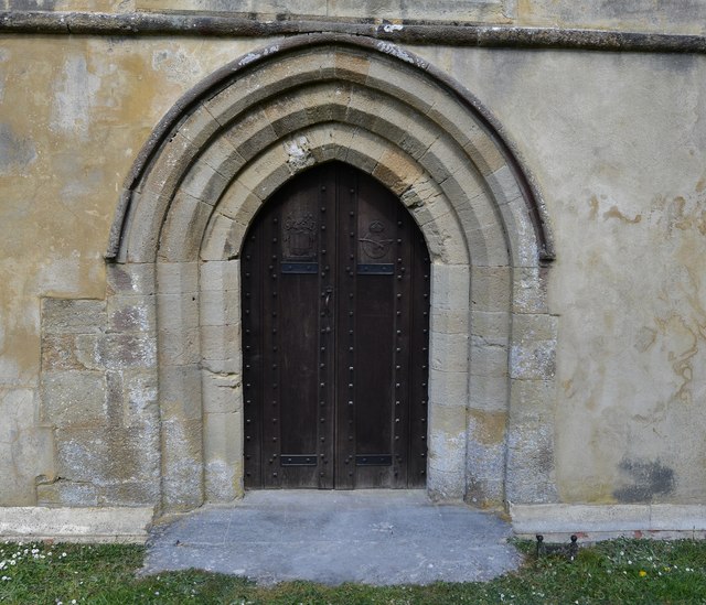
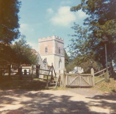
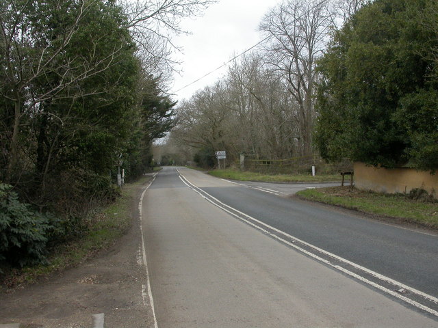
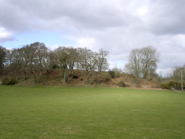
Battramsley Images

Images are sourced within 2km of 50.786319/-1.562259 or Grid Reference SZ3098. Thanks to Geograph Open Source API. All images are credited.

Path on Setley Plain
View across Milking Pound Bottom Low-lying land southwest of the railway embankment, which is just visible on the far slope.
View across Milking Pound Bottom
Low-lying land southwest of the railway embankment, which is just visible on the far slope.
Rodlease Lane Rodlease House is a little further on, to the right.
Rodlease Lane
Rodlease House is a little further on, to the right.
Boldre church The remotely situated church of St. John the Baptist, with a surprisingly large and well filled churchyard.
Boldre church
The remotely situated church of St. John the Baptist, with a surprisingly large and well filled churchyard.
33KV  electricity lines along Milking Pound Bottom Running parallel to the railway line, which is to the right of the lines.
33KV electricity lines along Milking Pound Bottom
Running parallel to the railway line, which is to the right of the lines.
Former Ford at Boldre This ford on Shallow Lane on the Lymington River does not look to have been used for some time.
Former Ford at Boldre
This ford on Shallow Lane on the Lymington River does not look to have been used for some time.
New Forest: Rodlease Rough
Boldre, St. John the Baptist's Church: The west doorway 1
Boldre, St. John the Baptist's Church: The west doorway 2
Boldre, St. John the Baptist's Church: HMS Hood memorial 1
Boldre, St. John the Baptist's Church: HMS Hood memorial 2
Boldre, St. John the Baptist's Church: HMS Hood memorial 3
Boldre, St. John the Baptist's Church: The nave
Boldre, St. John the Baptist's Church: Norman arches in the south aisle
Boldre, St. John the Baptist's Church: The pulpit designed by Norman Shaw 1
Boldre, St. John the Baptist's Church: The chancel
Boldre, St. John the Baptist's Church: The nave from the chancel
Boldre, St. John the Baptist's Church: Narrow passage by the south aisle
Show me another place!

Battramsley is located at Grid Ref: SZ3098 (Lat: 50.786319, Lng: -1.562259)

Administrative County: Hampshire

District: New Forest

Police Authority: Hampshire

What 3 Words

///retraced.petition.zips. Near Sway, Hampshire

Related Wikis

Shirley Holms Halt railway station

Shirley Holms Halt was a railway halt in the New Forest district of Hampshire. Opened in 1860 it was closed in 1888 with opening of Sway on the South West...

Boldre

Boldre is a village and civil parish in the New Forest district of Hampshire, England. It is in the south of the New Forest National Park, above the broadening...

Battramsley

Battramsley is a hamlet in the civil parish of Boldre, in the New Forest in Hampshire, England. == Overview == Battramsley is a hamlet located just west...

A337 road

The A337 road is a road in southern England that runs from the M27 motorway in Hampshire to Christchurch in Dorset. == Route of Road == The A337 begins...

Ampress Works Halt railway station

Ampress Works Halt was a halt station on the Lymington Branch Line which, between 1956 and 1989, served the Wellworthy engineering works near Lymington...

Buckland Rings

Buckland Rings is the site of an Iron Age hill fort in the town of Lymington, Hampshire. Today, the mounds and dykes around the outside which once constituted...

Roydon Woods

Roydon Woods is a 294.9-hectare (729-acre) biological Site of Special Scientific Interest near Brockenhurst in Hampshire. It is a nature reserve managed...

Pilley, Hampshire

Pilley is a small village in the civil parish of Boldre, in the New Forest national park in Hampshire, England. Pilley is located 2 miles north of the...

Nearby Amenities

Located within 500m of 50.786319,-1.562259
Bus Stop
Boldre Grange
Bench: no
Bin: no
Bus: yes
Naptan AtcoCode: 1900HA080564
Naptan Bearing: NW
Naptan CommonName: Boldre Grange
Naptan NaptanCode: hamajmja
Naptan Street: Southampton Road
Naptan Verified: no
Shelter: no
Source: naptan_import
Tactile Paving: no
Lat/Long: 50.787114/-1.5631306
Bus Stop
Boldre Grange
Bus: yes
Naptan AtcoCode: 1900HA080565
Naptan Bearing: SE
Naptan CommonName: Boldre Grange
Naptan NaptanCode: hamajmjg
Naptan Street: Southampton Road
Naptan Verified: no
Source: naptan_import
Lat/Long: 50.7871587/-1.563045
Bus Stop
Battramsley Cross Roads
Bench: no
Bin: no
Bus: yes
Naptan AtcoCode: 1900HA080566
Naptan Bearing: N
Naptan CommonName: Battramsley Cross Roads
Naptan Crossing: Southampton Road
Naptan NaptanCode: hamajmtp
Naptan Street: Shirley Holms
Naptan Verified: no
Shelter: no
Source: naptan_import
Tactile Paving: no
Lat/Long: 50.7838845/-1.5604512
Bus Stop
Battramsley Cross Roads
Bus: yes
Naptan AtcoCode: 1900HA080567
Naptan Bearing: S
Naptan CommonName: Battramsley Cross Roads
Naptan Crossing: Southampton Road
Naptan NaptanCode: hamajmtw
Naptan Street: Shirley Holms
Naptan Verified: no
Source: naptan_import
Lat/Long: 50.7839022/-1.560366
Battramsley Cross
Place: locality
Source: NPE
Source Name: NPE
Lat/Long: 50.7836279/-1.5594721
Post Box
Operator: Royal Mail
Operator Wikidata: Q638098
Ref: SO41 4
Lat/Long: 50.7832268/-1.5587003
Battramsley
Place: hamlet
Lat/Long: 50.7868666/-1.5625715
The data included in this document is from www.openstreetmap.org. The data is made available under ODbL.

Have you been to Battramsley?

Leave your review of Battramsley below (or comments, questions and feedback).