Foxes' Holes

Sea, Estuary, Creek in Pembrokeshire

Wales

Foxes' Holes

Mill Haven
Mill Haven Credit: Deborah Tilley

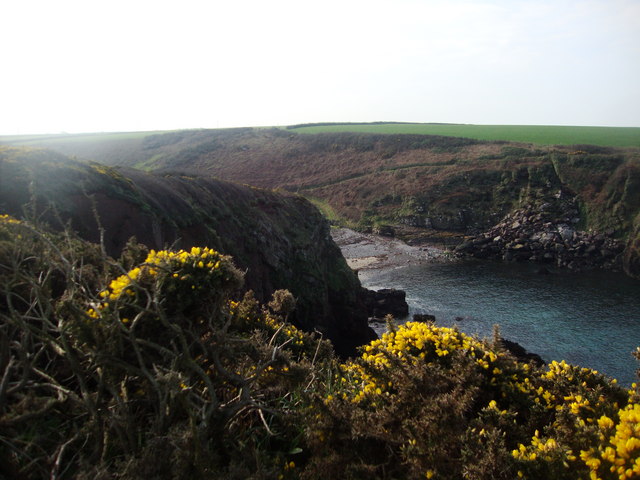
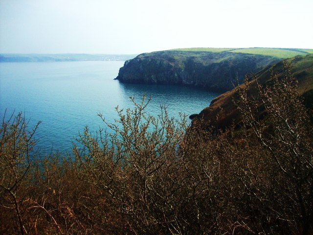
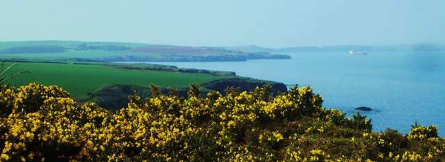
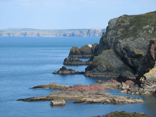
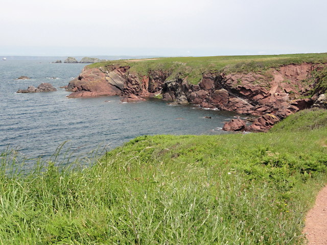
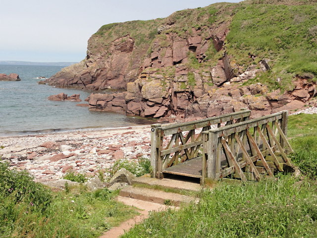
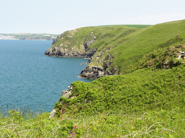
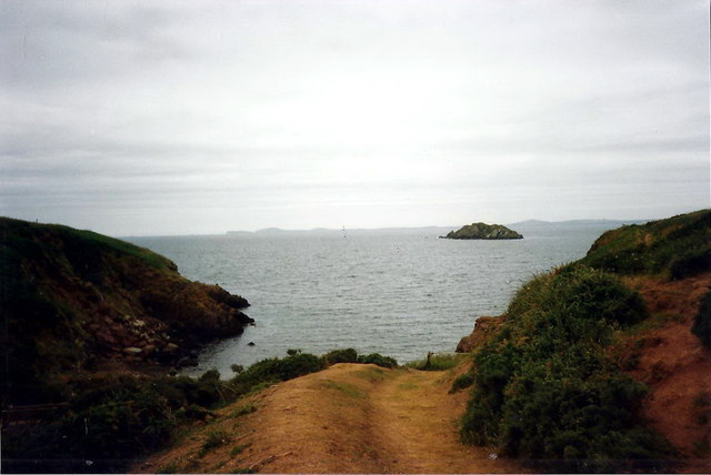
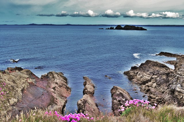
Located in the beautiful county of Pembrokeshire in Wales, Foxes' Holes is a picturesque area encompassing a sea, estuary, and creek. This natural wonder is situated along the dramatic coastline, offering breathtaking views and a diverse ecosystem.

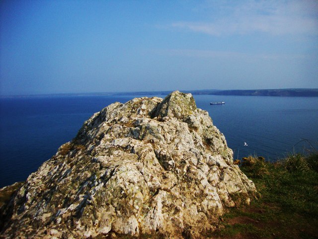
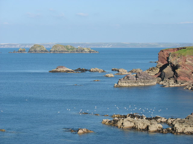
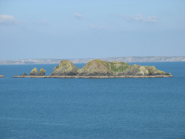
The sea at Foxes' Holes is part of the Celtic Sea, providing an ideal habitat for a wide variety of marine life. The crystal-clear waters are home to an array of fish species, including mackerel, cod, and herring. It is also a popular spot for diving enthusiasts, who are drawn to the area's underwater caves and vibrant coral reefs.

Adjacent to the sea, the estuary at Foxes' Holes is formed by the confluence of a river and the sea. This unique combination of fresh and saltwater creates a rich and fertile environment. The estuary is a haven for numerous bird species, such as herons, oystercatchers, and curlews. Birdwatchers flock to the area to observe these magnificent creatures in their natural habitat.

Finally, the creek at Foxes' Holes meanders through the landscape, creating a tranquil and idyllic setting. Lined with lush vegetation, the creek is a haven for wildlife, including otters, water voles, and kingfishers. Visitors can also enjoy peaceful walks along its banks, immersing themselves in the serene surroundings.

Overall, Foxes' Holes in Pembrokeshire offers a unique blend of sea, estuary, and creek, making it a paradise for nature lovers and outdoor enthusiasts. With its stunning vistas, diverse wildlife, and peaceful ambience, it is a must-visit destination for anyone seeking a true taste of the natural wonders of Wales.

If you have any feedback on the listing, please let us know in the comments section below.

Foxes' Holes Images

Images are sourced within 2km of 51.768826/-5.1656068 or Grid Reference SM8112. Thanks to Geograph Open Source API. All images are credited.

Mill Haven
Mill Haven
Rocky outcrop at Ticklas Point Looking over the bay towards Broad Haven and Nolton Haven.
Rocky outcrop at Ticklas Point
Looking over the bay towards Broad Haven and Nolton Haven.
Looking to Borough Head Viewed across the cove known as Holywell.
Looking to Borough Head
Viewed across the cove known as Holywell.
Lane to Broadmoor Farm
View to Nab Head Looking across the bay to Huntsmans Leap and the tip of Nab Head, an important Mesolithic flint working site (which was considerably inland during that era). Seen from the path above Mill Haven.
View to Nab Head
Looking across the bay to Huntsmans Leap and the tip of Nab Head, an important Mesolithic flint working site (which was considerably inland during that era). Seen from the path above Mill Haven.
Pembrokeshire coast near Halfway Rock The prominent islands on the left, about 1.5 kilometres away, are Stack Rocks.
Pembrokeshire coast near Halfway Rock
The prominent islands on the left, about 1.5 kilometres away, are Stack Rocks.
Stack Rocks In the distance, about 12 kilometres away, the village of Solva is seen on the left.
Stack Rocks
In the distance, about 12 kilometres away, the village of Solva is seen on the left.
The Pembrokeshire Coast Path west of Mill Haven This sculpture, the 'rock with the hole', is about 300 metres west of Mill Haven. Looking through the hole, it seemed to be aligned with Carnllundain <a href="https://www.geograph.org.uk/gridref/SM6923">SM6923</a>, the high point of Ramsey Island about 16km away, but the alignment was not precise enough for me to tell whether it was deliberate or accidental.
The Pembrokeshire Coast Path west of Mill Haven
This sculpture, the 'rock with the hole', is about 300 metres west of Mill Haven. Looking through the hole, it seemed to be aligned with Carnllundain SM6923, the high point of Ramsey Island about 16km away, but the alignment was not precise enough for me to tell whether it was deliberate or accidental.
Pembrokeshire coast near Mill Haven
Barn covered in creepers at Upper Ripperston Farm Looking west towards St Brides.
Barn covered in creepers at Upper Ripperston Farm
Looking west towards St Brides.
Tractor at Windmill Park Looking west towards St Brides.  The battlements of the 19th Century St Brides Castle can be seen in the background.
Tractor at Windmill Park
Looking west towards St Brides. The battlements of the 19th Century St Brides Castle can be seen in the background.
Wheat fields ready for harvest at Windmill Park Looking west from the gateway on the lane near the farm buildings.  St Brides Haven and the cliffs at Huntsman's Leap can be seen in the background.
Wheat fields ready for harvest at Windmill Park
Looking west from the gateway on the lane near the farm buildings. St Brides Haven and the cliffs at Huntsman's Leap can be seen in the background.
Warey Haven Looking over low sandstone cliffs.
Warey Haven
Looking over low sandstone cliffs.
Mill Haven An empty pebble beach flanked by red sandstone cliffs.
Mill Haven
An empty pebble beach flanked by red sandstone cliffs.
Looking Towards Ticklas Point A view of the coastal slope looking east towards the buttress of Ticklas Point.
Looking Towards Ticklas Point
A view of the coastal slope looking east towards the buttress of Ticklas Point.
The Coast Path to Borough Head Nice level walking on the approach to Borough Head.
The Coast Path to Borough Head
Nice level walking on the approach to Borough Head.
Mill Haven Llwybr cyhoeddus yn arwain at Mill Haven. Stack Rocks yw enw'r creigiau mas yn y mor. 

A public footpath heading towards Mill Haven. The rocks in the distance are known as Stack Rocks.
Mill Haven
Llwybr cyhoeddus yn arwain at Mill Haven. Stack Rocks yw enw'r creigiau mas yn y mor. A public footpath heading towards Mill Haven. The rocks in the distance are known as Stack Rocks.
Coast Path Near Mill Haven Looking northwest across St Brides Bay with Stack Rocks visible nearby
Coast Path Near Mill Haven
Looking northwest across St Brides Bay with Stack Rocks visible nearby
Show me another place!

Foxes' Holes is located at Grid Ref: SM8112 (Lat: 51.768826, Lng: -5.1656068)

Unitary Authority: Pembrokeshire

Police Authority: Dyfed Powys

What 3 Words

///embedded.hindered.ballooned. Near Broad Haven, Pembrokeshire

Related Wikis

RAF Talbenny

Royal Air Force Talbenny, or more simply RAF Talbenny, is a former Royal Air Force station located 5.6 miles (9.0 km) north west of Milford Haven, Pembrokeshire...

St Brides

St Brides (Welsh: Sain Ffraid) is a parish and small coastal village in Pembrokeshire, Wales, at the south of St Brides Bay, about 1+1⁄2 miles (2.4 km...
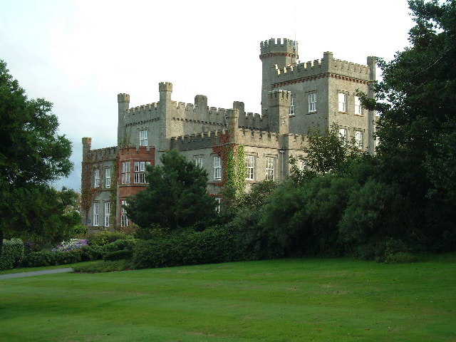
St Brides Castle

St Brides Castle is a 19th-century castellated baronial-style mansion in the parish of St Brides and the community of Marloes and St Brides, Pembrokeshire...

Marloes and St Brides

Marloes and St. Brides (Welsh: Marloes a Sain Ffraid) is a community in the West Wales county of Pembrokeshire. The main settlements are the villages of...

Nearby Amenities

Located within 500m of 51.768826,-5.1656068
Power: pole
Lat/Long: 51.7646382/-5.1636484
Historic: monument
Lat/Long: 51.7670252/-5.1703466
The data included in this document is from www.openstreetmap.org. The data is made available under ODbL.

Have you been to Foxes' Holes?

Leave your review of Foxes' Holes below (or comments, questions and feedback).