Mill Haven

Bay in Pembrokeshire

Wales

Mill Haven

A view of St Brides Bay Looking in the direction of Newgale. Stack Rocks are prominent in the Bay.
A view of St Brides Bay Credit: Deborah Tilley

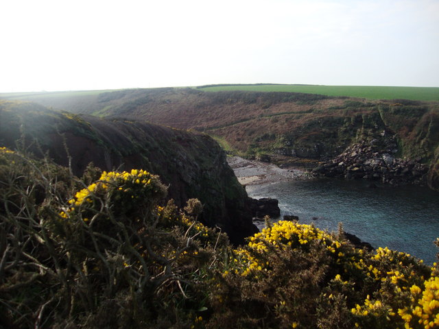
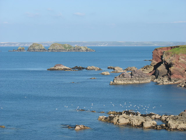
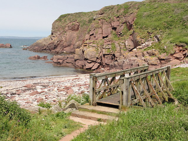
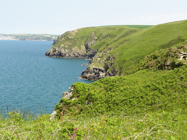
Mill Haven is a small coastal village located in the county of Pembrokeshire, Wales. Situated in the southwestern part of the country, the village is nestled within the stunning Pembrokeshire Coast National Park, renowned for its outstanding natural beauty. Mill Haven is positioned on the northern shore of St. Brides Bay, offering breathtaking views of the Atlantic Ocean.

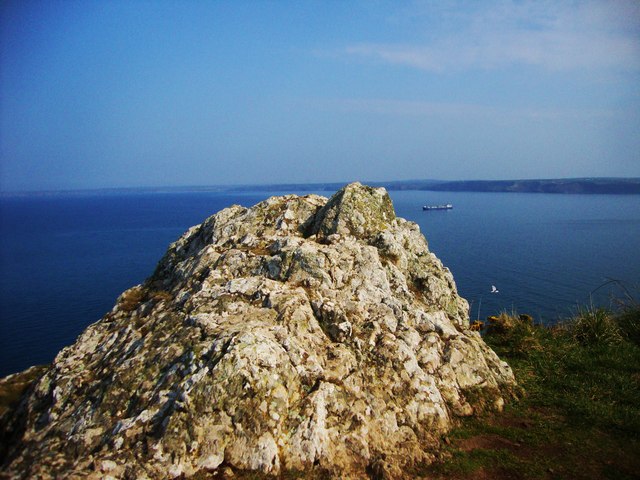
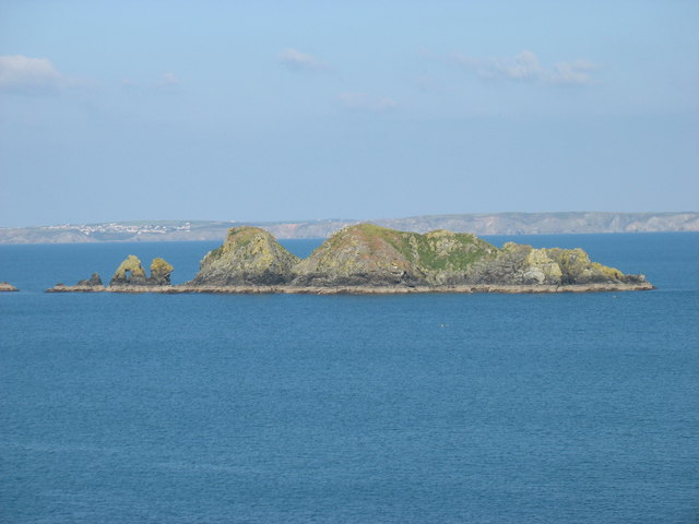
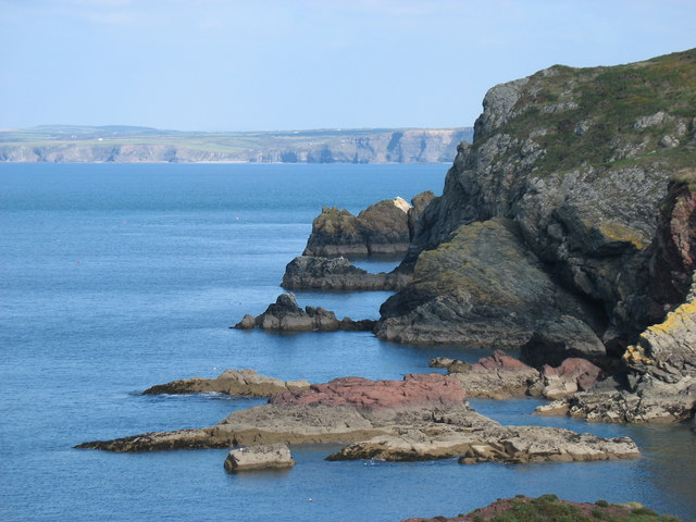
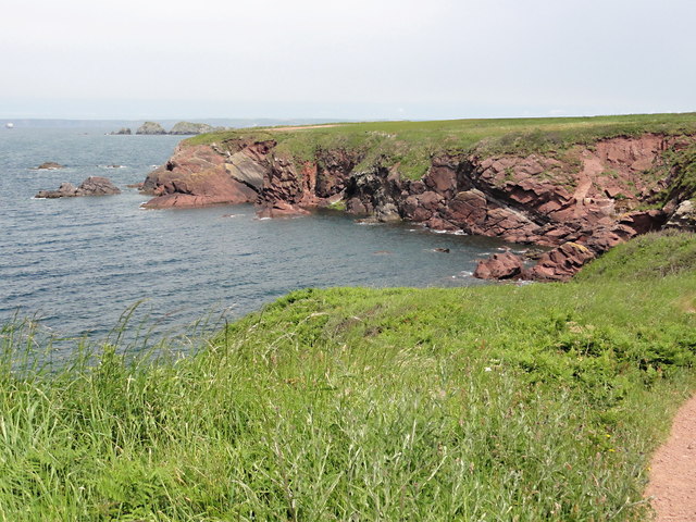
The village is characterized by its idyllic setting, with rolling green hills, rugged cliffs, and sandy beaches. The coastline is dotted with small coves and rocky outcrops, providing opportunities for exploration and coastal walks. Mill Haven itself is a peaceful and charming village, with a small population and a close-knit community.

Despite its tranquility, Mill Haven has a rich history. The village's name is derived from the watermill that once stood on the river that flows through the area. Today, remnants of the mill can still be seen, adding to the village's character. Mill Haven is also known for its connection to the maritime industry, with a long history of fishing and boatbuilding.

The area surrounding Mill Haven offers a range of outdoor activities for visitors to enjoy, including hiking, birdwatching, and water sports such as kayaking and sailing. The Pembrokeshire Coast Path, a famous long-distance trail, passes through the village, providing access to the stunning coastal scenery.

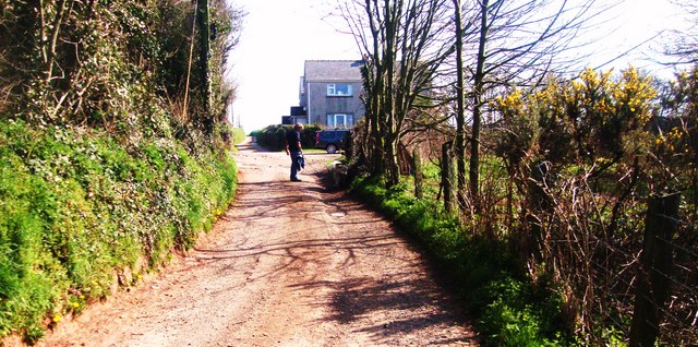
In terms of amenities, Mill Haven is a relatively quiet village, with limited facilities. However, nearby towns such as Milford Haven and Haverfordwest offer a wider range of services, including shops, restaurants, and accommodations.

Overall, Mill Haven is a picturesque coastal village that provides a peaceful retreat and serves as a gateway to the natural wonders of Pembrokeshire's coastline.

If you have any feedback on the listing, please let us know in the comments section below.

Mill Haven Images

Images are sourced within 2km of 51.767558/-5.1666052 or Grid Reference SM8112. Thanks to Geograph Open Source API. All images are credited.

A view of St Brides Bay Looking in the direction of Newgale. Stack Rocks are prominent in the Bay.
A view of St Brides Bay
Looking in the direction of Newgale. Stack Rocks are prominent in the Bay.
Mill Haven
Mill Haven
Rocky outcrop at Ticklas Point Looking over the bay towards Broad Haven and Nolton Haven.
Rocky outcrop at Ticklas Point
Looking over the bay towards Broad Haven and Nolton Haven.
Lane to Broadmoor Farm
View to Nab Head Looking across the bay to Huntsmans Leap and the tip of Nab Head, an important Mesolithic flint working site (which was considerably inland during that era). Seen from the path above Mill Haven.
View to Nab Head
Looking across the bay to Huntsmans Leap and the tip of Nab Head, an important Mesolithic flint working site (which was considerably inland during that era). Seen from the path above Mill Haven.
Pembrokeshire coast near Halfway Rock The prominent islands on the left, about 1.5 kilometres away, are Stack Rocks.
Pembrokeshire coast near Halfway Rock
The prominent islands on the left, about 1.5 kilometres away, are Stack Rocks.
Stack Rocks In the distance, about 12 kilometres away, the village of Solva is seen on the left.
Stack Rocks
In the distance, about 12 kilometres away, the village of Solva is seen on the left.
The Pembrokeshire Coast Path west of Mill Haven This sculpture, the 'rock with the hole', is about 300 metres west of Mill Haven. Looking through the hole, it seemed to be aligned with Carnllundain <a href="https://www.geograph.org.uk/gridref/SM6923">SM6923</a>, the high point of Ramsey Island about 16km away, but the alignment was not precise enough for me to tell whether it was deliberate or accidental.
The Pembrokeshire Coast Path west of Mill Haven
This sculpture, the 'rock with the hole', is about 300 metres west of Mill Haven. Looking through the hole, it seemed to be aligned with Carnllundain SM6923, the high point of Ramsey Island about 16km away, but the alignment was not precise enough for me to tell whether it was deliberate or accidental.
Pembrokeshire coast near Mill Haven
Cliff Cottage Taken from the driveway to St Bride's Castle
Cliff Cottage
Taken from the driveway to St Bride's Castle
Barn covered in creepers at Upper Ripperston Farm Looking west towards St Brides.
Barn covered in creepers at Upper Ripperston Farm
Looking west towards St Brides.
Tractor at Windmill Park Looking west towards St Brides.  The battlements of the 19th Century St Brides Castle can be seen in the background.
Tractor at Windmill Park
Looking west towards St Brides. The battlements of the 19th Century St Brides Castle can be seen in the background.
Wheat fields ready for harvest at Windmill Park Looking west from the gateway on the lane near the farm buildings.  St Brides Haven and the cliffs at Huntsman's Leap can be seen in the background.
Wheat fields ready for harvest at Windmill Park
Looking west from the gateway on the lane near the farm buildings. St Brides Haven and the cliffs at Huntsman's Leap can be seen in the background.
Lime Kiln at St Brides Haven For someone used to finding lime kilns scattered throughout the Yorkshire Dales, the positioning of those around the Pembrokeshire coast seems initially odd as there is no supply of limestone nearby. The reason is that limestone was brought by boat from quarries around the Cleddau estuary to lime kilns in places such as St Brides for the purpose of liming the land.
Lime Kiln at St Brides Haven
For someone used to finding lime kilns scattered throughout the Yorkshire Dales, the positioning of those around the Pembrokeshire coast seems initially odd as there is no supply of limestone nearby. The reason is that limestone was brought by boat from quarries around the Cleddau estuary to lime kilns in places such as St Brides for the purpose of liming the land.
Rocky foreshore at St Brides The shoreline at St Brides haven with Stack Rocks out to sea in the distance.
Rocky foreshore at St Brides
The shoreline at St Brides haven with Stack Rocks out to sea in the distance.
Warey Haven Looking over low sandstone cliffs.
Warey Haven
Looking over low sandstone cliffs.
Mill Haven An empty pebble beach flanked by red sandstone cliffs.
Mill Haven
An empty pebble beach flanked by red sandstone cliffs.
Looking Towards Ticklas Point A view of the coastal slope looking east towards the buttress of Ticklas Point.
Looking Towards Ticklas Point
A view of the coastal slope looking east towards the buttress of Ticklas Point.
Show me another place!

Mill Haven is located at Grid Ref: SM8112 (Lat: 51.767558, Lng: -5.1666052)

Unitary Authority: Pembrokeshire

Police Authority: Dyfed Powys

What 3 Words

///apparatus.bundles.quicker. Near Broad Haven, Pembrokeshire

Related Wikis

RAF Talbenny

Royal Air Force Talbenny, or more simply RAF Talbenny, is a former Royal Air Force station located 5.6 miles (9.0 km) north west of Milford Haven, Pembrokeshire...

St Brides

St Brides (Welsh: Sain Ffraid) is a parish and small coastal village in Pembrokeshire, Wales, at the south of St Brides Bay, about 1+1⁄2 miles (2.4 km...
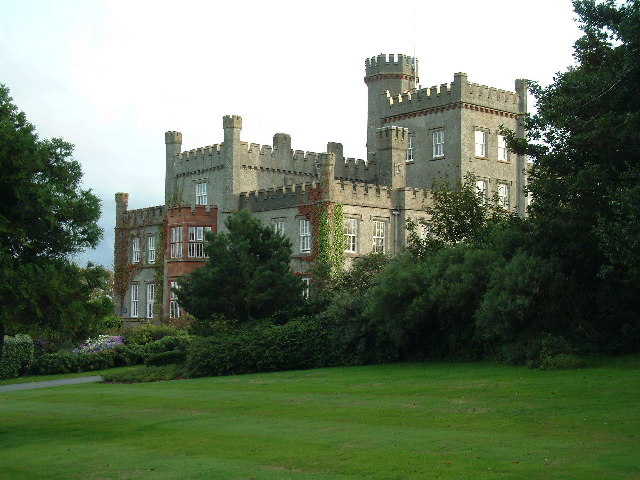
St Brides Castle

St Brides Castle is a 19th-century castellated baronial-style mansion in the parish of St Brides and the community of Marloes and St Brides, Pembrokeshire...

Marloes and St Brides

Marloes and St. Brides (Welsh: Marloes a Sain Ffraid) is a community in the West Wales county of Pembrokeshire. The main settlements are the villages of...

Little and Broad Haven Lifeboat Station

Little and Broad Haven Lifeboat Station is a Royal National Lifeboat Institution (RNLI) lifeboat station in Pembrokeshire, West Wales. The station was...

Marloes

Marloes is a village and parish in Pembrokeshire, Wales, on the Marloes Peninsula 7 miles (11 km) west of Milford Haven and forms the western tip of the...

Little Haven

Little Haven (Welsh: Hafan Fach) is a village at the south-east corner of St Bride's Bay, Pembrokeshire, Wales. It is in the Pembrokeshire Coast National...

Broad Haven

Broad Haven (Welsh: Aberllydan) is a village and seaside resort in the south east corner of St Bride's Bay at the western terminus of the B4341 road in...

Related Videos

Talbenny to Martins Haven via the Pembrokeshire Coast Path. February 2019.

We walked 17km from our Airbnb cottage in Talbenny, along the coastal path to Martins Haven. We were very lucky with the ...

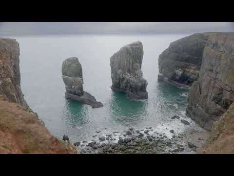
Stack Rocks in Pembrokeshire, Wales 4K TV Art | 1 Hour Ocean Sounds

Experience the rugged beauty of the Elegug Stack Rocks in Pembrokeshire, Wales in stunning 4K resolution. Visit one of the most ...

Pembrokeshire Coast Paddle - St Brides - Pembrokeshire - Wales

A pleasant evening paddle with George and Mike soaking up the last of the Sun from St.Brides in Pembrokeshire. My first decent ...

DJI MINI 2 CINEMATIC SHOTS "ST.BRIDES HAVEN & CASTLE

The DJI mini 2 is capable of capturing gorgeous looking 4k footage and it is easier to color grade in post-production to enhance its ...

Nearby Amenities

Located within 500m of 51.767558,-5.1666052
Power: pole
Lat/Long: 51.7648511/-5.1619955
Power: pole
Lat/Long: 51.7646382/-5.1636484
Power: pole
Lat/Long: 51.7638061/-5.1645579
Historic: monument
Lat/Long: 51.7670252/-5.1703466
The data included in this document is from www.openstreetmap.org. The data is made available under ODbL.

Have you been to Mill Haven?

Leave your review of Mill Haven below (or comments, questions and feedback).