Beagles Hole
Sea, Estuary, Creek in Cornwall
England
Beagles Hole

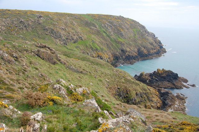
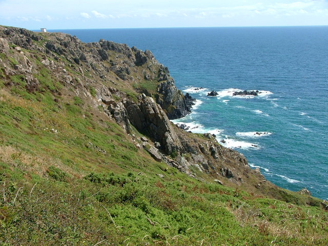
Beagles Hole is a beautiful coastal feature located in Cornwall, England. It is a small, hidden gem nestled between towering cliffs and surrounded by the vast Atlantic Ocean. Known for its stunning sea views, tranquil estuary, and picturesque creek, Beagles Hole is a popular destination for nature enthusiasts and outdoor adventurers.
The sea at Beagles Hole is a sight to behold. Its crystal-clear waters showcase a mesmerizing shade of turquoise, contrasting with the rugged coastline and golden sandy beaches. The crashing waves and salty sea air create a serene ambiance, perfect for those seeking tranquility and relaxation.
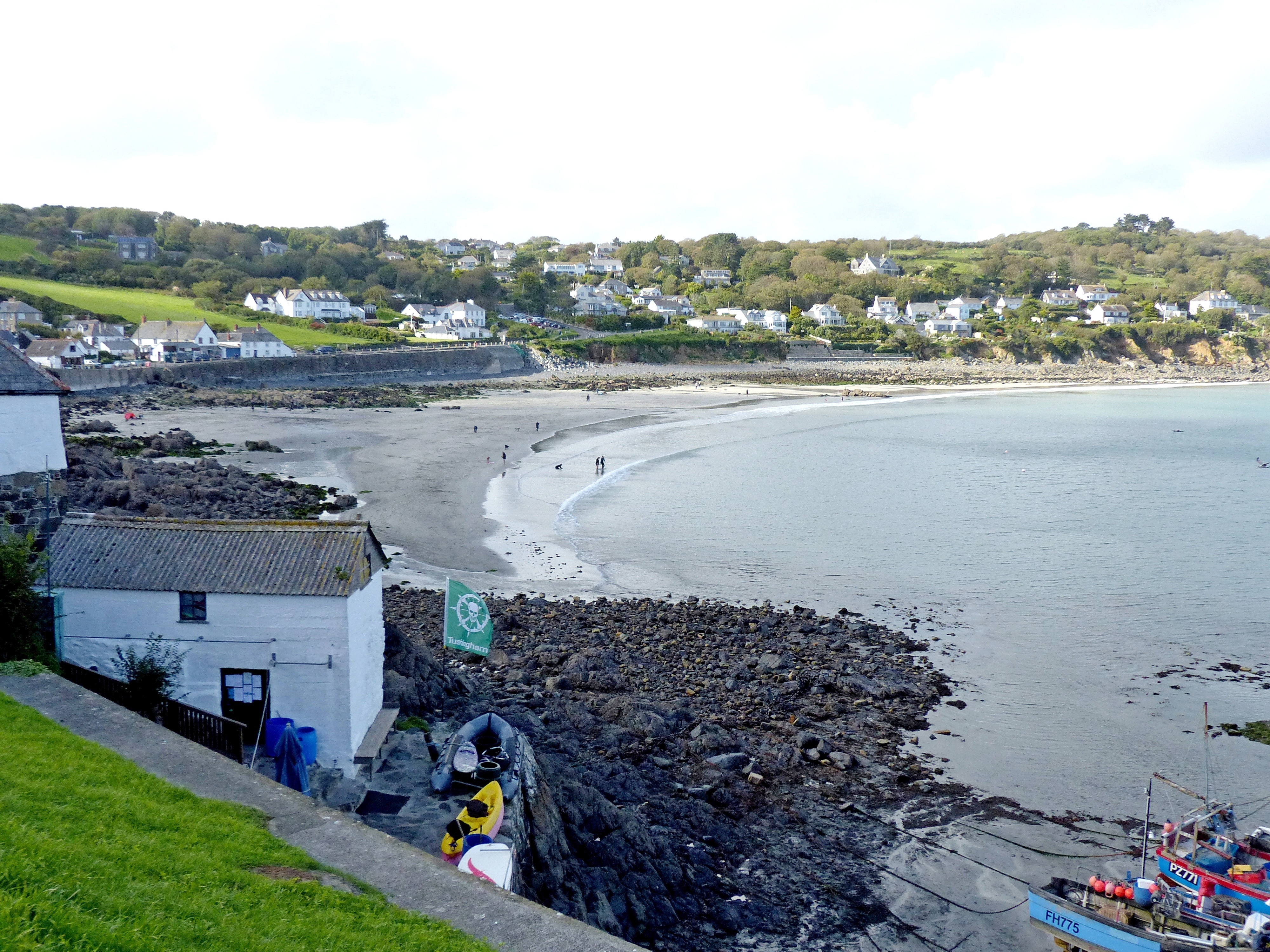
The estuary at Beagles Hole is a haven for wildlife. It provides a vital habitat for a diverse range of flora and fauna, including various species of birds, fish, and crustaceans. Nature lovers can enjoy birdwatching or explore the tidal pools, which are home to an array of fascinating marine creatures.
Nestled within the estuary is the charming creek of Beagles Hole. Its calm, shallow waters make it an ideal spot for kayaking, paddleboarding, or simply taking a refreshing dip. The creek is surrounded by lush greenery and ancient rock formations, creating a serene and picturesque setting.
In addition to its natural beauty, Beagles Hole offers stunning coastal walks and hiking trails, allowing visitors to explore the area further. The nearby cliffs offer breathtaking viewpoints, providing panoramic vistas of the sea, estuary, and surrounding countryside.
Overall, Beagles Hole is a must-visit destination for those seeking a peaceful coastal retreat, offering a unique blend of natural beauty, wildlife, and outdoor activities.
If you have any feedback on the listing, please let us know in the comments section below.
Beagles Hole Images
Images are sourced within 2km of 50.006004/-5.1156065 or Grid Reference SW7616. Thanks to Geograph Open Source API. All images are credited.


Beagles Hole is located at Grid Ref: SW7616 (Lat: 50.006004, Lng: -5.1156065)
Unitary Authority: Cornwall
Police Authority: Devon and Cornwall
What 3 Words
///improvise.victor.fumes. Near Landewednack, Cornwall
Nearby Locations
Related Wikis
Kennack to Coverack
Kennack to Coverack is a coastal Site of Special Scientific Interest (SSSI) on the Lizard Peninsula in Cornwall, England, UK, noted for both its biological...
Coverack
Coverack (Cornish: Porthkovrek, meaning cove of the stream) is a coastal village and fishing port in Cornwall, England. It lies in the parish of St Keverne...

Trelan
Trelan (Cornish: Trelann) is a hamlet in the parish of St Keverne in Cornwall, England, United Kingdom, on the eastern borders of Goonhilly Downs.Trelan...
Gwenter
Gwenter (Cornish: Gwynstir) is a hamlet in the parish of St Keverne (where the 2011 census population was included), Cornwall, England.Gwenter lies within...
Nearby Amenities
Located within 500m of 50.006004,-5.1156065Have you been to Beagles Hole?
Leave your review of Beagles Hole below (or comments, questions and feedback).