Meludjack
Island in Cornwall
England
Meludjack

Meludjack is a small island located off the coast of Cornwall, England. It is situated in the Celtic Sea, approximately 3 miles southwest of Land's End. The island covers an area of about 0.6 square miles and is largely uninhabited, with only a few scattered houses and buildings.
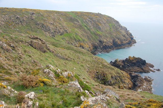
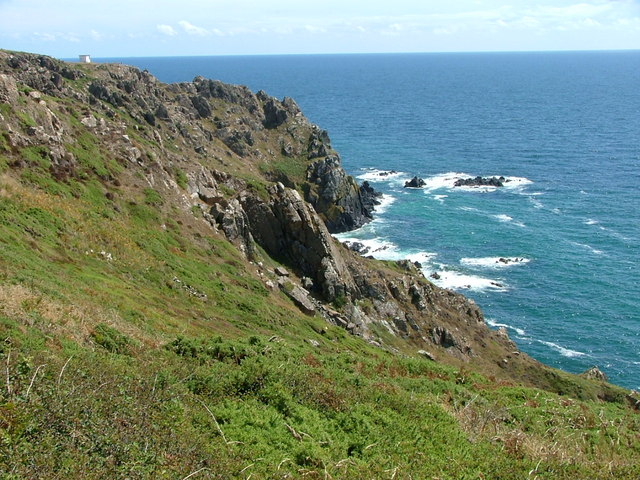
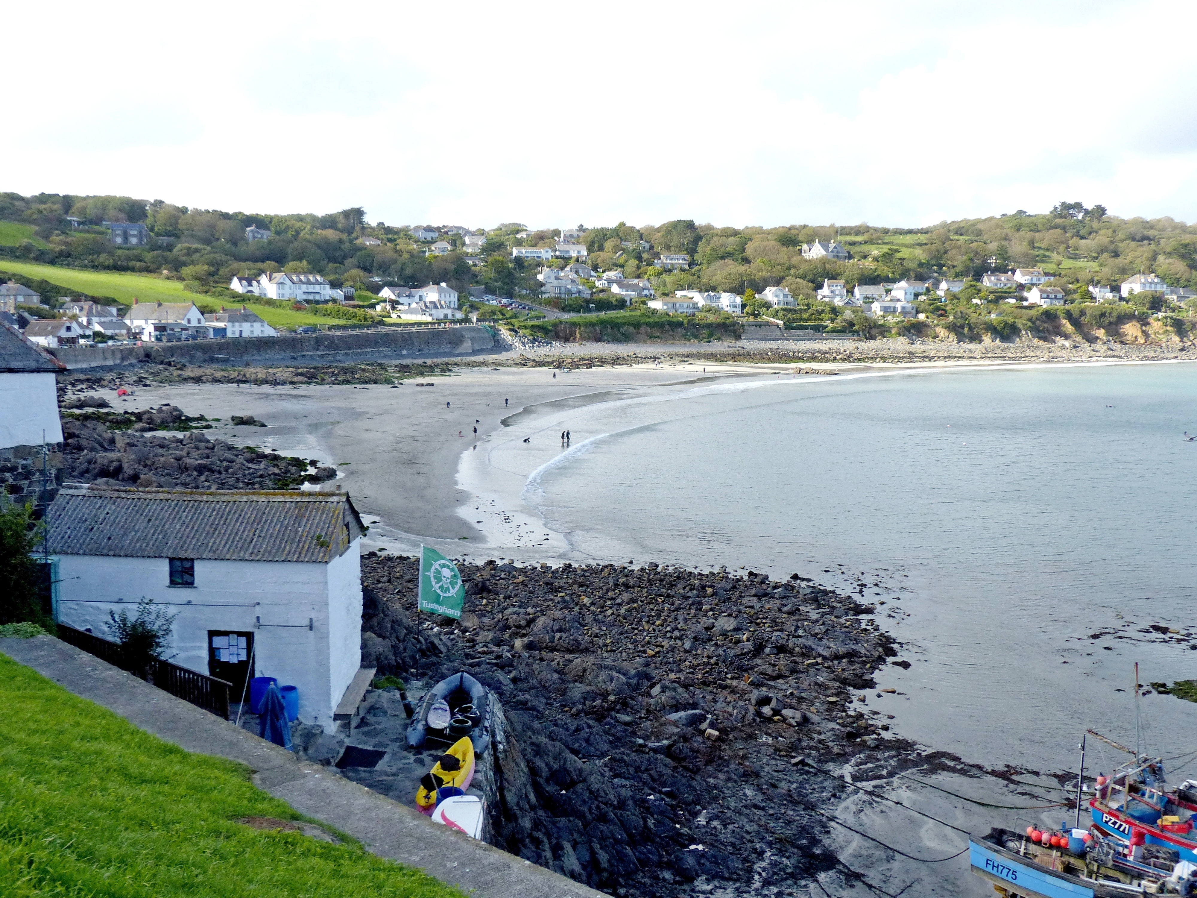
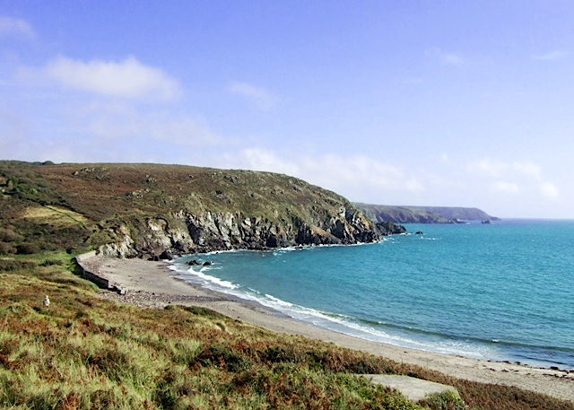
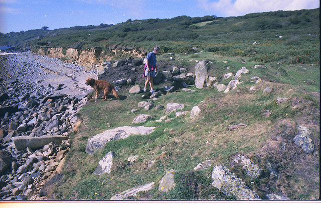
The island is known for its rugged and picturesque landscape, characterized by rocky cliffs, secluded coves, and sandy beaches. It offers breathtaking views of the Atlantic Ocean and is a popular spot for nature lovers and hikers. The island is home to a variety of wildlife, including seabirds, seals, and dolphins, making it a haven for birdwatchers and wildlife enthusiasts.
Visitors to Meludjack can explore the island's walking trails, which meander through its diverse terrain, providing opportunities to discover hidden caves and rock formations. The island's beaches are perfect for sunbathing, picnicking, and even swimming during the warmer months, although the sea can be chilly due to its proximity to the Atlantic.
Despite its small size, Meludjack boasts a rich history. It is believed to have been inhabited since prehistoric times and has archaeological sites that date back thousands of years. The island was also rumored to be a haven for pirates during the 17th and 18th centuries, adding to its allure and intrigue.
Accessible by boat or kayak, Meludjack offers a serene escape from the hustle and bustle of mainland Cornwall. Its untouched beauty and sense of tranquility make it a must-visit destination for those seeking a unique and off-the-beaten-path experience.
If you have any feedback on the listing, please let us know in the comments section below.
Meludjack Images
Images are sourced within 2km of 50.005981/-5.1161076 or Grid Reference SW7616. Thanks to Geograph Open Source API. All images are credited.


Meludjack is located at Grid Ref: SW7616 (Lat: 50.005981, Lng: -5.1161076)
Unitary Authority: Cornwall
Police Authority: Devon and Cornwall
What 3 Words
///duos.paramedic.films. Near Landewednack, Cornwall
Nearby Locations
Related Wikis
Kennack to Coverack
Kennack to Coverack is a coastal Site of Special Scientific Interest (SSSI) on the Lizard Peninsula in Cornwall, England, UK, noted for both its biological...
Coverack
Coverack (Cornish: Porthkovrek, meaning cove of the stream) is a coastal village and fishing port in Cornwall, England. It lies in the parish of St Keverne...

Trelan
Trelan (Cornish: Trelann) is a hamlet in the parish of St Keverne in Cornwall, England, United Kingdom, on the eastern borders of Goonhilly Downs.Trelan...
Gwenter
Gwenter (Cornish: Gwynstir) is a hamlet in the parish of St Keverne (where the 2011 census population was included), Cornwall, England.Gwenter lies within...
Kennack Sands
Kennack Sands is a beach and sand-dune system on the east coast of the Lizard Peninsula, Cornwall, England, UK. == Geography == The beach is approximately...

Three Brothers of Grugith
The Three Brothers of Grugith (Cornish: An Tri Broder a Grugwydh) is a prehistoric site, a dolmen of the Neolithic Age, near St Keverne in Cornwall, England...

Zoar, Cornwall
Zoar (Cornish: Zoara) is a hamlet on the Lizard Peninsula in south Cornwall, England, UK. It is situated 1+1⁄2 miles (2.4 km) northwest of the coastal...
Coverack to Porthoustock
Coverack to Porthoustock is a coastal Site of Special Scientific Interest (SSSI) in Cornwall, England, UK, noted for both its biological and geological...
Nearby Amenities
Located within 500m of 50.005981,-5.1161076Have you been to Meludjack?
Leave your review of Meludjack below (or comments, questions and feedback).