Loch Stornoway

Sea, Estuary, Creek in Argyllshire

Scotland

Loch Stornoway

The house at Carse This is the old road bridge, now by-passed.
The house at Carse Credit: Gordon Brown

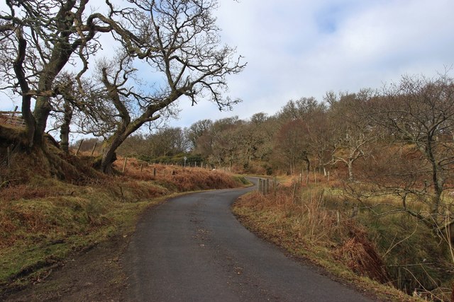
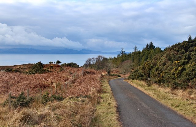
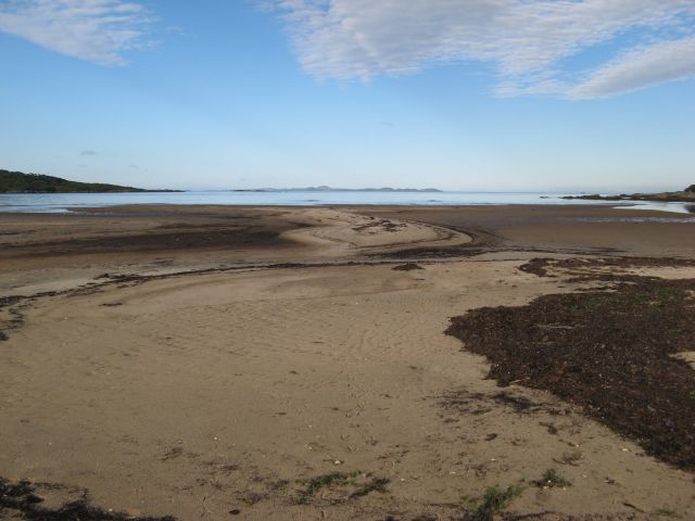
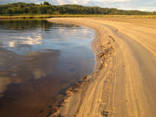
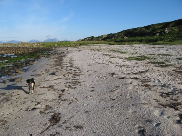
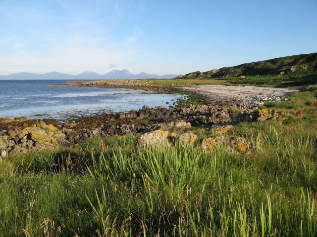
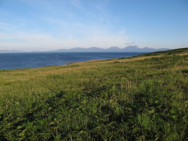
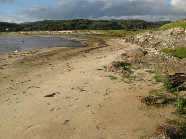
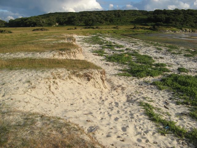
Loch Stornoway, located in Argyllshire, Scotland, is a picturesque body of water that encompasses the characteristics of a sea, estuary, and creek. Nestled between rolling hills and surrounded by lush greenery, the loch stretches approximately five miles in length and is an integral part of the local landscape.

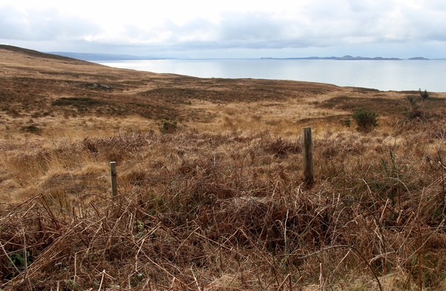
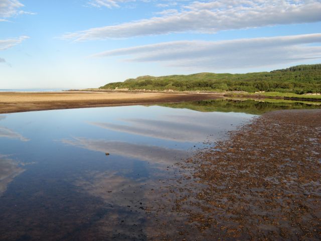
With its connection to the sea, Loch Stornoway exhibits tidal influences that result in a diverse ecosystem. During high tide, the loch fills with seawater, creating a saline environment that supports various marine species. At low tide, the water level recedes, exposing mudflats and revealing a rich feeding ground for wading birds and other coastal wildlife.

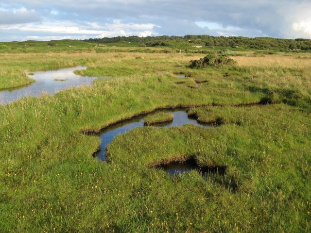
The loch also acts as an estuary, serving as a meeting point for freshwater streams and rivers that flow into it. This convergence of freshwater and saltwater creates a unique habitat where both freshwater and marine species thrive. The resulting brackish water supports a variety of plant and animal life, including fish, crustaceans, and waterfowl.

In addition to its sea and estuary characteristics, Loch Stornoway features narrow channels and meandering creeks that wind through its banks. These smaller waterways provide shelter and breeding grounds for smaller marine organisms and serve as a nursery for juvenile fish.

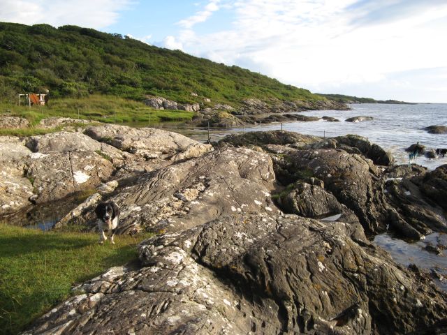
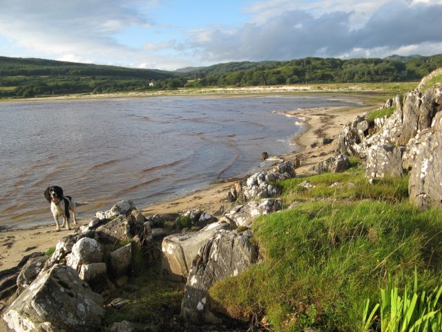
The surrounding area of Loch Stornoway is known for its natural beauty, attracting visitors with its scenic views and tranquil atmosphere. It provides opportunities for recreational activities such as fishing, boating, and birdwatching. Loch Stornoway is not only a haven for wildlife but also a place of peace, offering a unique blend of sea, estuary, and creek environments that contribute to its charm and allure.

If you have any feedback on the listing, please let us know in the comments section below.

Loch Stornoway Images

Images are sourced within 2km of 55.788474/-5.6198264 or Grid Reference NR7360. Thanks to Geograph Open Source API. All images are credited.

The house at Carse This is the old road bridge, now by-passed.
The house at Carse
This is the old road bridge, now by-passed.
Coastal scene by the B8024 Looking south past West Loch Tarbert (the inlet on the left) to the southern part of Kintyre.
Coastal scene by the B8024
Looking south past West Loch Tarbert (the inlet on the left) to the southern part of Kintyre.
Bridge and church at Carse
The road to Kilberry climbs Bruach nan Clach-muillin
Islay comes into view from the B8024
Moorland above Rubha Cruitiridh
Morning reflections Reflections in the estuary at the head of Loch Stornoway.
Morning reflections
Reflections in the estuary at the head of Loch Stornoway.
Patterns in sand Accumulations of seaweed accentuate the contours of sand at the high-tide mark. The island of Gigha occupies the horizon.
Patterns in sand
Accumulations of seaweed accentuate the contours of sand at the high-tide mark. The island of Gigha occupies the horizon.
Sand patterns Striations in the sandy bank of the estuary at the head of Loch Stornoway, highlighted in evening sunshine.
Sand patterns
Striations in the sandy bank of the estuary at the head of Loch Stornoway, highlighted in evening sunshine.
Sandy shore, Port Mòr A fine little bay below the relict cliff line which lies in shadow at this early-morning hour. Such is the importance of access to such locations that a small track makes its way down the cliffs from the road.
Sandy shore, Port Mòr
A fine little bay below the relict cliff line which lies in shadow at this early-morning hour. Such is the importance of access to such locations that a small track makes its way down the cliffs from the road.
Port Mòr A beautiful bay with a horizon filled by the distant island of Jura. There is another sandy bay without a name to the south-west of this little headland. The bay is developed in the Main rock Platform (see <a href="https://www.geograph.org.uk/photo/5097312">NR7062 : Erosion platform with Jura</a>), whose relict cliffs are well displayed here.
Port Mòr
A beautiful bay with a horizon filled by the distant island of Jura. There is another sandy bay without a name to the south-west of this little headland. The bay is developed in the Main rock Platform (see NR7062 : Erosion platform with Jura), whose relict cliffs are well displayed here.
Improved grazing A wide meadow spreads out below the road, but above the steep and high relict cliff line. Jura looks magnificent on the morning horizon.
Improved grazing
A wide meadow spreads out below the road, but above the steep and high relict cliff line. Jura looks magnificent on the morning horizon.
Carse Farm and bridge A view along the old loop of road past the farm house and bridge over the burn.
Carse Farm and bridge
A view along the old loop of road past the farm house and bridge over the burn.
Flooded marsh The salt-marsh below Gorten is inundated by an unusually high tide.
Flooded marsh
The salt-marsh below Gorten is inundated by an unusually high tide.
Port Mhic Dhonncha The glacially-sculpted rocks forming the shore by Port Mhic Dhonncha, a little-visited place, possibly because the tin bothy has fallen into disrepair. This shore never failed to produce a sighting of otters playing among the tidal rocks.
Port Mhic Dhonncha
The glacially-sculpted rocks forming the shore by Port Mhic Dhonncha, a little-visited place, possibly because the tin bothy has fallen into disrepair. This shore never failed to produce a sighting of otters playing among the tidal rocks.
Ardminish shore The sandy shore below Ardminish at the head of Loch Stornoway.
Ardminish shore
The sandy shore below Ardminish at the head of Loch Stornoway.
Ardminish shore (2) A view of the sandy end of Loch Stornoway below Ardminish. Although it is swept by rough seas, the tide seldom covers this area.
Ardminish shore (2)
A view of the sandy end of Loch Stornoway below Ardminish. Although it is swept by rough seas, the tide seldom covers this area.
Loch Stornoway dunes A small line of low dunes at the edge of the carse. The habitat is interesting, and coming close to forming a machair.
Loch Stornoway dunes
A small line of low dunes at the edge of the carse. The habitat is interesting, and coming close to forming a machair.
Show me another place!

Loch Stornoway is located at Grid Ref: NR7360 (Lat: 55.788474, Lng: -5.6198264)

Unitary Authority: Argyll and Bute

Police Authority: Argyll and West Dunbartonshire

What 3 Words

///brothers.pasta.muted. Near Tarbert, Argyll & Bute

Related Wikis

Kilcalmonell

The parish of Kilcalmonell is situated in Argyll and Bute, Scotland. It extends from Clachan, in Kintyre to Kilberry, in Knapdale. == References == W....

Ardpatrick, Argyll

Ardpatrick (Scottish Gaelic: Àird Phàdraig) is a village at the southwestern extremity of the Knapdale, Argyll, Scotland. The village is built along the...

Ardpatrick House

Ardpatrick House is a category-B-listed 18th-century country house in Ardpatrick, South Knapdale, Argyll and Bute, Scotland. == History == A fortified...

Kilberry

Kilberry (Scottish Gaelic: Cill Bheiridh) is a village in Argyll and Bute, Scotland. It is close to the western coast of the district of Knapdale. Kilberry...

Have you been to Loch Stornoway?

Leave your review of Loch Stornoway below (or comments, questions and feedback).