Garbh Phort

Sea, Estuary, Creek in Argyllshire

Scotland

Garbh Phort

A846 northbound, Isle of Jura
A846 northbound, Isle of Jura Credit: Alpin Stewart

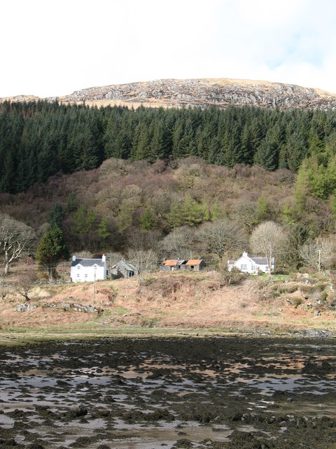
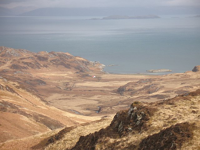
Garbh Phort is a picturesque coastal area located in Argyllshire, Scotland. Nestled between rolling hills and the vast expanse of the Atlantic Ocean, it is known for its stunning sea views, estuaries, and winding creeks.

The area is characterized by its rugged coastline, with rocky cliffs and sandy bays. The sea surrounding Garbh Phort is a vibrant shade of blue, and its crystal-clear waters are home to a diverse range of marine life. Visitors can often spot seals basking on the rocks or dolphins playfully swimming in the distance.

The estuary in Garbh Phort is a haven for birdwatchers, as it attracts a variety of bird species throughout the year. From graceful herons to elegant swans, the estuary provides a vital feeding and nesting ground for these creatures.

One of the highlights of Garbh Phort is its network of creeks that wind their way through the landscape. These narrow waterways offer a tranquil escape for kayakers and canoeists, allowing them to explore the area at their own pace.

Surrounding the sea, estuary, and creeks is a rich tapestry of flora and fauna. The coastal vegetation consists of hardy grasses, wildflowers, and shrubs that have adapted to the harsh coastal conditions. Inland, the rolling hills are covered in heather and bracken, providing a picturesque backdrop to the coastline.

Overall, Garbh Phort in Argyllshire is a natural wonderland, offering visitors a chance to immerse themselves in the beauty of Scotland's coastal landscapes. Whether exploring the sea, estuary, or creeks, there is no shortage of natural wonders to discover in this breathtaking location.

If you have any feedback on the listing, please let us know in the comments section below.
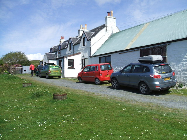
Garbh Phort Images

Images are sourced within 2km of 55.946486/-5.8464268 or Grid Reference NR5979. Thanks to Geograph Open Source API. All images are credited.

A846 northbound, Isle of Jura
Forestry by the Sound of Jura Some extensive clear-felling.
Forestry by the Sound of Jura
Some extensive clear-felling.
Clear felling at Corrynahera Looking back towards Lagg. The road is the A846.
Clear felling at Corrynahera
Looking back towards Lagg. The road is the A846.
The A846 to Craighouse The Sound of Jura to the left.
The A846 to Craighouse
The Sound of Jura to the left.
Deforestation of Jura Clear felling of coniferous plantations - not a pretty sight.
Deforestation of Jura
Clear felling of coniferous plantations - not a pretty sight.
The Sound of Jura With some rather untidy clear felling in the foreground.
The Sound of Jura
With some rather untidy clear felling in the foreground.
Clearfell south of Lagg, Isle of Jura
Outcrop of rock at summit of Cnoc an Ime Cnoc an Ime is a low hill on Jura, just 303m but a 'Marilyn'. The view is over a rock outcrop at the summit to Loch Tarbert and beyond with the island of Colonsay rippling the horizon.
Outcrop of rock at summit of Cnoc an Ime
Cnoc an Ime is a low hill on Jura, just 303m but a 'Marilyn'. The view is over a rock outcrop at the summit to Loch Tarbert and beyond with the island of Colonsay rippling the horizon.
Western side of Cnoc an Ime View to Loch Tarbet and the northern half of Jura.
Western side of Cnoc an Ime
View to Loch Tarbet and the northern half of Jura.
Clearfell near Lagg A section of clearfelled forest between the A846 and the eastern coastline of Jura, north of Lagg.
Clearfell near Lagg
A section of clearfelled forest between the A846 and the eastern coastline of Jura, north of Lagg.
Derelict house at Corrynahera, Isle of Jura
Descending to Lagg, Isle of Jura
Deer in a field at Lagg, Isle of Jura
Jura coast Jura is the wildest island in the Inner Hebrides.  A vast area of rock, bog and forest, there is only a single road for a population of about 200 in an area of 90,000 acres (37,000 hectares).
Jura coast
Jura is the wildest island in the Inner Hebrides. A vast area of rock, bog and forest, there is only a single road for a population of about 200 in an area of 90,000 acres (37,000 hectares).
Wind thrown trees A forestry block ready for harvesting. Some trees have been uprooted by the wind.
Wind thrown trees
A forestry block ready for harvesting. Some trees have been uprooted by the wind.
Sgeir Cul an Rubha Gulls outlined on Sgeir Cul an Rubha, a rock exposed at low water, viewed from Rubh' a' Chamais. The rock is the only feature within this grid square. View across Sound of Jura towards Kintyre.
Sgeir Cul an Rubha
Gulls outlined on Sgeir Cul an Rubha, a rock exposed at low water, viewed from Rubh' a' Chamais. The rock is the only feature within this grid square. View across Sound of Jura towards Kintyre.
The road north climbs into the forest Some trees have been felled but more are still standing.
The road north climbs into the forest
Some trees have been felled but more are still standing.
Towards Tarbert Bay Clearfelled woodland between Lagg and Tarbert.
Towards Tarbert Bay
Clearfelled woodland between Lagg and Tarbert.
Show me another place!

Garbh Phort is located at Grid Ref: NR5979 (Lat: 55.946486, Lng: -5.8464268)

Unitary Authority: Argyll and Bute

Police Authority: Argyll and West Dunbartonshire

What 3 Words

///moats.stoppage.merge. Near Craighouse, Argyll & Bute

Nearby Locations

Garbh Phort

Related Wikis

Lagg, Jura

Lagg is a hamlet on Lagg Bay, on the east coast of the island of Jura, in the council area of Argyll and Bute, Scotland. It is on the A846 8 miles (13...

Tarbert, Jura

Tarbert is a hamlet on Tarbert Bay, on the east coast of the island of Jura, in the council area of Argyll and Bute, Scotland. The Tarbert estate is owned...

Battle of the Western Isles

The Battle of the Western Isles was a series of conflicts in 1585 and 1586 on the islands of Jura, Islay, Mull and Tiree, Scotland as well as the peninsula...

Ardmenish

Ardmenish (Scottish Gaelic: Àird Mhèanais) is a largely cleared village on the island of Jura, in Argyll and Bute, Scotland. In 2003 the Rozga family were...

Nearby Amenities

Located within 500m of 55.946486,-5.8464268
An Oitir
Natural: bay
Lat/Long: 55.9423934/-5.8496616
Power: pole
Lat/Long: 55.9432888/-5.8518333
Power: pole
Lat/Long: 55.9446255/-5.851344
Power: pole
Lat/Long: 55.9439605/-5.8517882
Power: pole
Lat/Long: 55.9474412/-5.8494273
Power: pole
Lat/Long: 55.948146/-5.8489404
Power: pole
Lat/Long: 55.9488389/-5.8484987
Power: pole
Lat/Long: 55.9495371/-5.848026
Power: pole
Lat/Long: 55.9509281/-5.8470807
Power: pole
Lat/Long: 55.9503098/-5.8475201
Power: pole
Lat/Long: 55.9453724/-5.8508062
Power: pole
Lat/Long: 55.9467092/-5.8499152
Power: pole
Lat/Long: 55.9460216/-5.8503735
The data included in this document is from www.openstreetmap.org. The data is made available under ODbL.

Have you been to Garbh Phort?

Leave your review of Garbh Phort below (or comments, questions and feedback).