Cairidh Bheag

Sea, Estuary, Creek in Argyllshire

Scotland

Cairidh Bheag

Landing stage at Loch Tarbert, Isle of Jura
Landing stage at Loch Tarbert, Isle of Jura Credit: Alpin Stewart

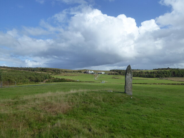
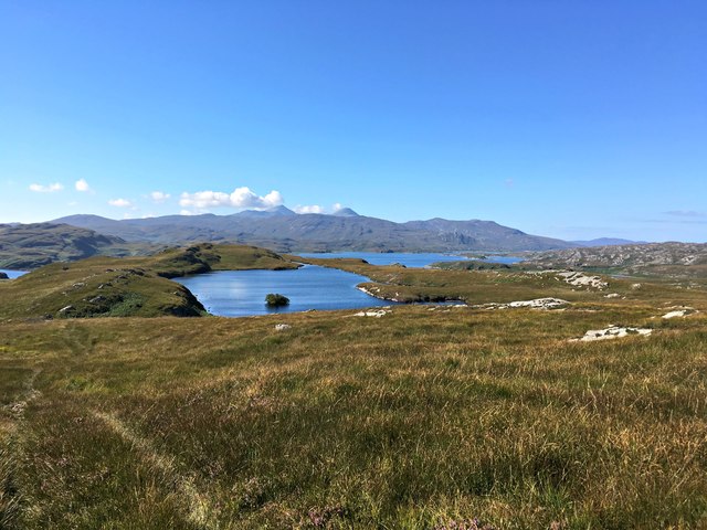
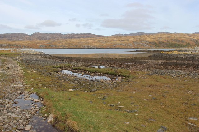
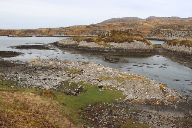
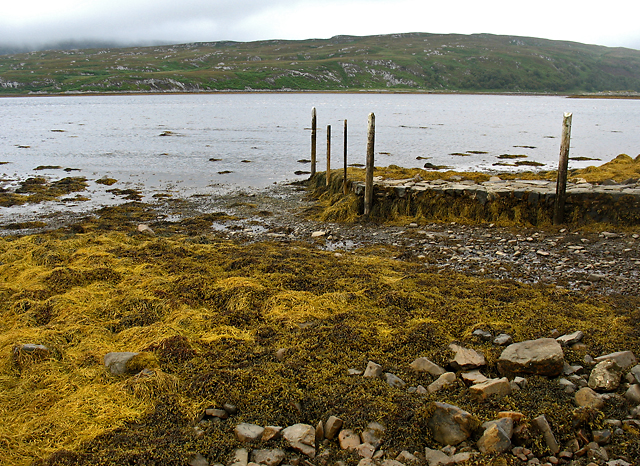
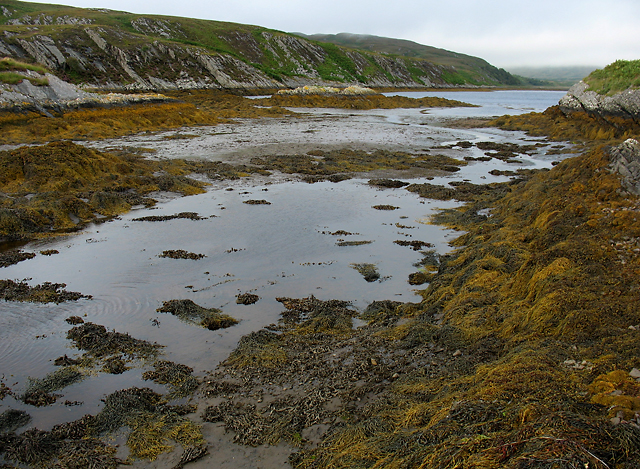
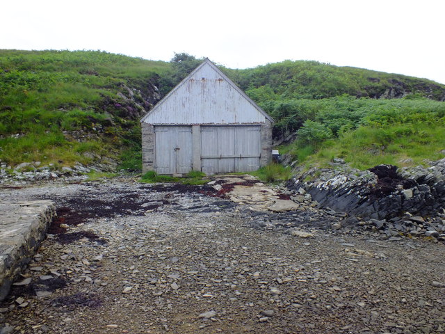
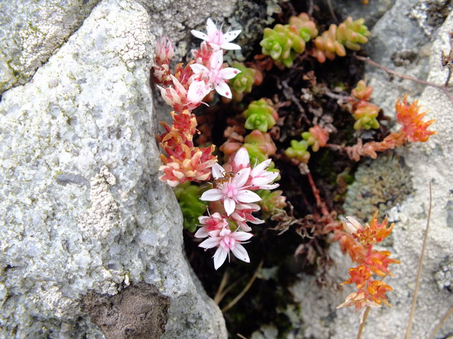
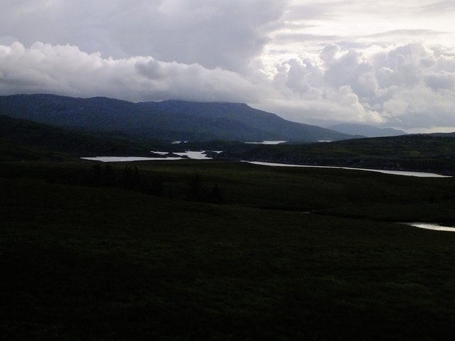
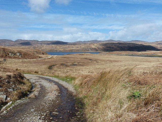
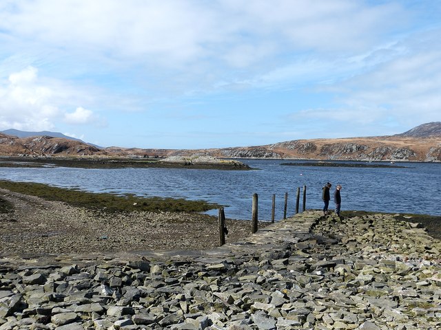
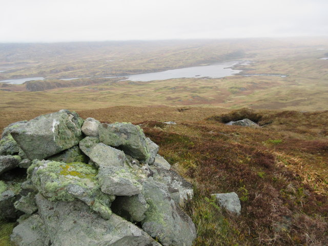
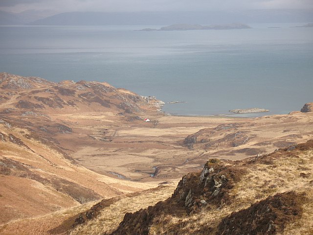
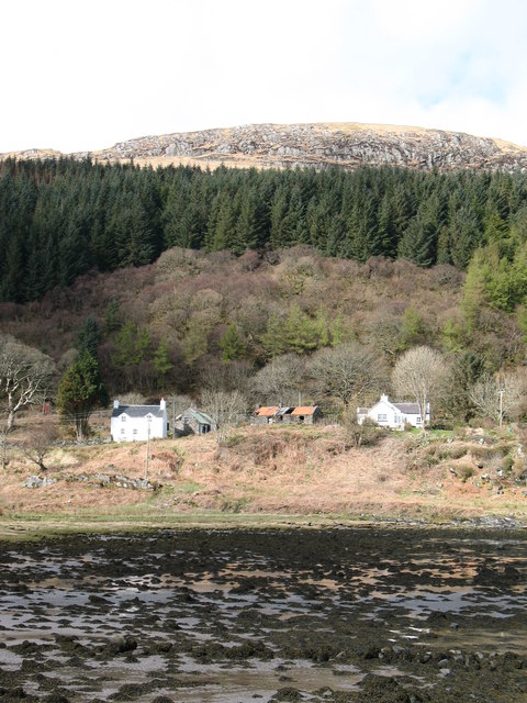
Cairidh Bheag is a small coastal village located in Argyllshire, Scotland. Situated on the western coast of the country, it is known for its stunning sea views, estuary, and creek. The village is surrounded by picturesque landscapes, with rolling hills and lush greenery.

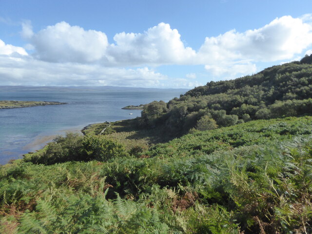
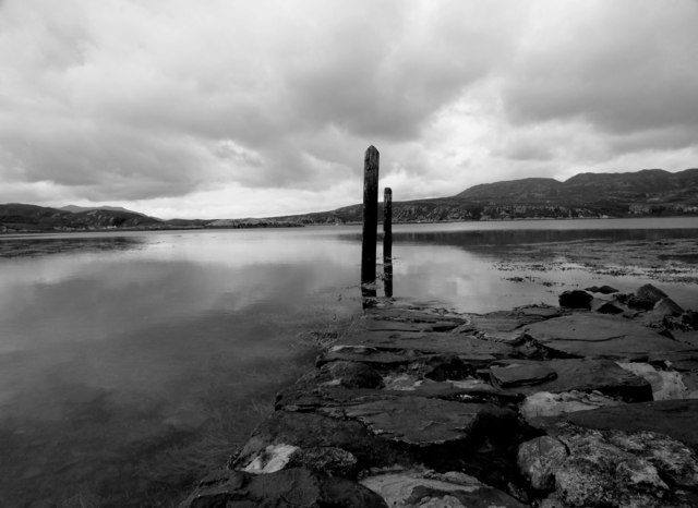
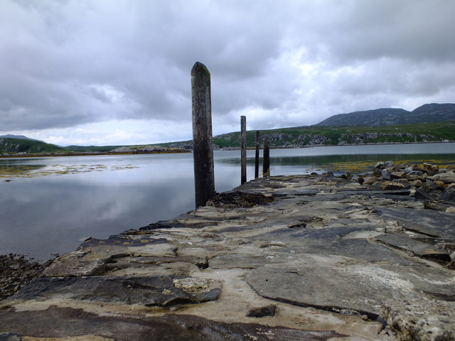
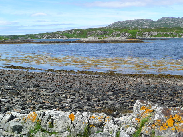
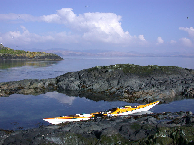
The sea in Cairidh Bheag offers breathtaking vistas, with its clear blue waters and crashing waves. It is a popular spot for water activities such as swimming, sailing, and fishing. The sea also attracts a variety of wildlife, including seals, dolphins, and a wide array of bird species.

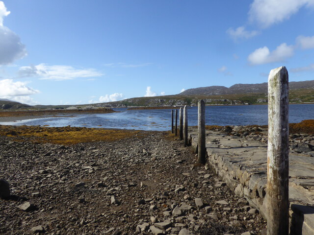
The village is also home to an estuary, where a river meets the sea. The estuary is a unique ecosystem, characterized by its mixture of fresh and saltwater. It is a haven for many species of fish, crabs, and other marine life. Visitors can enjoy walks along the estuary, taking in the scenic beauty and observing the diverse flora and fauna.

Cairidh Bheag is further complemented by a picturesque creek. The creek meanders through the village, adding to its charm. It is a tranquil spot, perfect for relaxation and reflection. Visitors can take leisurely walks along the creek, enjoying the soothing sound of flowing water and observing the local wildlife.

Overall, Cairidh Bheag offers a serene and natural environment, making it a popular destination for those seeking a peaceful coastal retreat. Its stunning sea, estuary, and creek provide ample opportunities for outdoor activities and wildlife observation, making it a must-visit location in Argyllshire.

If you have any feedback on the listing, please let us know in the comments section below.

Cairidh Bheag Images

Images are sourced within 2km of 55.978892/-5.8499679 or Grid Reference NR5982. Thanks to Geograph Open Source API. All images are credited.

Landing stage at Loch Tarbert, Isle of Jura
Standing stone at Tarbert, Isle of Jura
Looking down to Tarbert Bay, Isle of Jura
Loch na Pearaich Looking southwest over Loch na Pearaich and Loch Tarbert on a glorious summer's day.  The peaks of two of the Paps of Jura are visible in the distance.
Loch na Pearaich
Looking southwest over Loch na Pearaich and Loch Tarbert on a glorious summer's day. The peaks of two of the Paps of Jura are visible in the distance.
Foreshore of Inner Loch Tarbert
Islets in Loch Tarbert
Jetty on Loch Tarbert The jetty on the south side of Loch Tarbert, which almost bisects the Isle of Jura - the east coast of this island less than 2km distant. Tarbert derives from Norse, meaning draw-boat, signifying a place where Vikings were able to drag their boats a short distance overland to avoid a longer journey by sea.
Jetty on Loch Tarbert
The jetty on the south side of Loch Tarbert, which almost bisects the Isle of Jura - the east coast of this island less than 2km distant. Tarbert derives from Norse, meaning draw-boat, signifying a place where Vikings were able to drag their boats a short distance overland to avoid a longer journey by sea.
Loch Tarbert An inlet on the southern shore of Loch Tarbert on the Isle of Jura.
Loch Tarbert
An inlet on the southern shore of Loch Tarbert on the Isle of Jura.
Boat house, Loch Tarbert The old boat house and jetty at Loch Tarbert are the only sign of life except for the constant piping of oyster catchers and the odd "plop" as another otter disappears beneath the water's surface.
Boat house, Loch Tarbert
The old boat house and jetty at Loch Tarbert are the only sign of life except for the constant piping of oyster catchers and the odd "plop" as another otter disappears beneath the water's surface.
Jetty, Loch Tarbert The OS map describes this as a, "landing stage"; somehow we were expecting something a little grander. It was however, more beautiful than we could have expected and incredibly peaceful. Well worth the walk from Tarbert.
Jetty, Loch Tarbert
The OS map describes this as a, "landing stage"; somehow we were expecting something a little grander. It was however, more beautiful than we could have expected and incredibly peaceful. Well worth the walk from Tarbert.
Jetty, Loch Tarbert It was flat calm without the slightest breeze.
Jetty, Loch Tarbert
It was flat calm without the slightest breeze.
Spot the ant I was marveling at the tiny jewels that were the flowers of the English Stonecrop in all the cracks in the rocks all around Loch Tarbert, so I photographed one. It wasn't until I looked at the photos later that I spotted the red ant on the flower.
Spot the ant
I was marveling at the tiny jewels that were the flowers of the English Stonecrop in all the cracks in the rocks all around Loch Tarbert, so I photographed one. It wasn't until I looked at the photos later that I spotted the red ant on the flower.
Horse fly, Jura They all warned us about midges but no one mentioned these swines; they ate us alive. Horse flies or "clegs" as the locals call them were everywhere and whereas the midges were put off by a breeze the clegs weren't at all worried and you'd find yourself swatting wildly like someone with tourettes on acid to beat them off. At the end of the week our legs were covered in red lumps. Give me midges any day. Needless to say, this one didn't bite us again.
Horse fly, Jura
They all warned us about midges but no one mentioned these swines; they ate us alive. Horse flies or "clegs" as the locals call them were everywhere and whereas the midges were put off by a breeze the clegs weren't at all worried and you'd find yourself swatting wildly like someone with tourettes on acid to beat them off. At the end of the week our legs were covered in red lumps. Give me midges any day. Needless to say, this one didn't bite us again.
Loch Tarbert, Jura This is the view from the main road between Lussa and Tarbert of Loch Tarbert. The loch cuts deep into the landscape and the island which is 7 miles or so wide for most of its length is less than a mile wide between the loch and the hamlet of Tarbert.
Loch Tarbert, Jura
This is the view from the main road between Lussa and Tarbert of Loch Tarbert. The loch cuts deep into the landscape and the island which is 7 miles or so wide for most of its length is less than a mile wide between the loch and the hamlet of Tarbert.
Jura isthmus Looking across the isle of Jura at its narrowest point. A narrowing such as this is called an "isthmus", which in Gaelic is "tairbeart" hence several places in Scotland called Tarbert or Tarbet, such as here on Jura.
It is due to the importance of the isthmus in allowing passage from one side of the island to the other that Tarbert was at one time the centre of population on the Isle of Jura. Now very few people live here - or on Jura at all. Most of the population is now in Craighouse, several miles to the south.
In this photo the easternmost part of Loch Tarbert which is an inlet on the western side of the island can be seen ahead with the track snaking towards it.
Jura isthmus
Looking across the isle of Jura at its narrowest point. A narrowing such as this is called an "isthmus", which in Gaelic is "tairbeart" hence several places in Scotland called Tarbert or Tarbet, such as here on Jura. It is due to the importance of the isthmus in allowing passage from one side of the island to the other that Tarbert was at one time the centre of population on the Isle of Jura. Now very few people live here - or on Jura at all. Most of the population is now in Craighouse, several miles to the south. In this photo the easternmost part of Loch Tarbert which is an inlet on the western side of the island can be seen ahead with the track snaking towards it.
The innermost part of Loch Tarbert, Jura Loch Tarbert is a sea loch leading eastwards into Jura from its west coast in a series of sections joined by narrows. Seen here is the innermost of these sub-lochs with a jetty or landing stage leading into it. A track leads from this loch to the eastern coast of the island just one kilometre (about half a mile) away. This narrow constriction of the island is called an isthmus - or in Gaelic "tairbeart" after which the locality on the eastern coast called "Tarbert" is named.
The innermost part of Loch Tarbert, Jura
Loch Tarbert is a sea loch leading eastwards into Jura from its west coast in a series of sections joined by narrows. Seen here is the innermost of these sub-lochs with a jetty or landing stage leading into it. A track leads from this loch to the eastern coast of the island just one kilometre (about half a mile) away. This narrow constriction of the island is called an isthmus - or in Gaelic "tairbeart" after which the locality on the eastern coast called "Tarbert" is named.
Inner Loch Tarbert Loch Tarbert on Jura almost cuts the island in half.  This is the easternmost part and 1km from the Sound of Jura (over land);  it is 10km from the open Atlantic and tidal.
Inner Loch Tarbert
Loch Tarbert on Jura almost cuts the island in half. This is the easternmost part and 1km from the Sound of Jura (over land); it is 10km from the open Atlantic and tidal.
Creag nam Fiadh Mor View north from the summit cairn over Upper Loch Tarbet. There is very low cloud over the hills of northern Jura, making the horizon look flat - should be looking at lots of hills !
Creag nam Fiadh Mor
View north from the summit cairn over Upper Loch Tarbet. There is very low cloud over the hills of northern Jura, making the horizon look flat - should be looking at lots of hills !
Show me another place!

Cairidh Bheag is located at Grid Ref: NR5982 (Lat: 55.978892, Lng: -5.8499679)

Unitary Authority: Argyll and Bute

Police Authority: Argyll and West Dunbartonshire

What 3 Words

///corrects.include.sizes. Near Craighouse, Argyll & Bute

Related Wikis

Tarbert, Jura

Tarbert is a hamlet on Tarbert Bay, on the east coast of the island of Jura, in the council area of Argyll and Bute, Scotland. The Tarbert estate is owned...

Battle of the Western Isles

The Battle of the Western Isles was a series of conflicts in 1585 and 1586 on the islands of Jura, Islay, Mull and Tiree, Scotland as well as the peninsula...

Lagg, Jura

Lagg is a hamlet on Lagg Bay, on the east coast of the island of Jura, in the council area of Argyll and Bute, Scotland. It is on the A846 8 miles (13...

Sound of Jura

The Sound of Jura (Scottish Gaelic: An Linne Rosach) is a strait in Argyll and Bute, Scotland. It is one of the several Sounds of Scotland. It is to the...

Nearby Amenities

Located within 500m of 55.978892,-5.8499679
Cairidh Bheag
Place: locality
Lat/Long: 55.9801368/-5.8497101
The data included in this document is from www.openstreetmap.org. The data is made available under ODbL.

Have you been to Cairidh Bheag?

Leave your review of Cairidh Bheag below (or comments, questions and feedback).