Tòb Caversta

Sea, Estuary, Creek in Ross-shire

Scotland

Tòb Caversta

Fence, Cleite Mòr, Isle of Lewis The fence runs between improved land used as sheep pasture and moorland.
Fence, Cleite Mòr, Isle of Lewis Credit: Claire Pegrum

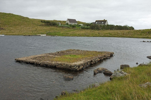
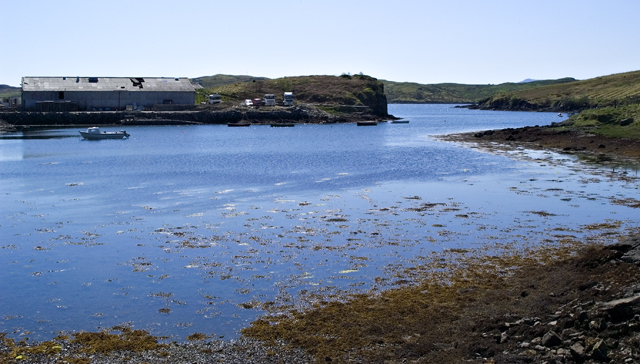
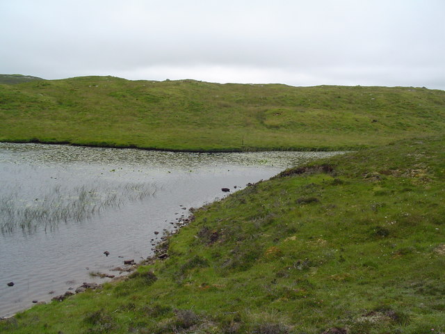
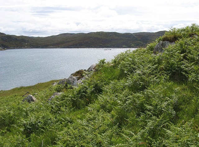
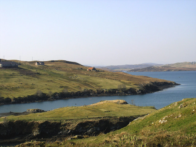
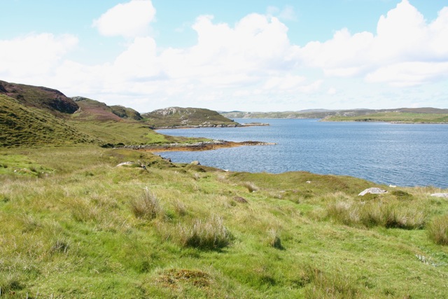
Tòb Caversta is a small coastal area located in Ross-shire, Scotland. Situated at the mouth of an estuary, it offers stunning views of the sea and surrounding landscape. The estuary itself is formed by the convergence of a creek and the open sea, creating a unique and diverse ecosystem.

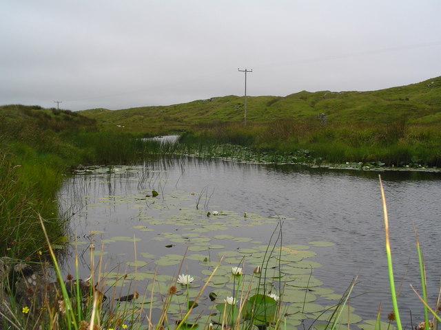
The area is known for its rich biodiversity, with a wide range of flora and fauna inhabiting the estuary and its surrounding marshlands. It is a haven for birdwatchers, as numerous species of wading birds, waterfowl, and seabirds can be spotted here throughout the year. The estuary also supports a variety of fish species, making it a popular spot for anglers.

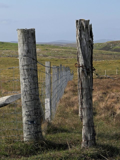
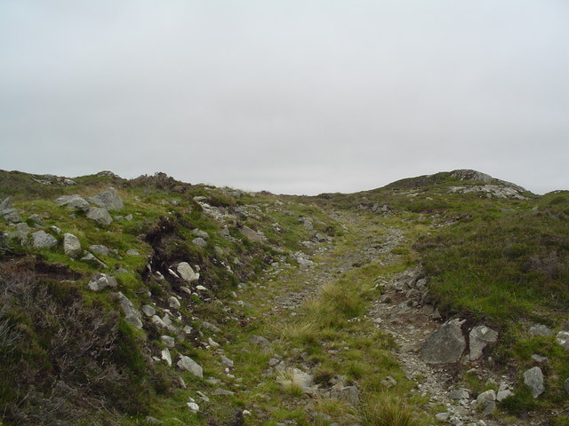
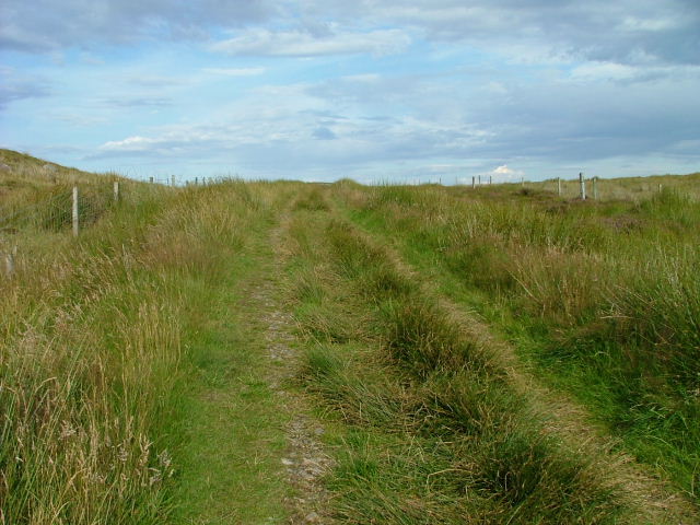
Tòb Caversta offers visitors the opportunity to explore its rugged coastal paths, which provide access to secluded sandy beaches and rocky coves. The area is perfect for leisurely walks, picnics, or simply enjoying the peacefulness of the natural surroundings.

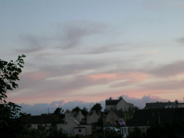
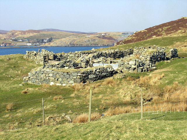
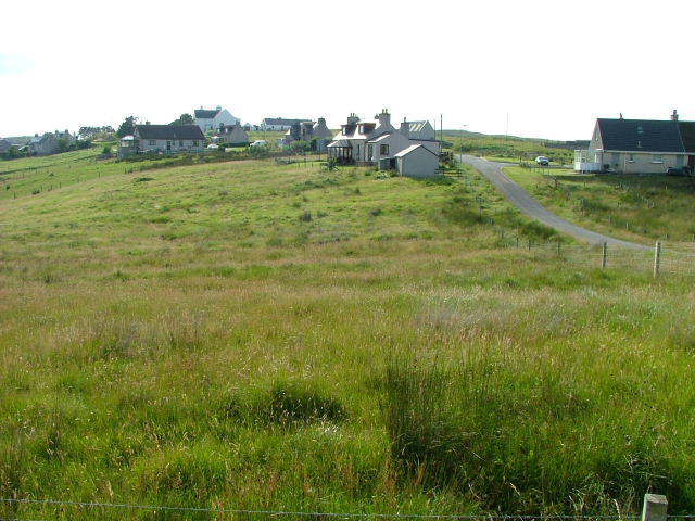
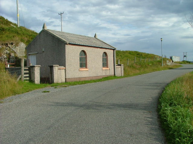
The nearby village of Caversta provides basic amenities and services for visitors, including a few small shops and accommodation options. The area is also well-connected by road, making it easily accessible for those traveling by car.

Overall, Tòb Caversta is a picturesque coastal area that offers a peaceful retreat for nature lovers and outdoor enthusiasts. With its stunning views, diverse wildlife, and tranquil atmosphere, it is a must-visit destination for anyone seeking a unique and immersive experience in Ross-shire.

If you have any feedback on the listing, please let us know in the comments section below.

Tòb Caversta Images

Images are sourced within 2km of 58.091706/-6.4744207 or Grid Reference NB3620. Thanks to Geograph Open Source API. All images are credited.

Fence, Cleite Mòr, Isle of Lewis The fence runs between improved land used as sheep pasture and moorland.
Fence, Cleite Mòr, Isle of Lewis
The fence runs between improved land used as sheep pasture and moorland.
Gate above Loch nan Caor, Isle of Lewis I'm guessing that this somewhat decorative field gate has previously been in a more domestic location!

According to the OS Name Book of 1848-1852, Loch nan Caor means Rowan Trees Loch.
Gate above Loch nan Caor, Isle of Lewis
I'm guessing that this somewhat decorative field gate has previously been in a more domestic location! According to the OS Name Book of 1848-1852, Loch nan Caor means Rowan Trees Loch.
Loch Èireasort A view across Loch Èireasort and a fish farm from the track at Glìb Cheòis.
Loch Èireasort
A view across Loch Èireasort and a fish farm from the track at Glìb Cheòis.
Platform in Loch Cheois This small concrete platform is at the southern end of Loch Cheois. There is nothing to indicate its function. (There is a slight possibility that it is associated with the WWII "chariot" training facility at Tavay.)
Platform in Loch Cheois
This small concrete platform is at the southern end of Loch Cheois. There is nothing to indicate its function. (There is a slight possibility that it is associated with the WWII "chariot" training facility at Tavay.)
The Harbour at Cèos The harbour at the crofting community of Cèos is mostly used to support the fish farms in Loch Èireasort
The Harbour at Cèos
The harbour at the crofting community of Cèos is mostly used to support the fish farms in Loch Èireasort
Croft in Garryvard The access gate to a croft in Garryvard. Crofting paraphanalia litters the area. A derelict croft house can be seen in the background.
Croft in Garryvard
The access gate to a croft in Garryvard. Crofting paraphanalia litters the area. A derelict croft house can be seen in the background.
Boats moored in Caversta A small inlet from Loch Erisort provides a perfect mooring for small boats.
Boats moored in Caversta
A small inlet from Loch Erisort provides a perfect mooring for small boats.
Caversta River A section of the Caversta River just south of Garryvard.
Caversta River
A section of the Caversta River just south of Garryvard.
Caversta River Pool A pool on the Caversta river.
Caversta River Pool
A pool on the Caversta river.
Hillside Track off B8060 A track leading up Cnoc a Mhaide from the B8060.
Hillside Track off B8060
A track leading up Cnoc a Mhaide from the B8060.
Evening over Glib Cheois Evening view over Glib Cheois
Evening over Glib Cheois
Evening view over Glib Cheois
South-western corner of Eilean Chaluim Chille The extreme north-eastern tip of the grid square is occupied by this corner of Eilean Chaluim Chille, a small island in Loch Èireasort.  This view looks across the loch to the mainland of Lewis near Cabharstadh.  The photo was taken despite the strenuous efforts of a couple of great black-backed gulls to deter the photographer from encroaching on their territory!
South-western corner of Eilean Chaluim Chille
The extreme north-eastern tip of the grid square is occupied by this corner of Eilean Chaluim Chille, a small island in Loch Èireasort. This view looks across the loch to the mainland of Lewis near Cabharstadh. The photo was taken despite the strenuous efforts of a couple of great black-backed gulls to deter the photographer from encroaching on their territory!
Garyvard from Caversta
Rubha Cabharstaidh Ruined blackhouse and enclosures at the end of the Caversta Road, on Croft 4.  Keos Glebe is the village across Loch Erisort.
Rubha Cabharstaidh
Ruined blackhouse and enclosures at the end of the Caversta Road, on Croft 4. Keos Glebe is the village across Loch Erisort.
Lochside, Loch Torasdaidh
Houses at Glib Cheois
Moorland track The track begins at the Glib Cheois road end.
Moorland track
The track begins at the Glib Cheois road end.
Free Church of Scotland Meeting house In the township of Ceos.
Free Church of Scotland Meeting house
In the township of Ceos.
Show me another place!

Tòb Caversta is located at Grid Ref: NB3620 (Lat: 58.091706, Lng: -6.4744207)

Unitary Authority: Na h-Eileanan an Iar

Police Authority: Highlands and Islands

What 3 Words

///blues.florists.pebble. Near Leurbost, Na h-Eileanan Siar

Related Wikis

Cabharstadh

Cabharstadh or Caversta (Scottish Gaelic: Cabharstaigh) is a village on the Isle of Lewis in the Outer Hebrides, Scotland. Caversta is situated in the...

Keose

Keose is a settlement in the Kinloch community council area of the Western Isles, Scotland, in the civil parish of Lochs. It lies on the north shore of...

Loch Erisort

Loch Erisort (Scottish Gaelic: Èireasort) is an 8-mile-long narrow sea inlet on the east coast of the Isle of Lewis in the Outer Hebrides off the west...

Eilean Chaluim Chille

Eilean Chaluim Chille (Gaelic: island of Saint Columba, Calum Cille) is an unpopulated island in the Outer Hebrides. It lies off the east coast of Lewis...

Nearby Amenities

Located within 500m of 58.091706,-6.4744207
Bus Stop
Caversta
Bus: yes
Naptan AtcoCode: 6010731604
Naptan Bearing: S
Naptan BusStopType: CUS
Naptan CommonName: Caversta
Naptan Indicator: Village
Naptan Landmark: Bus turning point
Naptan NaptanCode: 94723737
Naptan Street: Unclassified road
Naptan Verified: no
Source: naptan_import
Lat/Long: 58.0923939/-6.4723348
Bus Stop
Garyvard
Naptan AtcoCode: 6010731659
Naptan Bearing: S
Naptan CommonName: Garyvard
Naptan Indicator: Village
Naptan Landmark: Village
Naptan NaptanCode: 94723736
Naptan Street: Village
Naptan Verified: no
Source: naptan_import
Lat/Long: 58.0879157/-6.476518
Gearraidh Bhaird
Name En: Garyvard
Name Gd: Gearraidh Bhaird
Place: village
Lat/Long: 58.0903292/-6.4795024
Post Box
Collection Times: Mo-Fr 09:00; Sa 09:00
Operator: Royal Mail
Post Box Type: lamp
Ref: HS2 99
Royal Cypher: scottish_crown
Source: survey
Lat/Long: 58.0904891/-6.4785251
Telephone
Booth: KX100
Covered: booth
Operator: BT
Source: drive-by survey
Lat/Long: 58.0893896/-6.4775954
Turning Circle
Lat/Long: 58.0923759/-6.4723623
Cabharstaigh
Alt Name: Cabharstadh
Alt Name En: Caverstay
Name En: Caversta
Name Gd: Cabharstaigh
Place: village
Wikidata: Q3776571
Wikipedia: en:Cabharstadh
Lat/Long: 58.0905661/-6.4709419
Turning Circle
Lat/Long: 58.0910794/-6.4751465
Leisure: slipway
Lat/Long: 58.0912936/-6.4747166
Tob Caversta
Natural: bay
Source Name: OS_OpenData_StreetView
Lat/Long: 58.092273/-6.4748665
Barrier: cattle_grid
Lat/Long: 58.0917639/-6.4715894
Tob Garyvard
Natural: bay
Lat/Long: 58.091937/-6.4777494
Power: pole
Lat/Long: 58.0901182/-6.4782797
Power: pole
Lat/Long: 58.0885497/-6.4772043
Power: pole
Lat/Long: 58.0879756/-6.4758363
Power: pole
Lat/Long: 58.0917415/-6.4819022
Power: pole
Lat/Long: 58.091253/-6.4808499
Power: pole
Lat/Long: 58.0909777/-6.4803297
Power: pole
Lat/Long: 58.090705/-6.4796371
Power: pole
Lat/Long: 58.0903861/-6.478904
Power: pole
Lat/Long: 58.0897899/-6.4774417
Power: pole
Lat/Long: 58.089315/-6.4769831
Power: pole
Lat/Long: 58.0882434/-6.4780894
Power: pole
Lat/Long: 58.0884191/-6.4739384
Power: pole
Lat/Long: 58.0888102/-6.4712385
Power: pole
Lat/Long: 58.091708/-6.4717816
Power: pole
Lat/Long: 58.0911607/-6.4713687
Power: pole
Lat/Long: 58.0904798/-6.4712485
Power: pole
Lat/Long: 58.0899002/-6.4711326
Power: pole
Lat/Long: 58.0893504/-6.4712599
Power: pole
Lat/Long: 58.0888612/-6.4689722
Power: pole
Lat/Long: 58.0887468/-6.4699471
Power: pole
Lat/Long: 58.0876656/-6.4771143
Power: pole
Lat/Long: 58.0905507/-6.4748124
Power: pole
Lat/Long: 58.0903037/-6.4758664
Power: pole
Lat/Long: 58.0902389/-6.4768343
Power: pole
Lat/Long: 58.090183/-6.4776214
Power: pole
Lat/Long: 58.0902006/-6.4748431
Barrier: cattle_grid
Lat/Long: 58.0885011/-6.4691561
Barrier: cattle_grid
Lat/Long: 58.0917351/-6.4719689
Street Lamp
Lamp Type: electric
Lat/Long: 58.0908145/-6.4790863
Street Lamp
Lamp Type: electric
Lat/Long: 58.0904438/-6.4784157
Street Lamp
Lamp Type: electric
Lat/Long: 58.091271/-6.4807291
Street Lamp
Lamp Type: electric
Lat/Long: 58.0910548/-6.4799017
Power: pole
Lat/Long: 58.0904265/-6.4753803
Power: pole
Lat/Long: 58.0915596/-6.4815222
Power: pole
Lat/Long: 58.0920068/-6.4824645
Power: pole
Lat/Long: 58.0923988/-6.482325
Barrier: cattle_grid
Lat/Long: 58.0901334/-6.471011
Passing Place
Lat/Long: 58.0905036/-6.471186
Power: pole
Lat/Long: 58.0908079/-6.4713102
Power: pole
Lat/Long: 58.0884499/-6.4774948
Street Lamp
Lamp Type: electric
Lat/Long: 58.087641/-6.4765493
Street Lamp
Lamp Type: electric
Lat/Long: 58.0880876/-6.4767545
Street Lamp
Lamp Type: electric
Lat/Long: 58.0885867/-6.4770214
Street Lamp
Lamp Type: electric
Lat/Long: 58.0890943/-6.4773392
Street Lamp
Lamp Type: electric
Lat/Long: 58.0895508/-6.477645
Street Lamp
Lamp Type: electric
Lat/Long: 58.0899818/-6.4779333
The data included in this document is from www.openstreetmap.org. The data is made available under ODbL.

Have you been to Tòb Caversta?

Leave your review of Tòb Caversta below (or comments, questions and feedback).