Rubha Chabharstaidh

Coastal Feature, Headland, Point in Ross-shire

Scotland

Rubha Chabharstaidh

Fence, Cleite Mòr, Isle of Lewis The fence runs between improved land used as sheep pasture and moorland.
Fence, Cleite Mòr, Isle of Lewis Credit: Claire Pegrum

Rubha Chabharstaidh is a prominent headland located in Ross-shire, Scotland. Situated along the coast, this coastal feature stretches out into the North Sea, offering stunning views of the surrounding landscape. The headland is characterized by its rugged cliffs, which rise steeply from the sea and provide a dramatic backdrop to the area.

The name "Rubha Chabharstaidh" is derived from the Gaelic language, meaning "point of the fish trap." This name reflects the historical importance of the headland as a fishing spot for local communities. In ancient times, fishermen would set up traps in the waters surrounding the headland to catch fish and other marine life.

Today, Rubha Chabharstaidh continues to attract visitors due to its natural beauty and recreational opportunities. The headland offers several walking trails that wind along the cliffs, providing breathtaking views of the coastline and the North Sea. These paths are also popular among birdwatchers, as the headland is home to a variety of seabirds, including puffins, gannets, and kittiwakes.

The rocky shores of Rubha Chabharstaidh also provide a habitat for a diverse range of marine life. Exploring the rock pools during low tide reveals an abundance of colorful seaweed, small fish, and other marine organisms. The headland is also known for its impressive geology, with unique rock formations and fossilized remains dating back millions of years.

Overall, Rubha Chabharstaidh is a captivating coastal feature that offers a combination of natural beauty, historical significance, and recreational opportunities. Whether it's enjoying the breathtaking views, observing wildlife, or exploring the rocky shores, this headland provides a memorable experience for visitors.

If you have any feedback on the listing, please let us know in the comments section below.

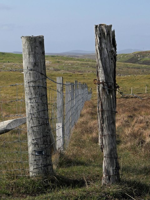
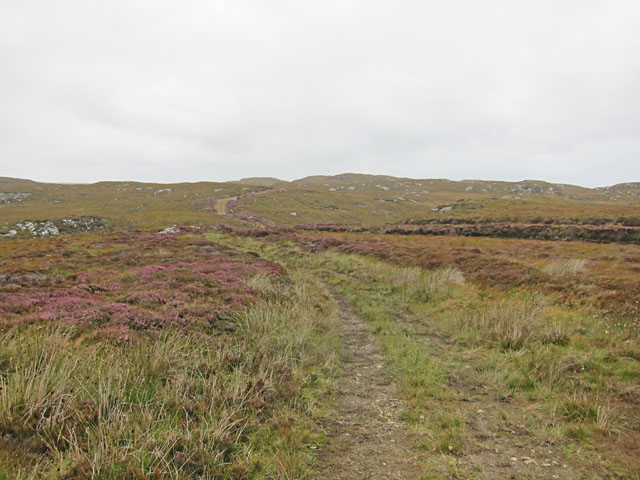
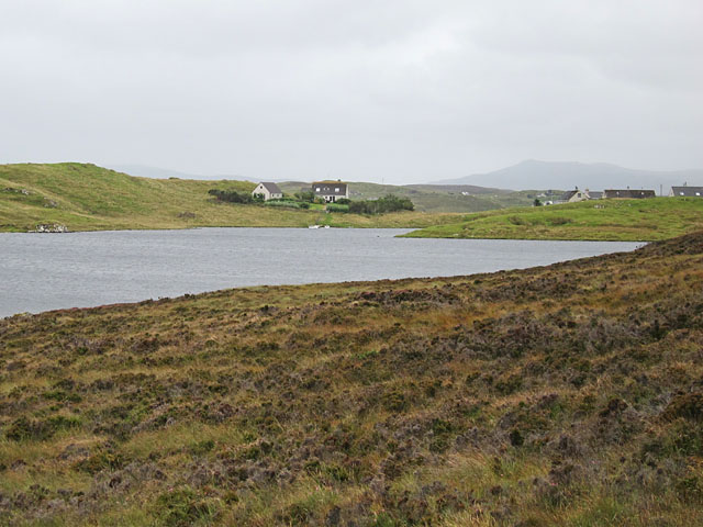
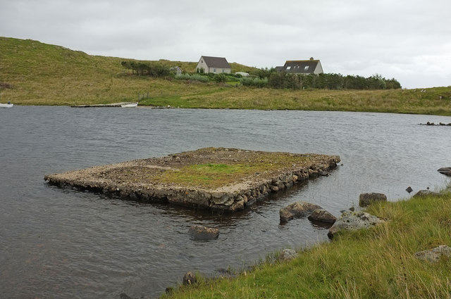
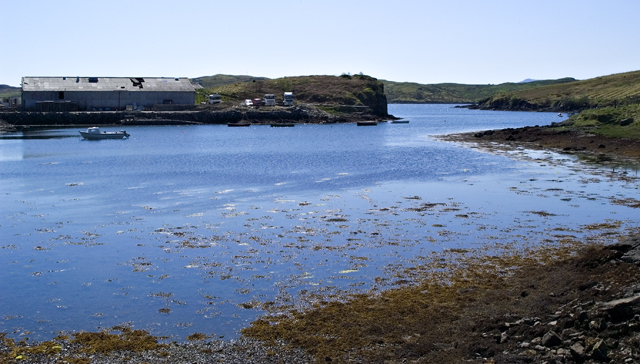
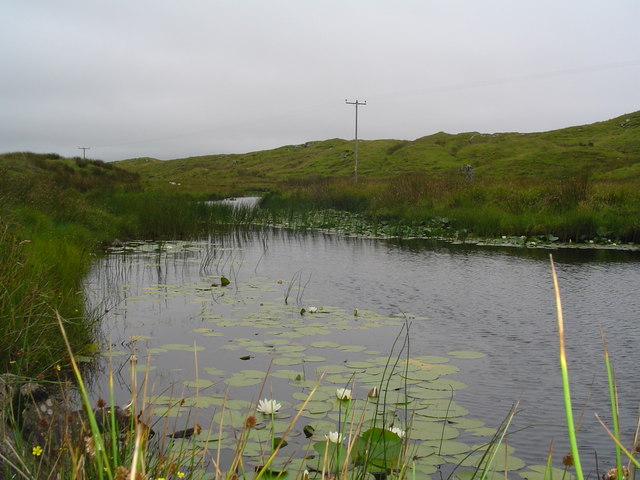
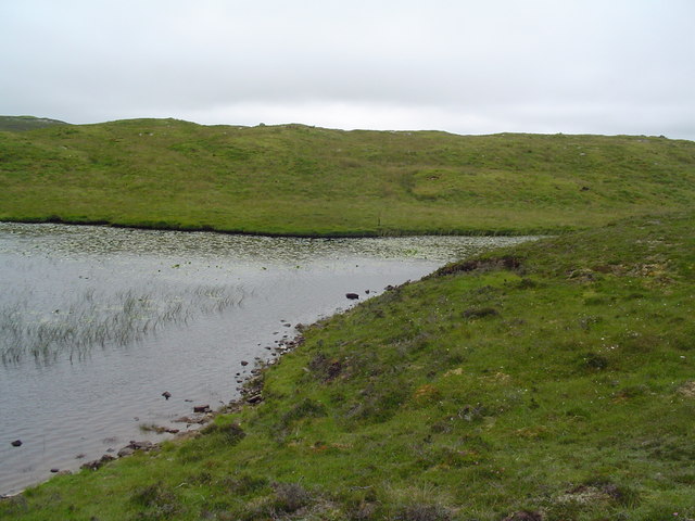
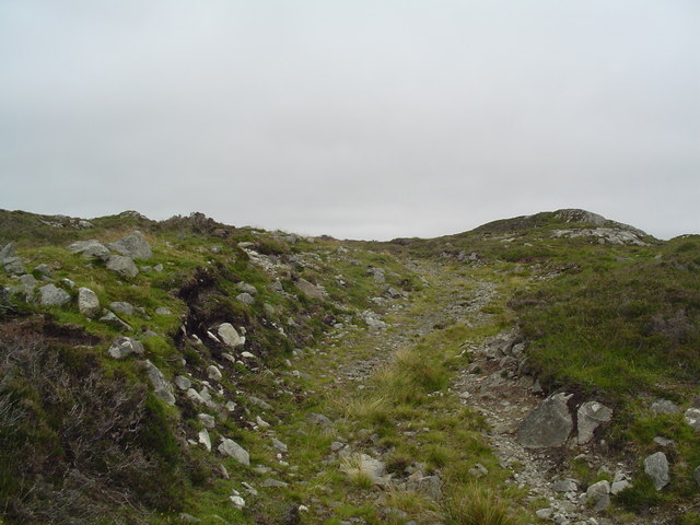
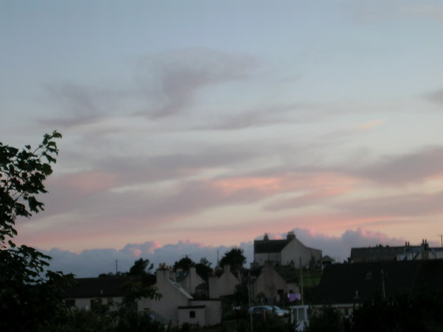
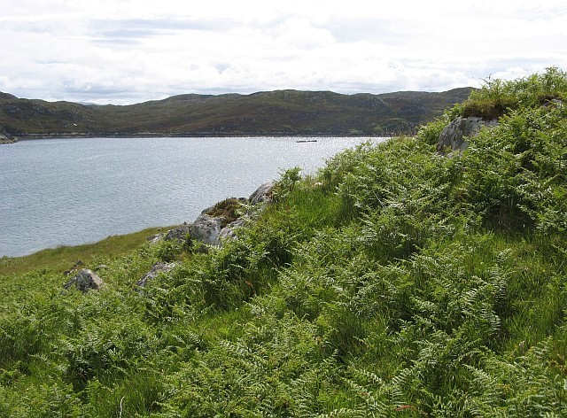
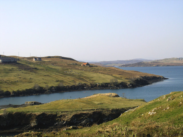
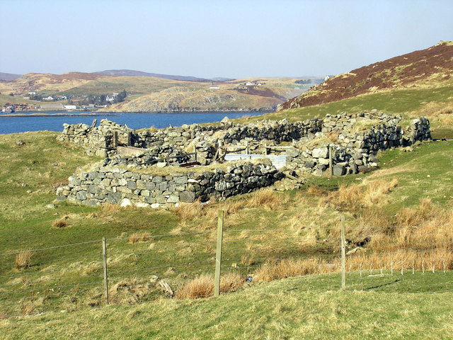
Rubha Chabharstaidh Images

Images are sourced within 2km of 58.095627/-6.4726535 or Grid Reference NB3620. Thanks to Geograph Open Source API. All images are credited.

Fence, Cleite Mòr, Isle of Lewis The fence runs between improved land used as sheep pasture and moorland.
Fence, Cleite Mòr, Isle of Lewis
The fence runs between improved land used as sheep pasture and moorland.
Gate above Loch nan Caor, Isle of Lewis I'm guessing that this somewhat decorative field gate has previously been in a more domestic location!

According to the OS Name Book of 1848-1852, Loch nan Caor means Rowan Trees Loch.
Gate above Loch nan Caor, Isle of Lewis
I'm guessing that this somewhat decorative field gate has previously been in a more domestic location! According to the OS Name Book of 1848-1852, Loch nan Caor means Rowan Trees Loch.
Moorland track east of Glìb Cheòis This track looks as if its main use is to provide access for peat cutting.
Moorland track east of Glìb Cheòis
This track looks as if its main use is to provide access for peat cutting.
Glìb Cheòis from the shore of Loch Cheòis Looking across the loch towards the last few houses at the end of the road in Glìb Cheòis.
Glìb Cheòis from the shore of Loch Cheòis
Looking across the loch towards the last few houses at the end of the road in Glìb Cheòis.
Loch Èireasort A view across Loch Èireasort and a fish farm from the track at Glìb Cheòis.
Loch Èireasort
A view across Loch Èireasort and a fish farm from the track at Glìb Cheòis.
Platform in Loch Cheois This small concrete platform is at the southern end of Loch Cheois. There is nothing to indicate its function. (There is a slight possibility that it is associated with the WWII "chariot" training facility at Tavay.)
Platform in Loch Cheois
This small concrete platform is at the southern end of Loch Cheois. There is nothing to indicate its function. (There is a slight possibility that it is associated with the WWII "chariot" training facility at Tavay.)
The Harbour at Cèos The harbour at the crofting community of Cèos is mostly used to support the fish farms in Loch Èireasort
The Harbour at Cèos
The harbour at the crofting community of Cèos is mostly used to support the fish farms in Loch Èireasort
Croft in Garryvard The access gate to a croft in Garryvard. Crofting paraphanalia litters the area. A derelict croft house can be seen in the background.
Croft in Garryvard
The access gate to a croft in Garryvard. Crofting paraphanalia litters the area. A derelict croft house can be seen in the background.
Boats moored in Caversta A small inlet from Loch Erisort provides a perfect mooring for small boats.
Boats moored in Caversta
A small inlet from Loch Erisort provides a perfect mooring for small boats.
Caversta River A section of the Caversta River just south of Garryvard.
Caversta River
A section of the Caversta River just south of Garryvard.
Caversta River Pool A pool on the Caversta river.
Caversta River Pool
A pool on the Caversta river.
Hillside Track off B8060 A track leading up Cnoc a Mhaide from the B8060.
Hillside Track off B8060
A track leading up Cnoc a Mhaide from the B8060.
Evening on Loch Cheois Evening view of Loch Cheois
Evening on Loch Cheois
Evening view of Loch Cheois
Evening over Glib Cheois Evening view over Glib Cheois
Evening over Glib Cheois
Evening view over Glib Cheois
South-western corner of Eilean Chaluim Chille The extreme north-eastern tip of the grid square is occupied by this corner of Eilean Chaluim Chille, a small island in Loch Èireasort.  This view looks across the loch to the mainland of Lewis near Cabharstadh.  The photo was taken despite the strenuous efforts of a couple of great black-backed gulls to deter the photographer from encroaching on their territory!
South-western corner of Eilean Chaluim Chille
The extreme north-eastern tip of the grid square is occupied by this corner of Eilean Chaluim Chille, a small island in Loch Èireasort. This view looks across the loch to the mainland of Lewis near Cabharstadh. The photo was taken despite the strenuous efforts of a couple of great black-backed gulls to deter the photographer from encroaching on their territory!
Garyvard from Caversta
Rubha Cabharstaidh Ruined blackhouse and enclosures at the end of the Caversta Road, on Croft 4.  Keos Glebe is the village across Loch Erisort.
Rubha Cabharstaidh
Ruined blackhouse and enclosures at the end of the Caversta Road, on Croft 4. Keos Glebe is the village across Loch Erisort.
Deserted steading beyond Torasdaidh
Show me another place!

Rubha Chabharstaidh is located at Grid Ref: NB3620 (Lat: 58.095627, Lng: -6.4726535)

Unitary Authority: Na h-Eileanan an Iar

Police Authority: Highlands and Islands

What 3 Words

///sketching.buffoon.whizzed. Near Leurbost, Na h-Eileanan Siar

Related Wikis

Cabharstadh

Cabharstadh or Caversta (Scottish Gaelic: Cabharstaigh) is a village on the Isle of Lewis in the Outer Hebrides, Scotland. Caversta is situated in the...

Keose

Keose is a settlement in the Kinloch community council area of the Western Isles, Scotland, in the civil parish of Lochs. It lies on the north shore of...

Loch Erisort

Loch Erisort (Scottish Gaelic: Èireasort) is an 8-mile-long narrow sea inlet on the east coast of the Isle of Lewis in the Outer Hebrides off the west...

Eilean Chaluim Chille

Eilean Chaluim Chille (Gaelic: island of Saint Columba, Calum Cille) is an unpopulated island in the Outer Hebrides. It lies off the east coast of Lewis...

Nearby Amenities

Located within 500m of 58.095627,-6.4726535
Bus Stop
Caversta
Bus: yes
Naptan AtcoCode: 6010731604
Naptan Bearing: S
Naptan BusStopType: CUS
Naptan CommonName: Caversta
Naptan Indicator: Village
Naptan Landmark: Bus turning point
Naptan NaptanCode: 94723737
Naptan Street: Unclassified road
Naptan Verified: no
Source: naptan_import
Lat/Long: 58.0923939/-6.4723348
Turning Circle
Lat/Long: 58.0923759/-6.4723623
Leisure: slipway
Lat/Long: 58.0912936/-6.4747166
Tob Caversta
Natural: bay
Source Name: OS_OpenData_StreetView
Lat/Long: 58.092273/-6.4748665
Barrier: cattle_grid
Lat/Long: 58.0917639/-6.4715894
Power: pole
Lat/Long: 58.091708/-6.4717816
Barrier: cattle_grid
Lat/Long: 58.0917351/-6.4719689
The data included in this document is from www.openstreetmap.org. The data is made available under ODbL.

Have you been to Rubha Chabharstaidh?

Leave your review of Rubha Chabharstaidh below (or comments, questions and feedback).