Llaneigon

Settlement in Brecknockshire

Wales

Llaneigon

Steep hill and bungalow Overlooking the Wye Valley between Hay and Glasbury.
Steep hill and bungalow Credit: Jonathan Billinger

Llaneigon is a small village located in the historic county of Brecknockshire, Wales. Situated in the heart of the Brecon Beacons National Park, Llaneigon is surrounded by stunning natural beauty and offers a peaceful retreat for residents and visitors alike.

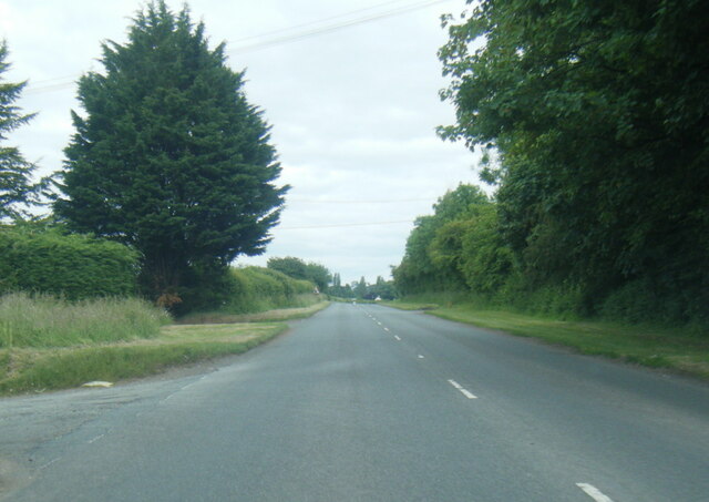
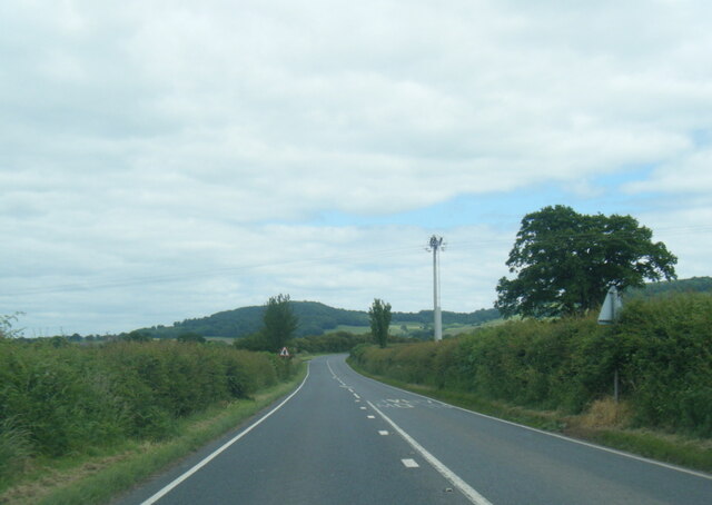
The village is nestled at the foot of the iconic Pen y Fan, the highest peak in southern Britain, making it a haven for outdoor enthusiasts. Llaneigon is renowned for its picturesque landscapes, with rolling hills, lush green meadows, and meandering streams creating a scenic backdrop for hiking, cycling, and other outdoor activities.

Despite its small size, Llaneigon boasts a strong sense of community and a rich history. The village dates back centuries and is home to several well-preserved historic buildings. The local church, St. Mary's, stands as a prominent landmark with its beautiful architecture and serves as a gathering place for religious ceremonies and community events.

In terms of amenities, Llaneigon offers a range of facilities to cater to the needs of its residents. A small number of shops and businesses provide essential services, and a few charming traditional pubs offer a friendly atmosphere for locals and visitors to socialize.

Llaneigon's location within the Brecon Beacons National Park also makes it a popular destination for tourists. The village attracts nature lovers, hikers, and those seeking a tranquil getaway from the hustle and bustle of city life.

In conclusion, Llaneigon is a picturesque village in Brecknockshire, Wales, offering a serene retreat within the breathtaking scenery of the Brecon Beacons National Park. With its strong community spirit and proximity to nature, Llaneigon provides a delightful escape for residents and visitors alike.

If you have any feedback on the listing, please let us know in the comments section below.

Llaneigon Images

Images are sourced within 2km of 52.054781/-3.150083 or Grid Reference SO2140. Thanks to Geograph Open Source API. All images are credited.

Steep hill and bungalow Overlooking the Wye Valley between Hay and Glasbury.
Steep hill and bungalow
Overlooking the Wye Valley between Hay and Glasbury.
B4350 near Ffordd-fawr
Sheep Farming near Glasbury
Gŵyl y Gelli / Hay Festival A little subdued on its final day, a wet Sunday.
Gŵyl y Gelli / Hay Festival
A little subdued on its final day, a wet Sunday.
B4350 at Little Ffordd Fawr
B4350 near Gypsy Castle Farm
B4350 Brecon Road at Hay-on-Wye boundary
Gate to Llanigon Church, Powys
Ford at Lanigon This is a second ford on the Digedi Brook at Llanigon.
Ford at Lanigon
This is a second ford on the Digedi Brook at Llanigon.
Ford at Plas Celyn This ford is found at Plas Celyn.
Ford at Plas Celyn
This ford is found at Plas Celyn.
A Llanigon Churchyard Yew The largest Churchyard Yew at Llanigon.
A Llanigon Churchyard Yew
The largest Churchyard Yew at Llanigon.
Llanigon, St Eigon
Llanigon, St Eigon
Farm buildings at Little Farm
Country road near Plas Celyn The sign reads "Unsuitable for HGVs". What lies ahead is scarcely suitable for any kind of vehicle!
Country road near Plas Celyn
The sign reads "Unsuitable for HGVs". What lies ahead is scarcely suitable for any kind of vehicle!
Village street in Llanigon
Ordnance Survey Cut Mark This OS cut mark can be found on the NW parapet of the bridge. It marks a point 121.692m above mean sea level.
Ordnance Survey Cut Mark
This OS cut mark can be found on the NW parapet of the bridge. It marks a point 121.692m above mean sea level.
Ordnance Survey Cut Mark This OS cut mark can be found on the south angle of St Nicholas Church. It marks a point 134.172m above mean sea level.
Ordnance Survey Cut Mark
This OS cut mark can be found on the south angle of St Nicholas Church. It marks a point 134.172m above mean sea level.
Sheep on the hillside A view over the Wye valley with Hay in the middle distance. taken from the side of a tortuous little road that winds its way down the hill.
Sheep on the hillside
A view over the Wye valley with Hay in the middle distance. taken from the side of a tortuous little road that winds its way down the hill.
Show me another place!

Llaneigon is located at Grid Ref: SO2140 (Lat: 52.054781, Lng: -3.150083)

Unitary Authority: Powys

Police Authority: Dyfed Powys

Also known as: Llanigon

What 3 Words

///awkward.migrate.fallback. Near Hay, Powys

Related Wikis

Llanigon

Llanigon is a village and community in Powys, Wales on the edge of the Brecon Beacons National Park, north of the Black Mountains, Wales. The community...

Hen-allt Common

Hen-allt Common is a Site of Special Scientific Interest in Brecknock, Powys, Wales. Its special features include unimproved grassland, Flat-sedge Blysmus...

Hay St Marys F.C.

Hay St Marys F.C. are a football club based in Hay-on-Wye. They currently play in the Ardal SE, the third tier of the Welsh football pyramid. The home...

St Mary's Church, Hay-on-Wye

St Mary's (also St Mary the Virgin) is an Anglican parish church in Hay-on-Wye, Brecknockshire, Powys, Wales. Separated by a deep dingle, which probably...

Nearby Amenities

Located within 500m of 52.054781,-3.150083
Llanigon
Is In: Powys, Wales,UK
Place: village
Source: npe
Wikidata: Q6661614
Lat/Long: 52.0546912/-3.1495678
Place Of Worship
Saint Eigon
Denomination: anglican
Religion: christian
Wikidata: Q29485811
Lat/Long: 52.0520484/-3.1479022
Barrier: kissing_gate
Foot: yes
Lat/Long: 52.0520902/-3.145662
Barrier: stile
Foot: yes
Lat/Long: 52.0544169/-3.1466671
Post Box
Operator: Royal Mail
Post Box Type: lamp
Ref: HR3 162
Royal Cypher: EIIR
Royal Cypher Wikidata: Q33102113
Source: GPS Survey
Lat/Long: 52.0548475/-3.1501109
Old Forge Garage
Shop: car_repair
Source: GPS Survey
Lat/Long: 52.0557332/-3.1498466
Telephone
Booth: KX100
Covered: booth
Lat/Long: 52.0519165/-3.1511983
Community Centre
Llanigon Village Hall
Community Centre: village_hall
Source: GPS Survey
Lat/Long: 52.0520519/-3.1517884
Place: farm
Lat/Long: 52.0588248/-3.1482265
Ford: yes
Source: OS OpenData StreetView
Lat/Long: 52.0520961/-3.1458364
Direction: SSW
Generator Method: photovoltaic
Generator Output Electricity: yes
Generator Solar Modules: 15
Generator Source: solar
Generator Type: solar_photovoltaic_panel
Location: roof
Power: generator
Lat/Long: 52.0553339/-3.1497288
Direction: 75
Generator Method: photovoltaic
Generator Output Electricity: yes
Generator Solar Modules: 6
Generator Source: solar
Generator Type: solar_photovoltaic_panel
Location: roof
Power: generator
Lat/Long: 52.0543938/-3.148436
Direction: 255
Generator Method: photovoltaic
Generator Output Electricity: yes
Generator Solar Modules: 10
Generator Source: solar
Generator Type: solar_photovoltaic_panel
Location: roof
Power: generator
Lat/Long: 52.0543625/-3.1485298
Direction: WSW
Generator Method: photovoltaic
Generator Output Electricity: yes
Generator Solar Modules: 16
Generator Source: solar
Generator Type: solar_photovoltaic_panel
Location: roof
Power: generator
Lat/Long: 52.054405/-3.1502713
Parking
Source: gps survey
Lat/Long: 52.0520062/-3.1511372
The data included in this document is from www.openstreetmap.org. The data is made available under ODbL.

Have you been to Llaneigon?

Leave your review of Llaneigon below (or comments, questions and feedback).