Llanegwad

Settlement in Carmarthenshire

Wales

Llanegwad

Field beyond the car park for the Halfway Inn, Llanegwad
Field beyond the car park for the Halfway Inn, Llanegwad Credit: Ruth Sharville

Llanegwad is a small rural village located in the county of Carmarthenshire, Wales. Situated on the banks of the River Tywi, it is nestled amidst the picturesque countryside, offering residents and visitors a tranquil and idyllic setting.

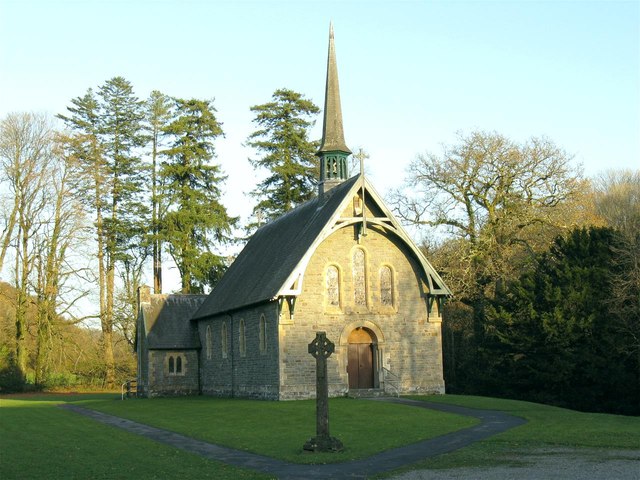
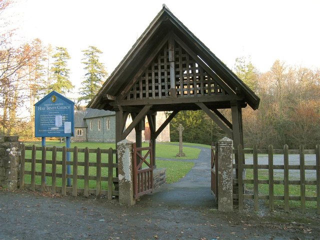
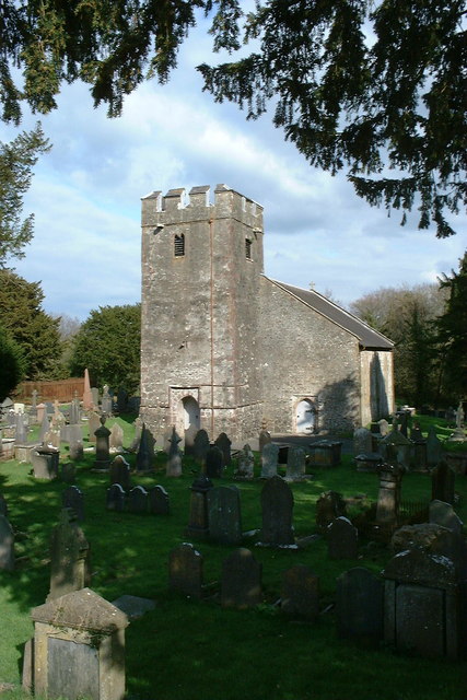
The village has a rich history, with evidence of human settlement dating back to prehistoric times. It is home to a number of historic landmarks, including St. Egwad's Church, a Grade II listed building that dates back to the 13th century. The church is renowned for its beautiful stained glass windows and is a testament to the village's religious heritage.

Llanegwad is primarily an agricultural community, with farming playing a central role in the local economy. The surrounding farmlands are known for their fertile soil, making it an ideal location for agricultural activities. The village boasts a strong sense of community, with many residents actively involved in farming and various rural initiatives.

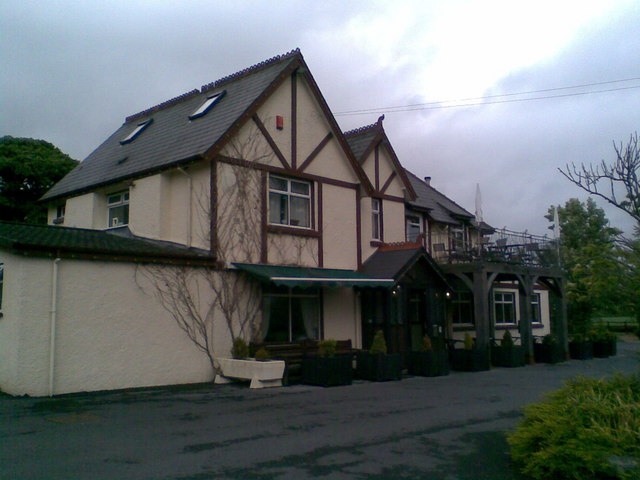
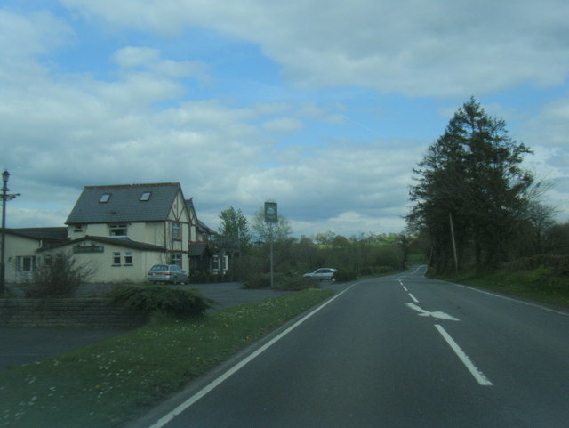
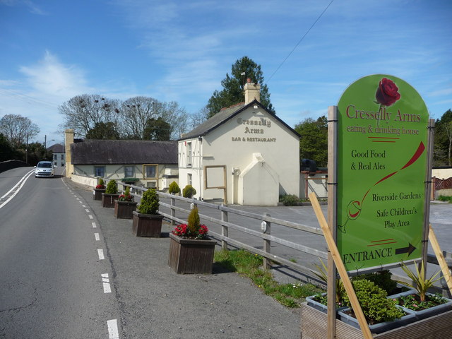
Despite its small size, Llanegwad offers a range of amenities for its residents. These include a village hall, a primary school, and a local pub, which serves as a gathering place for locals and visitors alike. The village also benefits from its proximity to the nearby town of Carmarthen, where residents can access a wider range of services, shops, and recreational facilities.

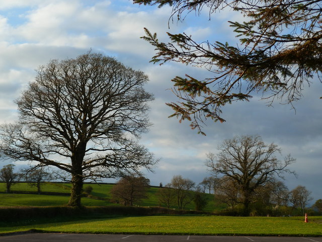
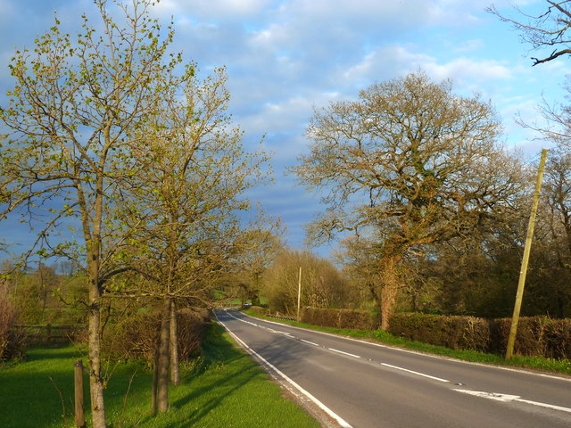
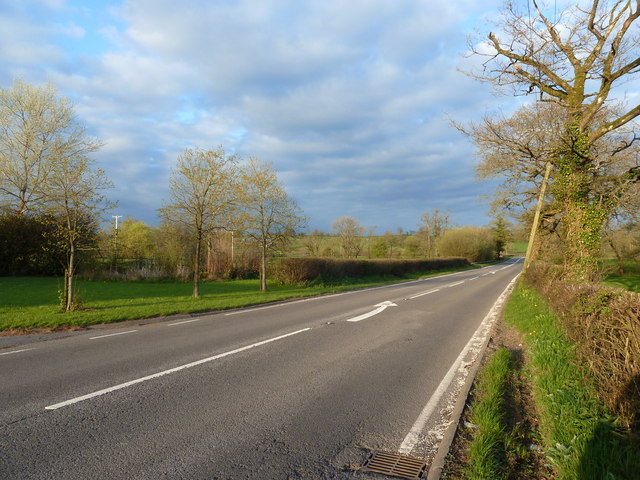
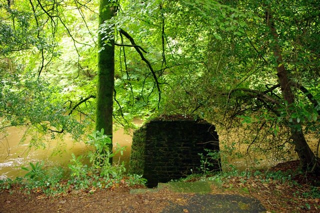
Nature lovers are drawn to Llanegwad due to its stunning natural surroundings. The river and rolling hills provide ample opportunities for outdoor activities such as fishing, hiking, and wildlife spotting. The village's peaceful ambiance and scenic beauty make it an attractive destination for those seeking a slower pace of life and a close connection to nature.

If you have any feedback on the listing, please let us know in the comments section below.
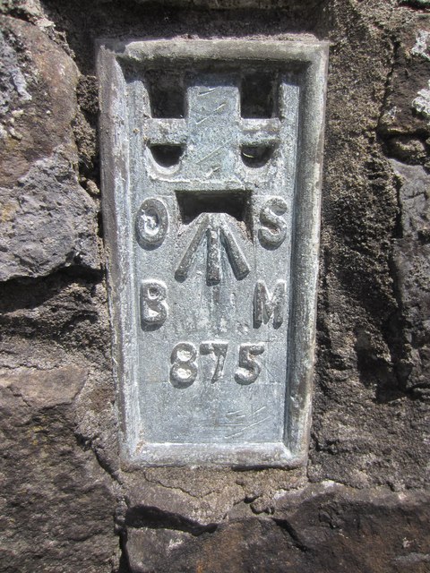
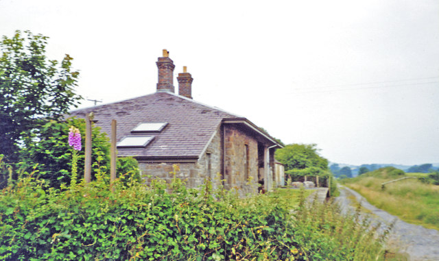
Llanegwad Images

Images are sourced within 2km of 51.872646/-4.150924 or Grid Reference SN5221. Thanks to Geograph Open Source API. All images are credited.

Field beyond the car park for the Halfway Inn, Llanegwad
A40 looking east from the Halfway Inn, Llanegwad
The A40 looking west from the Halfway Inn car park, Llanegwad
Halfway Inn A popular pub/restaurant near Nantgaredig.
Halfway Inn
A popular pub/restaurant near Nantgaredig.
Holy Trinity Church near Pontargothi On the north side of the quiet Cothi valley, over a kilometre upstream from the village of Pontargothi along narrow back roads, lies this church in quite spacious grounds.
Holy Trinity Church near Pontargothi
On the north side of the quiet Cothi valley, over a kilometre upstream from the village of Pontargothi along narrow back roads, lies this church in quite spacious grounds.
Lychgate, Holy Trinity Church This is the gate at <a href="https://www.geograph.org.uk/photo/2714525">SN5022 : Holy Trinity Church near Pontargothi</a>
Lychgate, Holy Trinity Church
Pont-ar-Gothi, bridge over River Cothi
A40 lane junction east of Pont-ar-Gothi
A40 looking east with Hafway Inn beyond
A40 at Wern Garage
A40 at Wern Garage
Another missing Carmarthenshire footbridge This is one of 44 bridges in the county in need of replacement, and another example of the shocking state of public footpaths in Carmarthenshire
Another missing Carmarthenshire footbridge
This is one of 44 bridges in the county in need of replacement, and another example of the shocking state of public footpaths in Carmarthenshire
St David's church, Llanarthney
The Cresselly Arms, Pont-ar-Gothi A well known and long established roadside hostelry.
The Cresselly Arms, Pont-ar-Gothi
A well known and long established roadside hostelry.
Ordnance Survey Flush Bracket This OS Flush Bracket (875) can be found on the south face of a roadside wall at the Golden Grove Arms, Llanarthne. It was used during the Second Geodetic Levelling of England & Wales (1912-21) Carmarthen - Llandovery Levelling Line. Also the Third Geodetic Levelling of England & Wales (1950-68) Llandovery - Carmarthen Levelling Line. It marks a point 79.1530ft above mean sea level.
Ordnance Survey Flush Bracket
This OS Flush Bracket (875) can be found on the south face of a roadside wall at the Golden Grove Arms, Llanarthne. It was used during the Second Geodetic Levelling of England & Wales (1912-21) Carmarthen - Llandovery Levelling Line. Also the Third Geodetic Levelling of England & Wales (1950-68) Llandovery - Carmarthen Levelling Line. It marks a point 79.1530ft above mean sea level.
Ordnance Survey Flush Bracket (874) This heavily painted over OS Flush Bracket (874) can be found on the north face of the stables at Bremenda Uchafa. It was used during the Second Geodetic Levelling of England & Wales (1912-21) Carmarthen - Llandovery Levelling Line. Also the Third Geodetic Levelling of England & Wales (1950-68) Llandovery - Carmarthen Levelling Line. It marks a point 81.5330ft above mean sea level.
Ordnance Survey Flush Bracket (874)
This heavily painted over OS Flush Bracket (874) can be found on the north face of the stables at Bremenda Uchafa. It was used during the Second Geodetic Levelling of England & Wales (1912-21) Carmarthen - Llandovery Levelling Line. Also the Third Geodetic Levelling of England & Wales (1950-68) Llandovery - Carmarthen Levelling Line. It marks a point 81.5330ft above mean sea level.
Ordnance Survey Flush Bracket (873) This OS Flush Bracket (873) can be found on the south east face of Pont ar Ffinnant. It was used during the Second Geodetic Levelling of England & Wales (1912-21) Carmarthen - Llandovery Levelling Line. Also the Third Geodetic Levelling of England & Wales (1950-68) Llandovery - Carmarthen Levelling Line. It marks a point 63.6340ft above mean sea level.
Ordnance Survey Flush Bracket (873)
This OS Flush Bracket (873) can be found on the south east face of Pont ar Ffinnant. It was used during the Second Geodetic Levelling of England & Wales (1912-21) Carmarthen - Llandovery Levelling Line. Also the Third Geodetic Levelling of England & Wales (1950-68) Llandovery - Carmarthen Levelling Line. It marks a point 63.6340ft above mean sea level.
Former Llanarthney station View westward, towards Carmarthen: ex-LNW Llandilo - Carmarthen branch, closed 9/9/63. The station has been acquired as a private residence.
Former Llanarthney station
View westward, towards Carmarthen: ex-LNW Llandilo - Carmarthen branch, closed 9/9/63. The station has been acquired as a private residence.
Water, water everywhere Part of Carmarthen flood plain, the sign on the gate reads, "Private access for fishing only to permit holders". Is a boat required?
Water, water everywhere
Part of Carmarthen flood plain, the sign on the gate reads, "Private access for fishing only to permit holders". Is a boat required?
Show me another place!

Llanegwad is located at Grid Ref: SN5221 (Lat: 51.872646, Lng: -4.150924)

Unitary Authority: Carmarthenshire

Police Authority: Dyfed Powys

What 3 Words

///bloodshot.tablet.undivided. Near Llanddarog, Carmarthenshire

Nearby Locations

Llanegwad

Related Wikis

Llanegwad

Llanegwad () is a village and community located in Carmarthenshire, Wales. The population taken at the 2011 census was 1,473. Llanegwad is built up mainly...

Pont-ar-Gothi

Pont-ar-gothi (otherwise Pontargothi or Cothi Bridge) is a village in Carmarthenshire, West Wales. The village takes its name from the bridge where the...

Llanarthney Halt railway station

Llanarthney railway station served the village of Llanarthney, in the historical county of Carmarthenshire, Wales, from 1865 to 1963 on the Llanelly Railway...

Llanarthney

Llanarthney (Welsh: Llanarthne; ) is a village and community in Carmarthenshire, south-west Wales. It is situated on the B4300 road, 12 km (7.5 miles)...

Nearby Amenities

Located within 500m of 51.872646,-4.150924
Llanegwad
Place: village
Wikidata: Q6661278
Lat/Long: 51.8720033/-4.1522378
Post Box
Collection Times: Mo-Fr 16:15; Sa 10:30
Post Box Type: lamp
Ref: SA32 158
Royal Cypher: EIIR
Royal Cypher Wikidata: Q33102113
Lat/Long: 51.8717349/-4.1518091
Direction: 215
Generator Method: photovoltaic
Generator Output Electricity: yes
Generator Solar Modules: 11
Generator Source: solar
Generator Type: solar_photovoltaic_panel
Location: roof
Power: generator
Lat/Long: 51.8716141/-4.1533953
Direction: 215
Generator Method: photovoltaic
Generator Output Electricity: yes
Generator Solar Modules: 5
Generator Source: solar
Generator Type: solar_photovoltaic_panel
Location: roof
Power: generator
Lat/Long: 51.8716328/-4.1535405
Direction: 165
Generator Method: photovoltaic
Generator Output Electricity: yes
Generator Solar Modules: 16
Generator Source: solar
Generator Type: solar_photovoltaic_panel
Location: roof
Power: generator
Lat/Long: 51.8735159/-4.1532132
The data included in this document is from www.openstreetmap.org. The data is made available under ODbL.

Have you been to Llanegwad?

Leave your review of Llanegwad below (or comments, questions and feedback).