Port an Lobhaidh
Sea, Estuary, Creek in Argyllshire
Scotland
Port an Lobhaidh
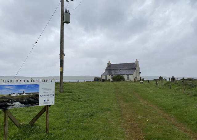
Port an Lobhaidh is a small coastal settlement located in the region of Argyllshire, Scotland. Situated on the western coast, it is renowned for its picturesque sea, estuary, and creek. The name "Port an Lobhaidh" translates to "Port of the lobsters," indicating the abundance of this crustacean in the area.
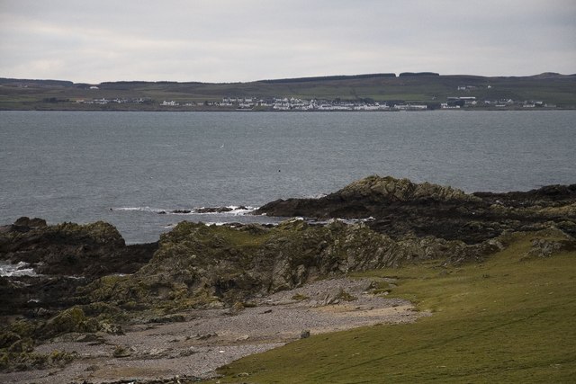
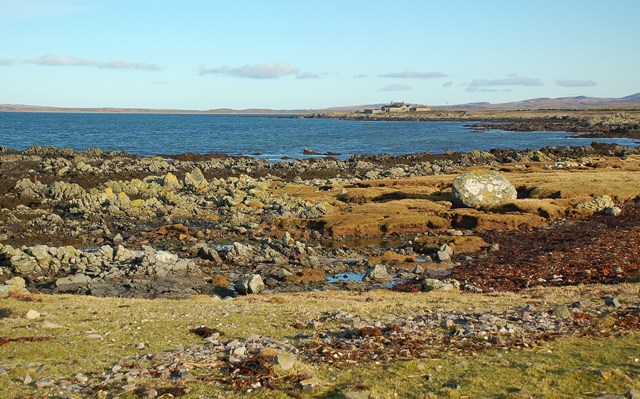
The settlement is nestled along the shores of a sheltered bay, providing a tranquil and scenic environment. The sea at Port an Lobhaidh is known for its crystal-clear waters and is a popular spot for various water activities such as swimming, snorkeling, and sailing. The bay also offers a safe haven for boats and fishing vessels, making it a significant hub for the local fishing industry.
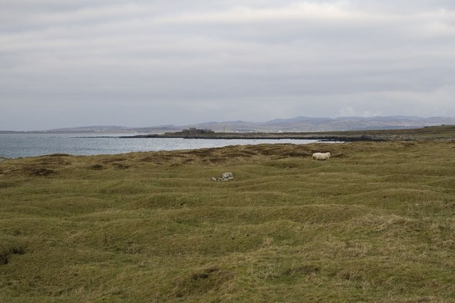
Adjacent to the sea, the estuary at Port an Lobhaidh is a natural wonder. It is formed by the convergence of a river and the sea, creating a unique ecosystem that supports a diverse range of marine and bird life. The estuary is a haven for birdwatchers, who can spot a variety of species, including herons, gulls, and even the occasional osprey.
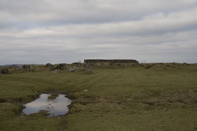
The creek at Port an Lobhaidh is a narrow inlet that meanders its way through the landscape. It is a haven for wildlife, providing a sanctuary for otters, seals, and various species of fish. The creek is also a popular spot for anglers, who can try their luck at catching salmon and trout.
Overall, Port an Lobhaidh in Argyllshire offers a charming coastal experience, boasting a beautiful sea, estuary, and creek that attracts nature enthusiasts, fishermen, and those seeking tranquility amidst stunning natural surroundings.
If you have any feedback on the listing, please let us know in the comments section below.
Port an Lobhaidh Images
Images are sourced within 2km of 55.739253/-6.3316117 or Grid Reference NR2858. Thanks to Geograph Open Source API. All images are credited.


Port an Lobhaidh is located at Grid Ref: NR2858 (Lat: 55.739253, Lng: -6.3316117)
Unitary Authority: Argyll and Bute
Police Authority: Argyll and West Dunbartonshire
What 3 Words
///squaring.wheels.clipboard. Near Port Charlotte, Argyll & Bute
Related Wikis
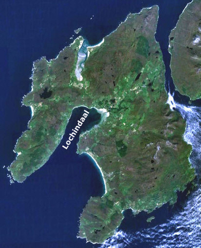
Loch Indaal
Loch Indaal (or Lochindaal) is a sea loch on Islay, the southernmost island of the Hebrides, off the west coast of Scotland. Together with Loch Gruinart...

A847 road
The A847 road is one of the two principal roads of Islay in the Inner Hebrides off the west coast of mainland Scotland. It connects Bridgend, at a junction...

Port Charlotte, Islay
Port Charlotte (Scottish Gaelic: Port Sgioba) is a village on the island of Islay in the Inner Hebrides, Scotland. It was founded in 1828. In 1991 it...

Port Charlotte distillery
Port Charlotte distillery (also known as Rhins distillery and Lochindaal distillery) was a Scotch whisky distillery on the island of Islay, off the west...

Clark Cottage
Clark Cottage is a residential building in the Scottish village of Port Charlotte on the island of Islay. The building is on the eastern side of Main Street...

Bowmore distillery
Bowmore distillery ( boh-MOR, Scottish Gaelic: Taigh-staile Bogh Mòr) produces Scotch whisky on the Isle of Islay, an island of the Inner Hebrides.The...
RAF Bowmore
Royal Air Force Bowmore or more simply RAF Bowmore is a former Royal Air Force seaplane station located in Bowmore, Argyll and Bute, Scotland. The following...
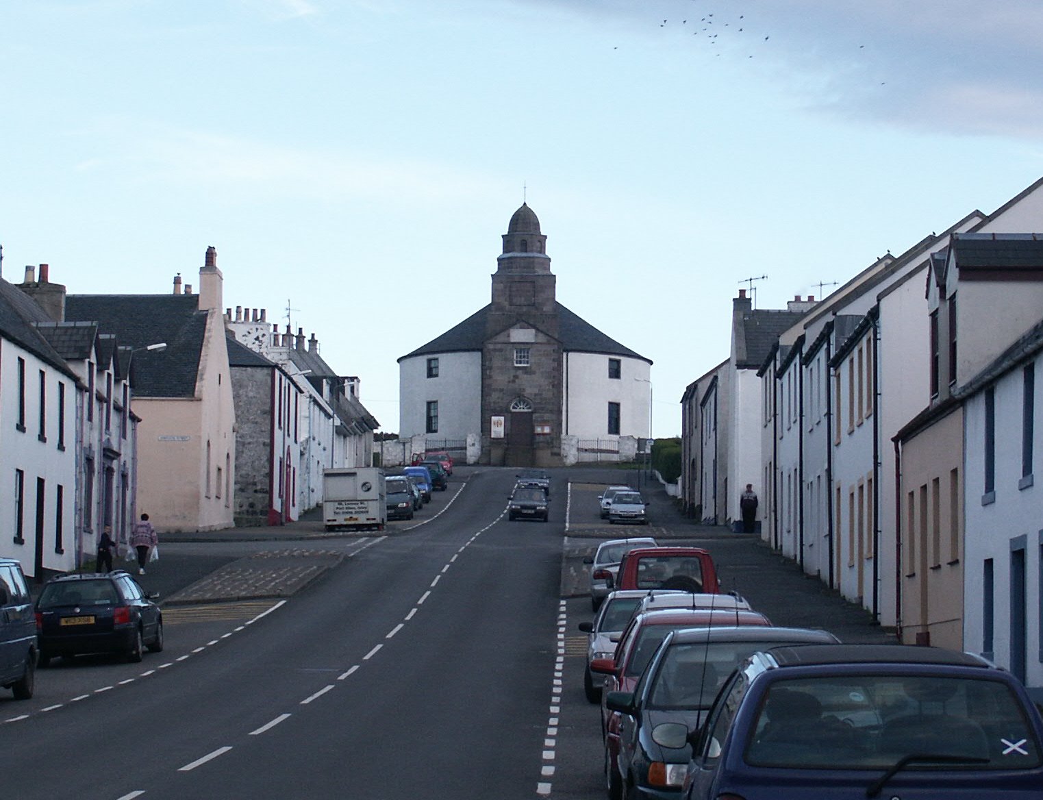
Kilarrow Parish Church
Kilarrow Church (Scottish Gaelic: Eaglais Cill an Rubha) is a Church of Scotland parish church, overlooking and serving Bowmore on the island of Islay...
Nearby Amenities
Located within 500m of 55.739253,-6.3316117Have you been to Port an Lobhaidh?
Leave your review of Port an Lobhaidh below (or comments, questions and feedback).