Llandynan

Settlement in Denbighshire

Wales

Llandynan

Llangollen Canal - the end Between the Bridge Hotel and the Horseshoe Falls, the canal terminates at this point.
Llangollen Canal - the end Credit: Trevor Harris

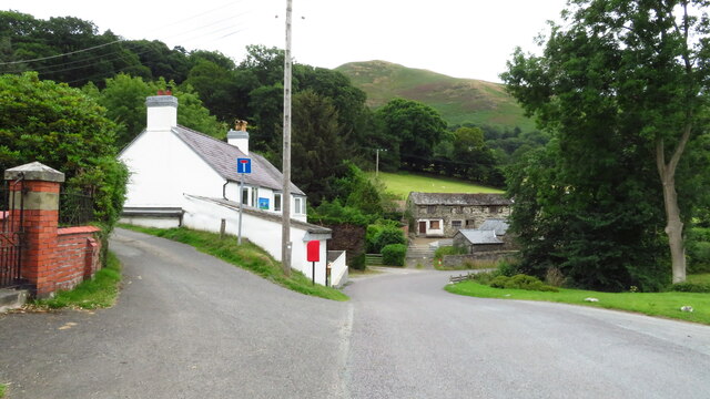
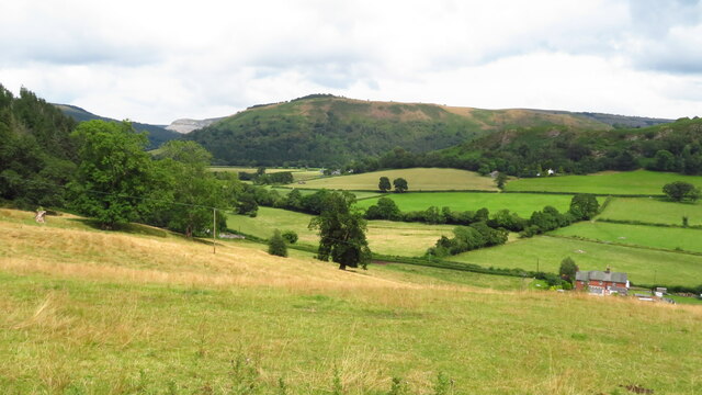
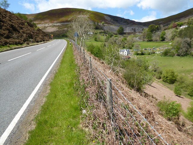
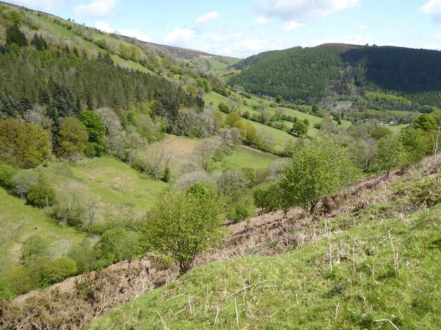
Llandynan is a small village located in Denbighshire, Wales. Situated in the scenic countryside, it is surrounded by rolling hills and beautiful farmland. The village is part of the Llansannan community and lies approximately 10 miles southwest of Denbigh.

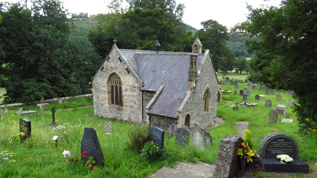
Llandynan has a rich history dating back many centuries. It is believed to have been settled during the medieval period, and remnants of this heritage can still be seen in the form of historic buildings and landmarks. The village is particularly known for its ancient church, St. Dynan's Church, which dates back to the 13th century. This impressive structure showcases traditional Welsh architecture and is a popular attraction for history enthusiasts.

Despite its small size, Llandynan is a tight-knit community with a welcoming atmosphere. The village is home to a close-knit population who take great pride in their local heritage. Llandynan has a friendly village pub, serving as a gathering place for both locals and visitors.

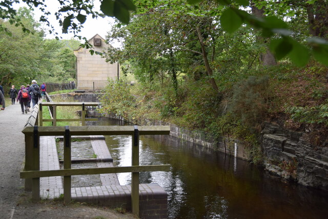
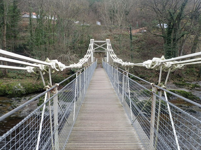
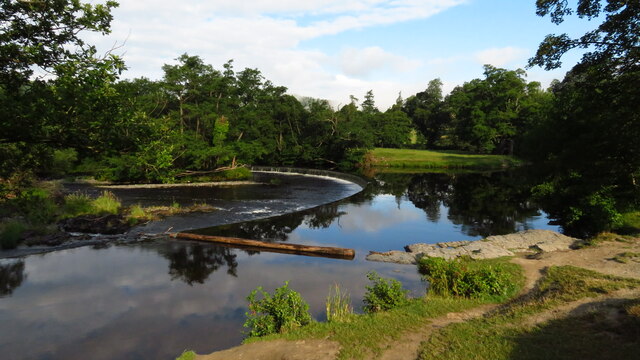
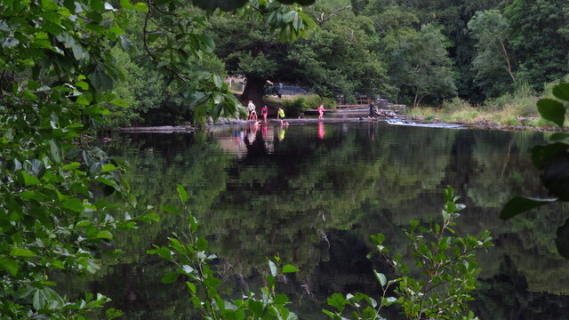
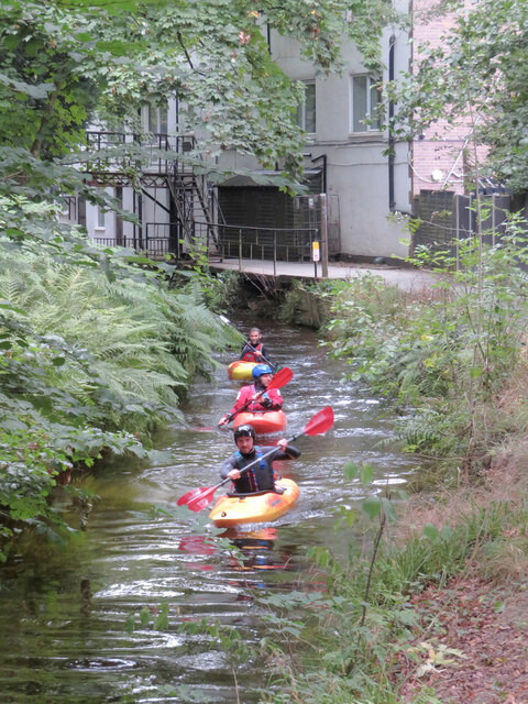
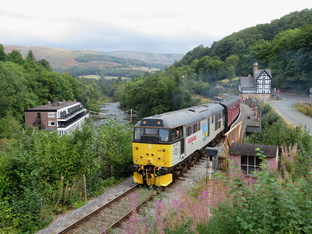
The surrounding area offers ample opportunities for outdoor activities and exploration. The picturesque countryside is ideal for hiking, cycling, and nature walks. The nearby River Clwyd also attracts anglers and provides a serene setting for leisurely strolls.

While Llandynan may be a quiet and tranquil village, its location allows for easy access to larger towns and cities. Denbigh, with its range of amenities, including shops, schools, and healthcare facilities, is just a short drive away.

Overall, Llandynan is a charming village that offers a peaceful retreat in the heart of the Welsh countryside, making it an attractive destination for those seeking a slower pace of life and a connection to nature.

If you have any feedback on the listing, please let us know in the comments section below.

Llandynan Images

Images are sourced within 2km of 52.995603/-3.210104 or Grid Reference SJ1844. Thanks to Geograph Open Source API. All images are credited.

Llangollen Canal - the end Between the Bridge Hotel and the Horseshoe Falls, the canal terminates at this point.
Llangollen Canal - the end
Between the Bridge Hotel and the Horseshoe Falls, the canal terminates at this point.
The Chain Bridge There has been a crossing point over the River Dee at Berwyn as far back as Roman times, later serving the Cistercian monks of the nearby Valle Crucis Abbey. At the beginning of the 19th century plans were made to build the first bridge in this most beautiful of locations. Exuperius Pickering was a local entrepreneur dealing in limestone and slate. He had been involved in the building of the Pontcysyllte Aqueduct and had got to know Thomas Telford well.
Telford had been given the work of building the now A5 from London to Holyhead following the latter being chosen as the main port between Britain and Ireland. The existing road was already a major coaching route but its condition was no better than a dirt track in many places. Pickering was quick to see the trading opportunity as the route of the new road would travel close to his works in Berwyn. In conjunction with Telford, the first Llangollen Chain Bridge was duly completed in 1814, the year before work started on the new road. This was made of wood, with chains slung underneath. It survived until 1870 before needing a complete refurbishment by another famous engineer Sir Henry Robinson, owner of the Brymbo Iron Works. <span class="nowrap"><a title="http://web.archive.org/web/20081028133232/http://www.llangollen.org/en/10_Wonders_of_Llangollen_/The_Chain_Bridge" rel="nofollow ugc noopener" href="http://web.archive.org/web/20081028133232/http://www.llangollen.org/en/10_Wonders_of_Llangollen_/The_Chain_Bridge">Archive Link</a><img style="margin-left:2px;" alt="External link" title="External link - shift click to open in new window" src="https://s1.geograph.org.uk/img/external.png" width="10" height="10"/></span> The bridge fell into disrepair <a href="https://www.geograph.org.uk/photo/2365661">SJ1943 : The Chain Bridge</a> but thankfully, the adjacent Chain Bridge hotel has had new owners in recent years and they have now repaired the bridge as seen here.
The Chain Bridge
There has been a crossing point over the River Dee at Berwyn as far back as Roman times, later serving the Cistercian monks of the nearby Valle Crucis Abbey. At the beginning of the 19th century plans were made to build the first bridge in this most beautiful of locations. Exuperius Pickering was a local entrepreneur dealing in limestone and slate. He had been involved in the building of the Pontcysyllte Aqueduct and had got to know Thomas Telford well. Telford had been given the work of building the now A5 from London to Holyhead following the latter being chosen as the main port between Britain and Ireland. The existing road was already a major coaching route but its condition was no better than a dirt track in many places. Pickering was quick to see the trading opportunity as the route of the new road would travel close to his works in Berwyn. In conjunction with Telford, the first Llangollen Chain Bridge was duly completed in 1814, the year before work started on the new road. This was made of wood, with chains slung underneath. It survived until 1870 before needing a complete refurbishment by another famous engineer Sir Henry Robinson, owner of the Brymbo Iron Works. Archive LinkExternal link The bridge fell into disrepair SJ1943 : The Chain Bridge but thankfully, the adjacent Chain Bridge hotel has had new owners in recent years and they have now repaired the bridge as seen here.
Two bridges from a third bridge The lower bridge (King's Bridge) carries the B5103 over the River Dee to join the A5 near Berwyn Railway Station. The higher bridge is a viaduct crossing a tributary which joins the River Dee and carrying the steam railway between Llangollen and Carrog. The photo was taken from the Chain Bridge <a href="https://www.geograph.org.uk/photo/6979038">SJ1943 : The Chain Bridge</a>, a footbridge crossing the river from the Chain Bridge Hotel to Berwyn Station.
Two bridges from a third bridge
The lower bridge (King's Bridge) carries the B5103 over the River Dee to join the A5 near Berwyn Railway Station. The higher bridge is a viaduct crossing a tributary which joins the River Dee and carrying the steam railway between Llangollen and Carrog. The photo was taken from the Chain Bridge SJ1943 : The Chain Bridge, a footbridge crossing the river from the Chain Bridge Hotel to Berwyn Station.
Horseshoe Falls, Berwyn near Llangollen
Road leading northeast into Rhewl, Dee Valley
Farmland at Maesyrychen uchaf as seen from Dee Valley Way, west of Llangollen
Llantysilio - St Tysilio's Church
Bathers at Horseshoe Falls, Berwyn near Llangollen
The Horseshoe Pass The A542 ascending the Horseshoe Pass.  Moel y Gamelin can be seen in the background.
The Horseshoe Pass
The A542 ascending the Horseshoe Pass. Moel y Gamelin can be seen in the background.
Valley below the Horseshoe Pass View into the valley below the A542 Horseshoe Pass.
Valley below the Horseshoe Pass
View into the valley below the A542 Horseshoe Pass.
The A5 at Berwyn
The A5 at Berwyn
Parkland above the Horsehoe Falls in Berwyn
Horseshoe Falls at Berwyn
Canoeing on the Llangollen Canal in Berwyn
Footbridge over the Llangollen Canal in Berwyn
View along the chainbridge at Berwyn
Derelict building beside the A5 in Berwyn It is not clear what this building once was. Old maps of the area show a Methodist chapel near this site, but this building doesn't look like a typical chapel.
Derelict building beside the A5 in Berwyn
It is not clear what this building once was. Old maps of the area show a Methodist chapel near this site, but this building doesn't look like a typical chapel.
Llangollen Railway at Berwyn Class 31 No. 31271 departs Berwyn with a service for Carrog during the Llangollen Railway's diesel gala.
Llangollen Railway at Berwyn
Class 31 No. 31271 departs Berwyn with a service for Carrog during the Llangollen Railway's diesel gala.
Show me another place!

Llandynan is located at Grid Ref: SJ1844 (Lat: 52.995603, Lng: -3.210104)

Unitary Authority: Denbighshire

Police Authority: North Wales

Also known as: Llandynnan

What 3 Words

///tumblers.cheered.dawn. Near Llangollen, Denbighshire

Related Wikis

Llantysilio Hall

Llantysilio Hall is a Grade II* listed country house in Llantysilio, near Llangollen in Denbighshire. It is on the bank of the River Dee and adjacent to...
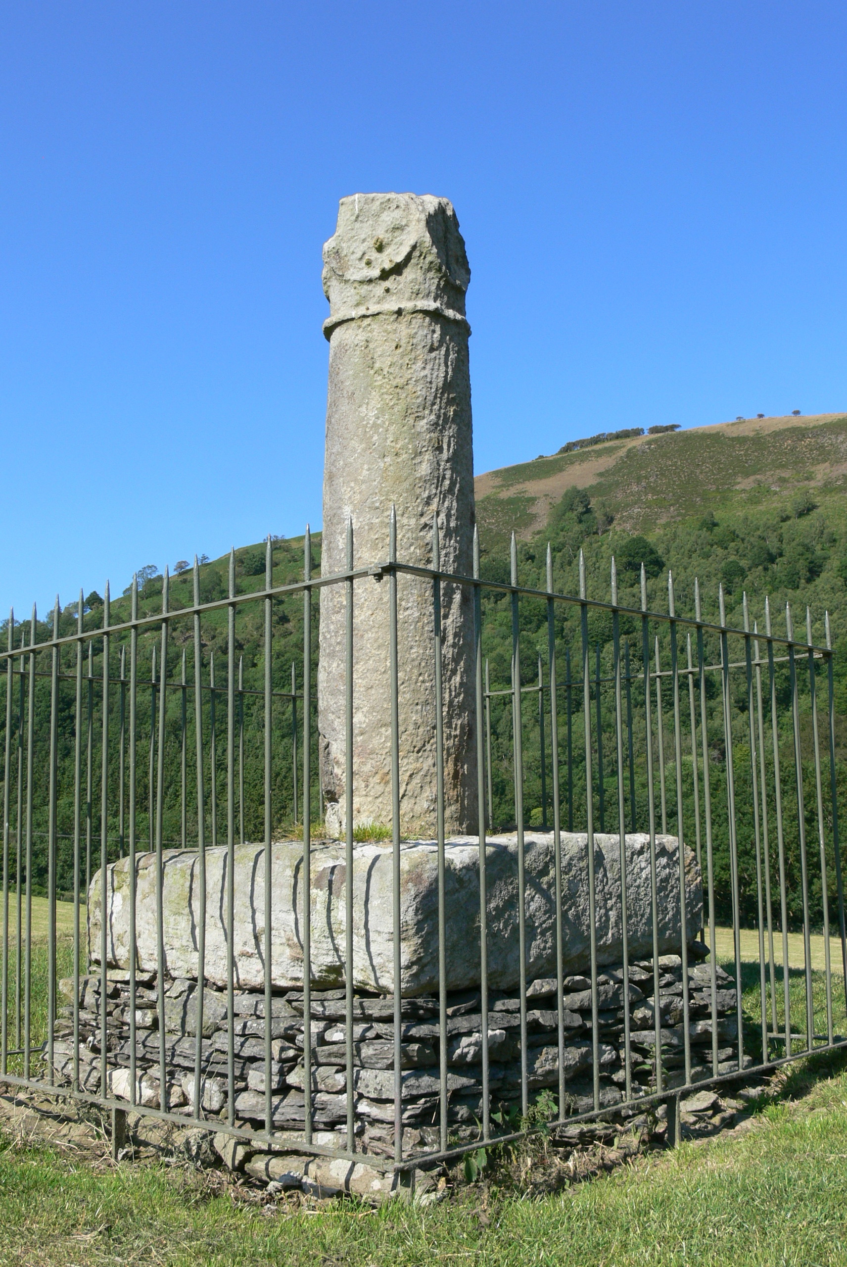
Pillar of Eliseg

The Pillar of Eliseg – also known as Elise's Pillar or Croes Elisedd in Welsh – stands near Valle Crucis Abbey, Denbighshire, Wales [Grid reference SJ...

Llantysilio

Llantysilio (Welsh: Llandysilio-yn-Iâl) is a community in Denbighshire, Wales, near Llangollen. It has a population of 472, falling to 421 at the 2011...

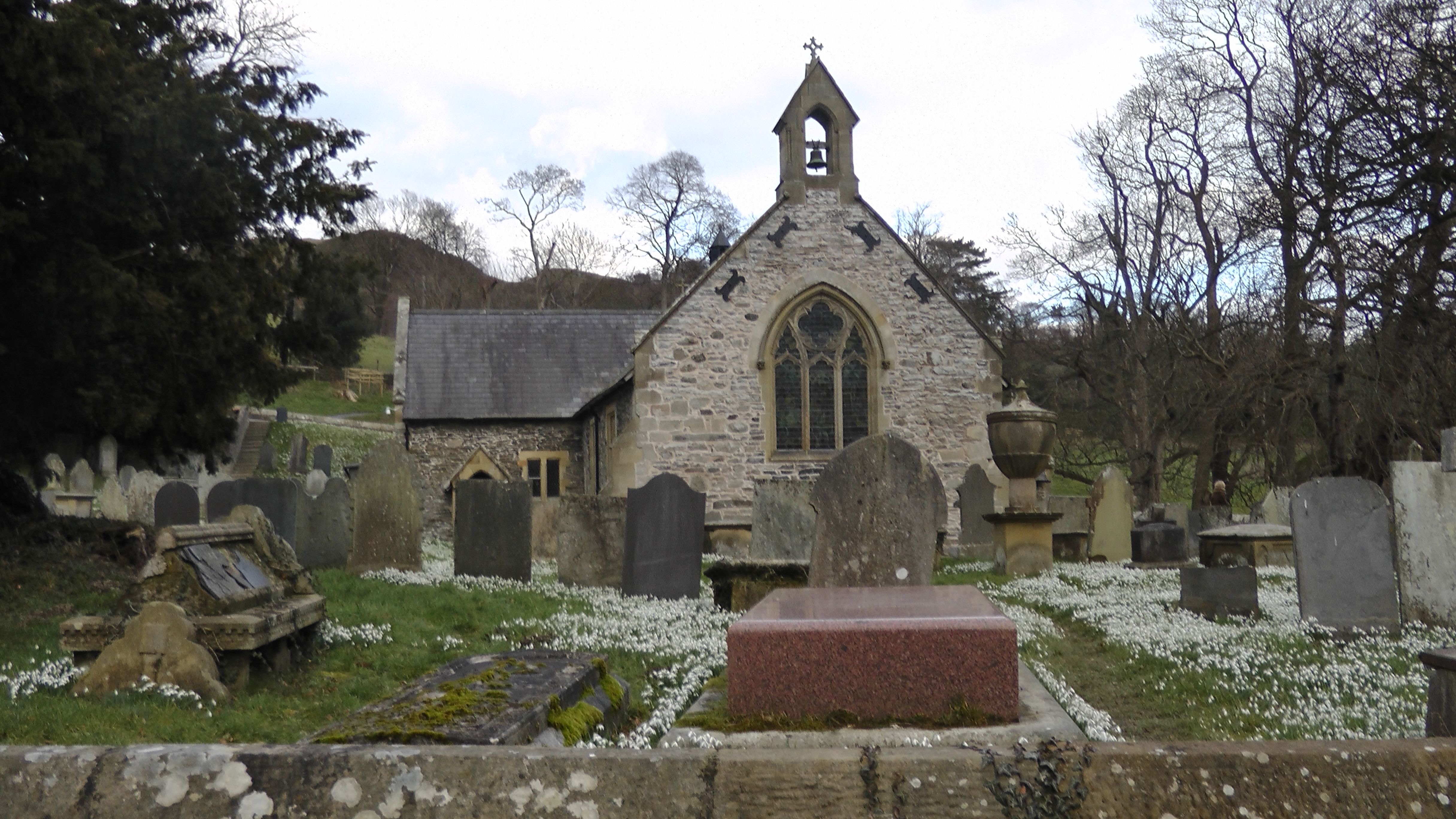
St Tysilio's Church, Llantysilio

Llantysilio Church is a parish church in Llantysilio, near Llangollen, Denbighshire, North Wales.It sits on uprising land from the banks of the river Dee...

Nearby Amenities

Located within 500m of 52.995603,-3.210104
Source: npe
Lat/Long: 52.9927767/-3.2155976
Source: npe
Lat/Long: 52.9917057/-3.2119021
Barrier: stile
Lat/Long: 52.9926233/-3.2077343
Barrier: stile
Lat/Long: 52.9944308/-3.2095418
Barrier: stile
Lat/Long: 52.9950731/-3.2107204
Llandynan
Place: village
Lat/Long: 52.9964392/-3.212456
Public Bookcase
Booth: K6
Colour: red
Disused Amenity: telephone
Man Made: telephone_box
Public Bookcase Type: phone_box
Lat/Long: 52.9952707/-3.2111233
Post Box
Post Box Type: lamp
Lat/Long: 52.995261/-3.2110978
Direction: WSW
Generator Method: photovoltaic
Generator Output Electricity: yes
Generator Solar Modules: 3
Generator Source: solar
Generator Type: solar_photovoltaic_panel
Location: roof
Power: generator
Lat/Long: 52.9922247/-3.2083029
Direction: SSE
Generator Method: photovoltaic
Generator Output Electricity: yes
Generator Solar Modules: 13
Generator Source: solar
Generator Type: solar_photovoltaic_panel
Location: roof
Power: generator
Lat/Long: 52.9922243/-3.2083739
The data included in this document is from www.openstreetmap.org. The data is made available under ODbL.

Have you been to Llandynan?

Leave your review of Llandynan below (or comments, questions and feedback).