Llandygwydd

Settlement in Cardiganshire

Wales

Llandygwydd

Scotland Hill Trig has been uprooted and relocated to the SSE gate corner. Up track from SE and cattle pasture gates.to find trig on way to TUMP summit. It doesn't get much better than bagging Scotland Hill in Wales.
Name: Scotland Hill
Hill number: 15420
Height:185m / 607ft
Parent (Ma/M): 2221  Rhos Ymryson
Section:31C: South-West Wales
County/UA: Cardiganshire [Ceredigion] (CoU)
Class: Tump (100-199m)
Grid ref:SN248453 (est)
Drop: 48m
Col:137m  SN270486
Scotland Hill Credit: Rude Health

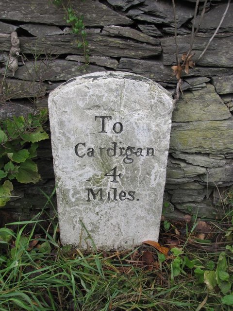
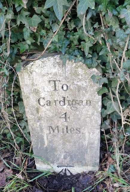
Llandygwydd is a small village located in the county of Cardiganshire, Wales. Situated approximately 4 miles northeast of Cardigan, it is nestled in a picturesque rural setting, surrounded by rolling hills and lush green countryside.

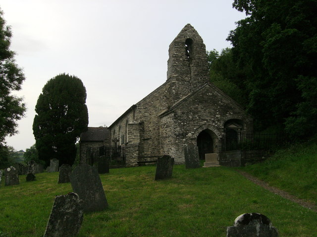
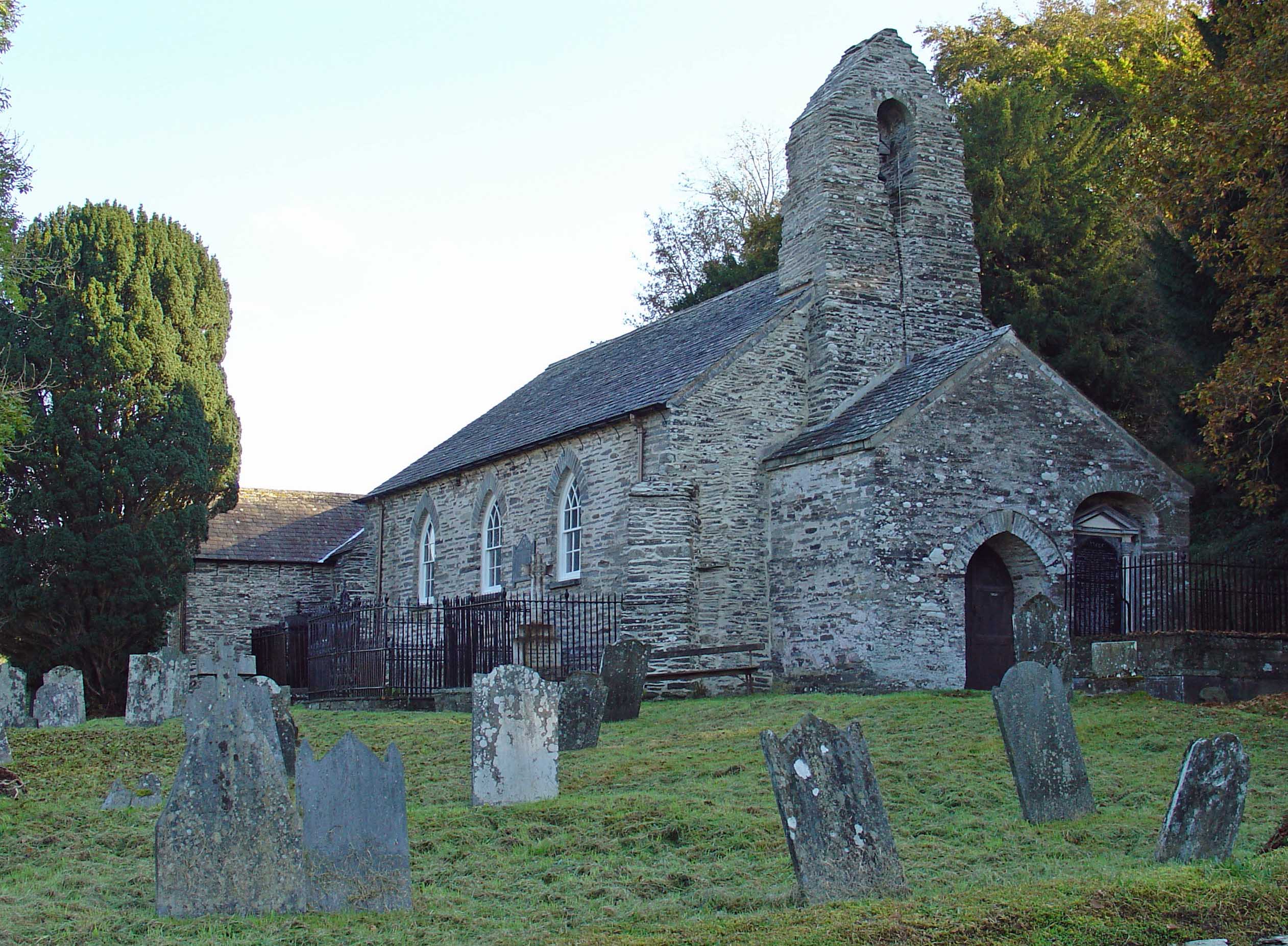
The village is home to a close-knit community and has a population of around 300 residents. It is known for its charming historic buildings, including the quaint St. Tygwydd's Church, which dates back to the 13th century. The church is a focal point of the village and holds regular services and community events.

Llandygwydd offers a tranquil and peaceful environment, making it an ideal place for those seeking a slower pace of life. The surrounding landscape provides ample opportunities for outdoor activities such as hiking, cycling, and horse riding, with numerous scenic trails and bridleways to explore.

Although relatively small, the village boasts a range of amenities to cater to the needs of its residents. These include a local pub, The Farmers Arms, which offers a warm and friendly atmosphere, and a village hall that hosts various social gatherings and events throughout the year.

For those in search of more extensive amenities, the nearby town of Cardigan provides a wider range of shops, supermarkets, schools, and healthcare facilities.

Overall, Llandygwydd is a charming and idyllic village that offers a peaceful and close-knit community, surrounded by beautiful countryside, making it a desirable place to live for those looking for a rural retreat.

If you have any feedback on the listing, please let us know in the comments section below.

Llandygwydd Images

Images are sourced within 2km of 52.063796/-4.566902 or Grid Reference SN2443. Thanks to Geograph Open Source API. All images are credited.

Scotland Hill Trig has been uprooted and relocated to the SSE gate corner. Up track from SE and cattle pasture gates.to find trig on way to TUMP summit. It doesn't get much better than bagging Scotland Hill in Wales.
Name: Scotland Hill
Hill number: 15420
Height:185m / 607ft
Parent (Ma/M): 2221  Rhos Ymryson
Section:31C: South-West Wales
County/UA: Cardiganshire [Ceredigion] (CoU)
Class: Tump (100-199m)
Grid ref:SN248453 (est)
Drop: 48m
Col:137m  SN270486
Scotland Hill
Trig has been uprooted and relocated to the SSE gate corner. Up track from SE and cattle pasture gates.to find trig on way to TUMP summit. It doesn't get much better than bagging Scotland Hill in Wales. Name: Scotland Hill Hill number: 15420 Height:185m / 607ft Parent (Ma/M): 2221 Rhos Ymryson Section:31C: South-West Wales County/UA: Cardiganshire [Ceredigion] (CoU) Class: Tump (100-199m) Grid ref:SN248453 (est) Drop: 48m Col:137m SN270486
Pen Bryn-Bwa Trig Point Trig has been uprooted from the summit of Scotland Hill and relocated to the SSE gate corner. Up track from SE + cattle pasture gates.to find trig on way to TUMP summit. It doesn't get much better than bagging Scotland Hill in Wales.
Pen Bryn-Bwa Trig Point
Trig has been uprooted from the summit of Scotland Hill and relocated to the SSE gate corner. Up track from SE + cattle pasture gates.to find trig on way to TUMP summit. It doesn't get much better than bagging Scotland Hill in Wales.
The uprooted and moved Pen Bryn-Bwa Triangulation Pillar This pillar used to stand on the Tumuli at SN 2487 4537 but now stands abandoned in a nearby gateway.
Looking westward.
The uprooted and moved Pen Bryn-Bwa Triangulation Pillar
This pillar used to stand on the Tumuli at SN 2487 4537 but now stands abandoned in a nearby gateway. Looking westward.
Manordeifi old church The redundant old church possibly dates from the early 14th century and had some alteration in the 19th century. The care of the church was taken over by the Friends of Friendless Churches in 2000 after its closure.
Manordeifi old church
The redundant old church possibly dates from the early 14th century and had some alteration in the 19th century. The care of the church was taken over by the Friends of Friendless Churches in 2000 after its closure.
Old Milestone by the A484, Llwynduris Farm, Beulah parish Cardigan tombstone by the A484, in parish of Beulah (Ceredigion District), Llwynduris Farm, Southwest of Llandygwydd, on verge against wall, East side of road.

Inscription reads:-
To
Cardigan
4
Miles

Grade II listed by Cadw.
Reference Number: 17960 <span class="nowrap"><a title="https://cadwpublic-api.azurewebsites.net/reports/listedbuilding/FullReport?lang=&id=17960" rel="nofollow ugc noopener" href="https://cadwpublic-api.azurewebsites.net/reports/listedbuilding/FullReport?lang=&id=17960">Link</a><img style="margin-left:2px;" alt="External link" title="External link - shift click to open in new window" src="https://s1.geograph.org.uk/img/external.png" width="10" height="10"/></span>

Surveyed

Milestone Society National ID: CRD_CACM04
Old Milestone by the A484, Llwynduris Farm, Beulah parish
Cardigan tombstone by the A484, in parish of Beulah (Ceredigion District), Llwynduris Farm, Southwest of Llandygwydd, on verge against wall, East side of road. Inscription reads:- To Cardigan 4 Miles Grade II listed by Cadw. Reference Number: 17960 LinkExternal link Surveyed Milestone Society National ID: CRD_CACM04
Ordnance Survey Cut Mark This OS cut mark can be found on the gatepost NW side of the road. It marks a point 133.698m above mean sea level.
Ordnance Survey Cut Mark
This OS cut mark can be found on the gatepost NW side of the road. It marks a point 133.698m above mean sea level.
Milestone - Cardigan 4 The OS cut mark on the stone marks a point 19.198m above mean sea level.
Milestone - Cardigan 4
The OS cut mark on the stone marks a point 19.198m above mean sea level.
Ordnance Survey Cut Mark This OS cut mark can be found on Pant-y-Llys. It marks a point 113.016m above mean sea level.
Ordnance Survey Cut Mark
This OS cut mark can be found on Pant-y-Llys. It marks a point 113.016m above mean sea level.
Ordnance Survey Cut Mark This OS cut mark can be found on a building at Aber Eifed. It marks a point 10.413m above mean sea level.
Ordnance Survey Cut Mark
This OS cut mark can be found on a building at Aber Eifed. It marks a point 10.413m above mean sea level.
Ordnance Survey Cut Mark This OS cut mark can be found on the remains of the porch of the ruin of St Tygwydd's Church. It marks a point 44.720m above mean sea level.
Ordnance Survey Cut Mark
This OS cut mark can be found on the remains of the porch of the ruin of St Tygwydd's Church. It marks a point 44.720m above mean sea level.
Church at Manordeifi Similar photo of others on this site, the most recent grave I could see is in line with the entrance door.
Church at Manordeifi
Similar photo of others on this site, the most recent grave I could see is in line with the entrance door.
A484 at Tanbank
A484 at Tanbank
A484 entering wooded area This is where the Afon Teifi is next to the road near Llandygwydd
A484 entering wooded area
This is where the Afon Teifi is next to the road near Llandygwydd
Through the woods on the A484 Just east of Llandygwydd turning
Through the woods on the A484
Just east of Llandygwydd turning
A484 heading for Llechryd View of the A484 heading for Llechryd from a bus stop near Llandygwydd.
A484 heading for Llechryd
View of the A484 heading for Llechryd from a bus stop near Llandygwydd.
A484 heading for Llechryd View of a narrower section of the A484 heading to Llechryd from Cenarth near Allt Llwynduris.
A484 heading for Llechryd
View of a narrower section of the A484 heading to Llechryd from Cenarth near Allt Llwynduris.
Tree-lined road to Llechryd This section of the tree-lined road to Llechryd near Llandygwydd, is just within the grid square. The Afon Teifi (River Teifi) runs alongside this section of the A484.
Tree-lined road to Llechryd
This section of the tree-lined road to Llechryd near Llandygwydd, is just within the grid square. The Afon Teifi (River Teifi) runs alongside this section of the A484.
Coracle: Manordeifi Old Church Originally, a coracle (not this one) was slung from the roof in the church, so that it would by dry for use when the river rose.
Coracle: Manordeifi Old Church
Originally, a coracle (not this one) was slung from the roof in the church, so that it would by dry for use when the river rose.
Show me another place!

Llandygwydd is located at Grid Ref: SN2443 (Lat: 52.063796, Lng: -4.566902)

Unitary Authority: Ceredigion

Police Authority: Dyfed Powys

What 3 Words

///knots.evoke.served. Near Cardigan, Ceredigion

Nearby Locations

Llandygwydd

Related Wikis

Pen-y-lan, Ceredigion

Pen-y-lan, Ceredigion is a hamlet in the community of Beulah, Ceredigion, Wales, which is 72.1 miles (116.1 km) from Cardiff and 193.9 miles (312 km) from...

Llandygwydd

Llandygwydd is a small settlement in Ceredigion, west Wales, between Newcastle Emlyn and the town of Cardigan. == Amenities & History == A small stream...

Rhyd, Ceredigion

Rhyd, Ceredigion is a hamlet in the community of Beulah, Ceredigion, Wales, which is 71.1 miles (114.4 km) from Cardiff and 192.9 miles (310.4 km) from...

Manordeifi Old Church

Manordeifi Old Church is a redundant church in Manordeifi, Pembrokeshire, Wales. It is designated by Cadw as a Grade II* listed building, and is under...

Nearby Amenities

Located within 500m of 52.063796,-4.566902
Llandygwydd
Is In: Carmarthenshire,Wales,UK
Place: village
Source: npe
Wikidata: Q11932059
Wikipedia: en:Llandygwydd
Lat/Long: 52.0638072/-4.5656927
The data included in this document is from www.openstreetmap.org. The data is made available under ODbL.

Have you been to Llandygwydd?

Leave your review of Llandygwydd below (or comments, questions and feedback).