An t-Òb

Sea, Estuary, Creek in Inverness-shire

Scotland

An t-Òb

Inside Am Bothan Bunkhouse, Leverburgh
Inside Am Bothan Bunkhouse, Leverburgh Credit: Phil Thirkell

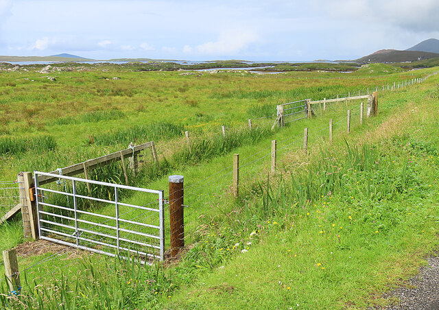
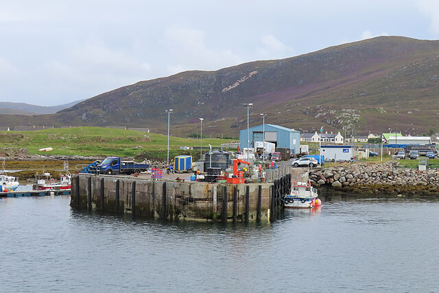
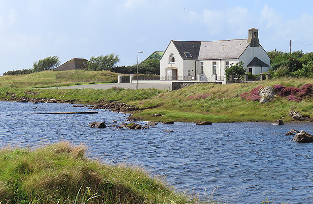
An t-Òb, located in Inverness-shire, Scotland, is a picturesque coastal area encompassing a sea, estuary, and creek. Situated on the western coast of Scotland, this natural landscape offers stunning views, rich biodiversity, and a tranquil atmosphere.

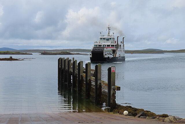
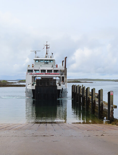
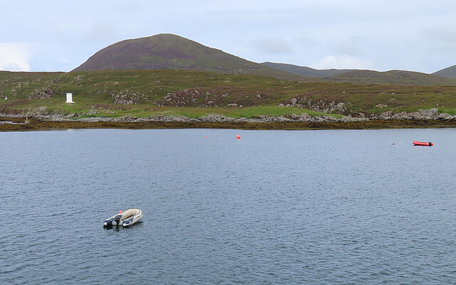
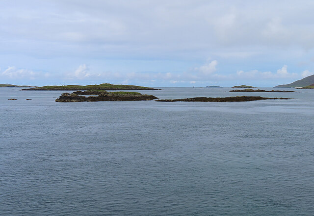
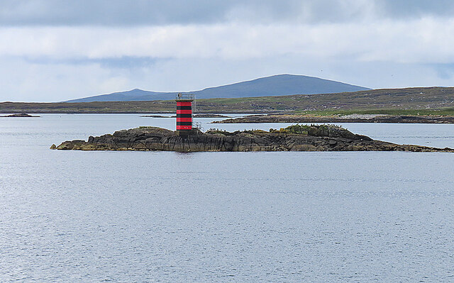
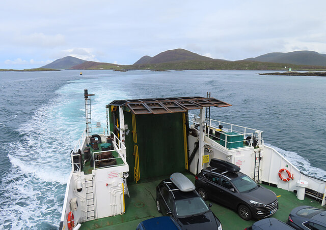
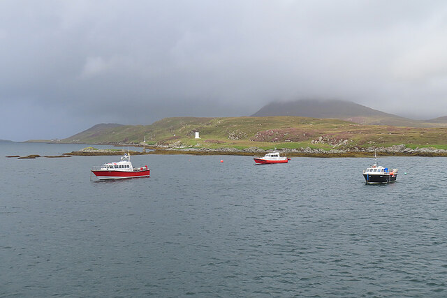
The sea surrounding An t-Òb is characterized by its crystal-clear waters, varying shades of blue, and gentle waves. It serves as a habitat for various marine species, including seals, dolphins, and a diverse array of fish, attracting nature enthusiasts and wildlife lovers alike.

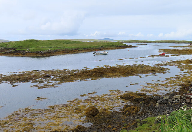
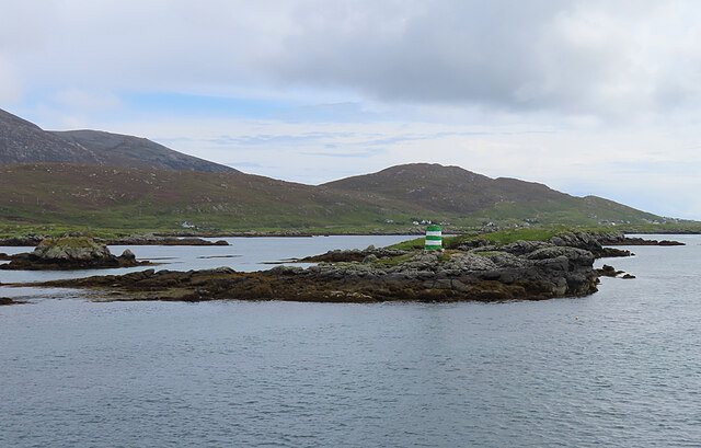
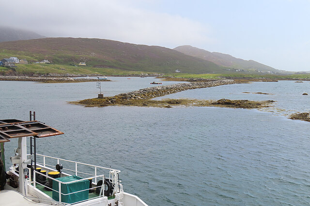
The estuary within An t-Òb is formed where a river meets the sea, creating a unique ecosystem that supports a wide range of plant and animal life. The estuary's brackish water, a mixture of saltwater and freshwater, provides a fertile environment for various species of birds, such as herons, gulls, and waders. It is also a popular spot for fishing, as the estuary teems with salmon and trout.

Nestled within the landscape is a tranquil creek, meandering through lush greenery and offering a serene haven for visitors. The creek is an ideal location for kayaking, canoeing, and boating, allowing visitors to explore the area's natural beauty at their own pace.

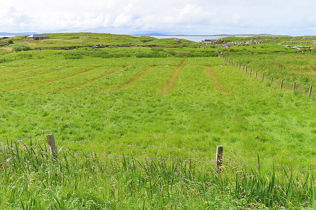
An t-Òb's rugged coastline, sandy beaches, and towering cliffs provide a dramatic backdrop to the surrounding landscape. The area offers numerous walking trails and hiking routes, allowing visitors to immerse themselves in the breathtaking scenery and explore hidden gems along the way.

Whether it's admiring the sea's vastness, exploring the estuary's diverse ecosystem, or unwinding in the peaceful creek, An t-Òb offers a captivating experience for nature enthusiasts and those seeking tranquility amidst Scotland's natural wonders.

If you have any feedback on the listing, please let us know in the comments section below.
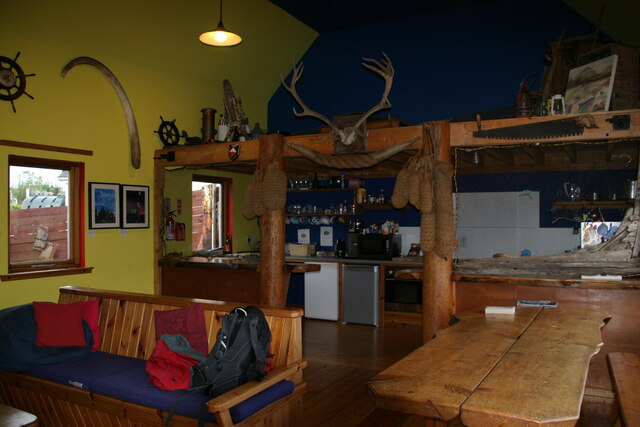
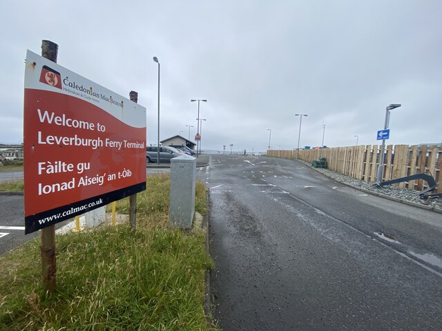
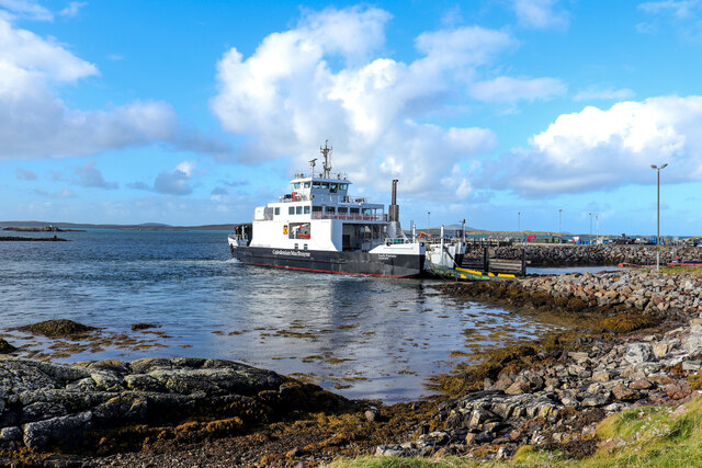
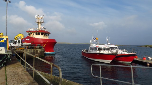
An t-Òb Images

Images are sourced within 2km of 57.772032/-7.0240691 or Grid Reference NG0186. Thanks to Geograph Open Source API. All images are credited.

Inside Am Bothan Bunkhouse, Leverburgh
Leverburgh Ferry Terminal Entrance A sign at the entrance to the Leverburgh Ferry Terminal
Leverburgh Ferry Terminal Entrance
A sign at the entrance to the Leverburgh Ferry Terminal
Leverburgh Ferry Terminal Leverburgh Ferry Terminal, Isle of Harris while Caledonian MacBrayne's Motor Vessel 'Loch Portain' loading up for departure
Leverburgh Ferry Terminal
Leverburgh Ferry Terminal, Isle of Harris while Caledonian MacBrayne's Motor Vessel 'Loch Portain' loading up for departure
Field Access It may be that the end of the access road here is sometimes used to pen livestock.
Field Access
It may be that the end of the access road here is sometimes used to pen livestock.
Old Lazybeds The parallel lines in this field are the remains of lazybeds. These are raised beds which are separated by ditches to assist in draining the land. They can be found all over the Hebrides, but few are still in regular cultivation.
Old Lazybeds
The parallel lines in this field are the remains of lazybeds. These are raised beds which are separated by ditches to assist in draining the land. They can be found all over the Hebrides, but few are still in regular cultivation.
Near Càirminis I think the nearest island is Eilean Chàirminis (Carminish Island).
Near Càirminis
I think the nearest island is Eilean Chàirminis (Carminish Island).
MV 'Lochportain' approaching Leverburgh MV 'Lochportain' operates the shuttle ferry between Leverburgh in Harris and Berneray.
MV 'Lochportain' approaching Leverburgh
MV 'Lochportain' operates the shuttle ferry between Leverburgh in Harris and Berneray.
Docking at Leverburgh MV 'Lochportain' has just completed the crossing of the Sound of Harris from Berneray.
Docking at Leverburgh
MV 'Lochportain' has just completed the crossing of the Sound of Harris from Berneray.
Leverburgh Pier This is the pier used by various commercial enterprises, a short distance from the ferry pier.
Leverburgh Pier
This is the pier used by various commercial enterprises, a short distance from the ferry pier.
Rubh' an Losaid The small headland north of Leverburgh Harbour.
Rubh' an Losaid
The small headland north of Leverburgh Harbour.
Sgeir Mhic Coma The closest skerries are Sgeir Mhic Coma, and Sgeir an Arbhair is a little further away, and to the right.
Sgeir Mhic Coma
The closest skerries are Sgeir Mhic Coma, and Sgeir an Arbhair is a little further away, and to the right.
Eilean a' Charnain The islet with the green-and-white striped beacon is just outside this grid square.
Eilean a' Charnain
The islet with the green-and-white striped beacon is just outside this grid square.
Dubh Sgeir This small skerry with its red-and-black striped beacon is also popular with seabirds.
Dubh Sgeir
This small skerry with its red-and-black striped beacon is also popular with seabirds.
M V 'Lochportain' The stern of MV 'Lochportain', looking back towards Harris.
M V 'Lochportain'
The stern of MV 'Lochportain', looking back towards Harris.
Approaching Leverburgh The ferry is almost abreast of a long jetty that shelters the harbour at Leverburgh.
Approaching Leverburgh
The ferry is almost abreast of a long jetty that shelters the harbour at Leverburgh.
Boats at Anchor Boats just off Rubh' an Losaid at Leverburgh.
Boats at Anchor
Boats just off Rubh' an Losaid at Leverburgh.
A Kirk in Leverburgh This is the Church of Scotland, looking very smart and with a large car park in front.
A Kirk in Leverburgh
This is the Church of Scotland, looking very smart and with a large car park in front.
Boats for St Kilda at Pier, Leverburgh, Harris The red and white boats are used for excursions out to St Kilda.
Boats for St Kilda at Pier, Leverburgh, Harris
The red and white boats are used for excursions out to St Kilda.
Show me another place!

An t-Òb is located at Grid Ref: NG0186 (Lat: 57.772032, Lng: -7.0240691)

Unitary Authority: Na h-Eileanan an Iar

Police Authority: Highlands and Islands

What 3 Words

///expires.clap.sparrows. Near Leverburgh, Na h-Eileanan Siar

Related Wikis

Leverburgh

Leverburgh (Scottish Gaelic: An t-Òb [ən̪ˠ ˈt̪ɔːp]) is the second largest village, after Tarbert, in Harris in the Outer Hebrides of Scotland. Leverburgh...

Outer Hebrides

The Outer Hebrides ( HEB-rid-eez) or Western Isles (Scottish Gaelic: na h-Eileanan Siar [nə ˈhelanən ˈʃiəɾ] , na h-Eileanan an Iar [nə ˈhelanən əɲ ˈiəɾ...

Roineabhal

Roineabhal is a hill in Harris, in the Western Isles of Scotland. The granite on the summit plateau of the mountain is anorthosite, and is similar in composition...

Ensay (Outer Hebrides)

Ensay (Gaelic Easaigh) is a currently unpopulated and privately owned island in the Outer Hebrides of Scotland. The island lies in the Sound of Harris...

Related Videos

Hebridean Way 2023 "Nancy's Walk"

Walking the Hebridean Way September 2023, raising money for Cancer Research in my mothers name, Nancy, who died from ...

Nearby Amenities

Located within 500m of 57.772032,-7.0240691
An t-Òb
Alt Name Gd: An Tòb
Is In: Na Hearadh, Na h-Eileanan Siar, Scotland, UK
Name En: Leverburgh
Name Gd: An t-Òb
Old Name En: Obbe
Place: village
Population: 200
Wikidata: Q2243731
Wikipedia: en:Leverburgh
Lat/Long: 57.7709955/-7.0192793
Waterway: weir
Lat/Long: 57.773158/-7.0206865
Bus Stop
Leverburgh
Naptan AtcoCode: 6010731720
Naptan Bearing: E
Naptan CommonName: Leverburgh
Naptan Indicator: School
Naptan Landmark: School
Naptan NaptanCode: 94723626
Naptan Street: School
Naptan Verified: no
Source: naptan_import
Lat/Long: 57.7709396/-7.0177287
Turning Circle
Lat/Long: 57.7735198/-7.0206512
Turning Circle
Lat/Long: 57.775232/-7.0246645
Turning Circle
Lat/Long: 57.7758965/-7.0255135
Post Box
Ref: HS5 138
Source: survey
Lat/Long: 57.7735223/-7.0237611
Shelter
Lat/Long: 57.7719623/-7.021225
Bicycle Parking
Bicycle Parking: wall_loops
Capacity: 5
Lat/Long: 57.770697/-7.0166279
Barrier: cattle_grid
Lat/Long: 57.7755361/-7.028295
Passing Place
Lat/Long: 57.7742102/-7.0257042
Barrier: cattle_grid
Lat/Long: 57.7750404/-7.0267013
Barrier: cattle_grid
Lat/Long: 57.7676039/-7.0233904
Power: pole
Lat/Long: 57.7757989/-7.0273665
Power: pole
Lat/Long: 57.7755557/-7.026457
Power: pole
Lat/Long: 57.7753312/-7.0255127
Power: pole
Lat/Long: 57.7750773/-7.0239976
Design: h-frame
Material: wood
Power: pole
Lat/Long: 57.7747454/-7.0224275
Design: h-frame
Material: wood
Power: pole
Lat/Long: 57.7743545/-7.0204272
Power: pole
Lat/Long: 57.7730832/-7.0208776
Power: pole
Lat/Long: 57.7723234/-7.0204606
Power: pole
Lat/Long: 57.773576/-7.0233723
Power: pole
Lat/Long: 57.7742054/-7.0228454
Power: pole
Lat/Long: 57.7713816/-7.0162447
Power: pole
Lat/Long: 57.7708624/-7.0167015
Power: pole
Lat/Long: 57.7710486/-7.0165922
Power: pole
Lat/Long: 57.7719094/-7.0159982
Power: pole
Lat/Long: 57.774075/-7.019464
Power: pole
Lat/Long: 57.7732488/-7.0168078
Turning Circle
Lat/Long: 57.7742055/-7.0187284
Street Lamp
Lamp Mount: straight_mast
Lamp Type: electric
Lat/Long: 57.7677258/-7.0241979
Street Lamp
Lamp Mount: straight_mast
Lamp Type: electric
Lat/Long: 57.7675584/-7.0246284
Material: wood
Power: pole
Lat/Long: 57.7741221/-7.0246729
Material: wood
Power: pole
Lat/Long: 57.7744857/-7.0247819
Material: wood
Power: pole
Lat/Long: 57.7738732/-7.0240826
Material: wood
Power: pole
Lat/Long: 57.7737049/-7.023685
Material: wood
Power: pole
Lat/Long: 57.7748029/-7.0248722
Street Lamp
Lamp Type: electric
Support: pole
Lat/Long: 57.7733925/-7.0218503
Street Lamp
Lamp Type: electric
Support: pole
Lat/Long: 57.7733199/-7.0226491
Street Lamp
Lamp Type: electric
Support: pole
Lat/Long: 57.7732793/-7.0232328
Street Lamp
Lamp Type: electric
Support: pole
Lat/Long: 57.7729946/-7.0228563
Street Lamp
Lamp Type: electric
Support: pole
Lat/Long: 57.7726073/-7.0221598
Street Lamp
Lamp Type: electric
Support: pole
Lat/Long: 57.7723834/-7.0217615
Street Lamp
Lamp Type: electric
Support: pole
Lat/Long: 57.7722053/-7.021444
Street Lamp
Lamp Type: electric
Support: pole
Lat/Long: 57.7719732/-7.0210334
Street Lamp
Lamp Type: electric
Support: pole
Lat/Long: 57.7717573/-7.0206609
Street Lamp
Lamp Type: electric
Support: pole
Lat/Long: 57.7715501/-7.0202906
Street Lamp
Lamp Type: electric
Support: pole
Lat/Long: 57.771297/-7.0199687
Street Lamp
Lamp Type: electric
Support: pole
Lat/Long: 57.7705717/-7.0166195
Street Lamp
Lamp Type: electric
Support: pole
Lat/Long: 57.7711151/-7.0188408
Street Lamp
Lamp Type: electric
Support: pole
Lat/Long: 57.7712211/-7.0193356
Street Lamp
Lamp Type: electric
Support: pole
Lat/Long: 57.7709884/-7.0182357
Street Lamp
Lamp Type: electric
Support: pole
Lat/Long: 57.772787/-7.0224936
The data included in this document is from www.openstreetmap.org. The data is made available under ODbL.

Have you been to An t-Òb?

Leave your review of An t-Òb below (or comments, questions and feedback).