Parkstone Lake

Sea, Estuary, Creek in Dorset

England

Parkstone Lake

Ships on New Quay, Poole Seen from The Quay. A pilot boat is seen on the left. In the centre is the tug Herbert Ballam and on the right the grab hopper dredger C H Horn. On the extreme right is the stern of a small coaster.
Ships on New Quay, Poole Credit: Chris Allen

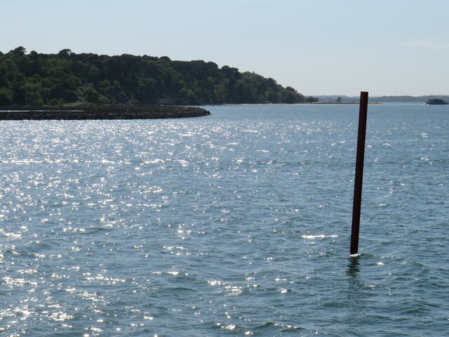
Parkstone Lake is a picturesque body of water located in Dorset, England. It is situated between the towns of Poole and Bournemouth, making it easily accessible to both locals and tourists. The lake is a unique blend of sea, estuary, and creek, offering a diverse range of natural attractions.

The lake is fed by Poole Harbour, a large natural harbor that connects to the English Channel. This connection allows for a constant flow of sea water into the lake, creating a dynamic ecosystem. The combination of saltwater and freshwater creates a unique habitat for various plant and animal species.

Surrounded by lush greenery, Parkstone Lake is a haven for wildlife enthusiasts. The lake is home to a variety of bird species, including herons, swans, and ducks. It also serves as a sanctuary for migratory birds during certain seasons.

The lake is an ideal spot for water-based recreational activities. Visitors can enjoy boating, kayaking, and paddleboarding on its calm waters. Fishing is also a popular pastime, with the lake being home to a range of fish species, including bass and bream.

In addition to its natural beauty, Parkstone Lake boasts a number of amenities for visitors. There are picnic areas, walking trails, and even a small beach where families can relax and soak up the sun. The lake is also surrounded by a variety of shops, cafes, and restaurants, ensuring that visitors have all they need for a day out in this scenic location.

Overall, Parkstone Lake offers a unique blend of natural beauty, recreational opportunities, and convenient amenities, making it a must-visit destination for nature enthusiasts and those seeking a tranquil escape.

If you have any feedback on the listing, please let us know in the comments section below.

Parkstone Lake Images

Images are sourced within 2km of 50.709025/-1.9581971 or Grid Reference SZ0389. Thanks to Geograph Open Source API. All images are credited.

Ships on New Quay, Poole Seen from The Quay. A pilot boat is seen on the left. In the centre is the tug Herbert Ballam and on the right the grab hopper dredger C H Horn. On the extreme right is the stern of a small coaster.
Ships on New Quay, Poole
Seen from The Quay. A pilot boat is seen on the left. In the centre is the tug Herbert Ballam and on the right the grab hopper dredger C H Horn. On the extreme right is the stern of a small coaster.
View from a boat heading to Brownsea Island
 Birds on a lagoon at Brownsea Island Birds on small islands in a lagoon on Brownsea Island.  Brownsea Island is situated in Poole Harbour, on the south coast of England.
Birds on a lagoon at Brownsea Island
Birds on small islands in a lagoon on Brownsea Island. Brownsea Island is situated in Poole Harbour, on the south coast of England.
Birdwatching hide, Brownsea Island A hide for observing birds on a lagoon on Brownsea Island, in Poole Harbour.
Birdwatching hide, Brownsea Island
A hide for observing birds on a lagoon on Brownsea Island, in Poole Harbour.
The Villa, Brownsea Island The Villa on Brownsea Island is now a wildlife exhibition centre managed by the Dorset Wildlife Trust.
The Villa, Brownsea Island
The Villa on Brownsea Island is now a wildlife exhibition centre managed by the Dorset Wildlife Trust.
Path on Brownsea Island A footpath on Brownsea Island, in Poole Harbour.
Path on Brownsea Island
A footpath on Brownsea Island, in Poole Harbour.
Trees on the shoreline, Brownsea Island Trees on the shoreline on Brownsea Island, with a view across Poole Harbour.
Trees on the shoreline, Brownsea Island
Trees on the shoreline on Brownsea Island, with a view across Poole Harbour.
Drain on Brownsea island A drain on Brownsea Island, which flows into a lagoon then in turn into Poole Harbour.
Drain on Brownsea island
A drain on Brownsea Island, which flows into a lagoon then in turn into Poole Harbour.
Navigation post in Poole Harbour A navigation post in Poole Harbour, marking the safe route for vessels into and out of Poole.  In the background is Brownsea Island, owned and managed by the National Trust.
Navigation post in Poole Harbour
A navigation post in Poole Harbour, marking the safe route for vessels into and out of Poole. In the background is Brownsea Island, owned and managed by the National Trust.
Turf Zone "TheShoreRoad" Leading towards Lilliput.
Turf Zone "TheShoreRoad"
Leading towards Lilliput.
Turf Zone "EveningHill" On Sandbanks Road, Lilliput.
Turf Zone "EveningHill"
On Sandbanks Road, Lilliput.
Turf Zone "CrichelZone" Path off Crichel Hill Road, Lilliput.
Turf Zone "CrichelZone"
Path off Crichel Hill Road, Lilliput.
Turf Zone "SalternsHotel" At Salterns Marina, Poole.
Turf Zone "SalternsHotel"
At Salterns Marina, Poole.
Sandbanks Road, Lilliput, Poole Sandbanks Road is on the route of the B3369 as it passes through Lilliput, a suburb of Poole.
Sandbanks Road, Lilliput, Poole
Sandbanks Road is on the route of the B3369 as it passes through Lilliput, a suburb of Poole.
Salterns Way, Lilliput, Poole Salterns Way is a residential road in Lilliput, a suburb of Poole.  Green barriers surround roadworks which were taking place when this photograph was taken.
Salterns Way, Lilliput, Poole
Salterns Way is a residential road in Lilliput, a suburb of Poole. Green barriers surround roadworks which were taking place when this photograph was taken.
Salterns Quay, Lilliput. Poole Salterns Quay, on Poole Harbour, is being developed into a marina with apartments and a hotel.
Salterns Quay, Lilliput. Poole
Salterns Quay, on Poole Harbour, is being developed into a marina with apartments and a hotel.
Show me another place!

Parkstone Lake is located at Grid Ref: SZ0389 (Lat: 50.709025, Lng: -1.9581971)

Unitary Authority: Bournemouth, Christchurch and Poole

Police Authority: Dorset

What 3 Words

///flap.boxing.select. Near Poole, Dorset

Nearby Locations

Parkstone Lake Blue Lagoon

Related Wikis

RAF Hamworthy

Royal Air Force Hamworthy or more simply RAF Hamworthy is a former Royal Air Force Coastal Command seaplane base at Poole Harbour in Dorset, England which...

Parkstone

Parkstone is an area of Poole, Dorset. It is divided into 'Lower' and 'Upper' Parkstone. Upper Parkstone - "Up-on-'ill" as it used to be known in local...

Baiter Park

Baiter Park is a waterfront area of Poole, Dorset. Baiter Park is part of Harbourside Park along with Whitecliff Park. The park is bordered to the north...

Whitecliff

Whitecliff, is a small area of Parkstone in Poole, Dorset, England. It is situated near the eastern shore of Poole Harbour and is a very sought-after residential...

Related Videos

WELCOME to our BRAND NEW Travel Channel!

We are launching this brand new channel to purely dedicate to our travels and adventures in Rene our old motorhome! Join us as ...

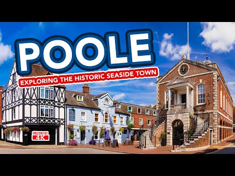
POOLE | Exploring the charming seaside town of Poole Dorset

Poole is a charming coastal town located near Bournemouth and Weymouth in Dorset, England. Visit Poole for its town streets ...

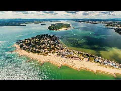
Welcome to Sandbanks - the perfect holiday location in the UK all year round!

Sandbanks is the perfect staycation location in the UK. With golden sands and Blue Flag waters. With family friendly beaches and ...

Walking Half the South West Coast Path - Dom Beckham

A series of videos I took as I walked half of the longest path in Britain.

Nearby Amenities

Located within 500m of 50.709025,-1.9581971
Source: PGS
Lat/Long: 50.7133862/-1.9569264
Source: PGS
Lat/Long: 50.7120585/-1.9605331
Source: PGS
Lat/Long: 50.7116511/-1.9598961
Source: PGS
Lat/Long: 50.7112058/-1.9534398
Source: PGS
Lat/Long: 50.7075387/-1.952504
Source: PGS
Lat/Long: 50.7079854/-1.9532202
Seamark Light Character: F
Seamark Light Colour: red
Seamark Light Group: 2
Seamark Name: Parkstone Yacht Club Haven
Seamark Type: light_minor
Lat/Long: 50.7096237/-1.9596811
Seamark Light Character: F
Seamark Light Colour: green
Seamark Light Group: 2
Seamark Name: Parkstone Yacht Club Haven
Seamark Type: light_minor
Lat/Long: 50.7100112/-1.9601341
Post Box
Collection Times: Mo-Fr 17:30; Sa 11:45
Operator: Royal Mail
Operator Wikidata: Q638098
Post Box Type: pillar
Ref: BH14 206
Ref GB Uprn: 10015426045
Royal Cypher: GVIR
Royal Cypher Wikidata: Q33102169
Lat/Long: 50.7116492/-1.9546316
Turning Circle
Lat/Long: 50.7097561/-1.9551568
Seamark Buoy Lateral Category: starboard
Seamark Buoy Lateral Colour: green
Seamark Buoy Lateral Shape: conical
Seamark Type: buoy_lateral
Source: GPS
Lat/Long: 50.70977/-1.9589987
Seamark Buoy Lateral Category: port
Seamark Buoy Lateral Colour: red
Seamark Buoy Lateral Shape: can
Seamark Light Character: Fl
Seamark Light Colour: red
Seamark Light Period: 2
Seamark Name: NC12
Seamark Type: buoy_lateral
Source: GPS
Lat/Long: 50.7051182/-1.9603319
Seamark Buoy Lateral Category: starboard
Seamark Buoy Lateral Colour: green
Seamark Buoy Lateral Shape: conical
Seamark Light Character: Fl
Seamark Light Colour: green
Seamark Light Period: 3
Seamark Name: NC11
Seamark Type: buoy_lateral
Source: GPS
Lat/Long: 50.7057851/-1.9601822
Access: private
Leisure: slipway
Lat/Long: 50.7119339/-1.9602978
Seamark Buoy Lateral Category: starboard
Seamark Buoy Lateral Colour: green
Seamark Buoy Lateral Shape: conical
Seamark Buoy Lateral System: iala-a
Seamark Type: buoy_lateral
Source: GPS
Lat/Long: 50.7064111/-1.9604716
Seamark Buoy Lateral Category: port
Seamark Buoy Lateral Colour: red
Seamark Buoy Lateral Shape: can
Seamark Buoy Lateral System: iala-a
Seamark Type: buoy_lateral
Source: GPS
Lat/Long: 50.7065547/-1.9607883
Seamark Buoy Lateral Category: starboard
Seamark Buoy Lateral Colour: green
Seamark Buoy Lateral Shape: conical
Seamark Buoy Lateral System: iala-a
Seamark Type: buoy_lateral
Source: GPS
Lat/Long: 50.7068843/-1.9602718
Seamark Buoy Lateral Category: port
Seamark Buoy Lateral Colour: red
Seamark Buoy Lateral Shape: can
Seamark Buoy Lateral System: iala-a
Seamark Type: buoy_lateral
Source: GPS
Lat/Long: 50.7071415/-1.9606211
Seamark Buoy Lateral Category: starboard
Seamark Buoy Lateral Colour: green
Seamark Buoy Lateral Shape: conical
Seamark Buoy Lateral System: iala-a
Seamark Type: buoy_lateral
Source: GPS
Lat/Long: 50.7073063/-1.9602464
Seamark Buoy Lateral Category: port
Seamark Buoy Lateral Colour: red
Seamark Buoy Lateral Shape: can
Seamark Buoy Lateral System: iala-a
Seamark Type: buoy_lateral
Source: GPS
Lat/Long: 50.7078619/-1.9604323
Seamark Buoy Lateral Category: starboard
Seamark Buoy Lateral Colour: green
Seamark Buoy Lateral Shape: conical
Seamark Buoy Lateral System: iala-a
Seamark Type: buoy_lateral
Source: GPS
Lat/Long: 50.7084382/-1.9598675
Source: PGS
Lat/Long: 50.7114658/-1.9530768
Source: PGS
Lat/Long: 50.7115609/-1.9529213
Source: PGS
Lat/Long: 50.7117085/-1.9526834
Toilets
Fee: no
Female: yes
Male: yes
Toilets Handwashing: yes
Toilets Position: seated
Lat/Long: 50.7129895/-1.9570563
The data included in this document is from www.openstreetmap.org. The data is made available under ODbL.

Have you been to Parkstone Lake?

Leave your review of Parkstone Lake below (or comments, questions and feedback).