Blue Lagoon

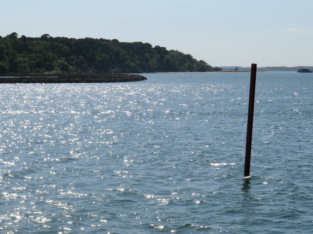
Coastal Marsh, Saltings in Dorset

England

Blue Lagoon

Poole Harbour trail
Poole Harbour trail Credit: Helen Steed

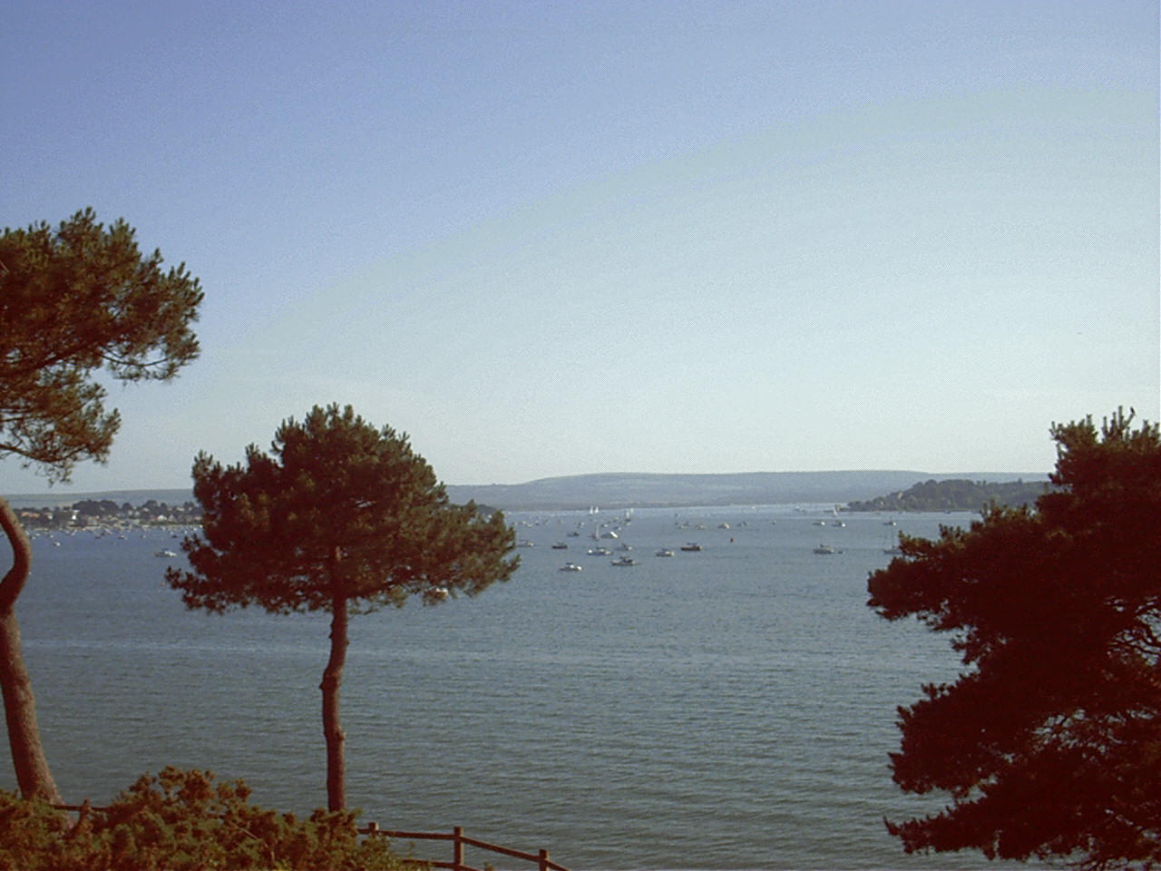
Blue Lagoon, located in Dorset on the south coast of England, is a captivating coastal marsh and saltings area renowned for its stunning natural beauty. The lagoon is situated near the village of West Lulworth and is part of the larger Lulworth Estate.

The Blue Lagoon gets its name from the crystal-clear turquoise waters that fill this former quarry. The water's vibrant color is due to the limestone deposits on the quarry walls, which reflect sunlight and create a mesmerizing spectacle. The lagoon is surrounded by a mix of cliffs, verdant vegetation, and pebble beaches, offering visitors a picturesque and tranquil setting.

This coastal marsh and saltings area is also home to a diverse range of wildlife. The lagoon's pristine environment provides a habitat for a variety of bird species, including gulls, waders, and terns. It is also a popular spot for birdwatching enthusiasts who come to observe and study these magnificent creatures.

In addition to its natural charm, Blue Lagoon offers visitors the opportunity to engage in various recreational activities. The calm waters are perfect for swimming, snorkeling, and kayaking, attracting both locals and tourists seeking water-based adventures. The surrounding cliffs provide excellent vantage points for hiking and offer breathtaking panoramic views of the lagoon and the English Channel beyond.

Blue Lagoon's accessibility and its unique combination of natural wonders make it a popular destination for nature lovers, photographers, and outdoor enthusiasts. Whether one seeks relaxation on the pebble beaches, exploration of the diverse wildlife or thrilling water activities, Blue Lagoon offers an unforgettable experience for all who visit.

If you have any feedback on the listing, please let us know in the comments section below.

Blue Lagoon Images

Images are sourced within 2km of 50.709319/-1.9510306 or Grid Reference SZ0389. Thanks to Geograph Open Source API. All images are credited.

Poole Harbour trail
Poole Harbour trail
Poole Harbour trail
Poole Harbour trail
View from Brownsea Road The protective sea wall and the lagoon at the north eastern end of Brownsea Island seen from the Poole-Brownsea ferry.
View from Brownsea Road
The protective sea wall and the lagoon at the north eastern end of Brownsea Island seen from the Poole-Brownsea ferry.
Yatchts moored in Wych Channel With Brownsea Island in the background - taken from the Poole-Brownsea Island Ferry.
Yatchts moored in Wych Channel
With Brownsea Island in the background - taken from the Poole-Brownsea Island Ferry.
View From a ferry in Main Channel, Poole Harbour Heading for Brownsea Island.
View From a ferry in Main Channel, Poole Harbour
Heading for Brownsea Island.
Italian Gardens, Compton Acres
View from a boat heading to Brownsea Island
 Birds on a lagoon at Brownsea Island Birds on small islands in a lagoon on Brownsea Island.  Brownsea Island is situated in Poole Harbour, on the south coast of England.
Birds on a lagoon at Brownsea Island
Birds on small islands in a lagoon on Brownsea Island. Brownsea Island is situated in Poole Harbour, on the south coast of England.
Birdwatching hide, Brownsea Island A hide for observing birds on a lagoon on Brownsea Island, in Poole Harbour.
Birdwatching hide, Brownsea Island
A hide for observing birds on a lagoon on Brownsea Island, in Poole Harbour.
Path on Brownsea Island A footpath on Brownsea Island, in Poole Harbour.
Path on Brownsea Island
A footpath on Brownsea Island, in Poole Harbour.
Trees on the shoreline, Brownsea Island Trees on the shoreline on Brownsea Island, with a view across Poole Harbour.
Trees on the shoreline, Brownsea Island
Trees on the shoreline on Brownsea Island, with a view across Poole Harbour.
Navigation post in Poole Harbour A navigation post in Poole Harbour, marking the safe route for vessels into and out of Poole.  In the background is Brownsea Island, owned and managed by the National Trust.
Navigation post in Poole Harbour
A navigation post in Poole Harbour, marking the safe route for vessels into and out of Poole. In the background is Brownsea Island, owned and managed by the National Trust.
Housing at Poole Head A poor man's Sandbanks?
Housing at Poole Head
A poor man's Sandbanks?
Beside Poole Harbour With Brownsea Island in view.
Beside Poole Harbour
With Brownsea Island in view.
Turf Zone "TheShoreRoad" Leading towards Lilliput.
Turf Zone "TheShoreRoad"
Leading towards Lilliput.
Turf Zone "EveningHill" On Sandbanks Road, Lilliput.
Turf Zone "EveningHill"
On Sandbanks Road, Lilliput.
Turf Zone "CrichelZone" Path off Crichel Hill Road, Lilliput.
Turf Zone "CrichelZone"
Path off Crichel Hill Road, Lilliput.
Show me another place!

Blue Lagoon is located at Grid Ref: SZ0389 (Lat: 50.709319, Lng: -1.9510306)

Unitary Authority: Bournemouth, Christchurch and Poole

Police Authority: Dorset

What 3 Words

///inches.forced.flock. Near Parkstone, Dorset

Nearby Locations

Parkstone Lake Blue Lagoon

Related Wikis

Parkstone

Parkstone is an area of Poole, Dorset. It is divided into 'Lower' and 'Upper' Parkstone. Upper Parkstone - "Up-on-'ill" as it used to be known in local...

RAF Hamworthy

Royal Air Force Hamworthy or more simply RAF Hamworthy is a former Royal Air Force Coastal Command seaplane base at Poole Harbour in Dorset, England which...

Landfall (house)

Landfall is a house in Poole, Dorset, England, that was built between 1936 and 1938 by the architect Oliver Hill in the modernist style. It has been designated...

Whitecliff

Whitecliff, is a small area of Parkstone in Poole, Dorset, England. It is situated near the eastern shore of Poole Harbour and is a very sought-after residential...

Lilliput, Dorset

Lilliput is a district of Poole, Dorset. It borders on Sandbanks, Canford Cliffs, Lower Parkstone, and Whitecliff and has a shoreline within Poole Harbour...

Baiter Park

Baiter Park is a waterfront area of Poole, Dorset. Baiter Park is part of Harbourside Park along with Whitecliff Park. The park is bordered to the north...

Uplands School, Poole

Uplands School was a co-educational independent school based in the coastal town of Poole, Dorset on the south coast of England. It consisted of a junior...

Parkstone railway station

Parkstone railway station serves the Parkstone area of Poole in Dorset, England. The platform sign formerly read Parkstone (for Sandbanks). The station...

Nearby Amenities

Located within 500m of 50.709319,-1.9510306
Source: PGS
Lat/Long: 50.7112058/-1.9534398
Source: PGS
Lat/Long: 50.711077/-1.9497913
Created By: almien_coastlines
Source: PGS
Lat/Long: 50.710786/-1.949016
Source: PGS
Lat/Long: 50.7079873/-1.948775
Source: PGS
Lat/Long: 50.7073564/-1.949449
Created By: almien_coastlines
Source: PGS
Lat/Long: 50.706829/-1.950719
Created By: almien_coastlines
Source: PGS
Lat/Long: 50.707092/-1.951521
Source: PGS
Lat/Long: 50.7075387/-1.952504
Source: PGS
Lat/Long: 50.7079854/-1.9532202
Source: PGS
Lat/Long: 50.705317/-1.949614
Source: PGS
Lat/Long: 50.7063388/-1.9468713
Post Box
Collection Times: Mo-Fr 17:30; Sa 11:45
Operator: Royal Mail
Operator Wikidata: Q638098
Post Box Type: pillar
Ref: BH14 152
Ref GB Uprn: 10015384590
Royal Cypher: EIIR
Royal Cypher Wikidata: Q33102113
Lat/Long: 50.7135717/-1.9517439
Post Box
Collection Times: Mo-Fr 17:30; Sa 11:45
Operator: Royal Mail
Operator Wikidata: Q638098
Post Box Type: pillar
Ref: BH14 206
Ref GB Uprn: 10015426045
Royal Cypher: GVIR
Royal Cypher Wikidata: Q33102169
Lat/Long: 50.7116492/-1.9546316
Turning Circle
Lat/Long: 50.7132806/-1.948447
Turning Circle
Lat/Long: 50.7097561/-1.9551568
Turning Circle
Lat/Long: 50.7099473/-1.9480415
Turning Circle
Lat/Long: 50.7087166/-1.9473507
Crossing
Crossing: unmarked
Crossing Island: no
Crossing Markings: no
Kerb: lowered
Tactile Paving: yes
Lat/Long: 50.7081478/-1.945226
Turning Circle
Lat/Long: 50.7132363/-1.9524914
Lilliput
Place: suburb
Wikidata: Q6548298
Lat/Long: 50.7080846/-1.9451658
Bus Stop
Bench: no
Bin: no
Bus: yes
Public Transport: platform
Shelter: no
Tactile Paving: no
Lat/Long: 50.7111974/-1.9484809
Bus Stop
Lilliput Square
Bench: yes
Bin: yes
Bus: yes
Lit: yes
Naptan AtcoCode: 1280POA11766
Naptan Bearing: N
Naptan CommonName: Lilliput Square
Naptan Indicator: N-bound
Naptan NaptanCode: plegjwt
Naptan PlusbusZoneRef: BOMO
Naptan Street: Sandbanks Road
Naptan Verified: no
Public Transport: platform
Shelter: yes
Tactile Paving: no
Lat/Long: 50.7086599/-1.9458617
Bus Stop
Bench: no
Bin: no
Bus: yes
Public Transport: platform
Shelter: no
Tactile Paving: no
Lat/Long: 50.710505/-1.9471922
Source: PGS
Lat/Long: 50.7114658/-1.9530768
Source: PGS
Lat/Long: 50.7115609/-1.9529213
Source: PGS
Lat/Long: 50.7117085/-1.9526834
Fuel
Fuel Berth
Name En: Fuel Berth
Lat/Long: 50.7052065/-1.9511743
Salterns Chandlery
Name En: Salterns Chandlery
Shop: electronics
Lat/Long: 50.7053459/-1.9510193
Fast Food
TJ's
Addr Housenumber: 254
Addr Postcode: BH14 8HA
Addr Street: Sandbanks Road
Cuisine: fish_and_chips
Fhrs Id: 1352799
Source Addr: FHRS Open Data
Takeaway: only
Wheelchair: yes
Lat/Long: 50.7088748/-1.9460936
Crossing
Crossing: unmarked
Crossing Island: no
Crossing Markings: no
Kerb: lowered
Tactile Paving: yes
Lat/Long: 50.7079911/-1.9455043
Post Box
Collection Times: Mo-Fr 17:15; Sa 12:30
Operator: Royal Mail
Operator Wikidata: Q638098
Post Box Design: type_k
Post Box Type: pillar
Ref: BH14 43
Ref GB Uprn: 10015354554
Royal Cypher: EIIR
Royal Cypher Wikidata: Q33102113
Lat/Long: 50.7087128/-1.9459107
Bicycle Rental
Sandbanks Road
Bicycle Rental: dropoff_point
Brand: Beryl
Brand Wikidata: Q106575365
Capacity: 7
Email: support@beryl.cc
Fee: yes
Mapillary: 296595415714995
Name Signed: no
Network: Beryl - Bournemouth Poole Christchurch
Official Name: Sandbanks Road
Operator: Beryl
Operator Type: business
Operator Wikidata: Q106575369
Payment App: yes
Payment App Android: cc.beryl.basis
Payment App Ios: 1386768364
Payment Cash: no
Payment Credit Cards: no
Payment Cryptocurrencies: no
Payment Debit Cards: no
Payment Electronic Purses: no
Phone: +44 20 3003 5044
Ref Gbfs: beryl_bcp:199
Rental: city_bike
Survey Date: 2021-08-16
Website: https://beryl.cc/scheme/bournemouth-christchurch-and-poole
Lat/Long: 50.7086067/-1.9458849
Bus Stop
Lilliput Square
Bench: no
Bin: no
Bus: yes
Bus Bay: yes
Lit: yes
Naptan AtcoCode: 1280POX38421
Naptan Bearing: SE
Naptan CommonName: Lilliput Square
Naptan Indicator: SE-bound
Naptan NaptanCode: plegmad
Naptan PlusbusZoneRef: BOMO
Naptan Street: Sandbanks Road
Naptan Verified: no
Public Transport: platform
Shelter: yes
Tactile Paving: no
Lat/Long: 50.7087957/-1.9457307
Bus Stop
Blake Dene Road
Bench: no
Bin: no
Bus: yes
Naptan AtcoCode: 1280POA11765
Naptan Bearing: SE
Naptan CommonName: Blake Dene Road
Naptan Indicator: SE-bound
Naptan NaptanCode: plegjtw
Naptan PlusbusZoneRef: BOMO
Naptan Street: Sandbanks Road
Naptan Verified: no
Public Transport: platform
Shelter: no
Tactile Paving: no
Lat/Long: 50.7104764/-1.9472355
Bus Stop
Blue Lagoon
Bench: no
Bin: no
Bus: yes
Lit: no
Naptan AtcoCode: 1280POA11764
Naptan Bearing: S
Naptan CommonName: Blue Lagoon
Naptan Indicator: opp
Naptan NaptanCode: plegjmw
Naptan PlusbusZoneRef: BOMO
Naptan Street: Sandbanks Road
Naptan Verified: no
Public Transport: platform
Shelter: no
Tactile Paving: no
Lat/Long: 50.7120619/-1.9493008
Bus Stop
Parkstone Cemetery
Bench: no
Bin: no
Bus: yes
Lit: no
Naptan AtcoCode: 1280POA11803
Naptan Bearing: W
Naptan CommonName: Parkstone Cemetery
Naptan Indicator: opp
Naptan NaptanCode: plegjma
Naptan PlusbusZoneRef: BOMO
Naptan Street: Elgin Road
Naptan Verified: no
Public Transport: platform
Shelter: no
Tactile Paving: no
Lat/Long: 50.7137383/-1.9498399
Bus Stop
Parkstone Cemetery
Bench: no
Bin: no
Bus: yes
Lit: no
Naptan AtcoCode: 1280POA11804
Naptan Bearing: E
Naptan CommonName: Parkstone Cemetery
Naptan Indicator: E-bound
Naptan NaptanCode: plegjgm
Naptan PlusbusZoneRef: BOMO
Naptan Street: Elgin Road
Naptan Verified: no
Public Transport: platform
Shelter: no
Tactile Paving: no
Lat/Long: 50.7137145/-1.9503388
Bus Stop
Blue Lagoon
Bench: no
Bin: no
Bus: yes
Lit: no
Naptan AtcoCode: 1280POA11789
Naptan Bearing: N
Naptan CommonName: Blue Lagoon
Naptan Indicator: N-bound
Naptan NaptanCode: plegjmj
Naptan PlusbusZoneRef: BOMO
Naptan Street: Sandbanks Road
Naptan Verified: no
Public Transport: platform
Shelter: no
Tactile Paving: no
Lat/Long: 50.7114862/-1.9489078
Bus Stop
Blake Dene Road
Bench: no
Bin: no
Bus: yes
Lit: yes
Naptan AtcoCode: 1280POA11788
Naptan Bearing: NW
Naptan CommonName: Blake Dene Road
Naptan Indicator: NW-bound
Naptan NaptanCode: plegjtg
Naptan PlusbusZoneRef: BOMO
Naptan Street: Sandbanks Road
Naptan Verified: no
Public Transport: platform
Shelter: no
Tactile Paving: no
Lat/Long: 50.7106335/-1.9476593
Bus Stop
Elgin Road
Bench: no
Bin: no
Bus: yes
Lit: yes
Naptan AtcoCode: 1280POA11763
Naptan Bearing: E
Naptan CommonName: Elgin Road
Naptan Indicator: E-bound
Naptan NaptanCode: plegjga
Naptan PlusbusZoneRef: BOMO
Naptan Street: Sandbanks Road
Naptan Verified: no
Public Transport: platform
Shelter: no
Tactile Paving: no
Lat/Long: 50.7135362/-1.9513996
Bus Stop
Elgin Road
Bench: no
Bin: no
Bus: yes
Lit: yes
Naptan AtcoCode: 1280POA11790
Naptan Bearing: W
Naptan CommonName: Elgin Road
Naptan Indicator: W-bound
Naptan NaptanCode: plegjdp
Naptan PlusbusZoneRef: BOMO
Naptan Street: Sandbanks Road
Naptan Verified: no
Public Transport: platform
Shelter: no
Tactile Paving: no
Lat/Long: 50.7135438/-1.9520782
Tesco Express
Addr Housenumber: 258-262
Addr Postcode: BH14 8HA
Addr Street: Sandbanks Road
Brand: Tesco Express
Brand Wikidata: Q98456772
Contact Website: https://www.tesco.com/store-locator/poole/260-262-sandbanks-rd
Fhrs Id: 1352167
Shop: convenience
Lat/Long: 50.7087499/-1.9460486
Crossing
Crossing: unmarked
Crossing Island: no
Crossing Markings: no
Kerb: lowered
Tactile Paving: yes
Lat/Long: 50.7066063/-1.9461143
Crossing
Crossing: unmarked
Crossing Island: no
Crossing Markings: no
Kerb: lowered
Tactile Paving: yes
Lat/Long: 50.7064721/-1.9461317
Crossing
Crossing: unmarked
Crossing Island: yes
Crossing Markings: no
Kerb: normal
Tactile Paving: no
Lat/Long: 50.7079915/-1.9451165
Crossing
Crossing: unmarked
Crossing Island: no
Crossing Markings: no
Kerb: lowered
Tactile Paving: yes
Lat/Long: 50.7078531/-1.9461747
Crossing
Crossing: unmarked
Crossing Island: no
Crossing Markings: no
Kerb: lowered
Tactile Paving: yes
Lat/Long: 50.7069503/-1.9455872
Entrance: main
Lat/Long: 50.7081622/-1.9465007
Noexit: yes
Lat/Long: 50.707693/-1.9455155
Noexit: yes
Lat/Long: 50.7067439/-1.9456194
Noexit: yes
Lat/Long: 50.7077851/-1.9446237
Pharmacy
Day Lewis Pharmacy
Addr Housename: Lilliput Medical Centre
Addr Postcode: BH14 8EE
Addr Street: Elms Avenue
Brand: Day Lewis Pharmacy
Brand Wikidata: Q62563772
Dispensing: yes
Drive Through: no
Healthcare: pharmacy
Opening Hours: Mo-Fr 08:30-18:00
Website: https://www.daylewis.co.uk/pharmacy-page/poole-lilliput-dorset/
Lat/Long: 50.7125646/-1.9503255
Parking Entrance
Maxheight: 1.8
Parking: underground
Lat/Long: 50.7125257/-1.950083
The data included in this document is from www.openstreetmap.org. The data is made available under ODbL.

Have you been to Blue Lagoon?

Leave your review of Blue Lagoon below (or comments, questions and feedback).