Lurgashall Green

Urban Greenspace in Sussex Chichester

England

Lurgashall Green

Interior of St Laurence's Church, Lurgashall
Interior of St Laurence's Church, Lurgashall Credit: Ian Cunliffe

Lurgashall Green is a charming urban greenspace located in the picturesque village of Lurgashall, Sussex, England. Situated amidst the rolling countryside of the South Downs National Park, this green oasis offers a tranquil retreat for residents and visitors alike.

Spanning approximately three acres, Lurgashall Green is a well-maintained space adorned with lush grass, mature trees, and vibrant flower beds. The green is a popular spot for picnics, leisurely walks, and community events throughout the year. Its open layout provides ample space for recreational activities, while benches and picnic tables offer a place to relax and take in the scenic surroundings.

The green is also home to a children's play area, complete with swings, slides, and climbing frames, catering to the needs of families and young visitors. Additionally, a well-equipped sports field provides opportunities for various outdoor games such as football and cricket.

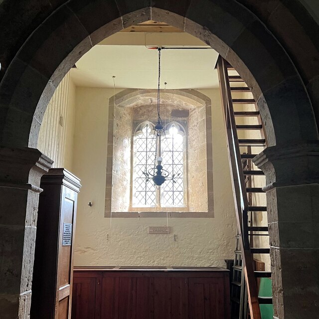
Lurgashall Green is not just a place of natural beauty; it also holds historical significance. Adjacent to the green stands the ancient St. Laurence Church, a Grade I listed building dating back to the 12th century. The church's stunning architecture and serene atmosphere provide a sense of history and spirituality to the greenspace.

The green is a focal point for community events, including summer fetes, fairs, and concerts. It serves as a gathering place for locals, fostering a strong sense of community spirit and providing a hub for social interactions.

Overall, Lurgashall Green is a delightful urban greenspace that seamlessly integrates nature, history, and community in a tranquil setting, making it a cherished gem of Sussex.

If you have any feedback on the listing, please let us know in the comments section below.

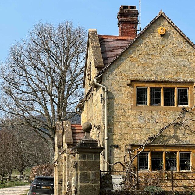
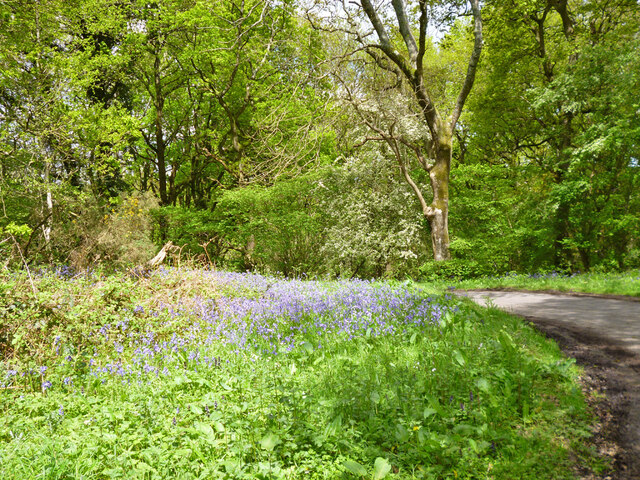
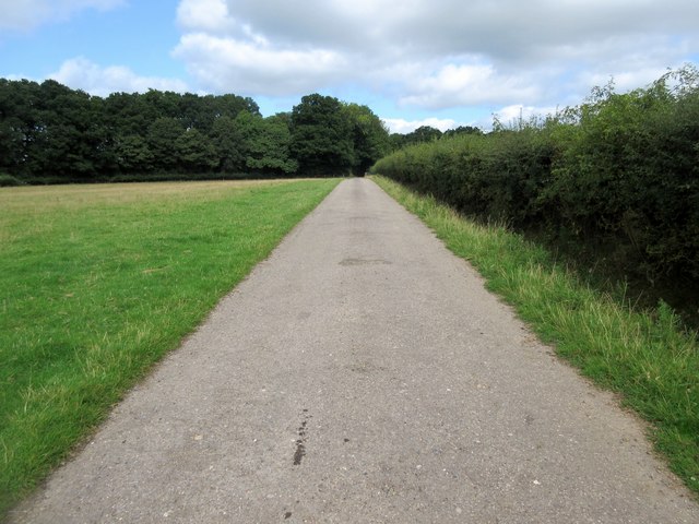
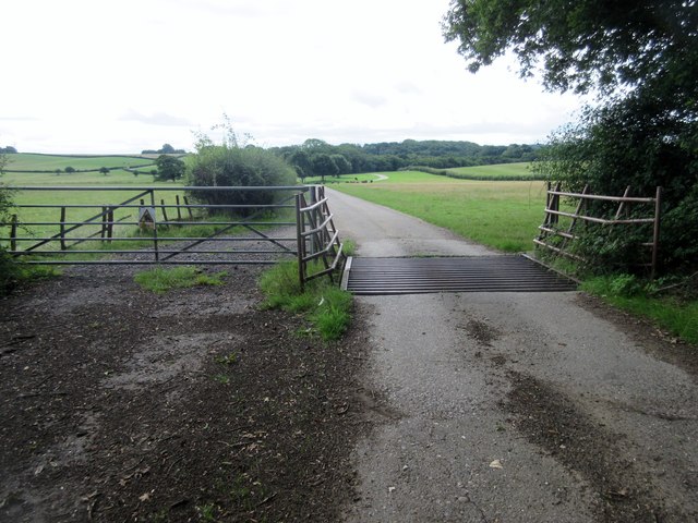
Lurgashall Green Images

Images are sourced within 2km of 51.035672/-0.66542768 or Grid Reference SU9327. Thanks to Geograph Open Source API. All images are credited.

Interior of St Laurence's Church, Lurgashall
Altar cloth - St Laurence's Church, Lurgashall
View SSW from the path west of Park Farm
Outbuilding near Park Farm "Woodcraft Folk" - <span class="nowrap"><a title="https://woodcraft.org.uk/about-woodcraft-folk/our-aims-principles/" rel="nofollow ugc noopener" href="https://woodcraft.org.uk/about-woodcraft-folk/our-aims-principles/">Link</a><img style="margin-left:2px;" alt="External link" title="External link - shift click to open in new window" src="https://s1.geograph.org.uk/img/external.png" width="10" height="10"/></span> - have a campsite hereabouts. I think this building belongs to them.
Outbuilding near Park Farm
"Woodcraft Folk" - LinkExternal link - have a campsite hereabouts. I think this building belongs to them.
The Lickfold Inn
The Lickfold Inn
View NNW towards Lower Gentilshurst Farm
The Lickfold Inn
The Lickfold Inn
The Lodge - Blackdown Park Estate The track/drive to the left of the lodge leads up to Blackdown Farm and Blackdown House.
The Lodge - Blackdown Park Estate
The track/drive to the left of the lodge leads up to Blackdown Farm and Blackdown House.
House at Little Brockhurst It could be that the house is called "Little Brockhurst". I'm not sure. I think those are vines in the foreground. There's certainly a winery hereabouts.
House at Little Brockhurst
It could be that the house is called "Little Brockhurst". I'm not sure. I think those are vines in the foreground. There's certainly a winery hereabouts.
Field by Chillinghurst Copse
Hedgerow east of lane
Gatehouse Copse Apparently named after the lodge on the other side of the road off to the right at an entrance to the walled part of the Petworth estate.
Gatehouse Copse
Apparently named after the lodge on the other side of the road off to the right at an entrance to the walled part of the Petworth estate.
Bluebells by lane bend, Hillgrove
Hillgrove Attractive clock tower in a hamlet west of Northchapel.
Hillgrove
Attractive clock tower in a hamlet west of Northchapel.
Cattle across footpath The Petworth Heard of Sussex Cattle including bull, cows and calves by public footpath 655.
Cattle across footpath
The Petworth Heard of Sussex Cattle including bull, cows and calves by public footpath 655.
Route to Chillinghurst Plantations Public footpath 655 on farm road.
Route to Chillinghurst Plantations
Public footpath 655 on farm road.
Oak trees by track Track to Benefold Copse
Oak trees by track
Track to Benefold Copse
Gate and cattle grid Beware of the bull sign on public footpath 655. The Petworth Heard of Sussex Cattle can be seen grazing in the distance.
Gate and cattle grid
Beware of the bull sign on public footpath 655. The Petworth Heard of Sussex Cattle can be seen grazing in the distance.
Show me another place!

Lurgashall Green is located at Grid Ref: SU9327 (Lat: 51.035672, Lng: -0.66542768)

Administrative County: West Sussex

District: Chichester

Police Authority: Sussex

What 3 Words

///squirted.basket.glider. Near Fernhurst, West Sussex

Related Wikis

Lurgashall

Lurgashall is a village and civil parish in the Chichester district of West Sussex, England, 6.5 km (4 ml) north west of Petworth, just inside the South...

Iberia Flight 062

Iberia Flight 062 was a twin-engined Sud Aviation Caravelle registered EC-BDD operating a scheduled flight from Málaga Airport, Spain, to London Heathrow...

North Ambersham

North Ambersham was a tithing in the Chichester district of West Sussex, England. Until 1844 North Ambersham was a detached part of Hampshire and was...

Northchapel

Northchapel is a village and civil parish in Chichester District in West Sussex, England. It stands on the A283 road just south of the Surrey border, around...

Blackdown, West Sussex

Blackdown, or Black Down, summit elevation 279.7 metres (918 ft) AMSL, is the highest point in both the historic county of Sussex and the South Downs National...

Midhurst transmitting station

The Midhurst transmitting station is a facility for both analogue and digital VHF/FM radio and UHF television transmission, 3.1 miles (5.0 km) northeast...

Northpark Copse to Snapelands Copse

Northpark Copse to Snapelands Copse is a 101.4-hectare (251-acre) biological Site of Special Scientific Interest north of Midhurst in West Sussex.This...

Ebernoe Common

Ebernoe Common is a 233.9-hectare (578-acre) biological Site of Special Scientific Interest in Ebernoe, north of Petworth in West Sussex. It is a Nature...

Nearby Amenities

Located within 500m of 51.035672,-0.66542768
Blind Lane
Naptan AtcoCode: 4400MO0387
Naptan Bearing: W
Naptan BusStopType: CUS
Naptan CommonName: Unnamed Road
Naptan Indicator: HAR
Naptan Landmark: Hail & Ride
Naptan NaptanCode: wsxdwtmj
Naptan Street: Unnamed Road
Naptan Verified: no
Source: naptan_import
Lat/Long: 51.0377195/-0.659406
Blind Lane
Naptan AtcoCode: 4400MO0390
Naptan Bearing: E
Naptan BusStopType: CUS
Naptan CommonName: Unnamed Road
Naptan Indicator: HAR
Naptan Landmark: Hail & Ride
Naptan NaptanCode: wsxdwtmp
Naptan Street: Unnamed Road
Naptan Verified: no
Source: naptan_import
Lat/Long: 51.0377471/-0.6594479
Parking
Village Hall parking
Lat/Long: 51.0339955/-0.6646875
Sewage Works
Lat/Long: 51.0328713/-0.662965
Post Box
Brand: Royal Mail
Brand Wikidata: Q638098
Collection Plate: CP7
Collection Times: Mo-Fr 16:30; Sa 09:30
Operator: Royal Mail
Operator Wikidata: Q638098
Post Box Mounting: pier
Post Box Type: lamp
Ref: GU28 73
Royal Cypher: EIIR
Royal Cypher Wikidata: Q33102113
Source: survey
Survey Point: 2022-08-25
Lat/Long: 51.0353715/-0.6648898
Defibrillator
Booth: K6
Covered: booth
Defibrillator Location: inside phone box, The Green, Lurgashall. This is an AED defibrillator. This defibrillator is mostly white in colour.
Disused Amenity: telephone
Emergency: defibrillator
Indoor: no
Listed Status: Grade II
Man Made: telephone_box
Operator: Cardiac Science
Source: survey
Lat/Long: 51.0353145/-0.6649402
Barrier: stile
Lat/Long: 51.034103/-0.6612519
Barrier: stile
Lat/Long: 51.0393735/-0.6656175
Post Office
Lurgashall Post Office
Addr City: Lurgashall, Petworth
Addr Country: GB
Addr Postcode: GU28 9ET
Brand: Post Office
Brand Wikidata: Q1783168
Contact Website: https://www.postoffice.co.uk/branch-finder/1289233/lurgashall
Description: This post office is inside Lurgashall Village Shop.
Operator: Post Office Ltd
Ref Pol Id: 2212
Source: receipt from visit
Lat/Long: 51.0354299/-0.6646098
Drinking Water
Access: yes
Drinking Water: yes
Man Made: water_tap
Lat/Long: 51.0371103/-0.6635238
Advertising: board
Colour: brown
Description: This noticeboard states "Lurgashall Parish Council Notices".
Lit: no
Material: wood
Note: The 2 middle of the 4 boards are laminated; the outer 2 are not.
Operator: Lurgashall Parish Council
Source: survey
Support: pole
Lat/Long: 51.0353513/-0.6649159
Bench
Backrest: yes
Colour: brown
Material: wood
Source: survey
Survey Point: 2022-08-25
Lat/Long: 51.0351978/-0.6650835
Bus Stop
Post Office
Bus: yes
Naptan AtcoCode: 4400MO0187
Naptan Bearing: SW
Naptan CommonName: Post Office
Naptan Indicator: o/s
Naptan NaptanCode: wsxdjawj
Naptan Street: Lurgashall Green
Naptan Verified: no
Public Transport: platform
Seats: yes
Shelter: yes
Source: survey
Lat/Long: 51.0353969/-0.6648823
Waste Basket
Ashtray: no
Colour: black
Covered: yes
Source: survey
Survey Point: 2022-08-25
Lat/Long: 51.0354221/-0.6648254
Bench
Backrest: yes
Colour: brown
Material: wood
Note: This bench is in memory of someone.
Source: survey
Survey Point: 2022-08-25
Lat/Long: 51.0351007/-0.6654535
Waste Basket
Covered: no
Source: survey
Survey Point: 2022-08-25
Lat/Long: 51.0351833/-0.6650584
The data included in this document is from www.openstreetmap.org. The data is made available under ODbL.

Have you been to Lurgashall Green?

Leave your review of Lurgashall Green below (or comments, questions and feedback).