Alwoodley Moss

Urban Greenspace in Yorkshire

England

Alwoodley Moss

Harewood House The southern gateway to Harewood House stands next to Millfield Farm on the main Leeds to Harrogate road.
Harewood House Credit: Mick Melvin

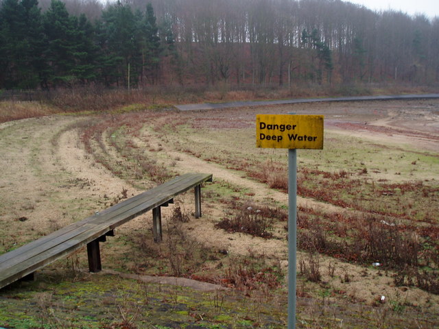
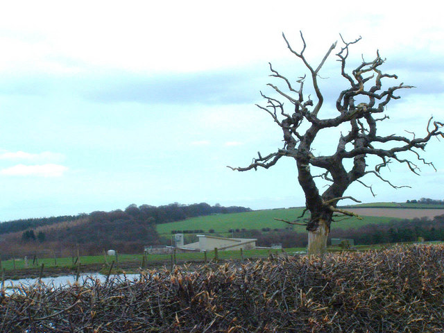
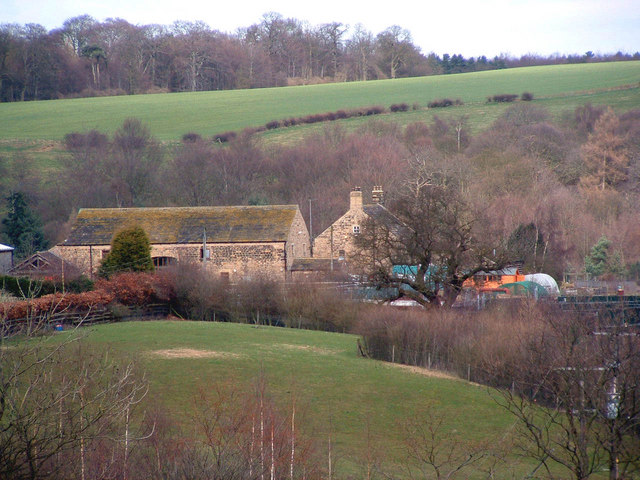
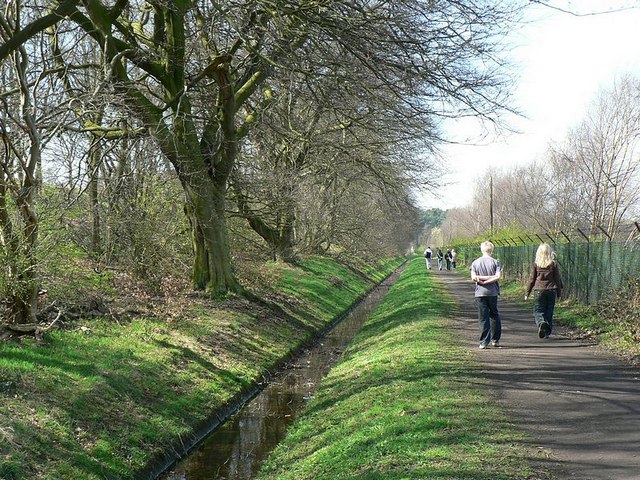
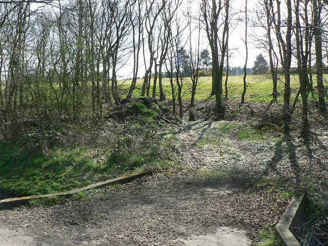
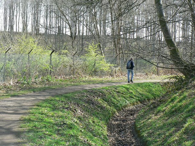
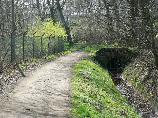
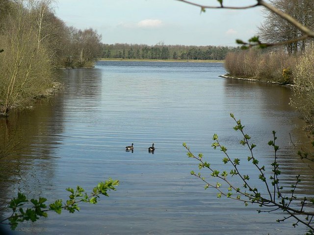
Alwoodley Moss, located in Yorkshire, is a prominent urban greenspace that covers a vast area of approximately 50 hectares. The moss is situated in the northeast of Leeds, specifically in the Alwoodley area, and offers residents and visitors a tranquil escape from the bustling city life.

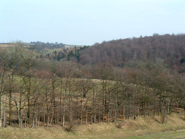
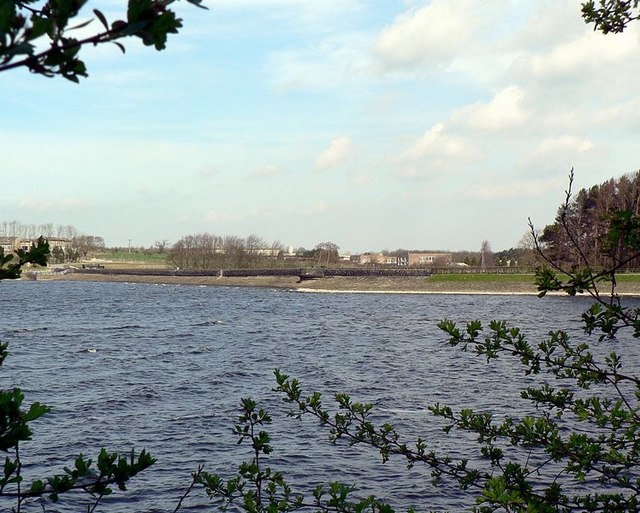
This greenspace is renowned for its diverse and rich ecosystem, comprising a mix of open water, reed beds, wet grassland, and woodland areas. It serves as an important habitat for a variety of flora and fauna, including several endangered species. The moss is particularly notable for its population of breeding birds, such as bitterns, reed warblers, and marsh harriers.

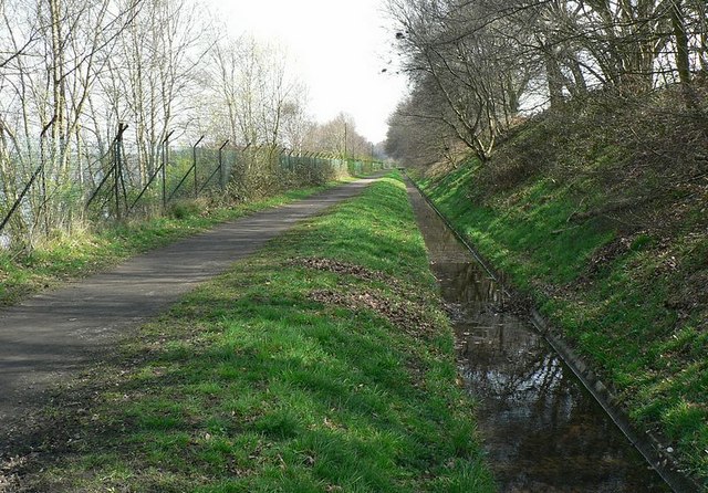
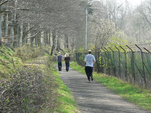
Visitors to Alwoodley Moss can enjoy a range of recreational activities. The moss features footpaths and nature trails, providing ample opportunities for walking, jogging, and cycling. Birdwatching enthusiasts can observe the impressive array of avian species from designated viewpoints and bird hides strategically located around the moss. Moreover, the moss is a popular spot for fishing, attracting anglers who seek to catch species like pike and perch.

Alwoodley Moss is not only a haven for wildlife but also serves as a valuable floodplain, helping to mitigate flood risks in the surrounding urban areas. The moss acts as a natural sponge, absorbing and retaining excess rainwater during heavy downpours.

Overall, Alwoodley Moss stands as a cherished urban greenspace in Yorkshire, offering a serene environment for nature lovers, providing important wildlife habitats, and playing a crucial role in flood prevention in the region.

If you have any feedback on the listing, please let us know in the comments section below.

Alwoodley Moss Images

Images are sourced within 2km of 53.85907/-1.5428421 or Grid Reference SE3040. Thanks to Geograph Open Source API. All images are credited.

Harewood House The southern gateway to Harewood House stands next to Millfield Farm on the main Leeds to Harrogate road.
Harewood House
The southern gateway to Harewood House stands next to Millfield Farm on the main Leeds to Harrogate road.
Eccup Reservoir Eccup reservoir has a viewing platform where many people enjoy watching the Red Kites
Eccup Reservoir
Eccup reservoir has a viewing platform where many people enjoy watching the Red Kites
Entrance to Leeds Grammar School, Alwoodley Gates The beginning of the drive from the school gate, Leeds Grammar School, Alwoodley Gates, Leeds looking east towards the buildings which are in the next square.
Entrance to Leeds Grammar School, Alwoodley Gates
The beginning of the drive from the school gate, Leeds Grammar School, Alwoodley Gates, Leeds looking east towards the buildings which are in the next square.
Sandmoor Golf Club, Alwoodley Lane, Leeds The main entrance, on the north side of Alwoodley Lane.
Sandmoor Golf Club, Alwoodley Lane, Leeds
The main entrance, on the north side of Alwoodley Lane.
High Wood from Eccup reservoir dam Looking west from the dam.  From this spot you are very likely to see red kite.
High Wood from Eccup reservoir dam
Looking west from the dam. From this spot you are very likely to see red kite.
Eccup Reservoir
Eccup Reservoir
Eccup Reservoir (?) Don't dive from the board
Eccup Reservoir (?)
Don't dive from the board
Dead tree Backed up by the water works at Eccup Reservoir
Dead tree
Backed up by the water works at Eccup Reservoir
Herd Farm Tucked away in the valley below Eccup Reservoir and hidden by the waterworks it only really shows itself from the middle of dam head.
Herd Farm
Tucked away in the valley below Eccup Reservoir and hidden by the waterworks it only really shows itself from the middle of dam head.
Path and ditch by Eccup Reservoir The reservoir is on the left behind the fence which runs all along the southern side. On the right is Sandmoor Golf Club and the former site of Alwoodley Old Hall, which was demolished in 1969. A picture from 1950 is on the Leodis archive <span class="nowrap"><a title="http://www.leodis.net/display.aspx?resourceIdentifier=20021010_98472232" rel="nofollow ugc noopener" href="http://www.leodis.net/display.aspx?resourceIdentifier=20021010_98472232">Link</a><img style="margin-left:2px;" alt="External link" title="External link - shift click to open in new window" src="https://s1.geograph.org.uk/img/external.png" width="10" height="10"/></span>

Turn round and continue the walk round the reservoir with <a href="https://www.geograph.org.uk/photo/394603">SE2941 : Eccup Reservoir in spring</a>
Path and ditch by Eccup Reservoir
The reservoir is on the left behind the fence which runs all along the southern side. On the right is Sandmoor Golf Club and the former site of Alwoodley Old Hall, which was demolished in 1969. A picture from 1950 is on the Leodis archive LinkExternal link Turn round and continue the walk round the reservoir with SE2941 : Eccup Reservoir in spring
Path between the Golf Course and Reservoir A long straight (and rather boring) stretch of the path. When you get to the corner look back at <a href="https://www.geograph.org.uk/photo/394611">SE3041 : Path and ditch by Eccup Reservoir</a>
Path between the Golf Course and Reservoir
A long straight (and rather boring) stretch of the path. When you get to the corner look back at SE3041 : Path and ditch by Eccup Reservoir
Bridge to Sandmoor Golf Course Over the ditch from the footpath by Eccup Reservoir. Don't cross it, but follow <a href="https://www.geograph.org.uk/photo/394616">SE3041 : Path between the Golf Course and Reservoir</a>
Bridge to Sandmoor Golf Course
Over the ditch from the footpath by Eccup Reservoir. Don't cross it, but follow SE3041 : Path between the Golf Course and Reservoir
Going round the corner Looking back along the path as it rounds the corner to go round the inlet between Sandmoor Golf Course (this side) and Wigton Knowle (far side).
Turn round to follow the path to <a href="https://www.geograph.org.uk/photo/394622">SE3041 : Bridge to Sandmoor Golf Course</a>
Going round the corner
Looking back along the path as it rounds the corner to go round the inlet between Sandmoor Golf Course (this side) and Wigton Knowle (far side). Turn round to follow the path to SE3041 : Bridge to Sandmoor Golf Course
End of the drain The drain along the south side of Eccup Reservoir goes into a pipe here. Carry on the circuit of Eccup Reservoir at <a href="https://www.geograph.org.uk/photo/394631">SE3041 : Going round the corner</a>
End of the drain
The drain along the south side of Eccup Reservoir goes into a pipe here. Carry on the circuit of Eccup Reservoir at SE3041 : Going round the corner
Inlet by Wigton Knowle, Eccup Reservoir A calm corner on a windy day.
Follow the circuit of Eccup Reservoir. Next is <a href="https://www.geograph.org.uk/photo/394637">SE3041 : End of the drain</a>
Inlet by Wigton Knowle, Eccup Reservoir
A calm corner on a windy day. Follow the circuit of Eccup Reservoir. Next is SE3041 : End of the drain
Path near the end of an inlet, Eccup Reservoir This runs into a small valley by Wigton Knowle, and I was expecting to a see a stream running into the reservoir, but didn't. It's probably been diverted to avoid   undesirable stuff getting into the water supply.
Continue the circuit of Eccup Reservoir at <a href="https://www.geograph.org.uk/photo/394641">SE3041 : Inlet by Wigton Knowle, Eccup Reservoir</a>.
Path near the end of an inlet, Eccup Reservoir
This runs into a small valley by Wigton Knowle, and I was expecting to a see a stream running into the reservoir, but didn't. It's probably been diverted to avoid undesirable stuff getting into the water supply. Continue the circuit of Eccup Reservoir at SE3041 : Inlet by Wigton Knowle, Eccup Reservoir.
Footpath between Wigton Knowle and Eccup Reservoir Much of the south side of the reservoir is a bit hidden by the fence, bushes and saplings.
Next on the circuit of Eccup Reservoir is <a href="https://www.geograph.org.uk/photo/394850">SE3041 : Path near the end of an inlet, Eccup Reservoir</a>
Footpath between Wigton Knowle and Eccup Reservoir
Much of the south side of the reservoir is a bit hidden by the fence, bushes and saplings. Next on the circuit of Eccup Reservoir is SE3041 : Path near the end of an inlet, Eccup Reservoir
Looking across Eccup Reservoir at the dam From the path alongside Wigton Knowle. The wire fence and bushes made it necessary to hold the camera above my head for this one.
Next go to <a href="https://www.geograph.org.uk/photo/394850">SE3041 : Path near the end of an inlet, Eccup Reservoir</a>
Looking across Eccup Reservoir at the dam
From the path alongside Wigton Knowle. The wire fence and bushes made it necessary to hold the camera above my head for this one. Next go to SE3041 : Path near the end of an inlet, Eccup Reservoir
Show me another place!

Alwoodley Moss is located at Grid Ref: SE3040 (Lat: 53.85907, Lng: -1.5428421)

Division: West Riding

Unitary Authority: Leeds

Police Authority: West Yorkshire

What 3 Words

///pulled.feared.shells. Near Chapel Allerton, West Yorkshire

Nearby Locations

Alwoodley Moss Alwoodley

Related Wikis

1929 Ryder Cup

The 2nd Ryder Cup Matches were held at the Moortown Golf Club in Leeds, England. It was very cold, with hail and at one point heavy snow on the greens...
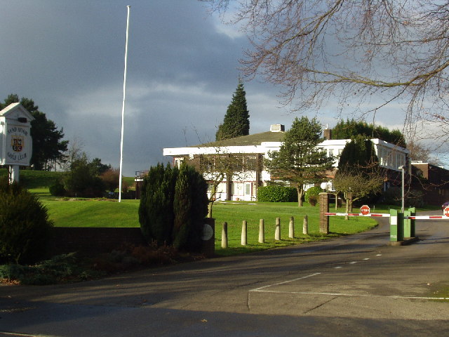
Sand Moor Golf Club

Sand Moor Golf Club is a golf club located in Alwoodley, North Leeds, West Yorkshire, England. It was founded in 1925. The 18-hole golf course was designed...
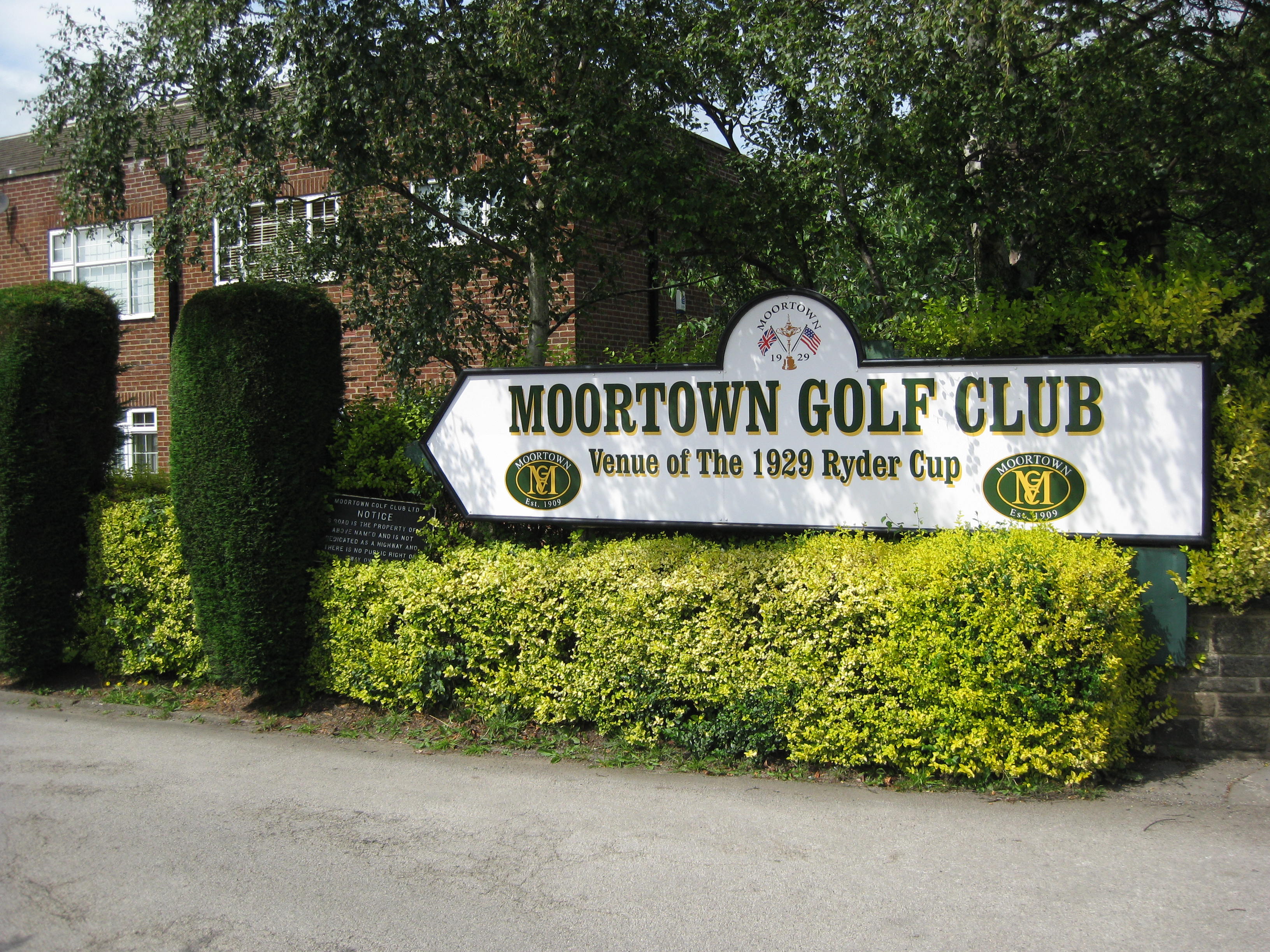
Moortown Golf Club

Moortown Golf Club is a golf club located in Alwoodley, near Leeds, West Yorkshire, England. It was founded in 1909, and the championship golf course was...

Alwoodley

Alwoodley is a suburb and civil parish of Leeds in West Yorkshire, England. It is 5 miles (8.0 km) north of central Leeds and is one of the most affluent...
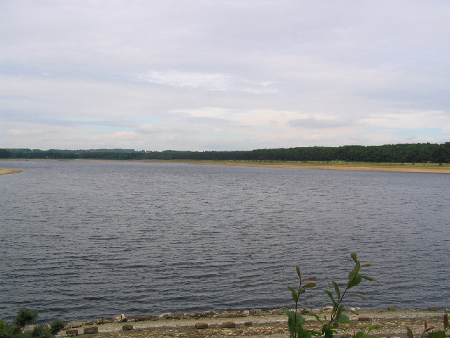
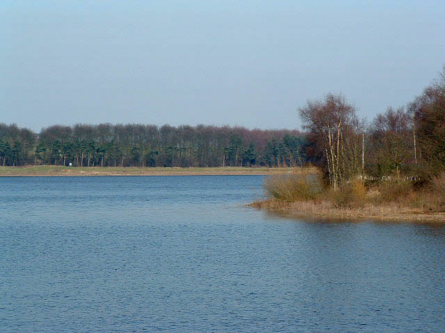
Eccup Reservoir

Eccup Reservoir is a reservoir in Alwoodley, a suburb of Leeds, West Yorkshire, England, near the village of Eccup. It was first constructed in 1843, and...

Allerton High School

Allerton High School is a coeducational secondary school and sixth form located in Alwoodley, Leeds, West Yorkshire, England. It is situated around 500...

Alwoodley Golf Club

Alwoodley Golf Club is a golf club located in Alwoodley, North Leeds, West Yorkshire, England. It was founded in 1907. The 18-hole golf course was the...

Moor Allerton

Moor Allerton is an area of Leeds, West Yorkshire, England. The area is situated in North Leeds, near to King Lane and the Leeds Outer Ring Road. ��2...

Nearby Amenities

Located within 500m of 53.85907,-1.5428421
Bus Stop
Alwoodley Lane The Fairway
Bus: yes
Local Ref: 45012658
Naptan AtcoCode: 450012658
Naptan Bearing: E
Naptan CommonName: Alwoodley Lane The Fairway
Naptan Crossing: The Fairway
Naptan Indicator: Stop 45012658
Naptan PlusbusZoneRef: LEEDS
Naptan ShortCommonName: The Fairway
Naptan Street: Alwoodley Lane
Naptan Verified: no
Public Transport: platform
Source: naptan_import
Lat/Long: 53.8618179/-1.5412392
Bus Stop
Alwoodley Lane Mount Drive
Bus: yes
Local Ref: 45012674
Naptan AtcoCode: 450012674
Naptan Bearing: E
Naptan CommonName: Alwoodley Lane Mount Drive
Naptan Crossing: Mount Drive
Naptan Indicator: Stop 45012674
Naptan PlusbusZoneRef: LEEDS
Naptan ShortCommonName: Mount Drive
Naptan Street: Alwoodley Lane
Naptan Verified: no
Public Transport: platform
Source: naptan_import
Lat/Long: 53.8625026/-1.5463865
Bus Stop
Alwoodley Lane Mount Drive
Bus: yes
Local Ref: 45012675
Naptan AtcoCode: 450012675
Naptan Bearing: W
Naptan CommonName: Alwoodley Lane Mount Drive
Naptan Crossing: Mount Drive
Naptan Indicator: Stop 45012675
Naptan Notes: On L/C-4
Naptan PlusbusZoneRef: LEEDS
Naptan ShortCommonName: Mount Drive
Naptan Street: Alwoodley Lane
Naptan Verified: no
Public Transport: platform
Source: naptan_import
Lat/Long: 53.8624608/-1.547208
Bus Stop
Alwoodley Lane The Fairway
Bus: yes
Local Ref: 45012676
Naptan AtcoCode: 450012676
Naptan Bearing: W
Naptan CommonName: Alwoodley Lane The Fairway
Naptan Crossing: The Fairway
Naptan Indicator: Stop 45012676
Naptan Notes: On L/C-54
Naptan PlusbusZoneRef: LEEDS
Naptan ShortCommonName: The Fairway
Naptan Street: Alwoodley Lane
Naptan Verified: no
Public Transport: platform
Source: naptan_import
Lat/Long: 53.8617383/-1.5415746
Turning Circle
Lat/Long: 53.8550509/-1.5445652
Turning Circle
Lat/Long: 53.8567663/-1.5384609
Turning Circle
Lat/Long: 53.8567283/-1.5366907
Turning Circle
Lat/Long: 53.8594016/-1.5356474
Bar
Sandmoor Golf Club Bar
Addr City: Leeds
Addr Housename: Sandmoor Golf Club
Addr Postcode: LS17 7DJ
Addr Street: Alwoodley Lane
Addr Suburb: Alwoodley
Fhrs Id: 466894
Lat/Long: 53.8625783/-1.5399152
Sandmoor Catering
Addr City: Leeds
Addr Housename: Sandmoor Golf Club
Addr Postcode: LS17 7DJ
Addr Street: Alwoodley Lane
Addr Suburb: Alwoodley
Craft: caterer
Fhrs Id: 1451200
Lat/Long: 53.862659/-1.539934
Post Box
Operator: Royal Mail
Post Box Type: wall
Ref: LS17 279
Lat/Long: 53.8559621/-1.5389449
Post Box
Operator: Royal Mail
Post Box Type: wall
Ref: LS17 782
Lat/Long: 53.8618523/-1.5411691
Waste Basket
Ref UK Leedscc Bin: 2589
Lat/Long: 53.854671/-1.541817
Waste Basket
Ref UK Leedscc Bin: 2588
Lat/Long: 53.855102/-1.540609
Waste Basket
Ref UK Leedscc Bin: 2590
Lat/Long: 53.857033/-1.54063
The data included in this document is from www.openstreetmap.org. The data is made available under ODbL.

Have you been to Alwoodley Moss?

Leave your review of Alwoodley Moss below (or comments, questions and feedback).