Watergate Beach

Beach in Cornwall

England

Watergate Beach

View east from Trevelgue Head Seen from Trevelgue Head, the coastline to the north-east.
View east from Trevelgue Head Credit: David Weston

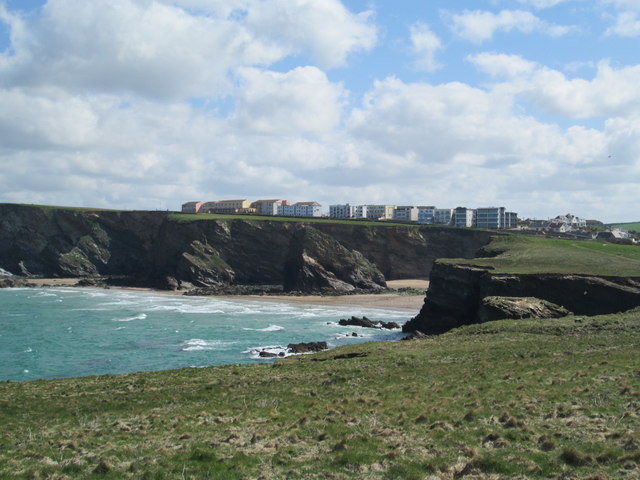
Watergate Beach, located on the north coast of Cornwall, England, is a picturesque stretch of coastline renowned for its natural beauty and excellent surfing conditions. With its wide sandy beach and stunning cliffs, it has become a popular destination for both locals and tourists alike.

Stretching for approximately two miles, Watergate Beach offers ample space for sunbathing, beach games, and leisurely walks. The golden sand is clean and well-maintained, making it a perfect spot for families to enjoy a day out by the sea. The beach is also known for its crystal-clear waters, inviting visitors to take a refreshing dip or try their hand at various water sports such as surfing, paddleboarding, and kayaking.

Surrounded by dramatic cliffs, Watergate Beach offers breathtaking panoramic views of the Atlantic Ocean. Many visitors choose to explore the cliffs and coastal paths, which provide excellent opportunities for hiking and birdwatching. At low tide, fascinating rock formations and caves are revealed, adding to the charm and intrigue of the area.

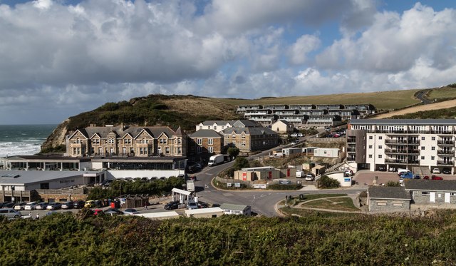
Facilities at Watergate Beach are well-developed, with ample parking, public toilets, and a range of amenities nearby. There are several cafes, restaurants, and beach bars offering a variety of refreshments and delicious seafood dishes. Additionally, surf schools and equipment hire services are available for those looking to ride the waves.

Overall, Watergate Beach is a stunning destination that combines natural beauty, outdoor activities, and relaxation. Whether you are seeking a thrilling surfing experience, a peaceful sunbathing spot, or a scenic coastal walk, this Cornish gem has something for everyone.

If you have any feedback on the listing, please let us know in the comments section below.

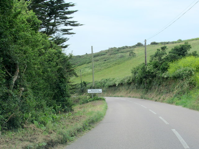
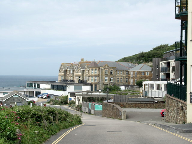
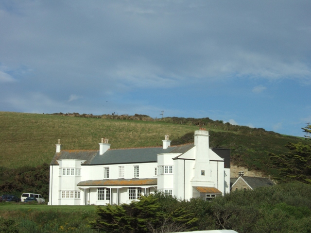
Watergate Beach Images

Images are sourced within 2km of 50.442757/-5.0465286 or Grid Reference SW8364. Thanks to Geograph Open Source API. All images are credited.

View east from Trevelgue Head Seen from Trevelgue Head, the coastline to the north-east.
View east from Trevelgue Head
Seen from Trevelgue Head, the coastline to the north-east.
Northward at Watergate Bay, 1995 Northward on the B3276 road to Stem Point and Griffins Point, past the celebrated Watergate Bay Hotel. {Cf. <a href="https://www.geograph.org.uk/photo/523402">SW8464 : Watergate Bay Hotel</a>}.
Northward at Watergate Bay, 1995
Northward on the B3276 road to Stem Point and Griffins Point, past the celebrated Watergate Bay Hotel. {Cf. SW8464 : Watergate Bay Hotel}.
Old Milestone by the B3276, Watergate Road Carved stone post by the B3276, in parish of NEWQUAY (RESTORMEL District), in lay-by, to left of footpath sign, on North side of road, remains of white paint (2001). Gravestone, erected by the parish in the 19th century. 

Inscription invisible.

Milestone Society National ID: CW_PSNQ.
Old Milestone by the B3276, Watergate Road
Carved stone post by the B3276, in parish of NEWQUAY (RESTORMEL District), in lay-by, to left of footpath sign, on North side of road, remains of white paint (2001). Gravestone, erected by the parish in the 19th century. Inscription invisible. Milestone Society National ID: CW_PSNQ.
Porth Reservoir Drain at Porth Beach
Watergate
Watergate
B3276 Tregurrian Village Sign
B3276 Watergate Bay Village Sign
Entering Watergate Bay
Porth Village Sign
Porth Village Sign
Watergate Bay, north of Newquay Coastal view looking north.
Watergate Bay, north of Newquay
Coastal view looking north.
The Paddock at the start of the Watergate Bay Hillclimb 2019
Exiting the chicane on the Watergate Bay Hillclimb 2019
The commentary post on the Watergate Bay Hillclimb 2019
Looking down to Watergate Bay from the coastal path
The chicane on Watergate Bay Hillclimb 2019
Stile leading to the coastal path on Tinner's Point
Beacon Cove Viewed from the South West Coast Path.
Beacon Cove
Viewed from the South West Coast Path.
Watergate Beach, Tregurrian
Show me another place!

Watergate Beach is located at Grid Ref: SW8364 (Lat: 50.442757, Lng: -5.0465286)

Unitary Authority: Cornwall

Police Authority: Devon and Cornwall

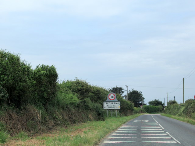
Also known as: Tregurrian

What 3 Words

///trumpet.roosters.skews. Near Newquay, Cornwall

Related Wikis

Watergate Beach

Watergate Beach is a two-mile-long stretch of sandy beach on the Atlantic coast of north Cornwall, England, United Kingdom. It is situated in Watergate...

Boardmasters Festival

Boardmasters Festival is an annual event held in Cornwall, United Kingdom, usually spanning five days on the second weekend of August. The event is a combination...

Tregurrian

Tregurrian (Cornish: Tregoryan, meaning Coryan's farm) is a hamlet 2 miles north-northeast of Newquay, on the north coast of Cornwall, England, United...

Trevarrian

Trevarrian pronounced (Tre-Varrion) is a hamlet south of Mawgan Porth, Cornwall, England, United Kingdom. == Cheese == St. Endellion is a brie style cheese...

Nearby Amenities

Located within 500m of 50.442757,-5.0465286
Source: PGS
Lat/Long: 50.4444505/-5.0419556
Source: PGS
Lat/Long: 50.443828/-5.0422474
Source: PGS
Lat/Long: 50.4432066/-5.0426874
Source: PGS
Lat/Long: 50.4426961/-5.0431664
Source: PGS
Lat/Long: 50.4421946/-5.0434718
Source: PGS
Lat/Long: 50.4419106/-5.0440291
Source: PGS
Lat/Long: 50.441646/-5.0442082
Source: PGS
Lat/Long: 50.4415569/-5.0445233
Source: PGS
Lat/Long: 50.4413549/-5.044734
Source: PGS
Lat/Long: 50.4413158/-5.0449257
Source: PGS
Lat/Long: 50.441263/-5.0450196
Source: PGS
Lat/Long: 50.4408209/-5.0458596
Source: PGS
Lat/Long: 50.4407865/-5.0459914
Source: PGS
Lat/Long: 50.4406873/-5.0460438
Source: PGS
Lat/Long: 50.4405498/-5.0460084
Source: PGS
Lat/Long: 50.440502/-5.0460854
Source: PGS
Lat/Long: 50.440438/-5.0461884
Source: PGS
Lat/Long: 50.4400265/-5.0466772
Source: PGS
Lat/Long: 50.4385348/-5.0485324
Restaurant
The Beach Hut
Addr City: Newquay
Addr Country: GB
Addr Housename: Fifteen Cornwall
Addr Place: Watergate Bay
Addr Postcode: TR8 4AA
Old Name: Jamie Oliver’s Fifteen Cornwall
Source Addr: FHRS Open Data
Website: https://www.watergatebay.co.uk/eat/the-beach-hut/
Lat/Long: 50.4441613/-5.0419824
Generator Method: photovoltaic
Generator Output Electricity: yes
Generator Source: solar
Generator Type: solar_photovoltaic_panel
Location: surface
Power: generator
Lat/Long: 50.4452135/-5.0410643
Barrier: cycle_barrier
Lat/Long: 50.4444763/-5.0403973
Defibrillator
Access: yes
Defibrillator Location: On outside wall between two buildings next to steps down to beach
Emergency: defibrillator
Indoor: no
Opening Hours: 24/7
Survey Date: 2024-02-18
Lat/Long: 50.4444096/-5.0417998
Waste Basket
Survey Date: 2024-02-18
Lat/Long: 50.4444668/-5.0401822
Waste Basket
Survey Date: 2024-02-18
Lat/Long: 50.4444871/-5.0401734
Waste Basket
Survey Date: 2024-02-18
Lat/Long: 50.4444358/-5.0399916
The data included in this document is from www.openstreetmap.org. The data is made available under ODbL.

Have you been to Watergate Beach?

Leave your review of Watergate Beach below (or comments, questions and feedback).