North Beach

Beach in Suffolk East Suffolk

England

North Beach

On the great Eastern Linear Park The Former path of the Lowestoft to Great Yarmouth Railway intersects this grid square. A cycle path along an old railway line, all the original bridges are still intact.
On the great Eastern Linear Park Credit: jrp45-the man in black

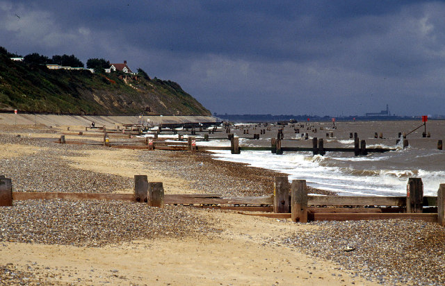
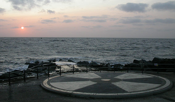
North Beach, Suffolk is a picturesque coastal village located on the eastern coast of England. Situated in the county of Suffolk, it is part of the larger town of Lowestoft. North Beach is known for its stunning sandy beaches and tranquil ambience, making it a popular destination for both locals and tourists alike.

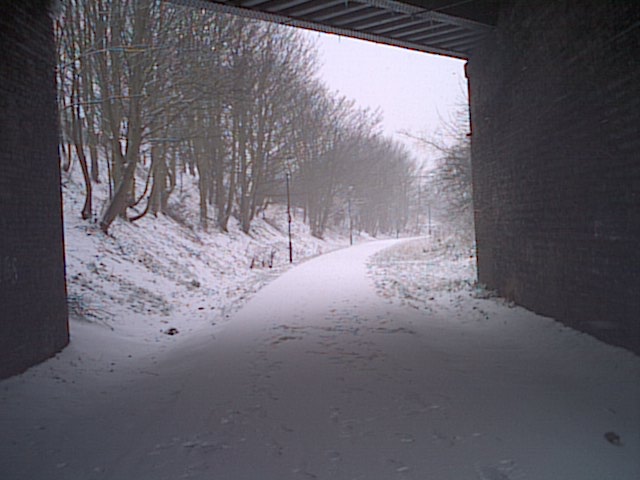
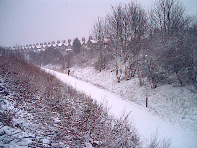
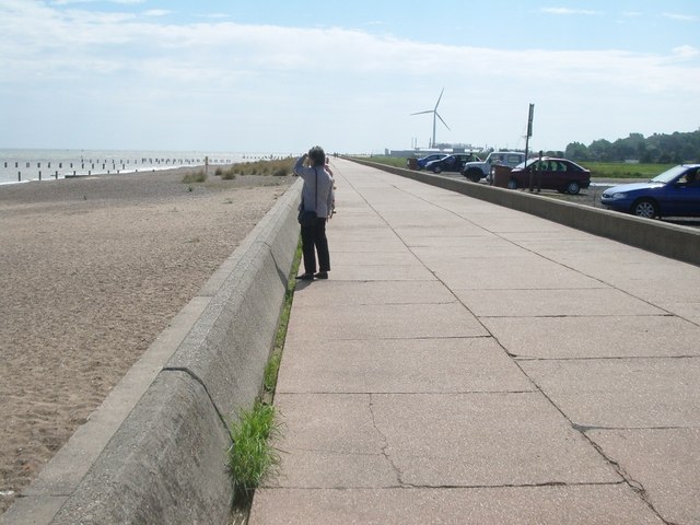
The beach itself stretches for approximately two miles and offers breathtaking views of the North Sea. Visitors can enjoy long walks along the shoreline, take a dip in the refreshing waters, or simply relax on the golden sand. The beach is also home to a variety of wildlife, including seabirds and seals, providing nature enthusiasts with ample opportunities for observation and photography.

In addition to its natural beauty, North Beach offers a range of amenities and attractions. The village has a selection of charming cafes, restaurants, and pubs where visitors can sample delicious local cuisine and enjoy a relaxed dining experience. There are also several shops and boutiques selling unique gifts and souvenirs.

For those seeking adventure, North Beach is a great base for exploring the surrounding area. The village is located within close proximity to the stunning Norfolk Broads, a network of rivers and lakes known for its beautiful scenery and abundant wildlife. Visitors can rent a boat and cruise along the waterways, or explore the many walking and cycling trails that wind through the area.

Overall, North Beach, Suffolk is a picturesque coastal village that offers a perfect blend of natural beauty and modern amenities. Whether you are looking to relax on the beach, explore the local wildlife, or embark on an adventure, North Beach has something to offer everyone.

If you have any feedback on the listing, please let us know in the comments section below.
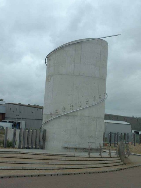
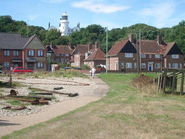
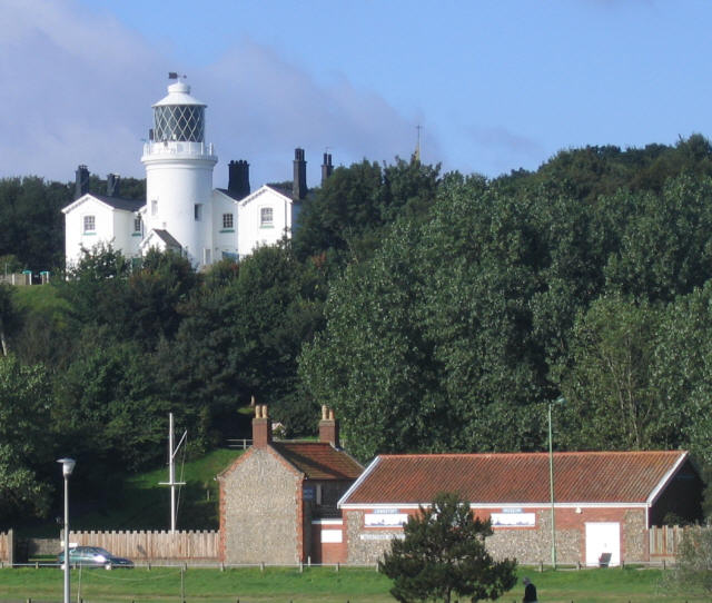
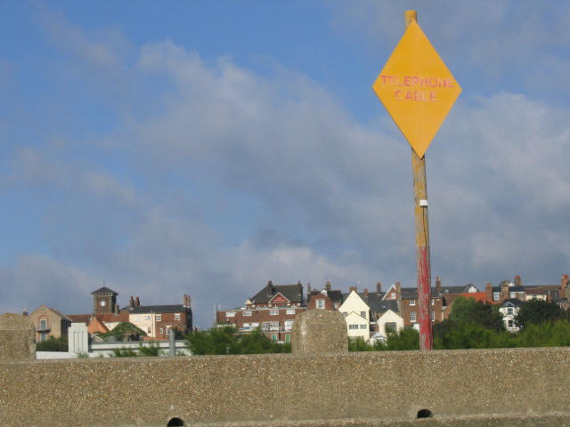
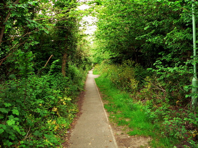
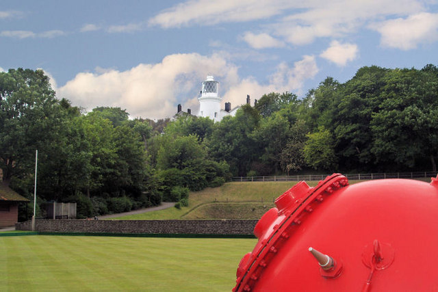
North Beach Images

Images are sourced within 2km of 52.490687/1.7600069 or Grid Reference TM5594. Thanks to Geograph Open Source API. All images are credited.

On the great Eastern Linear Park The Former path of the Lowestoft to Great Yarmouth Railway intersects this grid square. A cycle path along an old railway line, all the original bridges are still intact.
On the great Eastern Linear Park
The Former path of the Lowestoft to Great Yarmouth Railway intersects this grid square. A cycle path along an old railway line, all the original bridges are still intact.
View of the Park in winter This is part of the Great Eastern Linear Park. A cycle and footpath on the bed of a disused railway which ran from Great Yarmouth to Lowestoft
View of the Park in winter
This is part of the Great Eastern Linear Park. A cycle and footpath on the bed of a disused railway which ran from Great Yarmouth to Lowestoft
Plaque at Centre of The EuroScope, Ness Point, Lowestoftness, Lowestoft, Suffolk Lowestoftness is the most easterly point of the British Isles. This auspicious site is marked with a gas holder, frozen food factory, the town dump and a relatively small commemorative piece: the Euroscope. The Euroscope is a large flat indicator set into the concrete of the sea wall structure showing directions and distances to various places. In the centre of the Euroscope is the above plaque. Since this photo was taken (December 2004), the Tallest Wind Turbine in the UK has been built near this point - a long over-due structure to be proud of at one of the cardinal points of these islands
Plaque at Centre of The EuroScope, Ness Point, Lowestoftness, Lowestoft, Suffolk
Lowestoftness is the most easterly point of the British Isles. This auspicious site is marked with a gas holder, frozen food factory, the town dump and a relatively small commemorative piece: the Euroscope. The Euroscope is a large flat indicator set into the concrete of the sea wall structure showing directions and distances to various places. In the centre of the Euroscope is the above plaque. Since this photo was taken (December 2004), the Tallest Wind Turbine in the UK has been built near this point - a long over-due structure to be proud of at one of the cardinal points of these islands
Ness Point, Lowestoft Ness, Lowestoft, Suffolk - Most Easterly Point in the British Isles A view looking east from Ness Point from the position of the (then) future Euroscope (see supplemental picture). This photo was taken soon after sunrise on Easter Morning 1990. A groyne (characteristic of the coastal defences in this area) points defiantly towards Europe like a finger, marking the easternmost point of the kingdom.
Ness Point, Lowestoft Ness, Lowestoft, Suffolk - Most Easterly Point in the British Isles
A view looking east from Ness Point from the position of the (then) future Euroscope (see supplemental picture). This photo was taken soon after sunrise on Easter Morning 1990. A groyne (characteristic of the coastal defences in this area) points defiantly towards Europe like a finger, marking the easternmost point of the kingdom.
Local Council Plaque marking the Easterly Extremity of the British Isles. Mounted on the sea wall adjacent to the Euroscope.
Local Council Plaque marking the Easterly Extremity of the British Isles.
Mounted on the sea wall adjacent to the Euroscope.
Beach south of Corton
The Euroscope at Ness Point at Lowestoft The most easterly point in Britain. I was cycling from Lands End to John O'Groats but taking in the four cardinal points of the British mainland too. Lowestoft is well off the sensible route from LE to JOG, if there is such a thing! The Euroscope is a nice touch - pity it's hidden away behind an industrial estate!
The Euroscope at Ness Point at Lowestoft
The most easterly point in Britain. I was cycling from Lands End to John O'Groats but taking in the four cardinal points of the British mainland too. Lowestoft is well off the sensible route from LE to JOG, if there is such a thing! The Euroscope is a nice touch - pity it's hidden away behind an industrial estate!
Lowestoft Fishing Boats 1954
Lowestoft Ness This imposing looking structure which stands immediately behind the Euroscope at Lowestoft Ness is not in fact a tourist attraction but part of a new water treatment works
Lowestoft Ness
This imposing looking structure which stands immediately behind the Euroscope at Lowestoft Ness is not in fact a tourist attraction but part of a new water treatment works
Lighthouse at Lowestoft Denes
Lowestoft Denes
Lowestoft Denes
Lowestoft Denes lighthouse A closer view of <a href="https://www.geograph.org.uk/photo/223524">TM5594 : Lighthouse at Lowestoft Denes</a>.
Lowestoft Denes lighthouse
Telephone cable marker This large marker on the sea wall presumably marks the route of an undersea telephone cable.
Telephone cable marker
This large marker on the sea wall presumably marks the route of an undersea telephone cable.
Public Footpath to St. Peter Church Gunton, Suffolk
Lowestoft high light
Lowestoft Town Football Club Lowestoft town football club Love Road Lowestoft Suffolk.
Lowestoft Town Football Club
Lowestoft town football club Love Road Lowestoft Suffolk.
Lowestoft Wind Turbine
Show me another place!

North Beach is located at Grid Ref: TM5594 (Lat: 52.490687, Lng: 1.7600069)

Administrative County: Suffolk

District: East Suffolk

Police Authority: Suffolk

What 3 Words

///direct.oils.major. Near Lowestoft, Suffolk

Related Wikis

Lowestoft Maritime Museum

Lowestoft Maritime Museum is a private museum in the town of Lowestoft in Suffolk, England that is dedicated to local and national maritime history. Its...

Lowestoft Lighthouse

Lowestoft Lighthouse is a lighthouse operated by Trinity House located to the north of the centre of Lowestoft in the English county of Suffolk. It stands...

Lowestoft North railway station

Lowestoft North railway station was in Lowestoft, Suffolk, England. It closed in 1970.The station was located just to the east of the A12, opposite the...

Ormiston Denes Academy

Ormiston Denes Academy is a secondary school with academy status located in the northern outskirts of Lowestoft in the English county of Suffolk. It has...
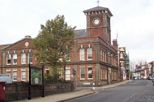
Lowestoft Town Hall

Lowestoft Town Hall is a municipal building in the High Street, Lowestoft, Suffolk, England. The town hall, which was the meeting place of Lowestoft Council...

Waveney District

Waveney was a local government district in Suffolk, England, named after the River Waveney that formed its north-east border. The district council was...
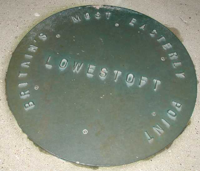
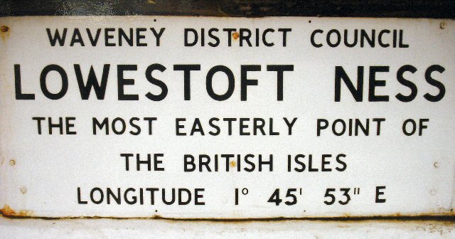
Ness Point

Ness Point, also known as Lowestoft Ness, is the most easterly point of England, Great Britain, the United Kingdom and the British Isles. It is located...
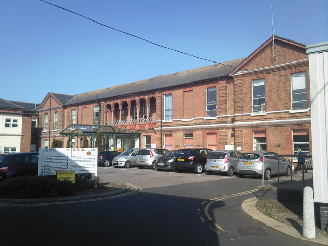
Lowestoft Hospital

Lowestoft Hospital was a National Health Service (NHS) hospital on Tennyson Road in Lowestoft in the English county of Suffolk. It was managed by the James...

Nearby Amenities

Located within 500m of 52.490687,1.7600069
Source: PGS
Lat/Long: 52.4865021/1.7613317
Source: PGS
Lat/Long: 52.4873906/1.7612029
Source: PGS
Lat/Long: 52.4893897/1.7607523
Source: PGS
Lat/Long: 52.4913495/1.7600227
Source: PGS
Lat/Long: 52.4925907/1.7595936
Bus Stop
Warren Road
Bus: yes
Naptan AtcoCode: 390070401
Naptan Bearing: S
Naptan BusStopType: CUS
Naptan CommonName: Warren Road
Naptan Indicator: opp
Naptan Landmark: Warren Road
Naptan NaptanCode: sufjadpw
Naptan Street: Corton Road
Naptan Verified: no
Public Transport: platform
Source: naptan_import
Lat/Long: 52.4913125/1.7528875
Lowestoft Lighthouse
Man Made: lighthouse
Seamark Information: Partially obscured 347° - shore.
Seamark Light Character: Fl
Seamark Light Colour: white
Seamark Light Height: 37
Seamark Light Period: 15
Seamark Light Range: 23
Seamark Light Reference: A 2280
Seamark Name: Lowestoft
Seamark Type: landmark
Source: US NGA Pub. 114. 2011-04-02
Wikidata: Q3739791
Lat/Long: 52.4869839/1.7559062
Life Ring
Emergency: life_ring
Lat/Long: 52.4871615/1.7607814
Generator Method: photovoltaic
Generator Output Electricity: yes
Generator Source: solar
Generator Type: solar_photovoltaic_panel
Location: surface
Power: generator
Lat/Long: 52.4902919/1.7539367
Generator Method: photovoltaic
Generator Output Electricity: yes
Generator Source: solar
Generator Type: solar_photovoltaic_panel
Location: roof
Power: generator
Lat/Long: 52.489214/1.7540064
Post Box
Brand: Royal Mail
Brand Wikidata: Q638098
Brand Wikipedia: en:Royal Mail
Check Date: 2021-05-27
Collection Times: Mo-Fr 09:00; Sa 07:00
Operator: Royal Mail
Operator Wikidata: Q638098
Post Box Design: type_b
Post Box Type: pillar
Ref: NR32 3241
Royal Cypher: EVIIR
Royal Cypher Wikidata: Q33102324
Source: survey
Lat/Long: 52.4896876/1.7528746
Leisure: bandstand
Lat/Long: 52.4881984/1.757328
Lowestoft Naval War Memorial
Historic: memorial
Memorial: war_memorial
Website: http://www.rnpsa.co.uk/cms//memorial/memorial.htm
Wikidata: Q26665173
Lat/Long: 52.4884761/1.7554772
Defibrillator
Defibrillator Location: Mounted on pole at at outer edge of cafe bar outdoor seating area
Emergency: defibrillator
Indoor: no
Operator: Heart 2 Heart Norfolk
Ref GB The Circuit: 6091C49C-1EF9-4664-8732-AE3C010E7398
Lat/Long: 52.4884896/1.7566756
Defibrillator
Defibrillator Location: On external wall of pavilion building near main entrance. Access restricted on evenings due to access gate being locked overnight.
Emergency: defibrillator
Indoor: no
Opening Hours: 08:00-17:30
Operator: Heart 2 Heart Norfolk
Ref GB The Circuit: C044BE66-ED76-42DA-BADA-AD3F0103DC72
Lat/Long: 52.4901083/1.7578504
Barrier: bollard
Bollard: removable
Material: metal
Lat/Long: 52.4900027/1.7580952
Barrier: bollard
Bollard: removable
Material: metal
Lat/Long: 52.488731/1.7573749
Post Box
Brand: Royal Mail
Brand Wikidata: Q638098
Brand Wikipedia: en:Royal Mail
Collection Times: Mo-Fr 09:00; Sa 07:00
Operator: Royal Mail
Operator Type: private
Operator Wikidata: Q638098
Post Box Type: lamp
Ref: NR32 3266
Royal Cypher: EIIR
Royal Cypher Wikidata: Q33102113
Lat/Long: 52.4867981/1.7578653
Colour: light_grey
Communication Mobile Phone: yes
Man Made: mast
Material: metal
Operator: Three UK
Tower Construction: freestanding
Tower Type: communication
Lat/Long: 52.4891607/1.7571322
The data included in this document is from www.openstreetmap.org. The data is made available under ODbL.

Have you been to North Beach?

Leave your review of North Beach below (or comments, questions and feedback).