Lowestoft Cliff

Cliff, Slope in Suffolk East Suffolk

England

Lowestoft Cliff

The Wheatsheaf, Lowestoft On High Street.
The Wheatsheaf, Lowestoft Credit: JThomas

Lowestoft Cliff is a prominent geological feature located in Lowestoft, Suffolk, England. It is a magnificent cliff that stretches along the coastline of the North Sea. The cliff is made up of layers of sedimentary rocks, primarily consisting of sand and clay.

This impressive cliff stands at a height of approximately 20 meters and spans a length of about 2 kilometers. Over the years, extensive erosion has shaped the cliff, resulting in a steep slope that attracts both locals and tourists alike. The erosion has exposed various layers of sedimentary rocks, providing a unique insight into the geological history of the area.

Due to its location, the Lowestoft Cliff offers breathtaking views of the North Sea and the surrounding coastal landscape. Visitors can enjoy panoramic vistas of the sea and observe the changing tides. The cliff also serves as an ideal vantage point for birdwatching, as it is a popular spot for various seabird species.

The Lowestoft Cliff has not only geological significance but also plays an important role in coastal erosion management. The cliff acts as a natural barrier, protecting the land behind it from the erosive forces of the sea. However, it is important to note that the cliff is also subject to ongoing erosion, which can be observed through the occasional landslips and rock falls.

Overall, the Lowestoft Cliff is a remarkable geological feature that offers stunning views and provides valuable insights into the region's geological history. It serves as a popular destination for nature enthusiasts, geologists, and those seeking a peaceful coastal experience.

If you have any feedback on the listing, please let us know in the comments section below.

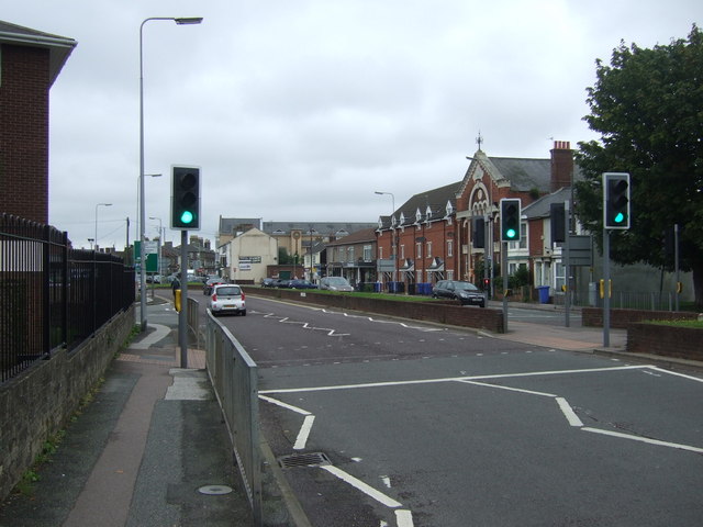
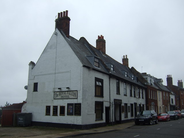
Lowestoft Cliff Images

Images are sourced within 2km of 52.492759/1.755085 or Grid Reference TM5594. Thanks to Geograph Open Source API. All images are credited.

The Wheatsheaf, Lowestoft On High Street.
The Wheatsheaf, Lowestoft
On High Street.
Sign for the Wheatsheaf, Lowestoft
Service station on High Street, Lowestoft
House on Park Road, Lowestoft
St Benedict's Church, Gunton
Sign outside St Benedict's Church, Gunton
Houses on Spashett Road
Bridge over National Cycle Route 1 Course of a disused railway.
Bridge over National Cycle Route 1
Course of a disused railway.
The Mariners Rest, Lowestoft On Rotterdam Road.
The Mariners Rest, Lowestoft
On Rotterdam Road.
Sign for the Mariners Rest, Lowestoft
North Lowestoft Post Office On High Street.
North Lowestoft Post Office
On High Street.
The Crown Hotel, Lowestoft On High Street.
The Crown Hotel, Lowestoft
On High Street.
Sign for the Crown Hotel, Lowestoft
Bayfields hotel and Bar, Lowestoft On High Street.
Bayfields hotel and Bar, Lowestoft
On High Street.
Car wash on Battery Green Road, Lowestoft
Hamilton House, Lowestoft On Battery Green Road.
Hamilton House, Lowestoft
On Battery Green Road.
Crossing on St Peter's Street (A12), Lowestoft Looking west.
Crossing on St Peter's Street (A12), Lowestoft
Looking west.
The Royal Falcon Hotel, Lowestoft On High Street.
The Royal Falcon Hotel, Lowestoft
On High Street.
Show me another place!

Lowestoft Cliff is located at Grid Ref: TM5594 (Lat: 52.492759, Lng: 1.755085)

Administrative County: Suffolk

District: East Suffolk

Police Authority: Suffolk

What 3 Words

///powder.anyway.stream. Near Lowestoft, Suffolk

Related Wikis

Lowestoft North railway station

Lowestoft North was a railway station in Lowestoft, Suffolk, England. It was a stop on the Yarmouth-Lowestoft line, which closed in 1970. The station was...

Ormiston Denes Academy

Ormiston Denes Academy is a secondary school with academy status located in the northern outskirts of Lowestoft in the English county of Suffolk. It has...

Lowestoft Maritime Museum

Lowestoft Maritime Museum is a private museum in the town of Lowestoft in Suffolk, England that is dedicated to local and national maritime history. Its...

Lowestoft Lighthouse

Lowestoft Lighthouse is a lighthouse operated by Trinity House located to the north of the centre of Lowestoft in the English county of Suffolk. It stands...

Nearby Amenities

Located within 500m of 52.492759,1.755085
Source: PGS
Lat/Long: 52.4913495/1.7600227
Source: PGS
Lat/Long: 52.4925907/1.7595936
Source: PGS
Lat/Long: 52.4953342/1.7584134
Source: PGS
Lat/Long: 52.4963402/1.7581774
Bus Stop
Warren Road
Bus: yes
Naptan AtcoCode: 390070401
Naptan Bearing: S
Naptan BusStopType: CUS
Naptan CommonName: Warren Road
Naptan Indicator: opp
Naptan Landmark: Warren Road
Naptan NaptanCode: sufjadpw
Naptan Street: Corton Road
Naptan Verified: no
Public Transport: platform
Source: naptan_import
Lat/Long: 52.4913125/1.7528875
Bus Stop
Denes High School
Bus: yes
Naptan AtcoCode: 390070402
Naptan Bearing: NW
Naptan CommonName: Denes High School
Naptan Indicator: o/s
Naptan Landmark: Denes High School
Naptan NaptanCode: sufjadta
Naptan PlusbusZoneRef: LOWSTFT
Naptan Street: Yarmouth Road
Naptan Verified: no
Public Transport: platform
Source: naptan_import
Lat/Long: 52.4912534/1.7488004
Bus Stop
Denes High School
Bus: yes
Naptan AtcoCode: 390070403
Naptan Bearing: SE
Naptan CommonName: Denes High School
Naptan Indicator: opp
Naptan Landmark: Denes High School
Naptan NaptanCode: sufjadtd
Naptan PlusbusZoneRef: LOWSTFT
Naptan Street: Yarmouth Road
Naptan Verified: no
Public Transport: platform
Source: naptan_import
Lat/Long: 52.4913318/1.7488808
Bus Stop
Station Road
Bus: yes
Naptan AtcoCode: 390070414
Naptan Bearing: NW
Naptan CommonName: Station Road
Naptan Indicator: opp
Naptan Landmark: Station Road
Naptan NaptanCode: sufjadwp
Naptan Street: Yarmouth Road
Naptan Verified: no
Public Transport: platform
Source: naptan_import
Lat/Long: 52.4897949/1.7511077
Bus Stop
Belle Vue Park
Bus: yes
Naptan AtcoCode: 390070415
Naptan Bearing: SE
Naptan CommonName: Belle View Park
Naptan Indicator: adj
Naptan Landmark: Belle View Park
Naptan NaptanCode: sufjadwt
Naptan Street: Yarmouth Road
Naptan Verified: no
Public Transport: platform
Source: naptan_import
Lat/Long: 52.4885024/1.7531508
Bus Stop
Links Road
Bus: yes
Naptan AtcoCode: 390070850
Naptan Bearing: N
Naptan BusStopType: CUS
Naptan CommonName: Links Road
Naptan Indicator: opp
Naptan Landmark: Links Road
Naptan NaptanCode: sufjmjaj
Naptan Street: Corton Road
Naptan Verified: no
Public Transport: platform
Source: naptan_import
Lat/Long: 52.4960544/1.7519948
Bus Stop
Links Road
Bus: yes
Naptan AtcoCode: 390070851
Naptan Bearing: S
Naptan BusStopType: CUS
Naptan CommonName: Links Road
Naptan Indicator: adj
Naptan Landmark: Links Road
Naptan NaptanCode: sufjmjam
Naptan Street: Corton Road
Naptan Verified: no
Public Transport: platform
Source: naptan_import
Lat/Long: 52.4960917/1.7522338
Bus Stop
Saturn Close
Bus: yes
Naptan AtcoCode: 390070890
Naptan Bearing: W
Naptan BusStopType: CUS
Naptan CommonName: Saturn Close
Naptan Indicator: adj
Naptan Landmark: Saturn Close
Naptan NaptanCode: sufjmjwa
Naptan Street: Station Road
Naptan Verified: no
Public Transport: platform
Source: naptan_import
Lat/Long: 52.4900796/1.7512056
Bus Stop
Saturn Close
Bus: yes
Naptan AtcoCode: 390070891
Naptan Bearing: E
Naptan BusStopType: CUS
Naptan CommonName: Saturn Close
Naptan Indicator: opp
Naptan Landmark: Saturn Close
Naptan NaptanCode: sufjmjwd
Naptan Street: Station Road
Naptan Verified: no
Public Transport: platform
Source: naptan_import
Lat/Long: 52.4901523/1.7511824
Bicycle Parking
Lat/Long: 52.4960481/1.757218
Post Box
Brand: Royal Mail
Brand Wikidata: Q638098
Brand Wikipedia: en:Royal Mail
Check Date: 2021-05-27
Collection Times: Mo-Fr 09:00; Sa 07:00
Operator: Royal Mail
Operator Wikidata: Q638098
Post Box Design: type_b
Post Box Type: pillar
Ref: NR32 3239
Royal Cypher: GR
Royal Cypher Wikidata: Q33102273
Source: survey
Lat/Long: 52.4932094/1.7525924
Lowestoft North
Historic Railway: station
Railway: site
Wikidata: Q6694036
Wikipedia: en:Lowestoft North railway station
Lat/Long: 52.4921738/1.749766
Generator Method: photovoltaic
Generator Output Electricity: yes
Generator Source: solar
Generator Type: solar_photovoltaic_panel
Location: roof
Power: generator
Lat/Long: 52.4952794/1.7532071
Generator Method: photovoltaic
Generator Output Electricity: yes
Generator Source: solar
Generator Type: solar_photovoltaic_panel
Location: surface
Power: generator
Lat/Long: 52.4902919/1.7539367
Generator Method: photovoltaic
Generator Output Electricity: yes
Generator Source: solar
Generator Type: solar_photovoltaic_panel
Location: roof
Power: generator
Lat/Long: 52.489214/1.7540064
Generator Method: photovoltaic
Generator Output Electricity: yes
Generator Source: solar
Generator Type: solar_photovoltaic_panel
Location: roof
Power: generator
Lat/Long: 52.4902302/1.7509253
Generator Method: photovoltaic
Generator Output Electricity: yes
Generator Source: solar
Generator Type: solar_photovoltaic_panel
Location: roof
Power: generator
Lat/Long: 52.4918858/1.7513323
Generator Method: photovoltaic
Generator Output Electricity: yes
Generator Source: solar
Generator Type: solar_photovoltaic_panel
Location: roof
Power: generator
Lat/Long: 52.4921716/1.7512464
Generator Method: photovoltaic
Generator Output Electricity: yes
Generator Source: solar
Generator Type: solar_photovoltaic_panel
Location: roof
Power: generator
Lat/Long: 52.4944677/1.7485723
Generator Method: photovoltaic
Generator Output Electricity: yes
Generator Source: solar
Generator Type: solar_photovoltaic_panel
Location: roof
Power: generator
Lat/Long: 52.4955635/1.7511311
Generator Method: photovoltaic
Generator Output Electricity: yes
Generator Source: solar
Generator Type: solar_photovoltaic_panel
Location: roof
Power: generator
Lat/Long: 52.4925767/1.7490256
Generator Method: photovoltaic
Generator Output Electricity: yes
Generator Source: solar
Generator Type: solar_photovoltaic_panel
Location: roof
Power: generator
Lat/Long: 52.4914139/1.7480707
Generator Method: photovoltaic
Generator Output Electricity: yes
Generator Source: solar
Generator Type: solar_photovoltaic_panel
Location: roof
Power: generator
Lat/Long: 52.4913322/1.7482799
Post Box
Brand: Royal Mail
Brand Wikidata: Q638098
Brand Wikipedia: en:Royal Mail
Check Date: 2021-05-27
Collection Times: Mo-Fr 09:00; Sa 07:00
Operator: Royal Mail
Operator Wikidata: Q638098
Post Box Design: type_b
Post Box Type: pillar
Ref: NR32 3241
Royal Cypher: EVIIR
Royal Cypher Wikidata: Q33102324
Source: survey
Lat/Long: 52.4896876/1.7528746
Lowestoft Naval War Memorial
Historic: memorial
Memorial: war_memorial
Website: http://www.rnpsa.co.uk/cms//memorial/memorial.htm
Wikidata: Q26665173
Lat/Long: 52.4884761/1.7554772
Defibrillator
Defibrillator Location: Mounted on pole at at outer edge of cafe bar outdoor seating area
Emergency: defibrillator
Indoor: no
Operator: Heart 2 Heart Norfolk
Ref GB The Circuit: 6091C49C-1EF9-4664-8732-AE3C010E7398
Lat/Long: 52.4884896/1.7566756
Defibrillator
Defibrillator Location: On external wall of pavilion building near main entrance. Access restricted on evenings due to access gate being locked overnight.
Emergency: defibrillator
Indoor: no
Opening Hours: 08:00-17:30
Operator: Heart 2 Heart Norfolk
Ref GB The Circuit: C044BE66-ED76-42DA-BADA-AD3F0103DC72
Lat/Long: 52.4901083/1.7578504
Barrier: bollard
Bollard: removable
Material: metal
Lat/Long: 52.4900027/1.7580952
Barrier: bollard
Bollard: removable
Material: metal
Lat/Long: 52.488731/1.7573749
Post Box
Brand: Royal Mail
Brand Wikidata: Q638098
Brand Wikipedia: en:Royal Mail
Collection Times: Mo-Fr 09:00; Sa 07:00
Operator: Royal Mail
Operator Type: private
Operator Wikidata: Q638098
Post Box Type: pillar
Ref: NR32 3243
Royal Cypher: EIIR
Royal Cypher Wikidata: Q33102113
Lat/Long: 52.4958278/1.7511136
Post Box
Brand: Royal Mail
Brand Wikidata: Q638098
Brand Wikipedia: en:Royal Mail
Collection Times: Mo-Fr 09:00; Sa 07:00
Operator: Royal Mail
Operator Type: private
Operator Wikidata: Q638098
Post Box Type: pillar
Ref: NR32 3232
Royal Cypher: GVIR
Royal Cypher Wikidata: Q33102169
Lat/Long: 52.4918517/1.7481634
Public Bookcase
Defibrillator
Access: yes
Booth: K6
Defibrillator Location: outside old red phone box (now used as book swap) Gunton Drive, Lowestoft
Disused Amenity: telephone
Emergency: defibrillator
Indoor: no
Man Made: telephone_box
Public Bookcase Type: phone_box
Ref GB The Circuit: 9F812581-DA77-4571-AA1F-AE8400FE47E1
Lat/Long: 52.4958641/1.7517499
Give Way
Direction: forward
Lat/Long: 52.4958272/1.7520309
Give Way
Direction: forward
Lat/Long: 52.4958343/1.7521787
Colour: light_grey
Communication Mobile Phone: yes
Man Made: mast
Material: metal
Operator: Three UK
Tower Construction: freestanding
Tower Type: communication
Lat/Long: 52.4891607/1.7571322
The data included in this document is from www.openstreetmap.org. The data is made available under ODbL.

Have you been to Lowestoft Cliff?

Leave your review of Lowestoft Cliff below (or comments, questions and feedback).