Tankerton Beach

Beach in Kent Canterbury

England

Tankerton Beach

Whites of Kent, High Street Whites of Kent have had shops across Kent for at least 50 years. The Whitstable shop on the High Street retains what looks as though it could be a 60s/70s frontage. Next door is a Sainsbury’s Local.
Whites of Kent, High Street Credit: Daniel Parks

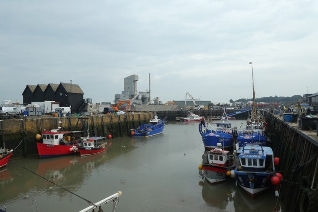
Tankerton Beach is a picturesque coastal area located in the county of Kent, England. Situated on the northeast coast, it is a part of the larger seaside town of Whitstable. Known for its charming pebble shoreline and stunning views, Tankerton Beach offers a delightful seaside experience for locals and visitors alike.

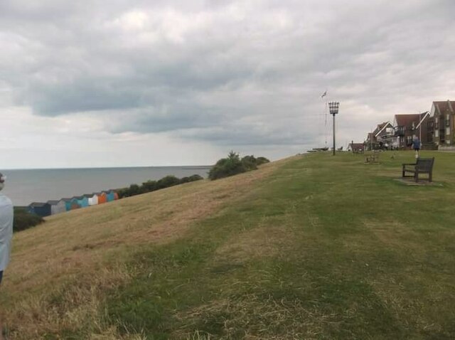
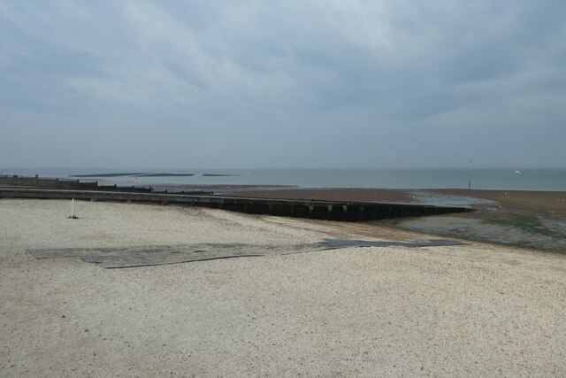
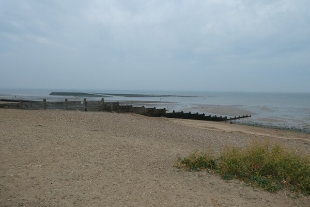
The beach stretches for approximately 1.5 miles, providing ample space for beachgoers to relax and enjoy the tranquil surroundings. At low tide, a vast expanse of sandy flats is revealed, perfect for long walks or beach games. The gently sloping beach is also popular for swimming, although caution is advised due to occasional strong currents.

One of the highlights of Tankerton Beach is the historic Tankerton Slopes, an elevated grassy area that overlooks the beach and offers panoramic views of the sea. The slopes are adorned with colorful beach huts, adding to the idyllic atmosphere of the area. Walking along the promenade, visitors can enjoy a leisurely stroll while taking in the breathtaking vistas.

Facilities at Tankerton Beach are well-maintained, with ample parking available nearby and accessible toilets for convenience. The beach is also equipped with lifeguards during peak seasons, ensuring the safety of swimmers. Additionally, there are various cafes and restaurants nearby, providing options for refreshments and dining.

Tankerton Beach is a popular destination for families, couples, and nature enthusiasts seeking a peaceful coastal retreat. Its natural beauty, combined with its convenient facilities and stunning views, make it a must-visit location for anyone exploring the Kent coastline.

If you have any feedback on the listing, please let us know in the comments section below.

Tankerton Beach Images

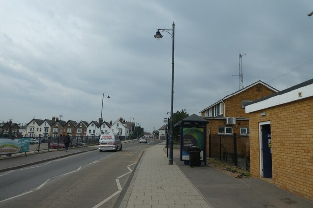
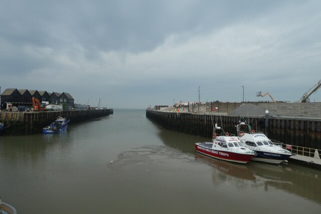
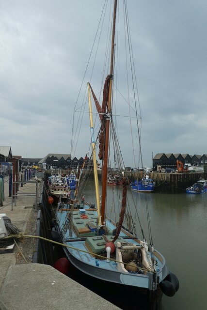
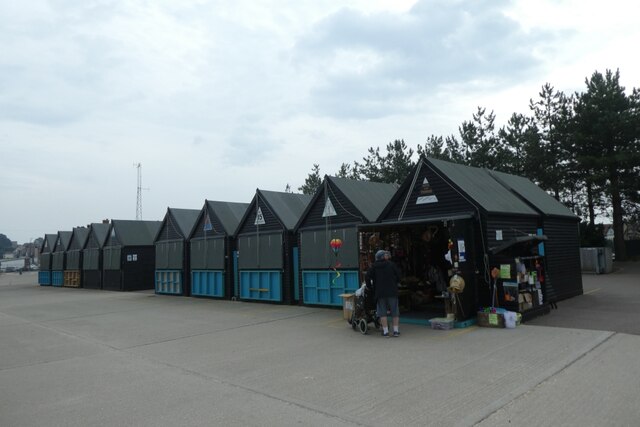
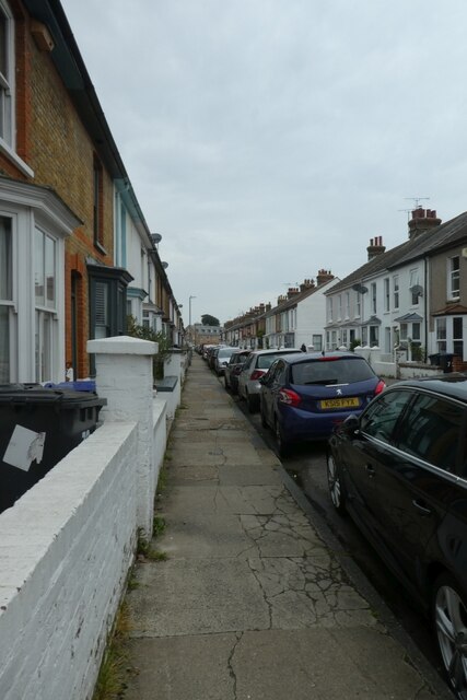
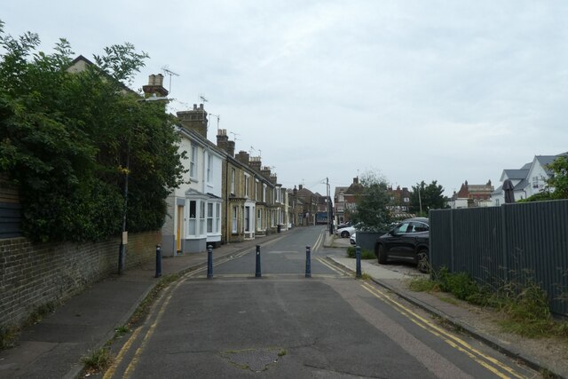
Images are sourced within 2km of 51.366694/1.0460675 or Grid Reference TR1267. Thanks to Geograph Open Source API. All images are credited.

Whites of Kent, High Street Whites of Kent have had shops across Kent for at least 50 years. The Whitstable shop on the High Street retains what looks as though it could be a 60s/70s frontage. Next door is a Sainsbury’s Local.
Whites of Kent, High Street
Whites of Kent have had shops across Kent for at least 50 years. The Whitstable shop on the High Street retains what looks as though it could be a 60s/70s frontage. Next door is a Sainsbury’s Local.
Whitstable Harbour
Whitstable Harbour
The Forge
The Forge
Chandlers Way
Chandlers Way
The Castle
The Castle
St Alphege Church
St Alphege Church
Coastguard Lookout
Coastguard Lookout
Tankerton slopes
Tankerton slopes
Tower Parade Looking along the B2205 in Whitstable.
Tower Parade
Looking along the B2205 in Whitstable.
Harbour entrance Looking towards the mouth of Whitstable harbour.
Harbour entrance
Looking towards the mouth of Whitstable harbour.
Boats in the harbour Looking at various fishing vessels at Whitstable.
Boats in the harbour
Looking at various fishing vessels at Whitstable.
Retail huts near the harbour Little huts sat beside the harbour at Whitstable.
Retail huts near the harbour
Little huts sat beside the harbour at Whitstable.
Harbour at Whitstable Looking along the harbour with various fishing boats.
Harbour at Whitstable
Looking along the harbour with various fishing boats.
Slipways on the beach Looking across the beach at Whitstable.
Slipways on the beach
Looking across the beach at Whitstable.
Groynes on the beach Looking along Reeves Beach at Whitstable.
Groynes on the beach
Looking along Reeves Beach at Whitstable.
Bus shelters on Oxford Street Looking along Oxford Street in Whitstable.
Bus shelters on Oxford Street
Looking along Oxford Street in Whitstable.
Regent Street Looking along Regent Street near the junction with Acton Road.
Regent Street
Looking along Regent Street near the junction with Acton Road.
Gladstone Road Looking along Gladstone Road near the junction with Regent Street.
Gladstone Road
Looking along Gladstone Road near the junction with Regent Street.
Show me another place!

Tankerton Beach is located at Grid Ref: TR1267 (Lat: 51.366694, Lng: 1.0460675)

Administrative County: Kent

District: Canterbury

Police Authority: Kent

What 3 Words

///allow.misty.taken. Near Tankerton, Kent

Related Wikis

Tankerton

Tankerton (formerly Tankerton-on-Sea) is a suburb of Whitstable in Kent in south-east England. It was designed in the late 19th century as the train network...

Whitstable Harbour railway station

Whitstable Harbour railway station was the name of two disused railway stations serving Whitstable the terminus of the Canterbury and Whitstable Railway...

Tankerton Halt railway station

Tankerton Halt was a minor station on the Canterbury and Whitstable Railway at Tankerton, Kent. It opened in 1914 and closed in 1931. == History == Tankerton...

Heart Kent

Heart Kent (previously Invicta FM) was an Independent Local Radio station owned and operated by Global Radio as part of the Heart network. It broadcast...

Nearby Amenities

Located within 500m of 51.366694,1.0460675
Tankerton
Is In: Kent, England, UK
Place: village
Source: NPE maps
Wikidata: Q7683545
Lat/Long: 51.3641122/1.0438624
Bicycle Parking
Bicycle Parking: stands
Capacity: 2
Check Date: 2023-08-31
Covered: no
Source: survey
Lat/Long: 51.3637073/1.0429921
Post Box
Post Box Type: pillar
Postal Code: CT5
Ref: CT5 192
Source: survey
Lat/Long: 51.3638162/1.0431088
Post Box
Mapillary: 241337864464833
Post Box Type: pillar
Postal Code: CT5
Ref: CT5 86
Source: survey
Survey Date: 2021-05-09
Lat/Long: 51.3638252/1.045307
Bicycle Parking
Bicycle Parking: stands
Capacity: 4
Covered: no
Source: survey
Lat/Long: 51.3638081/1.0455399
Post Box
Brand: Royal Mail
Brand Wikidata: Q638098
Collection Times: Mo-Fr 09:00; Sa 07:00
Operator: Royal Mail
Operator Wikidata: Q638098
Post Box Design: type_b
Post Box Type: pillar
Postal Code: CT5
Ref: CT5 243
Royal Cypher: GR
Royal Cypher Wikidata: Q33102273
Source: survey
Lat/Long: 51.3637916/1.0496251
Bicycle Parking
Bicycle Parking: front_wheel_only
Capacity: 5
Covered: no
Note: Not fixed to the ground!
Source: survey
Lat/Long: 51.3638312/1.0432177
Bicycle Parking
Bicycle Parking: stands
Capacity: 2
Covered: no
Source: survey
Lat/Long: 51.3638512/1.0435709
Bicycle Parking
Bicycle Parking: stands
Capacity: 4
Covered: no
Source: survey
Lat/Long: 51.3636923/1.0440112
Bicycle Parking
Bicycle Parking: stands
Capacity: 2
Covered: no
Source: survey
Lat/Long: 51.3637801/1.0450868
Bus Stop
Graystone Road
Bus: yes
Public Transport: platform
Ref: KNTGAJAW
Shelter: no
Lat/Long: 51.3637794/1.0457818
Recycling
Recycling Cans: yes
Recycling Clothes: yes
Recycling Glass Bottles: yes
Recycling Paper: yes
Recycling Shoes: yes
Lat/Long: 51.3641234/1.0489501
Bicycle Parking
Bicycle Parking: stands
Capacity: 10
Covered: no
Source: survey
Lat/Long: 51.3648365/1.0418413
Pub
The Marine Hotel
Addr City: Whitstable
Addr Country: GB
Addr Postcode: CT5 2BE
Addr Street: Marine Parade
Brewery: Shepherd Neame
Not Addr Postcode: CT5 2BQ
Note: FHRS postcode disagrees with website as of Oct 2017
Toilets Wheelchair: yes
Wheelchair: yes
Wheelchair Description: Follow signs as disabled access is at the back of the property
Lat/Long: 51.3645308/1.0432963
Bus Stop
Tankerton Circus
Bench: yes
Bin: yes
Lit: yes
Naptan AtcoCode: 2400A048650A
Naptan Bearing: W
Naptan CommonName: Tankerton Circus
Naptan Indicator: W-bound
Naptan Landmark: Tankerton Circus
Naptan NaptanCode: kntgajap
Naptan PlusbusZoneRef: HRNEBAY
Naptan Street: Tankerton Road
Naptan Verified: no
Shelter: yes
Source: naptan_import
Tactile Paving: no
Lat/Long: 51.363687/1.0410841
Bus Stop
Tankerton Circus
Bench: yes
Bin: no
Naptan AtcoCode: 2400A048660A
Naptan Bearing: E
Naptan CommonName: Tankerton Circus
Naptan Indicator: E-bound
Naptan Landmark: Tankerton Circus
Naptan NaptanCode: kntgajat
Naptan PlusbusZoneRef: HRNEBAY
Naptan Street: Tankerton Road
Naptan Verified: no
Shelter: yes
Source: naptan_import
Tactile Paving: no
Lat/Long: 51.3637881/1.0413613
Bus Stop
Graystone Road
Bus: yes
Naptan AtcoCode: 2400A048670A
Naptan Bearing: E
Naptan CommonName: Graystone Road
Naptan Indicator: E-bound
Naptan Landmark: Post Office
Naptan NaptanCode: kntgajaw
Naptan PlusbusZoneRef: HRNEBAY
Naptan Street: Tankerton Road
Naptan Verified: no
Public Transport: platform
Shelter: no
Source: naptan_import
Lat/Long: 51.3637842/1.0456582
Bus Stop
Graystone Road
Bus: yes
Naptan AtcoCode: 2400A048680A
Naptan Bearing: W
Naptan CommonName: Graystone Road
Naptan Indicator: W-bound
Naptan Landmark: Graystone Road
Naptan NaptanCode: kntgajda
Naptan PlusbusZoneRef: HRNEBAY
Naptan Street: Tankerton Road
Naptan Verified: no
Public Transport: platform
Source: naptan_import
Lat/Long: 51.3636777/1.0466587
Bus Stop
Pier Avenue
Naptan AtcoCode: 2400A048690A
Naptan Bearing: E
Naptan CommonName: Pier Avenue
Naptan Indicator: E-bound
Naptan Landmark: Car Park
Naptan NaptanCode: kntgajdg
Naptan PlusbusZoneRef: HRNEBAY
Naptan Street: Tankerton Road
Naptan Verified: no
Source: naptan_import
Lat/Long: 51.3637946/1.0494768
Bus Stop
Pier Avenue
Naptan AtcoCode: 2400A048700A
Naptan Bearing: W
Naptan CommonName: Pier Avenue
Naptan Indicator: W-bound
Naptan Landmark: Pier Avenue
Naptan NaptanCode: kntgajdj
Naptan PlusbusZoneRef: HRNEBAY
Naptan Street: Tankerton Road
Naptan Verified: no
Source: naptan_import
Lat/Long: 51.36361/1.0501522
Crossing
Crossing: uncontrolled
Crossing Markings: yes
Crossing Signals: no
Crossing Ref: zebra
Lat/Long: 51.3637244/1.0452585
Crossing
Crossing: uncontrolled
Crossing Island: no
Crossing Ref: zebra
Tactile Paving: yes
Lat/Long: 51.3637472/1.0424897
Copperas Court
Addr Housename: Copperas Court
Addr Housenumber: 169
Addr Postcode: CT5 2BY
Addr Street: Tankerton Road
Building: apartments
Source: local knowledge
Lat/Long: 51.3638717/1.0485374
Bench
Backrest: yes
Lat/Long: 51.3647138/1.0405395
Bench
Backrest: yes
Lat/Long: 51.3647216/1.0408524
Bench
Backrest: yes
Lat/Long: 51.3647288/1.0411514
Bench
Backrest: yes
Lat/Long: 51.3647399/1.041523
Bench
Backrest: yes
Lat/Long: 51.3648933/1.0417127
Bench
Backrest: yes
Lat/Long: 51.364874/1.041341
Bench
Backrest: yes
Lat/Long: 51.3648758/1.041302
Bench
Backrest: yes
Lat/Long: 51.3648637/1.0402291
Bench
Backrest: yes
Image: https://openbenches.org/image/581684ec7c1b76d5bab5a74b7de2f1bb2e37dd0d
Inscription: KAY MARY FRENCH 28-08-61 TO 19-12-14 "KEEP ME IN YOUR HEART I'LL STAY THERE FOREVER"
Openbenches Id: 19093
Lat/Long: 51.3648427/1.0396994
Bench
Backrest: yes
Image: https://openbenches.org/image/c12253ddc9e1dbc569b3267ddff7bb700520f350
Inscription: TONY LEDGER 1957 - 2011 LOVED AND GREATLY MISSED BY ALL WHO KNEW HIM
Openbenches Id: 19094
Lat/Long: 51.3648314/1.0395235
Bench
Backrest: yes
Lat/Long: 51.3648498/1.0398698
Bench
Backrest: yes
Lat/Long: 51.3649004/1.042074
Bench
Backrest: yes
Lat/Long: 51.3648948/1.0423961
Bench
Backrest: yes
Lat/Long: 51.3648964/1.042694
Bench
Backrest: yes
Lat/Long: 51.364895/1.0430223
Bench
Backrest: yes
Lat/Long: 51.3648876/1.0436037
Bench
Backrest: yes
Lat/Long: 51.364891/1.0432354
Bench
Backrest: yes
Lat/Long: 51.3647387/1.0437736
Bench
Backrest: yes
Lat/Long: 51.3647437/1.0434493
Bench
Backrest: yes
Lat/Long: 51.3648854/1.0448396
Bench
Backrest: yes
Lat/Long: 51.3648664/1.045328
Bench
Backrest: yes
Lat/Long: 51.3647328/1.0450612
Bench
Backrest: yes
Lat/Long: 51.3647384/1.0444549
Bench
Backrest: yes
Lat/Long: 51.3648631/1.0463726
Bench
Backrest: yes
Lat/Long: 51.3647974/1.0470813
Bench
Backrest: yes
Lat/Long: 51.3647997/1.0474699
Bench
Backrest: yes
Lat/Long: 51.364791/1.0478108
Bench
Backrest: yes
Lat/Long: 51.3647933/1.0480315
Bench
Backrest: yes
Lat/Long: 51.3647846/1.0483523
Bench
Backrest: yes
Lat/Long: 51.3648029/1.0494712
Bench
Backrest: yes
Lat/Long: 51.3647766/1.0499312
Bench
Backrest: yes
Lat/Long: 51.3647664/1.0501554
Bench
Backrest: yes
Lat/Long: 51.3647825/1.0503515
Bench
Backrest: yes
Lat/Long: 51.3647664/1.0505126
Bench
Backrest: yes
Lat/Long: 51.3647679/1.0506948
Bench
Backrest: yes
Lat/Long: 51.3647664/1.0509073
Bench
Backrest: yes
Lat/Long: 51.3647825/1.0513369
Bench
Backrest: yes
Lat/Long: 51.3648189/1.05177
Bench
Lat/Long: 51.3648281/1.0520492
Bench
Backrest: yes
Lat/Long: 51.3648433/1.0522326
Bench
Lat/Long: 51.3648368/1.0525179
Atm
Check Date: 2023-08-31
Lat/Long: 51.3636574/1.0425966
Atm
Tesco
Lat/Long: 51.3638297/1.0455175
Generator Method: photovoltaic
Generator Output Electricity: yes
Generator Solar Modules: 9
Generator Source: solar
Generator Type: solar_photovoltaic_panel
Location: roof
Power: generator
Lat/Long: 51.3630667/1.0486753
Generator Method: photovoltaic
Generator Output Electricity: yes
Generator Solar Modules: 3
Generator Source: solar
Generator Type: solar_photovoltaic_panel
Location: roof
Power: generator
Lat/Long: 51.3630714/1.0485587
Generator Method: photovoltaic
Generator Output Electricity: yes
Generator Solar Modules: 12
Generator Source: solar
Generator Type: solar_photovoltaic_panel
Location: roof
Power: generator
Lat/Long: 51.3644308/1.052236
Generator Method: photovoltaic
Generator Output Electricity: yes
Generator Source: solar
Generator Type: solar_photovoltaic_panel
Location: roof
Power: generator
Lat/Long: 51.3641136/1.0458038
Generator Method: photovoltaic
Generator Output Electricity: yes
Generator Source: solar
Generator Type: solar_photovoltaic_panel
Location: roof
Power: generator
Lat/Long: 51.3640667/1.0458025
Generator Method: photovoltaic
Generator Output Electricity: yes
Generator Source: solar
Generator Type: solar_photovoltaic_panel
Location: roof
Power: generator
Lat/Long: 51.3640164/1.0458011
Generator Method: photovoltaic
Generator Output Electricity: yes
Generator Source: solar
Generator Type: solar_photovoltaic_panel
Location: roof
Power: generator
Lat/Long: 51.3639544/1.0457761
Generator Method: photovoltaic
Generator Output Electricity: yes
Generator Solar Modules: 2
Generator Source: solar
Generator Type: solar_photovoltaic_panel
Location: roof
Power: generator
Lat/Long: 51.3644149/1.0482073
Generator Method: photovoltaic
Generator Output Electricity: yes
Generator Solar Modules: 9
Generator Source: solar
Generator Type: solar_photovoltaic_panel
Location: roof
Power: generator
Lat/Long: 51.3624974/1.0469239
Generator Method: photovoltaic
Generator Orientation: 179
Generator Output Electricity: yes
Generator Solar Modules: 2
Generator Source: solar
Generator Type: solar_photovoltaic_panel
Location: roof
Power: generator
Lat/Long: 51.36271/1.0456847
Generator Method: photovoltaic
Generator Orientation: 269
Generator Output Electricity: yes
Generator Solar Modules: 7
Generator Source: solar
Generator Type: solar_photovoltaic_panel
Location: roof
Power: generator
Lat/Long: 51.3627276/1.0456498
Generator Method: photovoltaic
Generator Orientation: 269
Generator Output Electricity: yes
Generator Solar Modules: 7
Generator Source: solar
Generator Type: solar_photovoltaic_panel
Location: roof
Power: generator
Lat/Long: 51.362772/1.0456498
Post Office
Tankerton Post Office
Addr City: Tankerton
Addr Housenumber: 141
Addr Postcode: CT5 2AW
Addr Street: Tankerton Road
Brand: Post Office
Brand Wikidata: Q1783168
Opening Hours: Mo-Fr 09:00-17:30; Sa 09:00-12:30
Operator: Post Office
Ref Pol Id: 1545
Source: local knowledge
Website: https://www.postoffice.co.uk/branch-finder/1089099/tankerton
Lat/Long: 51.3638558/1.04534
Generator Method: photovoltaic
Generator Output Electricity: yes
Generator Solar Modules: 16
Generator Source: solar
Generator Type: solar_photovoltaic_panel
Location: roof
Power: generator
Lat/Long: 51.3641085/1.0428704
Generator Method: photovoltaic
Generator Output Electricity: yes
Generator Solar Modules: 3
Generator Source: solar
Generator Type: solar_photovoltaic_panel
Location: roof
Power: generator
Lat/Long: 51.3645087/1.0481657
Generator Method: photovoltaic
Generator Output Electricity: yes
Generator Solar Modules: 3
Generator Source: solar
Generator Type: solar_photovoltaic_panel
Location: roof
Power: generator
Lat/Long: 51.3644626/1.0481657
Generator Method: photovoltaic
Generator Output Electricity: yes
Generator Solar Modules: 2
Generator Source: solar
Generator Type: solar_photovoltaic_panel
Location: roof
Power: generator
Lat/Long: 51.3632774/1.0475729
Generator Method: photovoltaic
Generator Output Electricity: yes
Generator Solar Modules: 4
Generator Source: solar
Generator Type: solar_photovoltaic_panel
Location: roof
Power: generator
Lat/Long: 51.3632615/1.0475327
Generator Method: photovoltaic
Generator Output Electricity: yes
Generator Solar Modules: 4
Generator Source: solar
Generator Type: solar_photovoltaic_panel
Location: roof
Power: generator
Lat/Long: 51.3632715/1.0476199
Generator Method: photovoltaic
Generator Output Electricity: yes
Generator Solar Modules: 20
Generator Source: solar
Generator Type: solar_photovoltaic_panel
Location: roof
Power: generator
Lat/Long: 51.363076/1.0473899
Generator Method: photovoltaic
Generator Output Electricity: yes
Generator Solar Modules: 4
Generator Source: solar
Generator Type: solar_photovoltaic_panel
Location: roof
Power: generator
Lat/Long: 51.3624948/1.0469788
Telephone
Booth: KX100
Covered: booth
Payment Coins: yes
Payment Credit Cards: yes
Payment Debit Cards: yes
Phone: +44 1227 274286
Lat/Long: 51.3638082/1.0496247
Bicycle Parking
Bicycle Parking: wall_loops
Capacity: 6
Covered: no
Lat/Long: 51.3637764/1.0506032
Bicycle Parking
Bicycle Parking: stands
Capacity: 2
Covered: no
Lat/Long: 51.3637773/1.0506662
Bicycle Parking
Bicycle Parking: stands
Capacity: 1
Covered: no
Note: Only one usable side
Lat/Long: 51.3637764/1.0505998
Caroline Kitchens
Shop: kitchen
Lat/Long: 51.3639829/1.0422167
Restaurant
Mucini
Lat/Long: 51.3641224/1.0417769
Shop: charity
Lat/Long: 51.364045/1.0417934
Diabetes Charity Shop
Addr City: Whitstable
Addr Street: Tankerton Road
Shop: charity
Lat/Long: 51.3636291/1.0423197
Fast Food
Carousel Fish Bar
Addr City: Whitstable
Addr Street: Tankerton Road
Cuisine: fish_and_chips
Survey Date: 2021-05-09
Lat/Long: 51.3636493/1.0429306
Crossing
Lat/Long: 51.3636388/1.0509922
Crossing
Crossing: unmarked
Crossing Island: no
Tactile Paving: yes
Lat/Long: 51.3637884/1.0497169
Crossing
Crossing: unmarked
Crossing Island: no
Tactile Paving: yes
Lat/Long: 51.3637176/1.049571
Crossing
Crossing: unmarked
Crossing Island: no
Tactile Paving: yes
Lat/Long: 51.3636648/1.0497149
Crossing
Lat/Long: 51.3637144/1.0498695
Crossing
Crossing: unmarked
Crossing Island: no
Tactile Paving: yes
Lat/Long: 51.3645964/1.0497293
Crossing
Lat/Long: 51.3646179/1.045978
Crossing
Lat/Long: 51.3636966/1.0433088
Crossing
Lat/Long: 51.3636906/1.0446259
Crossing
Lat/Long: 51.3637222/1.0460842
Crossing
Lat/Long: 51.3636833/1.0459624
Crossing
Lat/Long: 51.3637809/1.045964
Crossing
Lat/Long: 51.3637222/1.0458552
Bench
Backrest: yes
Lat/Long: 51.3646953/1.0397849
Bench
Backrest: yes
Lat/Long: 51.3647005/1.0401662
Seamark Type: wreck
Seamark Wreck Category: hull_showing
Lat/Long: 51.3667971/1.0507822
Hair 108
Addr City: Whitstable
Addr Street: Tankerton Road
Shop: hairdresser
Survey Date: 2021-05-09
Lat/Long: 51.3636316/1.0423835
Brown's Flooring
Addr City: Whitstable
Addr Street: Tankerton Road
Check Date: 2023-08-31
Shop: flooring
Lat/Long: 51.3636282/1.0422313
Tankerton Mini Market
Brand: Premier
Brand Wikidata: Q7240340
Shop: convenience
Lat/Long: 51.3636286/1.0425478
Sab's Barbers
Addr City: Whitstable
Addr Street: Tankerton Road
Shop: hairdresser
Survey Date: 2021-05-09
Lat/Long: 51.3636412/1.0427302
Sue Ryder
Addr City: Whitstable
Addr Street: Tankerton Road
Brand: Sue Ryder
Brand Wikidata: Q7634271
Shop: charity
Survey Date: 2021-05-09
Lat/Long: 51.3636404/1.0428093
Emm Gee Sports
Addr City: Whitstable
Addr Street: Tankerton Road
Shop: sports
Survey Date: 2021-05-09
Lat/Long: 51.3636521/1.0429957
Woollard & Kent Funeral Services
Addr City: Whitstable
Addr Street: Tankerton Road
Shop: funeral_directors
Lat/Long: 51.3636337/1.0434839
Waterman & Webb
Addr City: Whitstable
Addr Street: Tankerton Road
Shop: hairdresser
Survey Date: 2021-05-09
Lat/Long: 51.3636186/1.0437119
Cafe
The Bears Trading Company
Addr City: Whitstable
Addr Housenumber: 134
Addr Street: Tankerton Road
Internet Access: wlan
Phone: +441227264950
Survey Date: 2021-05-09
Website: https://www.thebearstradingcompany.co.uk/
Lat/Long: 51.3636211/1.0438433
Fast Food
Domino's
Addr City: Whitstable
Addr Street: Tankerton Road
Brand: Domino's
Brand Wikidata: Q839466
Cuisine: pizza
Survey Date: 2021-05-09
Takeaway: yes
Lat/Long: 51.3636152/1.0440767
Fast Food
Tankerton Kebabs
Addr City: Whitstable
Addr Street: Tankerton Road
Cuisine: kebab
Survey Date: 2021-05-09
Lat/Long: 51.3636152/1.0441558
Tankerton Hair Boutique
Addr City: Whitstable
Addr Street: Tankerton Road
Shop: hairdresser
Survey Date: 2021-05-09
Lat/Long: 51.3636152/1.0442309
Restaurant
Yantze Restaurant
Addr City: Whitstable
Addr Street: Tankerton Road
Check Date: 2023-08-31
Lat/Long: 51.3636136/1.044416
Ice Cream
Scoops
Addr Housenumber: 85
Addr Street: Tankerton Road
Website: https://www.cainsamusements.co.uk/tankerton-scoops
Lat/Long: 51.3638843/1.0422405
Waste Basket
Lat/Long: 51.3647034/1.0399644
Addr Housenumber: 17a
Addr Street: Marine Parade
Lat/Long: 51.3645014/1.0409582
Addr Housenumber: 17
Addr Street: Marine Parade
Lat/Long: 51.3644941/1.040574
Drinking Water: yes
Drinking Water Legal: yes
Man Made: water_tap
Lat/Long: 51.3647606/1.0418434
Addr Housenumber: 16
Addr Street: Marine Parade
Lat/Long: 51.3645054/1.0403251
Addr Housenumber: 18
Addr Street: Marine Parade
Lat/Long: 51.364502/1.0411772
The data included in this document is from www.openstreetmap.org. The data is made available under ODbL.

Have you been to Tankerton Beach?

Leave your review of Tankerton Beach below (or comments, questions and feedback).