Shoreham Beach

Beach in Sussex Adur

England

Shoreham Beach

Paddock A horse feeding in a paddock off the A283 near Old Shoreham, with Lancing College in the left background.
Paddock Credit: Ian Capper

The requested URL returned error: 429 Too Many Requests

If you have any feedback on the listing, please let us know in the comments section below.

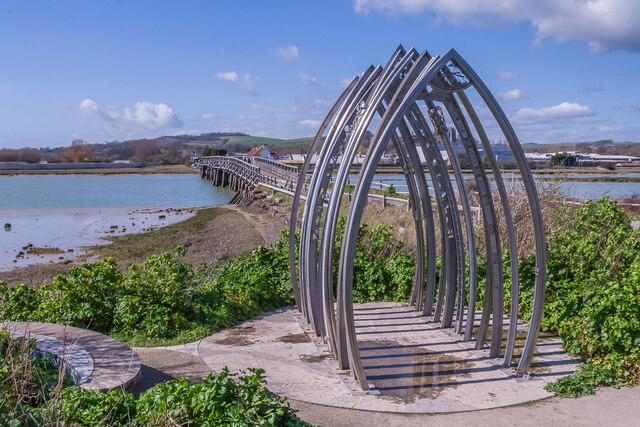
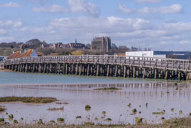
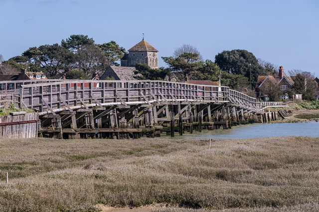
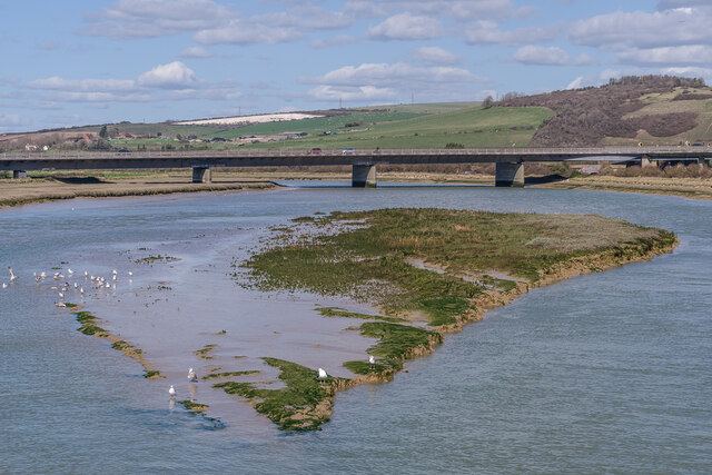
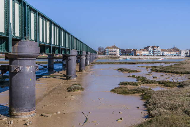
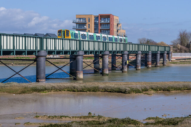
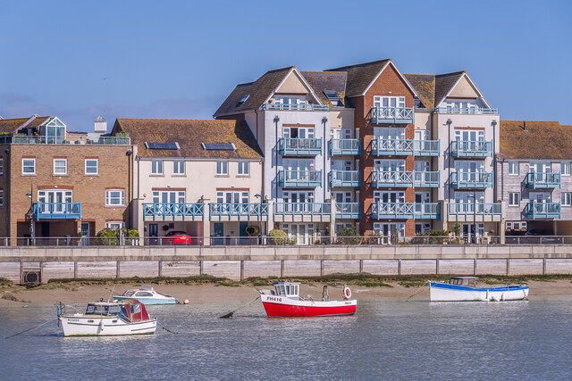
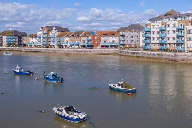
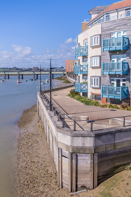
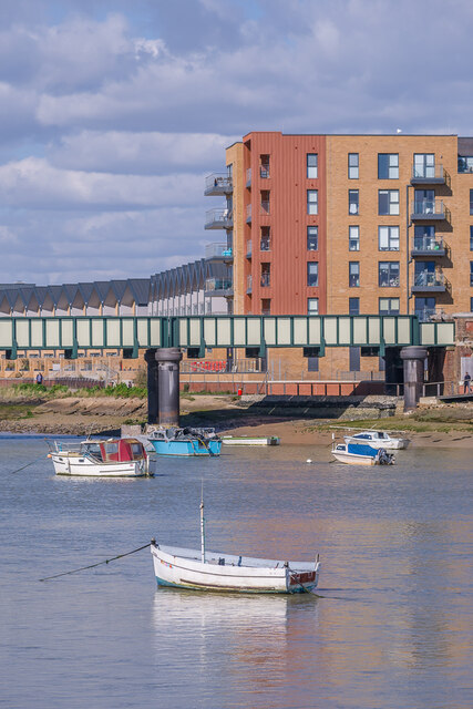
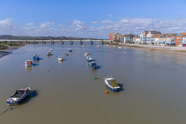
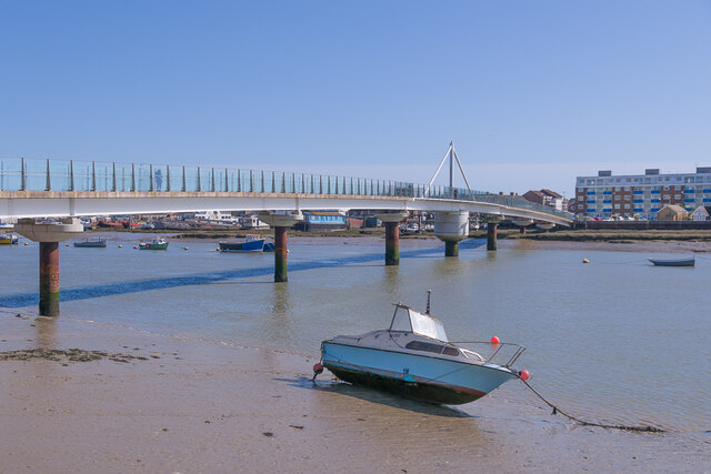
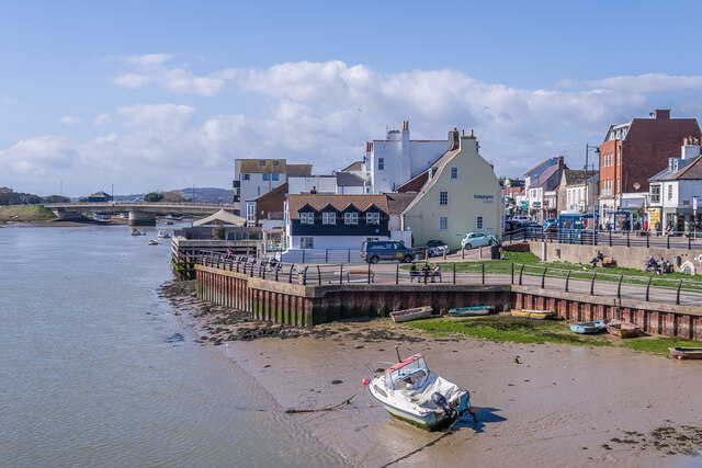
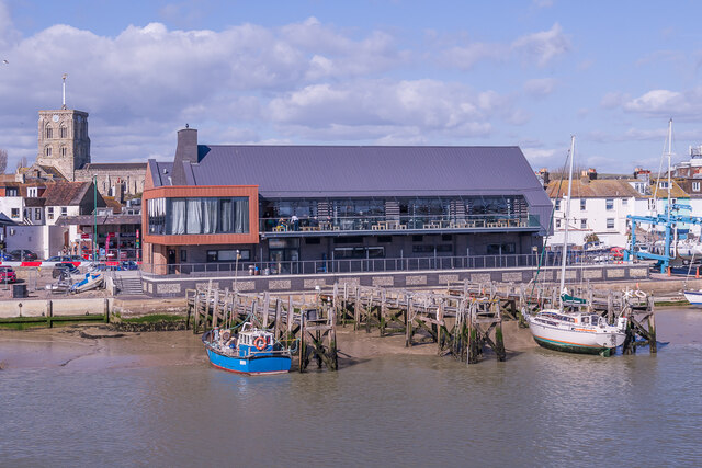
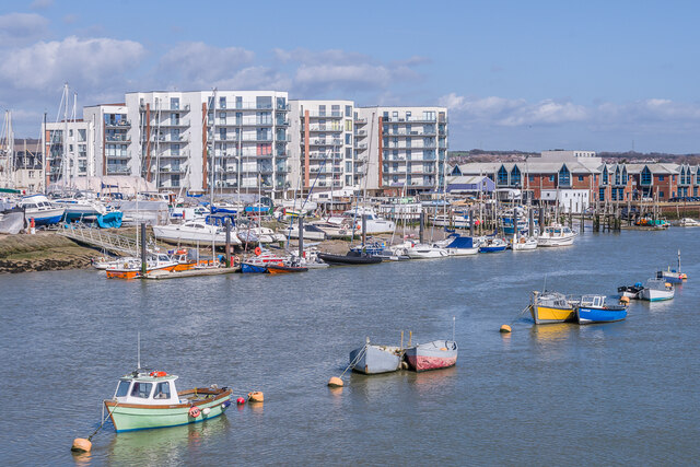
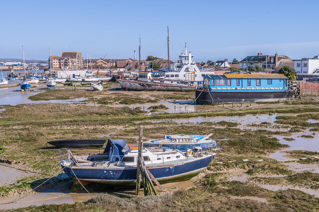
Shoreham Beach Images

Images are sourced within 2km of 50.826453/-0.28052022 or Grid Reference TQ2104. Thanks to Geograph Open Source API. All images are credited.

Paddock A horse feeding in a paddock off the A283 near Old Shoreham, with Lancing College in the left background.
Paddock
A horse feeding in a paddock off the A283 near Old Shoreham, with Lancing College in the left background.
Artwork Artwork alongside the Downs Link cycle/foot trail, with Old Shoreham Bridge across the River Adur in the background.
Artwork
Artwork alongside the Downs Link cycle/foot trail, with Old Shoreham Bridge across the River Adur in the background.
Old Shoreham Bridge Bridge over the River Adur near Old Shoreham, now a foot/cycle bridge.  Originally built in 1781, it was rebuilt to the same design during the First World War.  Until 1970 it formed part of the A27, with a toll for its use, until relieved by the opening of the Shoreham bypass, with a new viaduct over the river around 300m north of the old bridge.  It was then closed to road traffic and made a bridleway.  It underwent a full restoration in 2008.  Grade II* listed - see <span class="nowrap"><a title="https://historicengland.org.uk/listing/the-list/list-entry/1027895?section=official-list-entry" rel="nofollow ugc noopener" href="https://historicengland.org.uk/listing/the-list/list-entry/1027895?section=official-list-entry">Link</a><img style="margin-left:2px;" alt="External link" title="External link - shift click to open in new window" src="https://s1.geograph.org.uk/img/external.png" width="10" height="10"/></span>.

In the background is Lancing College.
Old Shoreham Bridge
Bridge over the River Adur near Old Shoreham, now a foot/cycle bridge. Originally built in 1781, it was rebuilt to the same design during the First World War. Until 1970 it formed part of the A27, with a toll for its use, until relieved by the opening of the Shoreham bypass, with a new viaduct over the river around 300m north of the old bridge. It was then closed to road traffic and made a bridleway. It underwent a full restoration in 2008. Grade II* listed - see LinkExternal link. In the background is Lancing College.
Old Shoreham Bridge Bridge over the River Adur near Old Shoreham, now a foot/cycle bridge.  Originally built in 1781, it was rebuilt to the same design during the First World War.  Until 1970 it formed part of the A27, with a toll for its use, until relieved by the opening of the Shoreham bypass, with a new viaduct over the river around 300m north of the old bridge.  It was then closed to road traffic and made a bridleway.  It underwent a full restoration in 2008.  Grade II* listed - see <span class="nowrap"><a title="https://historicengland.org.uk/listing/the-list/list-entry/1027895?section=official-list-entry" rel="nofollow ugc noopener" href="https://historicengland.org.uk/listing/the-list/list-entry/1027895?section=official-list-entry">Link</a><img style="margin-left:2px;" alt="External link" title="External link - shift click to open in new window" src="https://s1.geograph.org.uk/img/external.png" width="10" height="10"/></span>.

In the background is St Nicolas' Church, Old Shoreham.
Old Shoreham Bridge
Bridge over the River Adur near Old Shoreham, now a foot/cycle bridge. Originally built in 1781, it was rebuilt to the same design during the First World War. Until 1970 it formed part of the A27, with a toll for its use, until relieved by the opening of the Shoreham bypass, with a new viaduct over the river around 300m north of the old bridge. It was then closed to road traffic and made a bridleway. It underwent a full restoration in 2008. Grade II* listed - see LinkExternal link. In the background is St Nicolas' Church, Old Shoreham.
River Adur Looking along the River Adur from the Old Shoreham Bridge with the A27 Adur Viaduct, completed in 1970, in the background.
River Adur
Looking along the River Adur from the Old Shoreham Bridge with the A27 Adur Viaduct, completed in 1970, in the background.
Shoreham Railway Viaduct Viaduct carrying the West Coastway railway over the River Adur.  It was built in 1893, replacing an earlier wooden trestle viaduct opened in 1845.
Shoreham Railway Viaduct
Viaduct carrying the West Coastway railway over the River Adur. It was built in 1893, replacing an earlier wooden trestle viaduct opened in 1845.
Shoreham Railway Viaduct Viaduct carrying the West Coastway railway over the River Adur.  It was built in 1893, replacing an earlier wooden trestle viaduct opened in 1845.  Seen here with Class 313 no 313215 crossing on a westbound stopping service.
Shoreham Railway Viaduct
Viaduct carrying the West Coastway railway over the River Adur. It was built in 1893, replacing an earlier wooden trestle viaduct opened in 1845. Seen here with Class 313 no 313215 crossing on a westbound stopping service.
Linemans View Part of the Ropetackle development overlooking the River Adur, completed in 2005.
Linemans View
Part of the Ropetackle development overlooking the River Adur, completed in 2005.
Marline Court Part of the Ropetackle development overlooking the River Adur, completed in 2006.
Marline Court
Part of the Ropetackle development overlooking the River Adur, completed in 2006.
Linemans View and Marline Court Parts of the Ropetackle development overlooking the River Adur, completed in 2005 and 2006 respectively.
Linemans View and Marline Court
Parts of the Ropetackle development overlooking the River Adur, completed in 2005 and 2006 respectively.
Marline Court Part of the Ropetackle development overlooking the River Adur, completed in 2006.  In the background is the viaduct carrying the West Coastway railway over the river, with Lancing College beyond.
Marline Court
Part of the Ropetackle development overlooking the River Adur, completed in 2006. In the background is the viaduct carrying the West Coastway railway over the river, with Lancing College beyond.
River Adur Looking across the River Adur towards the viaduct carrying the West Coastway railway over the river, with Ringed Plover Apartments in Salt Marsh Road beyond.
River Adur
Looking across the River Adur towards the viaduct carrying the West Coastway railway over the river, with Ringed Plover Apartments in Salt Marsh Road beyond.
River Adur Looking up the River Adur towards the viaduct carrying the West Coastway railway over the river.
River Adur
Looking up the River Adur towards the viaduct carrying the West Coastway railway over the river.
Adur Ferry Bridge Footbridge over the River Adur, connecting the main part of Shoreham with Shoreham Beach.  Built in 2013, it replaced a previous one dating from 1921.  The central section is a swingbridge, allowing boats to access the next section of the river.
Adur Ferry Bridge
Footbridge over the River Adur, connecting the main part of Shoreham with Shoreham Beach. Built in 2013, it replaced a previous one dating from 1921. The central section is a swingbridge, allowing boats to access the next section of the river.
River Adur shoreline The shoreline of the River Adur, with buildings in High Street on the right.
River Adur shoreline
The shoreline of the River Adur, with buildings in High Street on the right.
Sussex Yacht Club The clubhouse of Sussex Yacht Club on the banks of the River Adur, completed in 2021.  In the left background is the tower of St Mary's Church.
Sussex Yacht Club
The clubhouse of Sussex Yacht Club on the banks of the River Adur, completed in 2021. In the left background is the tower of St Mary's Church.
Mariner Point Apartment development on the banks of the River Adur, completed in around 2020.
Mariner Point
Apartment development on the banks of the River Adur, completed in around 2020.
River Adur shoreline Boats moored alongside the River Adur at Shoreham Beach.  The former car ferry in the background, The Shieldsman, originally operated across the River Tyne between North and South Shields from 1976 until retired in 2007, and like many of the boats along this stretch of the river has now been converted into a houseboat.
River Adur shoreline
Boats moored alongside the River Adur at Shoreham Beach. The former car ferry in the background, The Shieldsman, originally operated across the River Tyne between North and South Shields from 1976 until retired in 2007, and like many of the boats along this stretch of the river has now been converted into a houseboat.
Show me another place!

Shoreham Beach is located at Grid Ref: TQ2104 (Lat: 50.826453, Lng: -0.28052022)

Administrative County: West Sussex

District: Adur

Police Authority: Sussex

What 3 Words

///keeps.animator.cobble. Near Shoreham-by-Sea, West Sussex

Related Wikis

Saltings (electoral division)

Saltings is an electoral division of West Sussex in the United Kingdom, and returns one member to sit on West Sussex County Council. == Extent == It comprises...

Shoreham Town Hall

Shoreham Town Hall is a municipal building in the High Street, Shoreham-by-Sea, West Sussex, England. The town hall, which was the headquarters of Shoreham...

Shoreham Beach

Shoreham Beach is a 26.2-hectare (65-acre) Local Nature Reserve in Shoreham-by-Sea in West Sussex. It is owned and managed by Adur District Council.The...

Marlipins Museum

Marlipins Museum, is a 12th to early-13th century Grade II* listed building on the High Street in Shoreham-by-Sea, a town in Adur district in West Sussex...

Nearby Amenities

Located within 500m of 50.826453,-0.28052022
Source: PGS
Lat/Long: 50.82925/-0.2753852
Source: PGS
Lat/Long: 50.8292686/-0.2756862
Source: PGS
Lat/Long: 50.8289675/-0.2787101
Source: PGS
Lat/Long: 50.8289957/-0.279924
Source: PGS
Lat/Long: 50.8290912/-0.2838795
Source: PGS
Lat/Long: 50.8294502/-0.2849645
Source: PGS
Lat/Long: 50.8299312/-0.2839248
Source: PGS
Lat/Long: 50.8301489/-0.2835144
Source: PGS
Lat/Long: 50.830393/-0.2830159
Created By: almien_coastlines
Source: PGS
Lat/Long: 50.830725/-0.282258
Recycling
Recycling Glass: yes
Lat/Long: 50.8286636/-0.2798777
Bus Stop
Weald Dyke
Naptan AtcoCode: 4400AD0152
Naptan Bearing: E
Naptan CommonName: Weald Dyke
Naptan Indicator: o/s 7
Naptan Landmark: Weald Dyke
Naptan NaptanCode: wsxadmad
Naptan PlusbusZoneRef: BRGHTN
Naptan Street: Beach Road
Naptan Verified: no
Public Transport: platform
Source: naptan_import
Lat/Long: 50.8276049/-0.2763616
Bus Stop
Beach Green
Naptan AtcoCode: 4400AD0161
Naptan Bearing: E
Naptan CommonName: Beach Green
Naptan Indicator: adj Playground
Naptan Landmark: Playground
Naptan NaptanCode: wsxadmdj
Naptan PlusbusZoneRef: BRGHTN
Naptan Street: Beach Green
Naptan Verified: no
Public Transport: platform
Source: naptan_import
Lat/Long: 50.8277295/-0.2791693
Bus Stop
Mardyke
Naptan AtcoCode: 4400AD0162
Naptan Bearing: E
Naptan CommonName: Mardyke
Naptan Indicator: outside no. 98
Naptan Landmark: Mardyke
Naptan NaptanCode: wsxadmdm
Naptan PlusbusZoneRef: BRGHTN
Naptan Street: Beach Green
Naptan Verified: no
Public Transport: platform
Source: naptan_import
Lat/Long: 50.8286455/-0.2835961
Bus Stop
Mardyke
Naptan AtcoCode: 4400AD0163
Naptan Bearing: W
Naptan CommonName: Mardyke
Naptan Indicator: outside no.57
Naptan Landmark: Mardyke
Naptan NaptanCode: wsxadmdp
Naptan PlusbusZoneRef: BRGHTN
Naptan Street: Beach Green
Naptan Verified: no
Public Transport: platform
Source: naptan_import
Lat/Long: 50.8285594/-0.2837934
Bus Stop
Adur Recreation Ground
Naptan AtcoCode: 4400AD0178
Naptan Bearing: SW
Naptan CommonName: Adur Rec Ground
Naptan Indicator: Opp Adur Recreation Ground
Naptan Landmark: Adur Recreation Ground
Naptan NaptanCode: wsxadmjt
Naptan PlusbusZoneRef: BRGHTN
Naptan Street: Brighton Road A259
Naptan Verified: no
Public Transport: platform
Source: naptan_import
Lat/Long: 50.8307138/-0.2824917
Bus Stop
Adur Recreation Ground
Bus: yes
Naptan AtcoCode: 4400AD0356
Naptan Bearing: NE
Naptan CommonName: Adur Rec Ground
Naptan Indicator: Adur Recreation Ground
Naptan Landmark: Adur Recreation Ground
Naptan NaptanCode: wsxdtapj
Naptan PlusbusZoneRef: BRGHTN
Naptan Street: Brighton Rd
Naptan Verified: no
Public Transport: platform
Shelter: no
Source: naptan_import
Lat/Long: 50.8303692/-0.2835496
Crossing
Crossing: uncontrolled
Crossing Island: no
Crossing Ref: zebra
Kerb: lowered
Tactile Paving: yes
Lat/Long: 50.8277744/-0.2795818
Description: View of RSPB Adur Estuary
Tourism: viewpoint
Lat/Long: 50.8307309/-0.2818564
Generator Method: photovoltaic
Generator Output Electricity: yes
Generator Source: solar
Generator Type: solar_photovoltaic_panel
Location: roof
Power: generator
Lat/Long: 50.8280108/-0.2763424
Generator Method: photovoltaic
Generator Output Electricity: yes
Generator Source: solar
Generator Type: solar_photovoltaic_panel
Location: roof
Power: generator
Lat/Long: 50.8277916/-0.276058
Generator Method: photovoltaic
Generator Output Electricity: yes
Generator Source: solar
Generator Type: solar_photovoltaic_panel
Location: roof
Power: generator
Lat/Long: 50.8286823/-0.2866738
Generator Method: photovoltaic
Generator Output Electricity: yes
Generator Source: solar
Generator Type: solar_photovoltaic_panel
Location: roof
Power: generator
Lat/Long: 50.8282799/-0.2848908
Generator Method: photovoltaic
Generator Output Electricity: yes
Generator Source: solar
Generator Type: solar_photovoltaic_panel
Location: roof
Power: generator
Lat/Long: 50.8275226/-0.2846521
Generator Method: photovoltaic
Generator Output Electricity: yes
Generator Source: solar
Generator Type: solar_photovoltaic_panel
Location: roof
Power: generator
Lat/Long: 50.8271227/-0.2840486
Generator Method: photovoltaic
Generator Output Electricity: yes
Generator Source: solar
Generator Type: solar_photovoltaic_panel
Location: roof
Power: generator
Lat/Long: 50.8270414/-0.2826431
Generator Method: photovoltaic
Generator Output Electricity: yes
Generator Source: solar
Generator Type: solar_photovoltaic_panel
Location: roof
Power: generator
Lat/Long: 50.8275082/-0.2819951
Generator Method: photovoltaic
Generator Output Electricity: yes
Generator Source: solar
Generator Type: solar_photovoltaic_panel
Location: roof
Power: generator
Lat/Long: 50.8287153/-0.2832118
Generator Method: photovoltaic
Generator Output Electricity: yes
Generator Source: solar
Generator Type: solar_photovoltaic_panel
Location: roof
Power: generator
Lat/Long: 50.8283409/-0.2817124
Generator Method: photovoltaic
Generator Output Electricity: yes
Generator Source: solar
Generator Type: solar_photovoltaic_panel
Location: roof
Power: generator
Lat/Long: 50.8292981/-0.2835873
Waste Basket
Ashtray: no
Colour: green
Covered: yes
Source: survey
Lat/Long: 50.8279881/-0.2866493
Post Box
Brand: Royal Mail
Brand Wikidata: Q638098
Brand Wikipedia: en:Royal Mail
Collection Plate: CP1D
Collection Times: Mo-Fr 09:00; Sa 07:00
Last Checked: 2020-10-01
Operator: Royal Mail
Operator Wikidata: Q638098
Post Box Type: pillar
Ref: BN43 1537D
Royal Cypher: EIIR
Royal Cypher Wikidata: Q33102113
Source: survey
Lat/Long: 50.8279905/-0.2866354
Post Box
Brand: Royal Mail
Brand Wikidata: Q638098
Brand Wikipedia: en:Royal Mail
Collection Plate: CP1D
Collection Times: Mo-Fr 09:00; Sa 07:00
Last Checked: 2020-10-01
Operator: Royal Mail
Operator Wikidata: Q638098
Post Box Type: pillar
Ref: BN43 1536D
Royal Cypher: EIIR
Royal Cypher Wikidata: Q33102113
Source: survey
Lat/Long: 50.8279113/-0.2809394
Waste Basket
Ashtray: no
Colour: black
Covered: yes
Source: survey
Lat/Long: 50.8278828/-0.2797459
Bus Stop
Benbow Close
Naptan AtcoCode: 4400AD0375
Naptan NaptanCode: wsxgjwdw
Public Transport: platform
Lat/Long: 50.8289652/-0.2752526
Bus Stop
Beach Green
Public Transport: platform
Lat/Long: 50.8278457/-0.2790242
The data included in this document is from www.openstreetmap.org. The data is made available under ODbL.

Have you been to Shoreham Beach?

Leave your review of Shoreham Beach below (or comments, questions and feedback).